


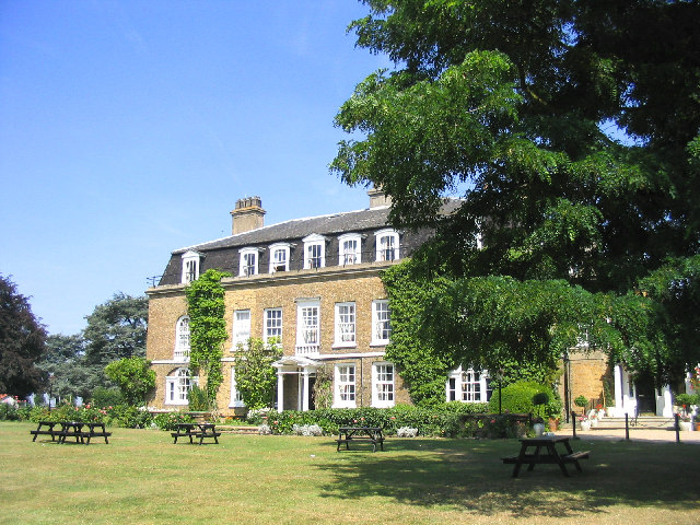
Why visit Orsett
Townapedia lists 1 museum or landmark, 7 parks and trails, 8 places to eat and 2 attractions in and around town.
Highlights include State Cinema, Mucking excavation, Thurrock Thameside Nature Park and Chafford Gorges Nature Park.
Weather in Orsett
Forecast from MET Norway (CC BY 4.0). Full forecast
About Orsett
Orsett is a village in the borough of Thurrock in Essex, England. It lies 3 miles (5 km) north-east of the centre of Grays, its post town. At the 2021 census the Orsett built up area had a population of 1,461.
From the Wikipedia article Orsett (this version), under CC BY-SA 4.0.
Things to do2

State Cinema
Cinema and theater · 3.1 mi
Former cinema and theatre in Grays, England

Museums and landmarks1

Mucking excavation
Monument and historic site · 3.0 mi
Archaeological site in Essex, England
Parks, trails and playgrounds7

Thurrock Thameside Nature Park
Park · 3.1 mi
Essex Wildlife Trust Nature reserve

Chafford Gorges Nature Park
Park · 3.3 mi
Essex Wildlife Trust Nature reserve

Restaurants and cafes8




McDonald's
Fast food · Burger · 1.3 mi
A13 Westbound, Orsett
Mo-Th 05:00-24:00; Fr-Sa 05:00-01:00; Su 05:00-24:00
History
In the Domesday Book of 1086, two estates or manors were listed at the vill of Orseda or Dorseda in the Barstable Hundred of Essex. A priest is mentioned in Domesday Book, suggesting Orsett was already a parish by that time. The current parish church, dedicated to St Giles and All Saints, dates back to the 12th century.
It has historically been a primarily agricultural community situated at the southern edge of the old ice age flood plain traversed by the river Mardyke.
Orsett contains a ring and bailey earthwork known locally as Bishop Bonner's palace; so called as it was the residence of the Bishops of London, including Bishop Edmund Bonner from 1553 to 1559. On the gravel terrace, there is a Neolithic causewayed enclosure discovered as a result of crop marks which showed on aerial photographs taken by Kenneth St Joseph of Cambridge University. It has three concentric ditches with a number of breaks or causeways. The enclosure was used as a burial ground by the Saxons and contained at least three barrows visible on the aerial photo.
Read more of the history
On the junction of Pound Lane and High Road is the village lock-up, removed in the mid 19th century but restored in the mid 20th century, the lockup or cage was built in the late 17th or early 18th century. It has barred windows and a plank door with heavy hinges. Before a national system of policing was set up many villages had their own lock-up. Petty criminals were held for a short time before being released or sent to a larger town for trial.
Orsett Heath in the south of the parish was formerly part of an extensive area of heathland that included Terrel's Heath.
Orsett was an ancient parish in the Barstable Hundred of Essex. In 1835, the Orsett Poor Law Union was established, being a group of 18 parishes which collectively delivered their responsibilities under the poor laws. A workhouse to serve the union was built in 1837 on Rowley Road in Orsett.
When elected parish and district councils were established in 1894, Orsett was included in the Orsett Rural District, which was based on the existing poor law union. The rural district council met at the workhouse in Orsett, but had its offices in the nearby town of Grays. The workhouse later became Orsett Hospital, which was completely rebuilt in the 1960s.
The civil parish and rural district were both abolished in 1936 on the creation of the new Thurrock Urban District. At the 1931 census (the last before its abolition), the civil parish of Orsett had a population of 1,771.
The parish of Orsett has also been abolished for ecclesiastical purposes, merging with Bulphan and Horndon-on-the-Hill to form a Church of England ecclesiastical parish called "Horndon, Orsett and Bulphan".
From the History section of Orsett on Wikipedia, under CC BY-SA 4.0.
More about Orsett
Geography
The centre of Orsett is aligned on an east–west axis along the High Road, on which is the parish church of St Giles and All Saints along with the animal pound and lock-up opposite Rowley Road. Its former workhouse on Rowley Road was developed into a large modern hospital in the 1960s but has, since the 1980s, been reduced in size once again. Most of the former shops in the High Road, including the Post Office opposite the Church and the blacksmith's in Rowley Road, have closed to be replaced by just one convenience store which contains a sub post office.
Two public houses have survived in the centre of the village, one being the prize-winning Whitmore Arms, the other the Foxhound, and outside the village centre Orsett has one additional pub – The Kings Arms.
Education
The village's primary school has been located since the mid-19th century in School Lane, educating children up to the age of 14 until 1944 and to 11 thereafter.
From the Wikipedia article Orsett, under CC BY-SA 4.0.
Notable people from Orsett
 Ryan BennettEnglish association football player (born 1990)Photo: @cfcunofficial (Chelsea Debs) London, CC BY-SA 2.0
 Jean LambertBritish politician (1950- )Photo: Foto-AG Gymnasium Melle, CC BY-SA 3.0
 Tim AkerBritish politician (born 1985)Photo: © European Union 2014 EP, Attribution
 Jen CraftBritish politician, from 2024 MP for Thurrock in the UK ParliamentPhoto: ©House of Commons, CC BY 3.0
 Danny CratesBritish Paralympic athletePhoto: Sportdynamics, CC BY-SA 4.0
- Alex PritchardEnglish association football player (born 1993)
- Nelly LandryBelgian-French tennis player
- Girija ShettarBritish actress
- Neil HarrisEnglish association football player and manager (born 1977)
- Sue HodgeBritish actress
- Rikki Clarkecricketer (born 1981)
- Steven BlaneyWelsh footballer (born 1977)
Born in Orsett, according to Wikidata (CC0). Each name links to its Wikipedia article.
Churches and places of worship6
Gas and EV charging1
Schools, colleges and libraries4
Healthcare1
Map of Orsett
30 places. The map loads OpenStreetMap tiles when you open it.
Getting there and nearby towns
Rochester Airport (RCS) is the nearest airport with scheduled flights listed in OpenStreetMap, 12 miles away.
- Bulphan 2 mi north, about 4 min by car
- Grays 3 mi southwest, about 5 min by car
- Stanford-le-Hope 3 mi east, about 5 min by car
- Tilbury 3 mi south, about 6 min by car
- South Ockendon 4 mi west, about 6 min by car
- Gravesend 5 mi south, about 8 min by car
- Basildon 5 mi northeast, about 9 min by car
- Swanscombe 5 mi southwest, about 8 min by car
- Upminster 6 mi northwest, about 9 min by car
- Pitsea 7 mi northeast, about 11 min by car
Drive times are estimates from straight-line distance, not routes.
Towns near Orsett


Keep exploring
Local news
Headlines from INDB.
Reviews, tips and questions
Loading what members have shared...
Sources and licences
- GeoNames (CC BY 4.0): population, coordinates, regions and time zone
- OpenStreetMap contributors (ODbL 1.0): places, airports, map data
- Wikidata (CC0 1.0): elevation, founding date, time zone, website, landmarks and historic places
- Wikimedia Commons (see each image): photos
- Wikipedia (CC BY-SA 4.0): overview and history text
Photo credits
- Charlestons downstairs bar2, Peter Hammond, Public domain
- Mucking fittingsDSCF9566, Johnbod, CC BY-SA 4.0
- Cory Environmental Centre, Artexplorer434, CC BY-SA 3.0
- St Nicholas' parish church, South Ockendon, Essex, AUM3RLE, CC BY-SA 4.0
- New orsett hall, Rjm at sleepers ( talk ), CC BY-SA 3.0
- Orsett Hall, John Winfield, CC BY-SA 2.0
Page built November 10, 2026. Spotted a mistake? Tell us or suggest a place.