


Why visit Pegswood
Townapedia lists 5 museums and landmarks, 6 parks and trails, 4 places to eat and 1 attraction in and around town.
Highlights include Morpeth Chantry Bagpipe Museum, Motte and bailey castle on Haw Hill, Carlisle Park and Mafeking Park.
Weather in Pegswood
Forecast from MET Norway (CC BY 4.0). Full forecast
About Pegswood
Pegswood is a historic mining village and civil parish in Northumberland, England, and the site of the former Pegswood Colliery. Pegswood is two miles (3 km) east of Morpeth and three miles (5 km) west of Ashington, with a population of around 3,280. Pegswood is on a small hill above the valley in which Morpeth is situated, close to the River Wansbeck and to the small stream Brocks Burn.
From the Wikipedia article Pegswood (this version), under CC BY-SA 4.0.
Photos of Pegswood

Things to do1

Museums and landmarks5
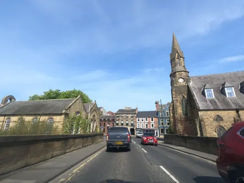
Morpeth Chantry Bagpipe Museum
Museum · 1.9 mi
Bagpipe museum in Morpeth, England

Motte and bailey castle on Haw Hill
Monument and historic site · 2.0 mi
Motte-and-bailey castle in Morpeth, Northumberland, England, UK

Newminster Abbey
Monument and historic site · 2.5 mi
Abbey in Morpeth, Northumberland, England, UK


Parks, trails and playgrounds6


Mafeking Park
Park · 1.9 mi
Public park in Morpeth, Northumberland, England



Restaurants and cafes4


History
The prevailing theory as to the origin of the name Pegswood is that it means Pecg's Enclosure, Pecg being a personal name. Another theory is that the element Peg- derives from the Anglo-Saxon word pecg meaning pig. Pegswood started as a small farming settlement, yet with the discovery of coal and the opening of Pegswood colliery, the village expanded to accommodate miners in 1872. The colliery shut in 1969, however the village is still classed as a pit village. All that is left today are the Pit Heap, now a park, and the entrance to the mine shaft, now in the Bothal Court estate. Coinciding with the coal industry, there was also a brickworks in Pegswood, which has since closed down.
Read more of the history
Though the original colliery closed, mining was practised until quite recently: as late as 1997, mining company The Banks Group opened up a 170-acre (0.69 km2) open-pit mine at Pegswood Moor, from which they extracted some 1.4 million tons of coal, with the help of a 236-ton face shovel made by Orenstein & Koppel. Also reaped was 84,000 tons of fire clay, a kind of high temperature resistant clay often found between coal layers. Mining there stopped in 2004, and the pit was converted into the Pegswood Community Park, which includes "a dedicated nature reserve, a new woodland and ponds." The second phase of the park's construction would also "provide a fishing lake, an amphitheatre sculpted out of the landform and a footpath link from Pegswood to Morpeth." Extensive open-pit mining still takes place in the area, but such operations remain controversial even when former sites are restored.
Like many other "former pit villages," Pegswood has benefited from increased interest among especially young families, who are attracted to such places for the countryside and the quality of education. Since 1969, when the pit closed, the town has welcomed new development plans and new housing estates have been built in an effort by Pegswood to "reinvent itself as a cheaper rural alternative to Morpeth and Newcastle." More recent renewal efforts include plans for a facelift for its Welfare Centre and a £48,000 garden with the colliery as its theme. Local services are also being improved.
From the History section of Pegswood on Wikipedia, under CC BY-SA 4.0.
More about Pegswood
Education
There is only one school in Pegswood, Pegswood Primary School. Secondary education is typically taken in either Ashington or Morpeth, the two closest towns.
From the Wikipedia article Pegswood, under CC BY-SA 4.0.
Notable people from Pegswood
- Billy KiddEnglish footballer (1907-1978)
- Billy RobinsonEnglish footballer
Born in Pegswood, according to Wikidata (CC0). Each name links to its Wikipedia article.
Churches and places of worship6
Shopping1
Schools, colleges and libraries1
Healthcare1
Map of Pegswood
25 places. The map loads OpenStreetMap tiles when you open it.
Getting there and nearby towns
Newcastle International Airport (NCL) is the nearest airport with scheduled flights listed in OpenStreetMap, 10 miles away.
- Morpeth 2 mi southwest, about 3 min by car
- Ashington 3 mi east, about 5 min by car
- Bedlington 4 mi southeast, about 6 min by car
- Lynemouth 5 mi northeast, about 8 min by car
- Blyth 6 mi southeast, about 10 min by car
- Cramlington 7 mi south, about 11 min by car
- East Chevington 8 mi north, about 12 min by car
- Seghill 9 mi southeast, about 14 min by car
- Dinnington 9 mi south, about 14 min by car
- Ponteland 10 mi southwest, about 16 min by car
Drive times are estimates from straight-line distance, not routes.
Towns near Pegswood


Keep exploring
Local news
Headlines from INDB.
Reviews, tips and questions
Loading what members have shared...
Sources and licences
- GeoNames (CC BY 4.0): population, coordinates, regions and time zone
- Mapillary (see each image): photos
- OpenStreetMap contributors (ODbL 1.0): places, airports, map data
- Wikidata (CC0 1.0): elevation, founding date, time zone, website, landmarks and historic places
- Wikimedia Commons (see each image): photos
- Wikipedia (CC BY-SA 4.0): overview and history text
Photo credits
- Pegswood railway station AB1, Adambro, CC BY-SA 3.0
- Pegswood railway station AB2, Adambro, CC BY-SA 3.0
- Pegswood railway station AB3, Adambro, CC BY-SA 3.0
- Carlisle Park, Morpeth (2022-12-26) 63, Simon Cobb, CC0
- Newminster Abbey near Morpeth Northumberland 1780, Unknown author Unknown author, Public domain
- Mafeking Park (Roundabout), Dreamy Jazz, CC BY-SA 4.0
- Roman Catholic Church of St Robert, Simon Cobb, CC0
- St James' Church, Morpeth, JThomas, CC BY-SA 2.0
- Bothal Castle2, DRomley, CC BY-SA 3.0
- Northumberland Fire appliance, Graham Mitchell, CC BY 2.0
- Carlisle Park, Morpeth (2022-12-26) 61, Simon Cobb, CC0
- Street-level photo, floatingboater, CC BY-SA 4.0
- Street-level photo, floatingboater, CC BY-SA 4.0
- Street-level photo, floatingboater, CC BY-SA 4.0
- Street-level photo, floatingboater, CC BY-SA 4.0
- Street-level photo, floatingboater, CC BY-SA 4.0
- Street-level photo, floatingboater, CC BY-SA 4.0


Page built November 10, 2026. Spotted a mistake? Tell us or suggest a place.