


Why visit Rowledge
Townapedia lists 7 museums and landmarks, 14 parks and trails, 16 places to eat, 1 place to stay and 3 attractions in and around town.
Highlights include Birdworld, Redgrave Theatre, Farnham, Crafts Study Centre and Farnham Castle.
Weather in Rowledge
Forecast from MET Norway (CC BY 4.0). Full forecast
About Rowledge
Rowledge is a village in England on the Surrey–Hampshire border, centred south of the A31 and Farnham. Neighbouring villages include Wrecclesham and Frensham. To the south west of the village is the Alice Holt Forest; to the west is Birdworld. It is in the Waverley Ward of Farnham, Wrecclesham and Rowledge.
From the Wikipedia article Rowledge (this version), under CC BY-SA 4.0.
Things to do3


Redgrave Theatre, Farnham
Cinema and theater · 2.5 mi
Former theatre in Farnham, England

Museums and landmarks7


Farnham Castle
Museum · 2.5 mi
Grade I listed historic house museum in Farnham, Surrey, England, UK

Museum of Farnham
Museum · 2.1 mi
Museum in Farnham, England, United Kingdom

Rural Life Living Museum
Museum · 2.2 mi
Open air museum of rural life near Farnham in Surrey, United Kingdom

Parks, trails and playgrounds14

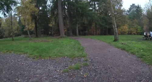




2 more on the map.
Restaurants and cafes16

The Bengal Lounge
Restaurant · 1.1 mi
1 The Street, Farnham
Mo-Th,Su 12:00-14:00,17:30-23:00; Fr-Sa 12:00-14:00,17:30-23:30
Lucky Star
Restaurant · Chinese · 1.5 mi
36 Weydon Lane, Farnham
We 17:30-22:00; Th, Mo 12:00-14:30, 17:30 - 22:00; Fr, Sa...


4 more on the map.
History
The area was from the Norman Conquest agricultural manorial, common land and land not suited for cultivation termed waste: it included large farms and scattered cottages. In the West End part to the south and in the Hampshire mostly forested part 19th century replacements of some of these exist. In the 1841 Census, there were only about 50 dwellings and 250 inhabitants within the boundaries of what is now known as Rowledge. Evidence on the ground is thin: no listed building is in the parish on the National Heritage list. Fir Grove House, later rebuilt as Frensham Heights by Charles Charrington, the brewer, and now a private school is in the southern part of the parish. A rather haphazard pattern of trackways and footpaths traversed the area which still exist today and formed the basis for the present-day road network.
The coming of the railways to Farnham in 1848 and the development of Aldershot as the home of the British Army in 1854, resulted in an influx of wealthy businessmen and Army officers, and saw the construction of many large houses in the late Victorian era. Tradesmen and service providers established themselves. The area was important for hop growing, supporting the brewing industry in Farnham.
Read more of the history
The Parish Church of St James' was built in 1869 and the School in 1872. The Methodist Church was established in 1875 and a new building erected in 1886. By 1871, a recognisable centre to the Village was established, with a post office, shops, public house and transport links to Farnham. A Rowledge cricket team did particularly well at the original Oval at Holt Pound so as to reach the village final at Lord's Cricket Ground.
Further development, particularly in the early 1900s, followed the established road network and gradually filled in the open fields, creating the present-day village.
In 1914 the Village Hall was built and the Recreation Ground became the centre for local cricket. Tennis and Bowls Clubs were established in the 1920s and 1930s. Another surge in development took place in the 1960s and 1970s, including Rowledge's first and only, housing estate in 1982.
From the History section of Rowledge on Wikipedia, under CC BY-SA 4.0.
More about Rowledge
Geography
Rowledge is centred in a southwest corner of Surrey, 3 miles (4.8 km) south west of the town of Farnham.
The relatively late (19th-century-created) ecclesiastical parish of Rowledge remains, unusually, one which straddles the Hampshire border: St James' Church, a few homes and Rowledge Primary School are in Hampshire. This two-county arrangement, which in respect of the same land applied to the largest contributor, Frensham, is unusual. It was formed in 1869 from parts of Farnham, Frensham and a very small percentage of Binsted parishes and includes the hamlets of Holt Pound and Bucks Horn Oak in Hampshire.
Rowledge had a civil parish, covering the area within Surrey, now forms part of the Waverley ward of Wrecclesham and Rowledge. The area of Frensham after marginal falls, fell from 8,807 acres (3,564 ha) within the 10 years before 1901 to 7,656 and fell during the 20 years before 1951 to 5,204 acres (2,106 ha), with its westerly hamlets gaining new local administration accordingly.
The village is bounded to the north by the Bourne Valley (an "Area of Strategic Visual Importance" or ASVI) and Wrecclesham and Boundstone/Upper Bourne; to the west by the Alice Holt Forest; to the east by open countryside and to the south by further open countryside (an "Area of Great Landscape Value" or AGLV).
From the Wikipedia article Rowledge, under CC BY-SA 4.0.
Where to stay1
Churches and places of worship8
Shopping3
Schools, colleges and libraries8
Map of Rowledge
60 places. The map loads OpenStreetMap tiles when you open it.
Getting there and nearby towns
RAF Odiham (ODH) is the nearest airport with scheduled flights listed in OpenStreetMap, 6 miles away.
- Farnham 2 mi northeast, about 4 min by car
- Crondall 4 mi northwest, about 6 min by car
- Churt 4 mi southeast, about 6 min by car
- Aldershot 5 mi northeast, about 8 min by car
- Bordon 5 mi south, about 8 min by car
- Fleet 7 mi north, about 11 min by car
- Alton 7 mi west, about 11 min by car
- Farnborough 8 mi north, about 13 min by car
- Haslemere 8 mi southeast, about 13 min by car
- Godalming 9 mi east, about 15 min by car
Drive times are estimates from straight-line distance, not routes.
Towns near Rowledge


Keep exploring
Local news
Headlines from INDB.
Reviews, tips and questions
Loading what members have shared...
Sources and licences
- GeoNames (CC BY 4.0): population, coordinates, regions and time zone
- Mapillary (see each image): photos
- OpenStreetMap contributors (ODbL 1.0): places, airports, map data
- Wikidata (CC0 1.0): elevation, founding date, time zone, website, landmarks and historic places
- Wikimedia Commons (see each image): photos
- Wikipedia (CC BY-SA 4.0): overview and history text
Photo credits
- Terry Pratchett Owl Parliament at Birdworld, Birdworld, CC BY-SA 4.0
- Redgrave Theatre Farnham Entrance, Jack1956, CC0
- Crafts Study Centre, University for the Creative Arts, Farnham, BabelStone, CC BY-SA 4.0
- Farnham Castle keep, Lewis Hulbert, CC BY-SA 3.0
- Back of Wilmer House (Museum of Farnham), BabelStone, CC BY-SA 4.0
- Tilford Rural Life Centre 88, Simon Burchell, CC BY-SA 3.0
- Underdown 3, Dudley Miles, CC BY-SA 4.0
- Former Park Lane Baptist Chapel, Bear Lane, Farnham (May 2015) (3), Hassocks5489, CC0
- St Andrew's Church, West Street, Farnham (May 2015) (1), Hassocks5489, CC0
- St Joan of Arc's Church, Tilford Road, Farnham (May 2015) (1), Hassocks5489, CC0
- University for the Creative Arts, Farnham, Courtyard Entrance, BabelStone, CC BY-SA 4.0
- St Peter's Church, Beales Lane, Wrecclesham (May 2015) (2), Hassocks5489, CC0
- Weydon School, BabelStone, CC BY-SA 3.0
- The Bengal Lounge, Wrecclesham, BabelStone, CC BY-SA 4.0
- The Bear And Ragged Staff, Farnham, BabelStone, CC BY-SA 4.0
- St Peter's Primary School, Farnham, BabelStone, CC BY-SA 4.0
- St James's Church, Church Lane, Rowledge (May 2021) (4), Hassocks5489, CC0
- Street-level photo, jpennycook, CC BY-SA 4.0
- Street-level photo, jpennycook, CC BY-SA 4.0
- Street-level photo, jpennycook, CC BY-SA 4.0
- Street-level photo, jpennycook, CC BY-SA 4.0
- Street-level photo, jpennycook, CC BY-SA 4.0
- Street-level photo, jpennycook, CC BY-SA 4.0
- Street-level photo, taft, CC BY-SA 4.0
- Street-level photo, jpennycook, CC BY-SA 4.0
- Street-level photo, jpennycook, CC BY-SA 4.0
- Street-level photo, jpennycook, CC BY-SA 4.0
- Street-level photo, jpennycook, CC BY-SA 4.0
- Street-level photo, jpennycook, CC BY-SA 4.0
- Street-level photo, jpennycook, CC BY-SA 4.0


Page built November 10, 2026. Spotted a mistake? Tell us or suggest a place.