


Why visit Tenby
Townapedia lists 27 museums and landmarks, 22 parks and trails, 80 places to eat, 51 places to stay and 2 attractions in and around town.
Highlights include Caldey Lighthouse, Tudor Merchant's House, Tenby Museum & Art Gallery and Manor Wildlife Park.
Weather in Tenby
Forecast from MET Norway (CC BY 4.0). Full forecast
About Tenby
Tenby (Welsh: Dinbych-y-pysgod, lit. 'fortlet of the fish') is a seaside town and community in the county of Pembrokeshire, Wales. It lies within Carmarthen Bay. In 2011, it had a population of 4,696.
From the Wikipedia article Tenby (this version), under CC BY-SA 4.0.
Travel tips from other travellers: Tenby on Wikivoyage (CC BY-SA 4.0).
Photos of Tenby


Things to do2

Caldey Lighthouse
Lighthouse · 3.0 mi
Lighthouse, Grade II listed building in Pembrokeshire, Wales; on the S side of Caldey Island, 0.5km approx S of the Abbey

Museums and landmarks27


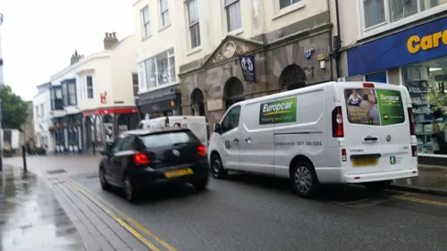



Tenby Museum and Art Gallery
Museum · 0.4 mi
Local history museum in Tenby, Wales

15 more on the map.
Parks, trails and playgrounds22




10 more on the map.
Restaurants and cafes80
The Crown Inn
Bar and pub
Lower Frog Street, Tenby
Mo-Th 00:00-00:30,11:00-00:00; Fr 00:00-00:30,11:00-00:00; Sa-Su...
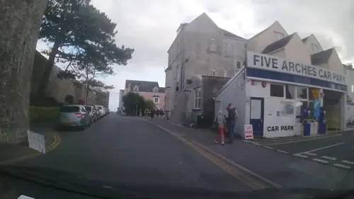






68 more on the map.
History
With its strategic position on the far west coast of Britain, and a natural sheltered harbour from both the Atlantic Ocean and the Irish Sea, Tenby was a natural settlement point, probably a hill fort with the mercantile nature of the settlement possibly developing under Hiberno-Norse influence. The earliest reference to a settlement at Tenby is in Etmic Dinbych, a poem probably from the ninth century.
Tenby was taken by the Normans when they invaded West Wales in the early 12th century. The town's first stone-wall fortification was on Castle Hill. Tenby's mercantile trade grew as it developed as a major seaport in Norman-controlled Little England beyond Wales.
Flemish settlers from Tenby tried to assassinate Cadell ap Gruffydd, the Welsh prince of Deheubarth, after which the settlement and castle were successfully attacked and sacked by his brothers Maredudd and Rhys in 1150 highlighting the need for additional defences. Sacking of the town was repeated in 1187 and again by Llywelyn ap Gruffudd in 1260.
Read more of the history
After the 1260 attack, the Earl of Pembroke at the time, William de Valence, ordered the completion of the Tenby town walls. The stone curtain wall, towers, and gates enclosed a large part of the settlement—now known as the "old town". In the Late Middle Ages, Tenby was awarded royal grants to finance the maintenance and improvement of its defences and the enclosure of its harbour. With the construction of the town walls, Tenby Castle was made obsolete and had been abandoned by the end of the 14th century. William de Valence granted Tenby a charter in 1290.
In 1452, King Henry VI gave the Marcher Lordship (and associated Earldom) to Jasper Tudor, his half-brother and uncle to the future Henry Tudor. In 1457, Tudor agreed to divide the costs of refurbishing and improving Tenby's defences with the town's merchants because of its economic importance to this part of Wales. Improvements included widening the dry ditch along the outside of the town walls to 30 feet (9.1 m), raising the wall's height to include a second tier of higher arrow slits behind a new parapet walk and adding additional turret towers to the ends of the walls where they abutted the cliff edges.
Traders sailed along the coast to Bristol and Ireland and further afield to France, Spain, and Portugal. Exports included wool, skins, canvas, coal, iron, and oil. It was during this period that the town was so busy and important; it was considered to be a national port. During the Wars of the Roses, Henry Tudor, the future King Henry VII of England, sheltered at Tenby before sailing into exile in 1471.
In the mid-16th century, the large D-shaped tower formerly known as the "Five Arches tavern" was built following fears of a second Spanish Armada. Tenby was formally incorporated as a borough by Elizabeth I in 1581.
Two key events caused the town to undergo a rapid and permanent decline in importance. First, Tenby declared for Parliament in the English Civil War. It resisted two attempts by the Royalists forces of Charles Gerard, who took most of the rest of South Wales. However, in the Second English Civil War the commander of Tenby Castle declared for the King in 1648, although ten weeks later the shattered town was surrendered to the parliamentarian Colonel Thomas Horton, who welcomed Oliver Cromwell shortly afterwards. Second, a plague outbreak killed half of the town's remaining population in 1650.
With limited infrastructure, resources, and people, the town's economy fell into decline. Most of the merchant and business class left, resulting in the town's decay and ruin. By the end of the 18th century, John Wesley noted during his visit how: "Two-thirds of the old town is in ruins or has entirely vanished. Pigs roam among the abandoned houses, and Tenby presents a dismal spectacle."
Another war led to a resurgence in Tenby's fortunes. Since 1798, the French General Napoleon Bonaparte had begun conquering Europe, restricting the rich British upper classes from making their Grand Tours to continental spa towns. In 1802, local resident, merchant banker and politician, Sir William Paxton, bought his first property in the old town. From this point onwards, he invested heavily in the area with the full approval of the town council.
With the growth in saltwater sea-bathing for health purposes, Paxton engaged engineer James Grier and architect Samuel Pepys Cockerell (the same team who had built his home at Middleton Hall) to create a "fashionable bathing establishment suitable for the highest society." His sea-bathing baths came into operation in July 1806 and, after acquiring the Globe Inn, transformed it into "a most lofty, elegant and convenient style" to lodge the more elegant visitors to his baths. Cottages were erected adjoining the baths with adjoining livery stables and a coach house.
A road was built on arches overlooking the harbour at Paxton's full expense in 1814. He had a private act of Parliament passed that enabled fresh water to be piped through the town. Despite these accomplishments, his 1809 theatre was closed in 1818 due to lack of patronage. The Market Hall was completed in 1829 and remodelled to serve as Tenby Town Hall in 1860.
Paxton also took in "tour" developments in the area as required by rich Victorian tourists. This included the discovery of a chalybeate spring in his own park at Middleton Hall, and coaching inns from Swansea to Narberth. He built Paxton's Tower, in memorial to Lord Nelson, whom he had met in 1802 when mayor of Carmarthen. Paxton's efforts to revive the town succeeded, and after the Battle of Trafalgar, the growth of Victorian Tenby was inevitable.
The borough was reformed to become a municipal borough in 1836.
From the History section of Tenby on Wikipedia, under CC BY-SA 4.0.
More about Tenby
Arts and culture
Tenby has been home to a number of artists, who have been exhibited variously in their own spaces or in commercial galleries, or in the Tenby Museum and Art Gallery.
In common with the rest of Wales, a range of genres of music is celebrated here. Beginning in 2025, Y Lle Da / The Good Place festival puts on a weekend of concerts in March and the Tenby International Music Festival (in partnership with the Wyoming International Chamber Music Festival) provides a Composer Fellowship programme and a series of chamber music concerts in August. A Blues festival takes place in November.
Education
There are four schools in the Tenby schools area, consisting of three primary schools and one secondary school: Ysgol Hafan-y-Mor, Tenby Church in Wales Primary School, St. Teilo's RC School and Ysgol Greenhill Secondary.
Pupils from St. Teilo's School and Tenby Church in Wales School are automatically enrolled in the Greenhill School, but parents can enrol them in a different school. Ysgol Hafan y Môr is a Welsh language medium school. Most of the pupils go on to Ysgol y Preseli, a Welsh-medium secondary school in Crymych.
Previous schools in the area were Tenby V.C. Infants School, which was an English medium school with a Welsh unit. Pupils from this school would automatically enrol in Tenby Junior School, which has now been converted into Ysgol Hafan y Môr. Tenby V.C. Infant school was demolished in 2016 and turned into a field for the nearby Greenhill School.
From the Wikipedia article Tenby, under CC BY-SA 4.0.
Notable people from Tenby
 Grant LlewellynWelsh conductorPhoto: User:Ncsymphony, Public domain
 Dorothy ThornhillBritish politician (born 1955)Photo: ©House of Lords / photography by Roger Harris, CC BY 3.0
 David Thomas19th-century Welsh preacher (1813-1894)Photo: John Cochran, Public domain
 Michael LieberBritish actorPhoto: Mattphotography, CC0
 John FowkeNew Zealand cricketer (1858-1938)Photo: Unknown author Unknown author, Public domain
- Robert RecordeWelsh mathematician and inventor of the symbol '='
- Augustus JohnWelsh painter (1878–1961)
- Kenneth GriffithWelsh actor (1921-2006)
- TudwalMedieval Breton bishop, considered to be one of the seven founder saints of Brittany.
- Nina HamnettWelsh painter (1890–1956)
- Clive MerrisonWelsh actor
- Cecil Woodham-SmithBritish historian (1896-1977)
Born in Tenby, according to Wikidata (CC0). Each name links to its Wikipedia article.
Where to stay51
Churches and places of worship11
Shopping28
Gas and EV charging1
Schools, colleges and libraries6
Healthcare3
Map of Tenby
231 places. The map loads OpenStreetMap tiles when you open it.
Getting there and nearby towns
Haverfordwest Airport (HAW) is the nearest airport with scheduled flights listed in OpenStreetMap, 16 miles away.
- Whitland 11 mi north, about 17 min by car
- Haverfordwest 14 mi northwest, about 23 min by car
- Milford Haven 14 mi west, about 23 min by car
- Carmarthen 21 mi northeast, about 34 min by car
- Llanelli 23 mi east, about 37 min by car
- Gorseinon 28 mi east, about 46 min by car
- Ammanford 32 mi east, about 51 min by car
- Swansea 33 mi east, about 53 min by car
- Clydach 34 mi east, about 55 min by car
- Neath 39 mi east, about 1 h by car
Drive times are estimates from straight-line distance, not routes.
Towns near Tenby


Keep exploring
Local news
Headlines from INDB.
Reviews, tips and questions
Loading what members have shared...
Sources and licences
- GeoNames (CC BY 4.0): population, coordinates, regions and time zone
- Mapillary (see each image): photos
- OpenStreetMap contributors (ODbL 1.0): places, airports, map data
- Wikidata (CC0 1.0): elevation, founding date, time zone, website, landmarks and historic places
- Wikimedia Commons (see each image): photos
- Wikipedia (CC BY-SA 4.0): overview and history text
Photo credits
- Caldey Island Lighthouse (6493), Nilfanion, CC BY-SA 4.0
- St Mary's Church Tenby (35448690362), Tony Hisgett from Birmingham, UK, CC BY 2.0
- St Catherine's Fort Front, Tenby From On The Island, TenbyIsland.co.uk, CC0
- Tenby town walls (6343), Nilfanion, CC BY-SA 4.0
- The Hope and Anchor Public House, Hywel72, CC BY-SA 3.0
- The Lifeboat Tavern, Hywel72, CC BY-SA 3.0
- Old Church Tenby Harbour (35459440282), Tony Hisgett from Birmingham, UK, CC BY 2.0
- Stmarystenby, David Jones from Isle of Wight, United Kingdom, CC BY 2.0
- Tenby Museum & Art Gallery, Peter Broster, CC BY-SA 4.0
- Cropped image of the Tenby town walls (August 2017), Seth Whales, CC BY-SA 4.0
- Tudor Merchant’s House, Tenby, Mac Edmunds, CC BY 4.0
- 1940 Headquarters of the First Belgian Fusiliers Battalion formed in Tenby which became The Belgian Liberation Brigade, Spudgun67, CC BY-SA 4.0
- Charles Norris 1779-1858 artist-author of Etchings of Tenby 1812 lived here c.1805-1821, Spudgun67, CC BY-SA 4.0
- Dylan Thomas (Oct 1914 - Nov 1953) read from the final version of Under Milk Wood, Spudgun67, CC BY-SA 4.0
- Tenby, Castle Beach; Blick auf Felsen mit steil stehenden Schichten, GerritR, CC BY-SA 4.0
- Street-level photo, matth81, CC BY-SA 4.0
- Street-level photo, trigpoint, CC BY-SA 4.0
- Street-level photo, trigpoint, CC BY-SA 4.0
- Street-level photo, trigpoint, CC BY-SA 4.0
- Street-level photo, trigpoint, CC BY-SA 4.0
- Street-level photo, trigpoint, CC BY-SA 4.0
- Street-level photo, rac_uk2, CC BY-SA 4.0
- Street-level photo, trigpoint, CC BY-SA 4.0
- Street-level photo, matth81, CC BY-SA 4.0
- Street-level photo, trigpoint, CC BY-SA 4.0
- Street-level photo, trigpoint, CC BY-SA 4.0
- Street-level photo, trigpoint, CC BY-SA 4.0
- Street-level photo, trigpoint, CC BY-SA 4.0
- Street-level photo, matth81, CC BY-SA 4.0
- Street-level photo, matth81, CC BY-SA 4.0
- Street-level photo, matth81, CC BY-SA 4.0
- Street-level photo, matth81, CC BY-SA 4.0
- Street-level photo, matth81, CC BY-SA 4.0
- Street-level photo, matth81, CC BY-SA 4.0
- Street-level photo, trigpoint, CC BY-SA 4.0
- Street-level photo, matth81, CC BY-SA 4.0
- Street-level photo, matth81, CC BY-SA 4.0

Page built November 10, 2026. Spotted a mistake? Tell us or suggest a place.