


Why visit Ludlow
Townapedia lists 35 museums and landmarks, 8 parks and trails, 70 places to eat, 9 places to stay and 3 attractions in and around town.
Highlights include Burway Bridge, Ludlow Assembly Rooms, Ludlow Castle and Shropshire Museums' Collections Centre.
Weather in Ludlow
Forecast from MET Norway (CC BY 4.0). Full forecast
About Ludlow
Ludlow is a market town and civil parish in south Shropshire, England. It is located 28 miles (45 km) south of Shrewsbury and 23 miles (37 km) north of Hereford, on the A49 road which bypasses the town. The town is near the confluence of the rivers Corve and Teme.
From the Wikipedia article Ludlow (this version), under CC BY-SA 4.0.
Travel tips from other travellers: Ludlow on Wikivoyage (CC BY-SA 4.0).
Photos of Ludlow

Things to do3
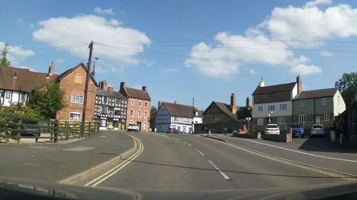

Museums and landmarks35

Ludlow Castle
Monument and historic site · 0.6 mi
Medieval fortification in Shropshire, England, UK
Castle Square, Ludlow




Chapel of St Thomas the Martyr
Monument and historic site · 0.7 mi
Dinham, Ludlow
23 more on the map.
Parks, trails and playgrounds8



Restaurants and cafes70


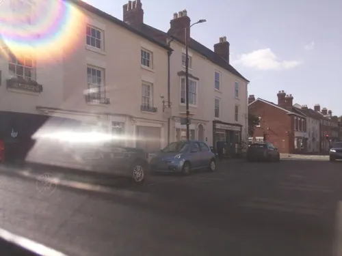

CSons
Cafe · 0.7 mi
Dinham Bridge, Ludlow
Mo 09:00-16:00; Tu 09:00-16:00; We 09:00-16:00; Th 09:00-16:00; Fr...

Taste at No 1
Cafe · Coffee Shop, Coffee · 0.5 mi
1 High Street, Ludlow
Mo-Sa 09:00-17:00; Su 10:00-16:00


58 more on the map.
History
The town is situated close to Wales, and lies near the midpoint of the 257-kilometre-long (160 mi) England–Wales border; it is also very close to the county border between Shropshire and Herefordshire (neighbouring Ludford remained part of Herefordshire until 1895). This strategic location invested it with national importance in medieval times, and thereafter with the town being the seat of the Council of Wales and the Marches during its existence (1472 to 1689).
At the time of the Domesday Book survey, the area was part of the large Stanton parish and manor, a possession of Walter de Lacy. Neither Ludlow nor Dinham are mentioned in the Book, compiled in 1086, although the Book recorded manors and not settlements per se. The Book does record a great number of households and taxable value for Stanton, perhaps suggesting that any early settlement by the nascent castle was being counted. Neighbouring places Ludford, the Sheet and Steventon do feature in the Book, as they were manors, proving that they were well-established places by the Norman conquest. The manor of Stanton came within the hundred of Culvestan, but during the reign of Henry I this Saxon hundred was merged into the new Munslow hundred.
Read more of the history
Walter's son Roger de Lacy began the construction of Ludlow Castle on the western promontory of the hill about 1075, forming what is now the inner bailey. Between about 1090 and 1120, the Chapel of St. Mary Magdalene was built inside the walls, and by 1130 the Great Tower was added to form the gatehouse. About 1170 the larger outer bailey was added to the castle. (The town walls however were not built until the mid-13th century.) The settlement of Dinham grew up alongside the development of the early castle in the late 11th century, with the northern part of this early settlement disturbed by the building of the outer bailey. Dinham had its own place of worship, the Chapel of St Thomas the Martyr, dedicated to Thomas Becket sometime in 1177–1189 when the present chapel replaced an older (late 11th-century) church building.
During the 12th century, the planned town of Ludlow was formed, in stages, the town providing a useful source of income for successive Marcher Lords, based on rents, fines, and tolls. They developed the town on a regular grid pattern, although this was adapted somewhat to match the local topography, from the late 11th century through the 12th century. The first laid street was along the ridge of the hilltop, what is now Castle Square, High Street and King Street. This formed a wide marketplace (later in-filled by buildings in places) running from the castle gates east across to St Laurence's and the Bull Ring, itself located on the ancient north–south road, now called Corve Street to the north and Old Street to the south. The wide Mill and Broad Streets were added later, as part of a southern grid plan of streets and burgage plots filling the area bounded by Dinham, the new High Street market, Old Street and the Teme to the south. Originally, Old Street ran down to a ford which took the ancient route south across to Ludford. A bridge was constructed (possibly by Josce de Dinan) at the foot of Broad Street, upstream of the ford, which then replaced the ford; its 15th-century replacement is the present-day Ludford Bridge.
St Laurence's Church, whose origins are late 11th century, was rebuilt and enlarged (with a bell tower) in 1199-1200 and became a parish church, with the separation of Ludlow from the parish of Stanton Lacy by 1200. The town notably had two schools (a choir and a grammar) in existence c. 1200; Ludlow Grammar School remained in existence until 1977, when it became Ludlow College.
Ludlow Castle was an important border fortification along the Welsh Marches, and one of the largest in the Norman/English ring of castles surrounding Wales. It played a significant role in local, regional and national conflicts such as the Owain Glyndŵr rebellion, the Wars of the Roses and the English Civil War. The castle and its adjoining town grew in political importance and in the 15th century the castle became the seat of the Council of Wales and the Marches. It was a temporary home to several holders of the title Prince of Wales, including King Edward V and Arthur Tudor, who died there in 1502.
The site features heavily in the folk-story of Fulk FitzWarin, outlawed Lord of Whittington, Shropshire and a possible inspiration for the Robin Hood legend. Fulk is brought up in the castle of Josce de Dinan, and fights for his master against Sir Gilbert de Lacy – these battles are the source of the story of Marion de la Bruyere, the betrayed lover whose ghost is still said to be heard screaming as she plummets from the castle's turrets.
The first recorded royal permission to maintain defensive town walls was given to the "men of Ludlow" in the Patent Rolls of 1233. The entry is however incomplete and atypical and was not renewed in the usual way. A murage grant was next made in 1260 and renewed regularly over the next two centuries. This time the grant was made by name to Geoffrey de Genevile, Lord of Ludlow. From this and other surviving documents it seems that the town walls and gates were in place by 1270. They were constructed about the central part of the community with four main gates and three postern gates. Because the walls were constructed after the development of the town's streets, the positions and names of the four main gates are based on the streets they crossed; the postern gates on the other hand are located by and named after old outlying districts. The 7 gates are (clockwise from the castle; postern gates in italics) Linney, Corve, Galdeford, Old, Broad, Mill and Dinham. An eighth unnamed 'portal' gate (smaller than a postern gate) existed in the wall just to the northwest of the castle, now in the gardens of Castle Walk House. The town walls are largely still in existence, although a section alongside the churchyard of St Lawrence's is, as of 2015, in need of repairs.
From the History section of Ludlow on Wikipedia, under CC BY-SA 4.0.
More about Ludlow
Geography
The medieval settlement is largely on the top of a hill, with the castle, market place and parish church (St Laurence's) situated along the flat land on this hilltop, which has a maximum elevation of 111 metres (364 ft) at the castle, falling only gradually towards the east, with an elevation of 107 metres (351 ft) at the Buttercross.
The streets then run down to the Rivers Teme and Corve (their confluence being to the northwest of the centre of Ludlow) to the north and south. The surface of the Teme has an approximate elevation of 76 metres (249 ft) as it passes Ludford Bridge.
In the western part of the historic core, Dinham retains the character of a village, though dominated by the castle, with a road leading steeply down from Castle Square to the Teme and then over Dinham Bridge (an early 19th century replacement of an older bridge very slightly downstream). The old chapel in Dinham, a Grade II* listed building, though no longer used for worship, features the oldest built structure in Ludlow outside the castle. To the east a rolling landscape exists, and it is in this direction that the town has steadily grown. East Hamlet was the name of the settlement to the east of the town.
Economy
McConnel Limited, a manufacturer of hedge cutting and verge mowing machinery, is based in Ludlow, occupying a seven-acre industrial site in the Temeside/Weeping Cross area of the town known as the Temeside Works. The company claims to be the innovator of the first tractor-mounted hedge cutting machine (produced in 1945) and a leading producer of reach flail mower hedge and verge mowing power-arm technology.
The town has regular outdoor markets held on Castle Square, an area that was enlarged in 1986 with the demolition of the Town Hall (which was also known as Market Hall). General markets are held on Mondays, Wednesdays, Fridays and Saturdays. Specialist markets (examples being crafts, antiques, local produce) are held on occasional Thursdays and Sundays. They are run by the town council.
Arts and culture
The now-defunct Ludlow Festival was held annually from 1960, during June and July each year. An open area within the castle served as the stage and backdrop for various Shakespearean plays, while a number of supporting events at various venues included classical and pop/rock concerts, varied musicians, lecture talks from public figures, and entertainers. The 54-year-old Festival which had been "loss-making" collapsed in 2014 due to "financial troubles". Organisers said it was "simply not commercially viable".
The Medieval Christmas Fayre continued to take place until 2019, the Covid 19 pandemic meant that the 2020 and 2021 Fayres could not go ahead. It was set up for 2022 but a storm caused damage the night before and meant it was cancelled at last minute. The financial impact meant that the festival organisers folded.
The Medieval Christmas Fayre was replaced by the Ludlow Winter festival in 2023 and was due to take place again in November 2024
Education
Ludlow has two primary schools for children aged 5–11 and a secondary school – the Ludlow Church of England School — for pupils aged 11–16.
Ludlow College is a sixth form college in the town centre, formed by the merger of the town's boys grammar school and girls high school. Prior to its merger with Herefordshire College in 2012 it was one of the oldest educational institutions in the country, dating back some 800 years.
From the Wikipedia article Ludlow, under CC BY-SA 4.0.
Notable people from Ludlow
 Thomas Andrew KnightBritish botanist (1759-1838)Photo: Solomon Cole (c.1806–1893), Public domain
 Charles Cardale BabingtonEnglish botanist and archaeologist (1808-1895)Photo: Worthy Vizard, Public domain
 Dick Heckstall-SmithEnglish jazz and blues saxophonist (1934-2004)Photo: Heinrich Klaffs, CC BY-SA 2.0
 Philip DunneBritish politician (born 1958)Photo: Richard Townshend, CC BY 3.0
 Katherine Mortimer, Countess of WarwickEnglish countessPhoto: Own work by Editornado, CC BY-SA 3.0
 Maria Eliza Rundell19th-century British author of cookery booksPhoto: Maria Rundell (1745–1828), Public domain
 Molly WeaverBritish cyclistPhoto: Claudio Martino, CC BY-SA 4.0
 William OwenEnglish portrait painter (1769–1825)Photo: William Owen, Public domain
- Henry Peach RobinsonBritish photographer (1830–1901)
- Peter Inge, Baron IngeChief of the General Staff and Defence Staff; head of the British Army (1935–2022)
- Philip BachEnglish footballer (1872–1937)
- Edmund MortimerEnglish rebel with Welsh leader Owain Glyndŵr
Born in Ludlow, according to Wikidata (CC0). Each name links to its Wikipedia article.
Where to stay9
Churches and places of worship10
Shopping29
Gas and EV charging2
Schools, colleges and libraries7
Healthcare2
Map of Ludlow
175 places. The map loads OpenStreetMap tiles when you open it.
Getting there and nearby towns
Gloucestershire Airport (GLO) is the nearest airport with scheduled flights listed in OpenStreetMap, 40 miles away.
- Stourport-on-Severn 18 mi east, about 30 min by car
- Telford 24 mi northeast, about 38 min by car
- Worcester 24 mi southeast, about 39 min by car
- Wellington 24 mi north, about 39 min by car
- Wombourne 25 mi northeast, about 40 min by car
- Dudley 28 mi east, about 45 min by car
- Wolverhampton 29 mi northeast, about 46 min by car
- West Bromwich 32 mi east, about 51 min by car
- Walsall 34 mi northeast, about 55 min by car
- Birmingham 35 mi east, about 56 min by car
Drive times are estimates from straight-line distance, not routes.
Towns near Ludlow


Keep exploring
Local news
Headlines from INDB.
Reviews, tips and questions
Loading what members have shared...
Sources and licences
- GeoNames (CC BY 4.0): population, coordinates, regions and time zone
- Mapillary (see each image): photos
- OpenStreetMap contributors (ODbL 1.0): places, airports, map data
- Wikidata (CC0 1.0): elevation, founding date, time zone, website, landmarks and historic places
- Wikimedia Commons (see each image): photos
- Wikipedia (CC BY-SA 4.0): overview and history text
Photo credits
- A frosty Ludlow, Shropshire&TelfordTSB, CC BY 2.0
- Feathers hotel, Newton2 at English Wikipedia, CC BY 2.5
- Ludlow - Ludlow College, Smb1001, CC BY-SA 4.0
- St Laurence's Church, Ludlow, Ian Capper, CC BY-SA 2.0
- The Bull Hotel, Ludlow - IMG 0162, Rept0n1x, CC BY-SA 3.0
- Ludlow Hospital, Ian Capper, CC BY-SA 2.0
- Fishmore Hall, Ian Capper, CC BY-SA 2.0
- Ludlow Library & Museum Resource Centre - IMG 0277, Rept0n1x, CC BY-SA 3.0
- Ludlow College - IMG 0190, Rept0n1x, CC BY-SA 3.0
- Ludlow Castle - Marcher Fortress - panoramio, Adrian Farwell, CC BY 3.0
- The Feathers Hotel, Michael D Beckwith, CC0
- Broad Gate House, Ludlow, Philip Pankhurst, CC BY-SA 2.0
- Street-level photo, trigpoint, CC BY-SA 4.0
- Street-level photo, southglos, CC BY-SA 4.0
- Street-level photo, trigpoint, CC BY-SA 4.0
- Street-level photo, southglos, CC BY-SA 4.0
- Street-level photo, southglos, CC BY-SA 4.0
- Street-level photo, trigpoint, CC BY-SA 4.0
- Street-level photo, trigpoint, CC BY-SA 4.0
- Street-level photo, southglos, CC BY-SA 4.0
- Street-level photo, southglos, CC BY-SA 4.0
- Street-level photo, southglos, CC BY-SA 4.0
- Street-level photo, southglos, CC BY-SA 4.0
- Street-level photo, southglos, CC BY-SA 4.0

Page built November 10, 2026. Spotted a mistake? Tell us or suggest a place.