


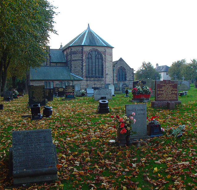


Skelmersdale, United Kingdom
Skelmersdale is a town of 38,813 people in England, United Kingdom.
Why visit Skelmersdale
Townapedia lists 8 museums and landmarks, 28 parks and trails, 39 places to eat and 4 attractions in and around town.
Highlights include Gathurst Viaduct, Halton Castle and Lathom House.
Weather in Skelmersdale
Forecast from MET Norway (CC BY 4.0). Full forecast
About Skelmersdale
Skelmersdale is a town in the West Lancashire district of Lancashire, England. It sits on the River Tawd, 6 miles (10 km) west of Wigan, 13 miles (21 km) north-east of Liverpool and 15 miles (24 km) south-west of Preston. In 2006, it had a population of 38,813. The town is known locally as Skem .
From the Wikipedia article Skelmersdale (this version), under CC BY-SA 4.0.
Travel tips from other travellers: Skelmersdale on Wikivoyage (CC BY-SA 4.0).
Photos of Skelmersdale

Things to do4



Museums and landmarks8

Halton Castle
Monument and historic site · 3.2 mi
Moated site in Lathom, West Lancashire, UK; possibly site of fortified house

Lathom House
Monument and historic site · 2.5 mi
Country house in Lancashire, England, UK


Amazing Novelty-Orium & Mechanical Museum
Museum
Arcade of vintage mechanical novelties
Southway, Skelmersdale
We-Su 11:00-17:30

ruined farm or quarry workings
Monument and historic site · 1.4 mi
Remains of Belle View Farm
Parks, trails and playgrounds28


16 more on the map.
Restaurants and cafes39



Cafe Seven
Cafe · 0.9 mi
7 Lyndale, Skelmersdale
Mo 08:30-18:30; Tu 08:30-16:00; We 08:30-14:15; Th 08:30-17:00; Fr...
Grimshaw Lane Inn
Bar and pub · 0.4 mi
373 Ormskirk Road, Skelmersdale
Mo-Th 14:00-24:00, Fr-Su 12:00-24:00
Siesta Coffee
Cafe · Coffee Shop, Cake, Sandwich, Toastie, Salad
Unit 110 The Concourse Shopping Centre, Skelmersdale
The Coffee House
Cafe · Coffee Shop
Unit 33-35 The Concourse Shopping Centre, Skelmersdale
27 more on the map.
History
Skelmersdale means "Skjaldmarr's valley", from the Old Norse personal name Skjaldmarr + probably Old Norse dalr (or Old English dæl) "dale, valley". The name was recorded as Skalmeresedel in 1136.
It is locally known as "Skem", with a further distinction being made between "Old Skem" (the area which was a small mining town before 1961) and the broader swathe of development on the east side of the town.
Until the creation of Skelmersdale Urban District Council at the end of the 19th century, the town was part of the Parish of Ormskirk in the West Derby hundred, an ancient subdivision of Lancashire, covering the southwest of the county.
In the mid-14th century, the manor of Skelmersdale was held by William Dacre, 2nd Baron Dacre.
In 1858, Blague Gate railway station in Skelmersdale was opened on the new Ormskirk to Rainford line. It was renamed to Skelmersdale railway station in 1874, before closing in 1956 and its demolition shortly after 1968.
Skelmersdale's population in 1851 was only 760, but 50 years later it had increased to 5,699. It was a busy coal mining town. There were over 100 fatalities in Skelmersdale collieries from 1851 to 1900, according to the Reports of the Inspectors of Coal Mines, and an unknown number of serious injuries. In 1880 there were 14 Skelmersdale collieries—most of them closed in the 1920s and '30s.
Read more of the history
The miners, many of whom were Welsh migrants, brought with them their own brand of Nonconformist Christianity. By the start of the 20th century there were at least six dissenting chapels in the town: two Wesleyan (Berry Street, closed in the 1920s, and Liverpool Road, closed 1969), an independent Methodist, a Primitive Methodist, a Congregational and a Welsh Chapel (closed in 1963).
Today, there is little to remind people that the town was part of the once great Lancashire Coalfield, although a Skelmersdale Heritage Society was re-established in 2019.
There were also numerous brickworks in the area, and in the early-20th century Victoria County History, Skelmersdale was described as "a particularly bare, unpleasing district" owing to its coal mines and brickworks.
In 1961 Skelmersdale was designated a new town, designed to house overspill population from the north Liverpool conurbation. The town was the first in the second wave of designations.
Skelmersdale endured mixed economic fortunes during the last three decades of the 20th century. With the economic downturn in the late 1970s, large industrial employers left the town en masse, resulting in an increase in crime, drug abuse and poverty. Today, West Lancashire has a crime rate below the national average. 2006 saw a regeneration drive for the town coordinated through English Partnerships and the Northwest Regional Development Agency and publicly headed by the designer Wayne Hemingway. Among the proposals was a new central focus for the entertainment and commerce for the town in the evening.
In 2012, a £20m vision to create a regenerated town centre for Skelmersdale was revealed. It is expected to create as many as 500 permanent jobs, and current projections seem to satisfy that target. Although Skelmersdale faces a looming employment crisis, the regeneration of the town centre is a step towards recovery, and up to 100 extra jobs would be generated during the scheme's construction phase alone.
Proposals included a new food store as well as a number of bars, shops and restaurants, and a five-screen cinema. A new promenade would be fronted by these establishments to overlook the Tawd Valley Park, and a new civic square would also be created between the Concourse Shopping Centre and the town library. Regeneration specialists St Modwen have been working on the proposals with West Lancashire Council and the Homes and Communities Agency.
In January 2020, work began on a new Lidl supermarket and a B&M store, along with an additional vacant retail unit, which would later be leased out to Poundstretcher, and work began on a new two-screen cinema operated by US company Star Cinemas in May 2020, which opened in May 2021 under the name Ultra Star Cinema; however it was re-branded to "Capitol Cinema" in June 2021. In June 2020, Lancashire County Council acquired the site of the former Glenburn Sports College, and approved £2 million of funding to demolish the site and prepare the location for development as a railway station.
The new Lidl store opened on 9 June 2022, and the B&M store opened on 6 July 2022. In addition to this, the third vacant retail unit was taken up by Poundstretcher, which opened on 1 November 2022. In addition to this, the pathway between West Lancashire College and the Concourse Shopping Centre opened in June, however, the high street linking the two sites has not yet been constructed. In addition to this, the Queen Elizabeth II Platinum Jubilee Park was constructed in the area, linking in with the new town centre developments. The park opened in June but was closed again in August due to vandalism and health and safety concerns due to missing safety equipment and fires caused by local teenagers.
There are plans to redevelop the land behind the new Lidl store to build a new health and wellbeing centre, featuring a gym, swimming pool, café, and children's play park. This will also result in the demolition of the existing Nye Bevan site. Plans have also been submitted by EG Group and approved by West Lancashire Borough Council to build a Starbucks café in the car park of the town's Asda store, the Starbucks café officially opened on 19 June 2025.
From the History section of Skelmersdale on Wikipedia, under CC BY-SA 4.0.
More about Skelmersdale
Geography
Skelmersdale is situated in a small valley on the River Tawd. The town was designed to accommodate both nature and compact housing estates, and the town centre contains a large amount of forestation. The Beacon Country Park lies to the east of Skelmersdale, where the Beacon Point lies, along with a golf club. Furthermore, the Tawd Valley Park runs through the centre of the town, where improvement efforts from the council are currently ongoing.
The town borders Up Holland to the east, Ormskirk to the north-west, and St Helens to the south. Furthermore, the town lies on the periphery of Wigan and Greater Manchester. The M58 runs to the south of Skelmersdale, from Wigan to Liverpool.
The New Town is the larger eastern part of the town which was built primarily in the 1960s as a second wave new town, and the 'Old Town' is the much smaller and older part of the town in the south west; Skelmersdale was mentioned in the Domesday Book of 1086. The town is further divided into seven wards: Skelmersdale North, Skelmersdale South, Birch Green, Ashurst, Digmoor, Moorside and Tanhouse.
Economy
Although consisting predominantly of housing estates, Skelmersdale's industry includes the Co-operative Bank which employs 650 people, distribution centres for Asda, P&G, Victorian Plumbing, a Walkers snack food factory, Chemist 4 U and many others. Skelmersdale formerly housed the corporate base and a distribution centre for Matalan, the discount clothing and homewares store, who later relocated to Knowsley Industrial Park. Frederick's Dairies, now owned by R&R Ice Cream UK Ltd, who make ice cream for Cadbury, and many others, are also located in Skelmersdale.
Skelmersdale's town centre is made up of the Concourse Shopping Centre, (colloquially known as "the Connie") as well as a supermarket, a library, a swimming pool and gym named after former Minister of Health Aneurin Bevan (however there are plans to redevelop these facilities), West Lancashire College's main campus, a multistorey car park, and the Tawd Valley Retail Park.
The Concourse is home to a number of national chain stores. The Concourse used to have an artwork by Alan Boyson, in the shape of a pyramid. The pyramid was located in front of the entrance opposite the ecumenical centre until the early to mid-1980s but was removed for safety reasons.
There are also smaller shopping parades in Skelmersdale which include Sandy Lane Shopping Centre, Digmoor Parade and Ashurst Shopping Centre.
Education
Skelmersdale has a number of primary schools, and has two high schools: Our Lady Queen of Peace Catholic Engineering College and Lathom High School. Glenburn Sports College closed on 31 August 2016 following an unsuccessful campaign backed by former local MP Rosie Cooper to prevent the closure.
West Lancashire College has a campus in the centre of the town. The college merged with Newcastle College in 2007 and was graded as 'good' in a recent Ofsted inspection. In 2021, Brian Cox launched the college's 'School of Science', a £1.3 million facility with the intention of increasing the number of students who study science, technology, engineering and mathematics.
There is a Transcendental Meditation movement community within Skelmersdale, called "European Sidhaland". It has a Maharishi School which, as of 2019, performed 'well above average' according to Ofsted. In 2011, it was one of 24 schools that applied for and received government funding as a flagship free school.
Skelmersdale is also home to a large public library with facilities including free internet access and an extensive local history section.
The town is host to a number of cultural and social organisations, such as the Artz Centre which provides opportunities in creative fields, and The Birchwood Centre which aims to reduce social isolation and homelessness.
From the Wikipedia article Skelmersdale, under CC BY-SA 4.0.
Notable people from Skelmersdale
 SoniaBritish singer (born 1971)Photo: Andrew Hurley, CC BY-SA 2.0
 Jessica GagenEnglish aerospace engineer and beauty pageant titleholder (born 1995)Photo: Zebrichcois, CC0
- John Andertonfootballer (born 1933)
- John GregsonEnglish footballer (born 1939)
- Jimmy BriscoeScottish footballer
- Matt WoodsEnglish footballer (1931-2014)
- Peter SmithEnglish footballer born in 1980
- Harry SwainstonEnglish footballer (1880-?)
- Jimmy HolmesEnglish footballer (1908-1971)
- Jimmy TootleEnglish footballer
Born in Skelmersdale, according to Wikidata (CC0). Each name links to its Wikipedia article.
Churches and places of worship12
Shopping12
Gas and EV charging8
Schools, colleges and libraries26
Our Lady Queen of Peace Catholic High School
School · Roman Catholic · 1.2 mi
Glenburn Road, Skelmersdale
St Francis of Assisi Catholic Primary School
School · Roman Catholic · 0.7 mi
Blakehall, Skelmersdale
Trinity Church of England/Methodist School
School · Anglican, Methodist · 0.8 mi
Kiln Lane, Skelmersdale
Healthcare4
Skelmersdale Walk In Centre
Clinic and pharmacy
116-118 The Concourse Shopping Centre, Skelmersdale
Map of Skelmersdale
141 places. The map loads OpenStreetMap tiles when you open it.
Getting there and nearby towns
Warton Aerodrome (WRT) is the nearest airport with scheduled flights listed in OpenStreetMap, 14 miles away.
- Ormskirk 5 mi west, about 7 min by car
- Wigan 6 mi east, about 9 min by car
- St Helens 7 mi south, about 11 min by car
- Ashton in Makerfield 7 mi southeast, about 11 min by car
- Ince-in-Makerfield 7 mi east, about 11 min by car
- Haydock 7 mi southeast, about 11 min by car
- Maghull 7 mi west, about 12 min by car
- Hindley 8 mi east, about 13 min by car
- Abram 8 mi east, about 13 min by car
- Golborne 9 mi southeast, about 14 min by car
Drive times are estimates from straight-line distance, not routes.
Towns near Skelmersdale


Keep exploring
Local news
Headlines from INDB.
Reviews, tips and questions
Loading what members have shared...
Sources and licences
- GeoNames (CC BY 4.0): population, coordinates, regions and time zone
- Mapillary (see each image): photos
- OpenStreetMap contributors (ODbL 1.0): places, airports, map data
- Wikidata (CC0 1.0): elevation, founding date, time zone, website, landmarks and historic places
- Wikimedia Commons (see each image): photos
- Wikipedia (CC BY-SA 4.0): overview and history text
Photo credits
- The Concourse, Skelmersdale, Small-town hero, Public domain
- Lathom House West Wing, Small-town hero, Public domain
- St Thomas the Martyr Up Holland, July 2018, PC78, CC BY-SA 4.0
- St Luke's Church, Orrell, Gary Rogers, CC BY-SA 2.0
- St Paul's Church, Skelmersdale (1), Rept0n1x, CC BY-SA 3.0
- Skelmersdale War Memorial (5), Rept0n1x, CC BY-SA 3.0
- Lune Halton village 6105, Photograph by Clem Rutter, Rochester, Kent. ( www.clemrutter.net )., CC BY-SA 3.0
- Skem at night, One SMart Bean, CC0
- Street-level photo, davidsong, CC BY-SA 4.0
- Street-level photo, mappo2, CC BY-SA 4.0
- Street-level photo, mappo2, CC BY-SA 4.0
Page built November 10, 2026. Spotted a mistake? Tell us or suggest a place.