

Why visit Stone
Townapedia lists 4 museums and landmarks, 10 parks and trails, 42 places to eat, 3 places to stay and 2 attractions in and around town.
Highlights include Stone Meadows and Canal Cruising Company.
Weather in Stone
Forecast from MET Norway (CC BY 4.0). Full forecast
About Stone
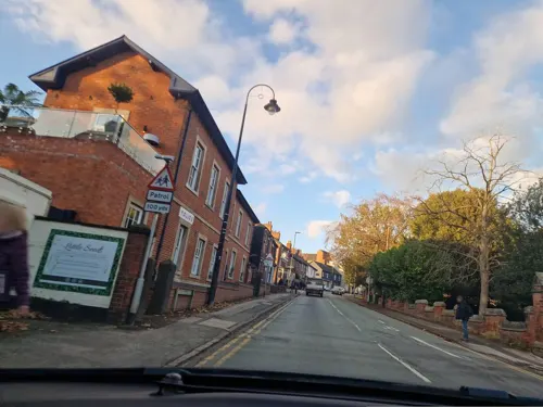
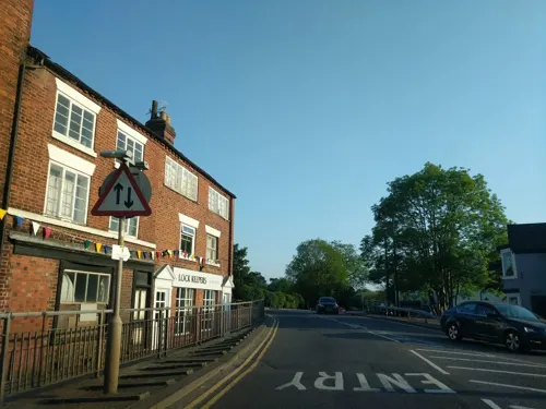
Stone is a market town and civil parish in the Borough of Stafford in Staffordshire, England. It is situated approximately 7 miles (11 km) north of Stafford, 7 miles (11 km) south of Stoke-on-Trent and 15 miles (24 km) north of Rugeley. As a notable canal town, Stone is recognised for its rich history, originating from the early Bronze Age and continuing through the Industrial Revolution, with the introduction of the Trent and Mersey Canal shaping the town's development and local industry.
From the Wikipedia article Stone, Staffordshire (this version), under CC BY-SA 4.0.
Things to do2


Museums and landmarks4

Parks, trails and playgrounds10

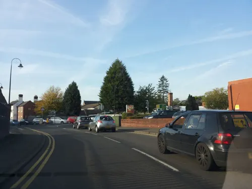




Restaurants and cafes42
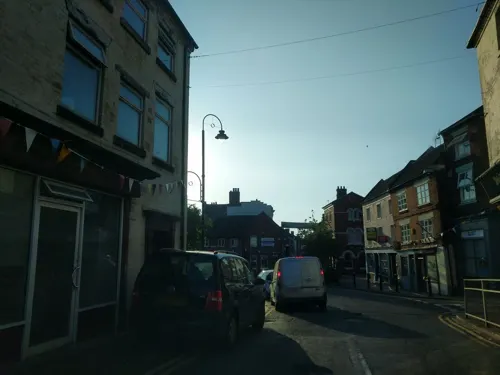
Cavalli
Restaurant · Indian · 0.5 mi
3 Lichfield Street, Stone
Mo-Th,Su 17:30-22:30; Fr-Sa 17:30-23:00
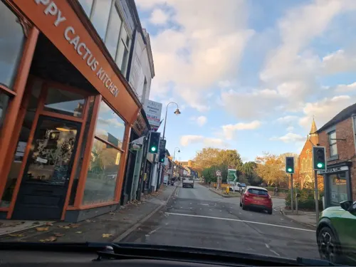


Costa
Cafe · Coffee Shop
55 High Street, Stone
Mo-Fr 07:00-19:00; Sa 07:00-18:00; Su 08:00-17:00

30 more on the map.
History
There is a Bronze Age ring ditch at Pirehill suggesting occupation in prehistoric times.
Stone lies within the territory of the Iron Age Celtic tribe 'the Cornovii' (people of the horn; perhaps a horned god or topographical feature), mentioned by Ptolemy in the 2nd century AD in his Geography. To the north-west of Stone lies one of their hill forts, which overlooks the Trent and perhaps the salt production in the region.
The early history of Stone is unclear and is clouded by the 12th century medieval romance concerning the murder of the Saxon princes Wulfad and Rufin by their father, Wulfhere of Mercia, who reputedly had his base near Darleston (Wulfherecester). The murder of Wulfad in the 7th century and his subsequent entombment under a cairn of stones is the traditional story (described as "historically valueless" by Thacker 1985: 6).
Read more of the history
The church built over the stones marking the graves of Wulfad and Rufin in 670 lasted until the 9th century, before being destroyed by invading Danes. It was replaced in 1135 by the Augustinian Stone Priory, which survived until its dissolution in the reign of Henry VIII. The building collapsed in 1749 and the present church of St. Michael's was built in 1758. All that remains of the original priory is the rib-vaulted undercroft which forms the foundations beneath Priory House, which is located on Lichfield Street opposite the Frank Jordan Community Centre.
Stone lay within the Pirehill hundred of Staffordshire named after nearby Pire Hill. In 1251 Henry III granted Stone a market charter.
The Common Plot (also known as Mudley Pits) is a large area of open and wooded common land, sited just to the north of the town of Stone. It was reserved as an area of common land for the inhabitants of the town when the previous strip-farmed fields were enclosed by the Stone Inclosure Act 1798 (38 Geo. 3. c. 78 Pr.). The Duke of Cumberland built extensive winter fortifications and a camp here; traces of which can still be seen, during the winter of 1745/46. The purpose of the camp was to bring the Duke's army down from the freezing Staffordshire Moorlands and Peak District, where they had been seeking to stop an advance on London by a force of 6,000 Jacobite rebels. The rebels were thought to be using pack-horse routes over the high country, with the aim of reaching Derby. Stone was also strategic in preventing any break-away Jacobite group going across to Wales to recruit more men there but, with winter coming on, the Jacobites decided to retreat back to Scotland.
Stone Urban District was an urban district, based on the Stone civil parish which equates to the town of Stone. There were two amendments in parts of the Stone Rural parish in Stone Rural District were transferred in. The district was abolished by the Local Government Act 1972 and replaced with Stafford Borough Council and Stone Town Council. The latter publishes a history of Stone.
Stone stands in the valley of the River Trent, and was an important stopping-off point for stagecoaches on one of the roads turnpiked in the 18th century. A directory for 1851 says that "Stone was a very lively town and a great thoroughfare for coaches, carriers and travellers. No fewer than 38 stage coaches passed through the town daily." The main coaching route was the London to Holyhead route, via Watling Street as far as Lichfield and then the A51.
To support the coaching trade, Stone was a principal stopping point with many coaching inns to refresh both horses and travellers. Notable hostelries include the Crown Hotel, Crown & Anchor, Red Lion and the Black Horse Inn.
The River Trent, which runs through the town, had been used for cargo-carrying vessels since Roman times, but further inland smaller boats could only be used. Seasonal fluctuations in water depth proved insurmountable, although cargo could be carried from the sea as far south as Wilden Ferry (south-east of Derby), where the River Derwent joins the Trent and increases the quantity of water, then onwards by road. Prior to tarmac roads, journeys overland by roads were slow and delicate wares were prone to breakages over the rough terrain.
James Brindley, the canal builder, put forward the scheme to build what he called the Grand Trunk Canal to connect the two rivers, Mersey and Trent in 1766. It was backed by Josiah Wedgwood, who saw that it offered an efficient way to bring raw materials to the potteries and to transport finished wares to his customers.
By 29 September 1772, two days after Brindley's death, 48 miles of the Grand Trunk Canal (now known as the Trent and Mersey Canal) from Wilden Ferry to Stone was navigable; the length past Burton-on-Trent was completed in 1770.
On completion of the Star Lock, a grand opening was held and during this opening a cannon was fired in celebration; however, disaster struck and the cannon damaged the new lock, requiring a rebuild.
Stone became the headquarters of the canal company with its office at Westbridge House, sited then below Star Lock on what is now Westbridge Park. The offices were moved later to Stoke-on-Trent.
Due to the quality of the local water beneath Stone, two brewers were located here carrying on the Augustinian monks' tradition of beer making. The most notable was John Joule & Sons Ltd, established in 1780. The company was acquired by Bass Charrington in 1968 and ceased brewing at the end of October 1974. The brewery was demolished in the autumn of 1977; the adjacent bottling plant was closed some years before. The canal played a great part in the export of beer. Joules once owned a pair of boats that delivered coal to the brewery and, as late as the 1950s, had the telephone number Stone 1. Joules' draught beer stores and bottling plant remains an imposing building on the canal and can be clearly identified by the red cross logo of John Joules in the brickwork.
From the History section of Stone, Staffordshire on Wikipedia, under CC BY-SA 4.0.
More about Stone
Economy
Staffordshire Fire and Rescue Service has its headquarters just south of Stone. Yarnfield Park Training and Conference Centre just outside the town is a major training centre for the UK telecommunications industry. It is owned by BT Group and run by Accenture.
The canal still dominates the town. Many canal side sites have in recent times been taken over for modern day use including The Moorings, a development of apartments based on the old Stubbs warehouse. Apartments and housing surround the old Trent Hospital, once the workhouse. Housing developments also border the canal.
Commercial traffic has now been replaced by the leisure craft that pass through Stone each year. The Canal Cruising Company today operates from the historic site of the canal maintenance and boat building operations of the Trent and Mersey Canal Company. This restored docks complex with its workshops, by Yard Lock, continues to be used for the maintenance of pleasure craft and historic boats. In 2010, a new marina opened just south of the town, below Aston Lock, with moorings for pleasure craft, a farm shop and a café.
Stone is the key UK manufacturing site for the Quickfit laboratory glassware system which finds widespread use in many school, college and university science departments.
The National Association of Chimney Sweeps is located in the town.
Education
State education within Stone is based on the three-tier school system, with a range of first and primary schools, two middle schools (Walton Priory Middle and Christchurch Academy) and a high school (Alleyne's Academy). Independent education is served by the Catholic St Dominic's Priory School founded with the convent of the same name in the 19th century by Mother Margaret Hallahan when the school was originally known as Blessed Imelda's Enpension School.
From the Wikipedia article Stone, Staffordshire, under CC BY-SA 4.0.
Notable people from Stone
 Stan CollymoreEnglish footballerPhoto: ПБК ЦСКА Москва, CC BY 3.0
 Andy WilkinsonEnglish footballer (born 1984)Photo: Ronnie Macdonald, CC BY 2.0
 WerburghAnglo-Saxon saintPhoto: Wolfgang Sauber, CC BY-SA 3.0
 Peter De WintEnglish landscape painter (1784-1849)Photo: Peter DeWint (1784 - 1849) – Artist..., Public domain
- Cedric PriceBritish architect (1934–2003)
- Jakki DeggBritish model
- Scout NiblettBritish musician
- David WarrilowBritish actor
- A. N. WilsonBritish poet, biographer, critic, journalist writer and newspaper columnist (1950-)
- Chris BanksBritish footballer (born 1965)
- James Boltonassociation football player (born 1994)
- John JamesEnglish footballer, born 1948
Born in Stone, according to Wikidata (CC0). Each name links to its Wikipedia article.
Where to stay3
Churches and places of worship5
Shopping5
Gas and EV charging2
Schools, colleges and libraries11
Healthcare1
Map of Stone
85 places. The map loads OpenStreetMap tiles when you open it.
Getting there and nearby towns
Manchester Airport (MAN) is the nearest airport with scheduled flights listed in OpenStreetMap, 31 miles away.
- Stoke-on-Trent 7 mi north, about 11 min by car
- Newcastle under Lyme 7 mi northwest, about 12 min by car
- Uttoxeter 12 mi east, about 19 min by car
- Telford 20 mi southwest, about 32 min by car
- Wellington 21 mi southwest, about 33 min by car
- Wolverhampton 22 mi south, about 36 min by car
- Burton upon Trent 22 mi east, about 36 min by car
- Whitchurch 22 mi west, about 36 min by car
- Walsall 23 mi south, about 37 min by car
- Winsford 25 mi northwest, about 40 min by car
Drive times are estimates from straight-line distance, not routes.
Towns near Stone


Keep exploring
Local news
Headlines from INDB.
Reviews, tips and questions
Loading what members have shared...
Sources and licences
- GeoNames (CC BY 4.0): population, coordinates, regions and time zone
- Mapillary (see each image): photos
- OpenStreetMap contributors (ODbL 1.0): places, airports, map data
- Wikidata (CC0 1.0): elevation, founding date, time zone, website, landmarks and historic places
- Wikimedia Commons (see each image): photos
- Wikipedia (CC BY-SA 4.0): overview and history text
Photo credits
- Crown Meadow, Staffordshire 2, AtticTapestry, CC BY-SA 4.0
- Street-level photo, adam2, CC BY-SA 4.0
- Street-level photo, adam2, CC BY-SA 4.0
- Street-level photo, edloach, CC BY-SA 4.0
- Street-level photo, adam2, CC BY-SA 4.0
- Street-level photo, edloach, CC BY-SA 4.0
- Street-level photo, endszbrxns, CC BY-SA 4.0
- Street-level photo, endszbrxns, CC BY-SA 4.0
- Street-level photo, endszbrxns, CC BY-SA 4.0
- Street-level photo, adam2, CC BY-SA 4.0
- Street-level photo, adam2, CC BY-SA 4.0
- Street-level photo, edloach, CC BY-SA 4.0
- Street-level photo, edloach, CC BY-SA 4.0
- Street-level photo, adam2, CC BY-SA 4.0
- Street-level photo, adam2, CC BY-SA 4.0
- Street-level photo, adam2, CC BY-SA 4.0
- Street-level photo, edloach, CC BY-SA 4.0
- Street-level photo, edloach, CC BY-SA 4.0
- Street-level photo, edloach, CC BY-SA 4.0
- Street-level photo, edloach, CC BY-SA 4.0
- Street-level photo, edloach, CC BY-SA 4.0
- Street-level photo, adam2, CC BY-SA 4.0
- Street-level photo, adam2, CC BY-SA 4.0
Page built November 10, 2026. Spotted a mistake? Tell us or suggest a place.