


Starcross, United Kingdom
Starcross is a town of 1,737 people in England, United Kingdom.
Why visit Starcross
Townapedia lists 10 museums and landmarks, 9 parks and trails, 32 places to eat, 8 places to stay and 1 attraction in and around town.
Highlights include Powderham Castle, A La Ronde and Dawlish Warren National Nature Reserve.
Weather in Starcross
Forecast from MET Norway (CC BY 4.0). Full forecast
About Starcross
Starcross is a village with a 2021 census recorded population of 1,694 situated on the west shore of the Exe Estuary in Teignbridge in the English county of Devon. The village is popular in summer with leisure craft, and is home to one of the United Kingdom's oldest sailing clubs.
From the Wikipedia article Starcross (this version), under CC BY-SA 4.0.
Photos of Starcross


Things to do1

Museums and landmarks10


A La Ronde
Museum · 2.0 mi
Heritage Museum in South West England, United Kingdom


Parks, trails and playgrounds9






Restaurants and cafes32

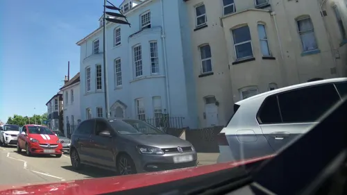
China Garden
Restaurant · Chinese · 1.5 mi
23 Imperial Road, Exmouth
Tu-Sa 12:00-14:00,17:00-22:30; Su 17:30-22:30
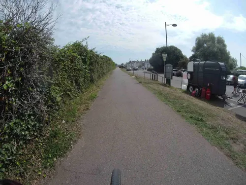
Teign Bean @ Starcross
Cafe · Coffee Shop
"Opening hours subject to weather – Please check our social media for live updates"
09:00-17:00




Land & Sea
Restaurant · 1.3 mi
14 Pilot Wharf Pier Head, Exmouth
Mo-Fr 11:00-22:00; Sa 10:00-22:00; Su 10:00-20:00
20 more on the map.
Where to stay8
Churches and places of worship9
Parish Church of the Nativity of the Blessed Virgin Mary
Church · 1.8 mi
St Margaret and St Andrew's Church, Littleham, Exmouth
Church · 3.3 mi
Shopping9
Schools, colleges and libraries4
Healthcare2
Map of Starcross
84 places. The map loads OpenStreetMap tiles when you open it.
Getting there and nearby towns
Exeter Airport (EXT) is the nearest airport with scheduled flights listed in OpenStreetMap, 7 miles away.
- Kenton 1 mi northwest, about 2 min by car
- Exmouth 2 mi east, about 3 min by car
- Dawlish 3 mi south, about 5 min by car
- Teignmouth 6 mi south, about 10 min by car
- Exeter 8 mi northwest, about 12 min by car
- Kingsteignton 8 mi southwest, about 13 min by car
- Newton Abbot 10 mi southwest, about 16 min by car
- Sidmouth 10 mi northeast, about 16 min by car
- Whimple 10 mi northeast, about 17 min by car
- Torquay 12 mi south, about 19 min by car
Drive times are estimates from straight-line distance, not routes.
Towns near Starcross


Keep exploring
Local news
Headlines from INDB.
Reviews, tips and questions
Loading what members have shared...
Sources and licences
- GeoNames (CC BY 4.0): population, coordinates, regions and time zone
- Mapillary (see each image): photos
- OpenStreetMap contributors (ODbL 1.0): places, airports, map data
- Wikidata (CC0 1.0): elevation, founding date, time zone, website, landmarks and historic places
- Wikimedia Commons (see each image): photos
- Wikipedia (CC BY-SA 4.0): overview and history text
Photo credits
- Starcross station (2021-07-31) 02, Simon Cobb, CC0
- Starcross 2020-07-31 8, Simon Cobb, CC0
- Starcross 2020-07-31 9, Simon Cobb, CC0
- Starcross station (2021-07-31) 06, Simon Cobb, CC0
- Starcross 2020-07-31 40, Simon Cobb, CC0
- Starcross 2020-07-31 41, Simon Cobb, CC0
- Starcross 2020-07-31 42, Simon Cobb, CC0
- Starcross railway station MMB 07, mattbuck ( category ), CC BY-SA 3.0
- Starcross railway station MMB 15 150121, mattbuck ( category ), CC BY-SA 3.0
- Powderham Castle, 2009, raymond cocks, CC BY 2.0
- A La Ronde (5523285615), Becks, CC BY 2.0
- Dawlish MethodistChurch, Motacilla, CC BY-SA 4.0
- Starcross 2020-07-31 36, Simon Cobb, CC0
- Cockwood (2021-07-31) 08, Simon Cobb, CC0
- Kenton (2021-09-26) 19, Simon Cobb, CC0
- Kenton 2021-04-08 IMG 25, Simon Cobb, CC0
- The Strand, Simon Cobb, CC0
- The Grove (1), Simon Cobb, CC0
- Lower Halsdon Farm NT (39409877681), kitmasterbloke, CC BY 2.0
- Exmouth Marina. (3843154671), Phil Sangwell from United Kingdom, CC BY 2.0
- Street-level photo, southglos, CC BY-SA 4.0
- Street-level photo, jasskurn, CC BY-SA 4.0
- Street-level photo, southglos, CC BY-SA 4.0
- Street-level photo, southglos, CC BY-SA 4.0
- Street-level photo, southglos, CC BY-SA 4.0
- Street-level photo, southglos, CC BY-SA 4.0
- Street-level photo, southglos, CC BY-SA 4.0
- Street-level photo, jasskurn, CC BY-SA 4.0
- Street-level photo, southglos, CC BY-SA 4.0
- Street-level photo, WaggyDog, CC BY-SA 4.0
- Street-level photo, southglos, CC BY-SA 4.0
- Street-level photo, southglos, CC BY-SA 4.0
- Street-level photo, southglos, CC BY-SA 4.0
- Street-level photo, southglos, CC BY-SA 4.0
- Street-level photo, southglos, CC BY-SA 4.0
- Street-level photo, southglos, CC BY-SA 4.0
- Street-level photo, southglos, CC BY-SA 4.0
- Street-level photo, southglos, CC BY-SA 4.0
- Street-level photo, southglos, CC BY-SA 4.0
- Street-level photo, southglos, CC BY-SA 4.0
- Street-level photo, southglos, CC BY-SA 4.0


Page built November 10, 2026. Spotted a mistake? Tell us or suggest a place.