



Stourport-on-Severn, United Kingdom
Stourport-on-Severn is a town of 20,586 people in England, United Kingdom.
Why visit Stourport-on-Severn
Townapedia lists 10 museums and landmarks, 34 parks and trails, 44 places to eat, 10 places to stay and 4 attractions in and around town.
Highlights include Bewdley Bridge, Stourport Civic Centre, Bewdley Museum and Hartlebury Castle.
Weather in Stourport-on-Severn
Forecast from MET Norway (CC BY 4.0). Full forecast
About Stourport-on-Severn
Stourport-on-Severn, often shortened to Stourport, is a town and civil parish in the Wyre Forest District of North Worcestershire, England, 4 miles to the south of Kidderminster and downstream on the River Severn from Bewdley. At the 2021 census, it had a population of 20,653.
From the Wikipedia article Stourport-on-Severn (this version), under CC BY-SA 4.0.
Travel tips from other travellers: Stourport-on-Severn on Wikivoyage (CC BY-SA 4.0).
Things to do4

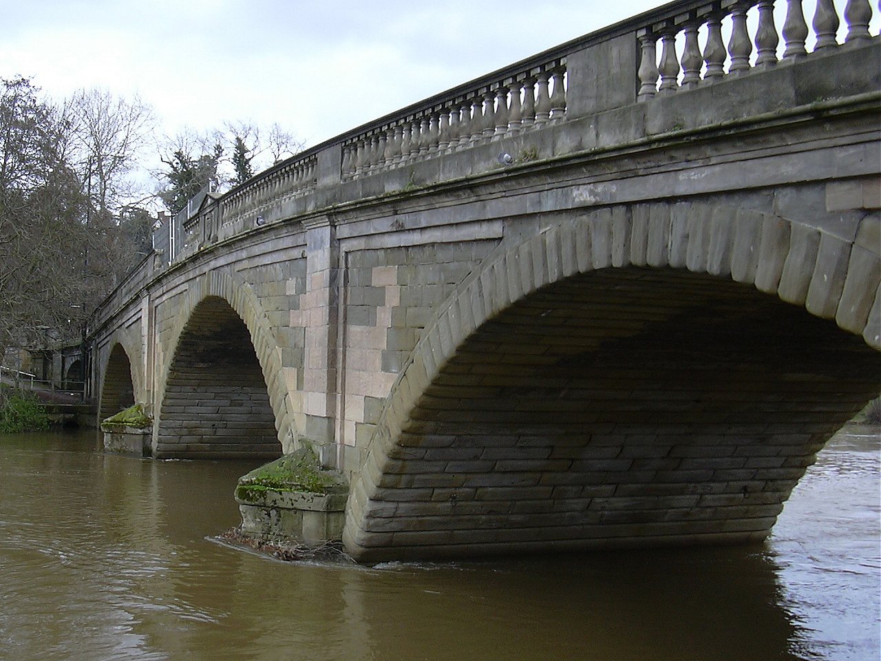
Bewdley Bridge
Bridge · 2.9 mi
Grade I listed bridge in Bewdley, Worcestershire, England
Stourport Civic Centre
Cinema and theater
Theatre and public hall in Stourport on Severn, England


Museums and landmarks10
Bewdley Museum
Museum · 2.9 mi
Museum in Bewdley, England, United Kingdom

Hartlebury Castle
Museum · 1.6 mi
Grade I listed house in Hartlebury, Wychavon, Worcestershire, England, UK

Worcestershire County Museum
Museum · 1.6 mi
Museum in Hartlebury Castle, near KIdderminster, England, United Kingdom

Parks, trails and playgrounds34

West Midland Safari Park
Park · 2.5 mi
Safari park in Worcestershire, England



22 more on the map.
Restaurants and cafes44


32 more on the map.
History
Stourport came into being around the canal basins at the Severn terminus of the Staffordshire and Worcestershire Canal, which was completed in 1768. In 1772 the junction between the Staffordshire and Worcestershire and the Birmingham Canal was completed and Stourport became one of the principal distributing centres for goods to and from the rest of the West Midlands. The canal terminus was built on meadowland to the south west of the hamlet of Lower Mitton. The terminus was first called Stourmouth and then Newport, with the final name of Stourport settled on by 1771.
The population of Stourport rose from about 12 in the 1760s to 1300 in 1795. In 1771 John Wesley had called Stourport a "well built village" but by 1788 he noted that "where twenty years ago there was but one house; now there are two or three streets, and as trade increases it will probably grow into a considerable town". In 1790 he found the town "twice as large as two years ago".
With the completion of the Worcester and Birmingham Canal in 1816, the revenue of the Staffordshire and Worcestershire Canal plunged sharply and from 1812 the population of Stourport scarcely rose, with many male workers leaving the town.
Read more of the history
In the area close to Stourport there are several large manor and country houses, among which Witley Court, Astley Hall, Pool House, Areley Hall, Hartlebury and Abberley Hall (with its clock tower) are particularly significant. Hartlebury was the residence of the Bishops of Worcester from the early 13th century until 2007, and Astley Hall was the home of Prime Minister Stanley Baldwin, who died here in 1947.
The George Gilbert Scott church replaced an earlier brick church of 1782 by James Rose. This building was never finished, and after suffering storm damage, had to be partly demolished. The current St. Michael's church sits partially within its ruins. The baptismal font was salvaged from the ruins of the old church, and is still used in the current building.
In 1944, the town was the location of a famous address to US army troops by General George S. Patton. Stourport Civic Centre, which is now used as an events venue, was completed in 1966.
In 1968 the Transport Act designated the canal a "cruise way" for pleasure purposes.
The town is the birthplace of singer-songwriter Clifford T. Ward, and the ornithologist Henry Eliot Howard (1873–1940) died there.
From the History section of Stourport-on-Severn on Wikipedia, under CC BY-SA 4.0.
Notable people from Stourport-on-Severn
 Ray ThomasBritish musician, flautist, singer, songwriter (1941–2018)Photo: Nationaal Archief, Den Haag,..., CC0
 John WeaverAmerican lawyer, politician; mayor of PhiladelphiaPhoto: Cosmopolitan Magazine, 1905, Public domain
- Irving DavisAmerican soccer player (1896-1958)
- Richard BurgessEnglish footballer (born 1974)
- Clifford T. WardEnglish singer-songwriter
- Tom BreakwellBritish association football player (born 1915)
- Neil Jonescricketer
- Julius HarrisonEnglish composer and conductor
- Lee CaldicottEnglish cricketer (born 1969)
- Roland DaviesWelsh graphic artist
- Philip ElsmoreBritish television presenter
- Toby HughesEnglish cricketer
Born in Stourport-on-Severn, according to Wikidata (CC0). Each name links to its Wikipedia article.
Where to stay10
Churches and places of worship15
Shopping5
Gas and EV charging3
Schools, colleges and libraries10
St Wulstan's Catholic Primary School
School · Roman Catholic · 0.7 mi
60 Elmfield Walk, Stourport-on-Severn
Healthcare1
Map of Stourport-on-Severn
136 places. The map loads OpenStreetMap tiles when you open it.
Getting there and nearby towns
Birmingham Airport (BHX) is the nearest airport with scheduled flights listed in OpenStreetMap, 24 miles away.
- Worcester 11 mi south, about 17 min by car
- Dudley 14 mi northeast, about 22 min by car
- Wombourne 14 mi north, about 23 min by car
- West Bromwich 17 mi northeast, about 28 min by car
- Wolverhampton 18 mi north, about 29 min by car
- Wednesbury 18 mi northeast, about 29 min by car
- Birmingham 19 mi northeast, about 30 min by car
- Walsall 21 mi northeast, about 34 min by car
- Solihull 22 mi east, about 35 min by car
- Telford 24 mi north, about 39 min by car
Drive times are estimates from straight-line distance, not routes.
Towns near Stourport-on-Severn


Keep exploring
Local news
Headlines from INDB.
Reviews, tips and questions
Loading what members have shared...
Sources and licences
- GeoNames (CC BY 4.0): population, coordinates, regions and time zone
- Mapillary (see each image): photos
- OpenStreetMap contributors (ODbL 1.0): places, airports, map data
- Wikidata (CC0 1.0): elevation, founding date, time zone, website, landmarks and historic places
- Wikimedia Commons (see each image): photos
- Wikipedia (CC BY-SA 4.0): overview and history text
Photo credits
- Canal boats at Stourport Basin, Mike Warren, CC BY 2.0
- Bewdley Bridge from Severnside North, Loganberry, Public domain
- Giraffes at west midlands safari park, Robek, CC BY 2.5
- Hartlebury Castle by ICW, IanChristopherWeston, CC BY-SA 4.0
- Street-level photo, uk360, CC BY-SA 4.0
- Street-level photo, richardc, CC BY-SA 4.0
- Street-level photo, richardc, CC BY-SA 4.0
- Street-level photo, richardc, CC BY-SA 4.0
- Street-level photo, richardc, CC BY-SA 4.0
- Street-level photo, uk360, CC BY-SA 4.0
- Street-level photo, daniturn3, CC BY-SA 4.0
- Street-level photo, endszbrxns, CC BY-SA 4.0
- Street-level photo, endszbrxns, CC BY-SA 4.0
- Street-level photo, richardc, CC BY-SA 4.0
- Street-level photo, richardc, CC BY-SA 4.0
- Street-level photo, endszbrxns, CC BY-SA 4.0
- Street-level photo, richardc, CC BY-SA 4.0
- Street-level photo, uk360, CC BY-SA 4.0
Page built November 10, 2026. Spotted a mistake? Tell us or suggest a place.