

Tandragee, United Kingdom
Tandragee is a town of 3,122 people in Northern Ireland, United Kingdom.
Why visit Tandragee
Townapedia lists 5 museums and landmarks and 1 place to stay in and around town.
Weather in Tandragee
Forecast from MET Norway (CC BY 4.0). Full forecast
About Tandragee
Tandragee (from Irish Tóin re Gaoith, meaning 'backside to the wind') is a small historic market town in County Armagh, Northern Ireland. It is on a hillside above the Cusher River, and is overlooked by Tandragee Castle. The town is in the civil parish of Ballymore and the historic barony of Orior Lower. Earlier spellings of the name include 'Tanderagee' and 'Tonregee'.
From the Wikipedia article Tandragee (this version), under CC BY-SA 4.0.
Museums and landmarks5

Where to stay1

Churches and places of worship4
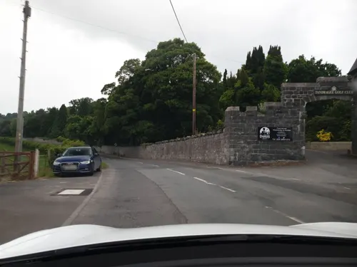

Ballymore Parish Church
Church
Church in Tandragee, County Armagh, Northern Ireland
Shopping1
History
Overlooking the town is Tandragee Castle. It was originally the seat of the chief of the O'Hanlon clan, who was Lord of Orior. Because some of the O'Hanlons took part in the Nine Years' War, the castle and surrounding territory were confiscated from the O'Hanlons and granted to Oliver St John and his heirs.
Tandragee Castle was rebuilt in about 1837, after having previously been destroyed during the Irish Rebellion of 1641, for George Montagu, 6th Duke of Manchester. Its grounds have been home to the Tayto potato-crisp factory since 1956, after being bought by businessman Thomas Hutchinson.
On 23 October 1641, the fortified town of Tandragee was attacked and taken by Irish rebels led by Patrick and Edmond O'Hanlon, as a part of the O'Hanlon clan's efforts to reclaim their territory. The rebels set fire to the church of Ballymore, as well as Captain Oliver St John's castle (Tandragee Castle), resulting in the destruction of the town. They also reportedly executed Protestant settlers living in Tandragee.
In April 1642, Felim O'Neill, leading the rebellion, commanded that his forces gather at Tandragee to prepare to confront the Scots Covenanters who had landed in Ulster. About 2,000 soldiers responded to O'Neill's call.
Read more of the history
On 12 May 1643, General Robert Monro led an army of 4,000 Covenanters to Tandragee, and burned homes in the surrounding region. Felim O'Neill's forces, comprising both cavalry and infantry, engaged Monro's men. During this skirmish, the lieutenant of Colonel Monro's cavalry, along with two captains and several soldiers, lost their lives. Ultimately, the O'Hanlons lost their hold of Tandragee, with the castle left in a state of disrepair as a result of the conflict.
On 9 September 1679 a group of Redmond O'Hanlon's followers murdered Henry St John, grandnephew of Sir Oliver St John, when horse-riding near Knockbridge. He was the owner of Tandragee Castle and its demesne at the time.
In the late 18th century, Britain was engaged in the American Revolutionary War. This heightened the risk of invasion by French and Spanish forces, especially in Ireland. In response, groups of Irish Volunteers were formed throughout Ireland. They were equipped and managed independently and mostly consisted of Protestants, mainly from the Church of Ireland. Several companies were set up in the Tandragee area.
The Tandragee Volunteers, organised by Captain Nicholas Johnston in 1779, were fitted with scarlet uniforms faced with white details. Johnston set up another company in Tandragee known as the Tandragee Invincibles. In the churchyard, there is a grave dedicated to one of its volunteers, John Whitten, who died in 1785.
Other companies included the Tandragee Light Dragoons, led by James Craig. Volunteer activities were mostly ceremonial, featuring reviews and shooting competitions. The Tandragee Volunteers played a notable role in a skirmish at Lisnagade in 1791. A group of Catholic Defenders set up camp at Lisnagade fort, planning to confront a group of Protestant Peep O' Day Boys commemorating King William's triumph at the Battle of the Boyne. This skirmish inspired the creation of a ballad known as Lisnagade ("Ye Protestants of Ulster").
The Volunteers' influence waned after the American Revolutionary War as new government-sanctioned groups emerged, such as the Yeomanry. Following the Battle of the Diamond, the Yeomanry became associated with the Orange Order. Established in 1796, the Tandragee Yeomanry, along with the County Armagh Yeomanry, played a key role in suppressing the 1798 United Irishmen Rebellion. The Newry Telegraph estimated that 40,000 met at a demonstration in Tandragee. With the Irish Volunteers disbanded and the United Irishmen defeated, the Acts of Union 1800 dissolved the all-Ireland Parliament.
From the introduction of the First Home Rule Bill in 1886, the Protestant community in Tandragee strongly opposed the idea and played a role in the establishment of a proposed 'Orange Army'. An effigy of Prime Minister William Gladstone was set alight in the town following an anti-Home Rule demonstration.
Tandragee also had a strong representation in the Ulster Defence Union. In the central assembly of 600 members appointed on 21 October 1886, the southern region, including Armagh, Cavan, and Monaghan, was represented by eight local representatives: Rev. P.A. Kelly, Rev. W. McEndoo, Rev. R.J. Whan, Maynard Sinton, Thomas White, William O’Brien, John Atkinson, and Rev. George Laverty.
In 1910, branches of the Unionist Club were founded in Tandragee, Clare, Scarva, Poyntzpass, and Ballyshiel. In September, under the supervision of William Montagu, 9th Duke of Manchester, members of the Tandragee Club engaged in drills prior to the Ulster Covenant.
During the Third Home Rule Crisis, the Ulster Unionist Party leadership chose to unite the various unionist paramilitary groups. By December 1912, the County Armagh Committee included several figures from the business sector, the legal field, and the local aristocracy. The representatives from Tandragee were Rev. R.J. Whan and George Davison. These people played a role in the eventual formation of a local battalion of the Ulster Volunteers.
Tandragee was identified by the Royal Irish Constabulary in 1912 as one of ten locations where unionist paramilitary drills were occurring. The population of the Tandragee area became a majority of the Third Battalion of the County Armagh Regiment of the Ulster Volunteer Force - also known as the Tandragee Volunteers. Tandragee Castle was the headquarters of the Tandragee Volunteers, with records indicating that the 9th Duke of Manchester occasionally inspected the troops and permitted the use of his estate.
A mural commemorating the Third Battalion of the County Armagh Regiment UVF is located at the junction of Montague Street and Ballymore Road in Tandragee.
From the History section of Tandragee on Wikipedia, under CC BY-SA 4.0.
Notable people from Tandragee
 W. J. LoftieBritish clergyman and writer (1839–1911)Photo: The British Library, No restrictions
- Kyle McKinstryNorthern Irish darts player
- Trevor SmithIrish equestrian
- Mick HoyIrish footballer
Born in Tandragee, according to Wikidata (CC0). Each name links to its Wikipedia article.
Gas and EV charging2
Schools, colleges and libraries3
Map of Tandragee
16 places. The map loads OpenStreetMap tiles when you open it.
Getting there and nearby towns
Belfast International Airport (BFS) is the nearest airport with scheduled flights listed in OpenStreetMap, 22 miles away.
- Portadown 5 mi north, about 8 min by car
- Banbridge 5 mi east, about 8 min by car
- Craigavon 6 mi north, about 10 min by car
- Armagh 10 mi west, about 16 min by car
- Newry 13 mi south, about 20 min by car
- Dungannon 18 mi northwest, about 28 min by car
- Lisburn 19 mi northeast, about 31 min by car
- Warrenpoint 19 mi south, about 30 min by car
- Cookstown 24 mi northwest, about 39 min by car
- Belfast 26 mi northeast, about 41 min by car
Drive times are estimates from straight-line distance, not routes.
Towns near Tandragee


Keep exploring
Local news
Headlines from INDB.
Reviews, tips and questions
Loading what members have shared...
Sources and licences
- GeoNames (CC BY 4.0): population, coordinates, regions and time zone
- Mapillary (see each image): photos
- OpenStreetMap contributors (ODbL 1.0): places, airports, map data
- Wikidata (CC0 1.0): elevation, founding date, time zone, website, landmarks and historic places
- Wikimedia Commons (see each image): photos
- Wikipedia (CC BY-SA 4.0): overview and history text
Photo credits
- US Army in Tandragee (1943), Unknown author Unknown author, CC0
- Street-level photo, yannakis, CC BY-SA 4.0
- Street-level photo, mackerski, CC BY-SA 4.0
- Street-level photo, bct, CC BY-SA 4.0
- Street-level photo, mackerski, CC BY-SA 4.0
Page built November 10, 2026. Spotted a mistake? Tell us or suggest a place.