


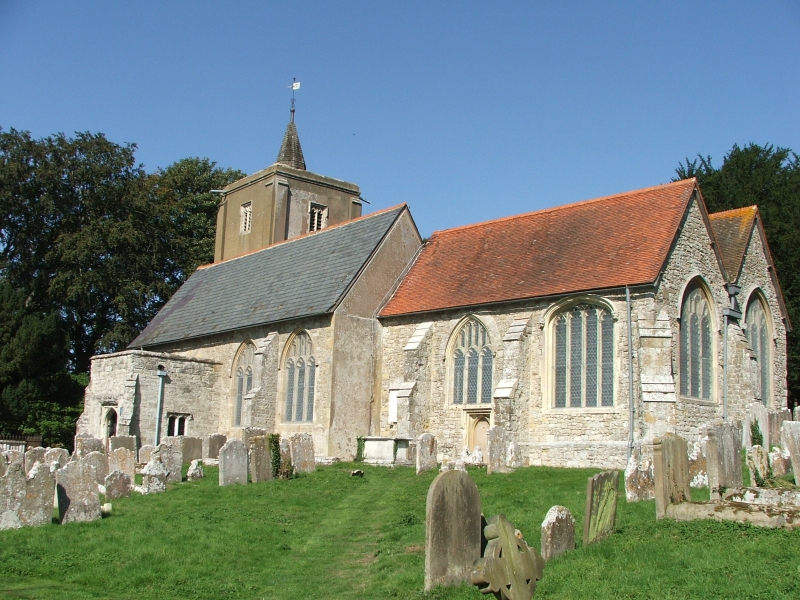


Wateringbury, United Kingdom
Wateringbury is a town of 2,396 people in England, United Kingdom.
Why visit Wateringbury
Townapedia lists 6 museums and landmarks, 6 parks and trails, 15 places to eat, 1 place to stay and 2 attractions in and around town.
Highlights include East Farleigh Bridge, Teston Bridge, Smith's Hall and Teapot Island.
Weather in Wateringbury
Forecast from MET Norway (CC BY 4.0). Full forecast
About Wateringbury
Wateringbury is a village and civil parish near the town of Maidstone in Kent, England. The Wateringbury Stream flows into the River Medway just above Bow Bridge. It formerly powered three watermills in the village, one of which survives. The Wateringbury railway station is on the Medway Valley Line.
From the Wikipedia article Wateringbury (this version), under CC BY-SA 4.0.
Things to do2
East Farleigh Bridge
Bridge · 2.7 mi
Grade I listed bridge in Kent, England, UK

Teston Bridge
Bridge · 1.1 mi
Grade I listed bridge in Teston, Kent, England
Museums and landmarks6
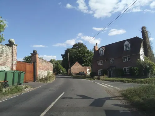

Teapot Island
Museum · 2.3 mi
Tourist attraction dedicated to teapots

West Malling Runway Memorial
Monument and historic site · 1.4 mi
Memorial dedicated to the airmen who served in West Malling airfield during World War II
Townsend Square
Parks, trails and playgrounds6
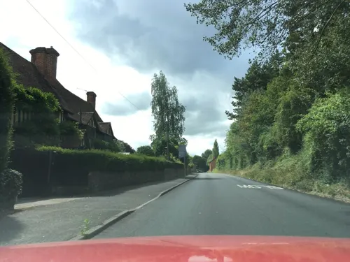
Manor Park Country Park
Park · 2.4 mi
Park in West Malling, Tonbridge and Malling, Kent, England


Restaurants and cafes15
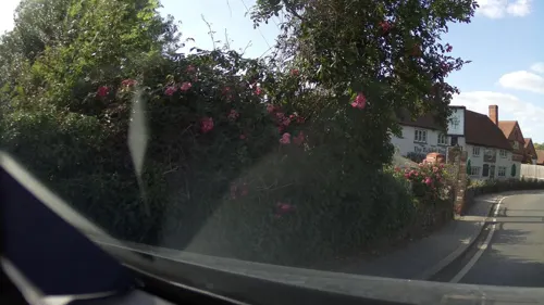
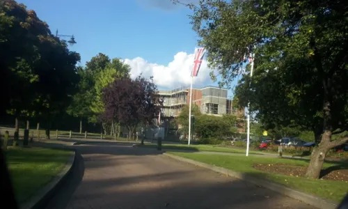
Costa
Cafe · Coffee Shop · 1.5 mi
1 Queen Street, West Malling
Mo-Fr 06:30-18:30; Sa 07:00-18:30; Su 08:30-17:30
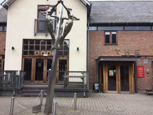
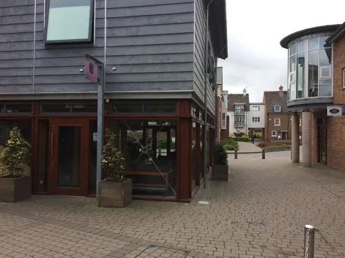

Sage & Time Cafe
Cafe · 1.1 mi
Kenward Road, Maidstone
Mo-Fr 10:16-16:00; Sa 11:00-15:00

3 more on the map.
History
The name Wateringbury, like many of the nearby parishes (such as West Malling, Barming, Farleigh), is an Anglo-Saxon name, meaning "The fortification (bury) of the people (ing) of Othere (Water)".
Wateringbury's existence is first documented in the 10th-century will of Bihtric and Aelfswith and in the early 11th-century obligation recorded in the Textus Roffensis to maintain part of Rochester Bridge. The settlement had a detached 'den', used in autumn to feed pigs on acorns and nuts, in the forested Weald of Kent at Lilly Hoo, which remained a part of the parish for secular matters until the 19th century (and for ecclesiastical matters until the 20th century).
In 1066, as recorded by the Domesday Book of 1086, Wateringbury consisted of two manors owned respectively by Leofeva and Godil, both Anglo-Saxon women with land-holdings elsewhere. By 1086, they were replaced by incoming Normans, Ralph son of Thorold and Hugh de Brebouef, both of whom held the manor from Bishop Odo of Bayeux. There were 30 heads of household (including villagers, small-holders and slaves) recorded in the Domesday Book at the two manors, which might imply a total population of about 150 people including children. Three mills were recorded, one which still exists and another which was in existence until the early 20th century.
Read more of the history
A Church is also mentioned in the Domesday Book. A stone church dedicated to St. John the Baptist (a popular late Anglo-Saxon dedication) stands in Wateringbury. The chancel and tower of the current church building date from the 13th century. However, the current church is probably on the same site as the Anglo-Saxon church.
Adjacent to the church, Wateringbury Place is the largest house in the village and in medieval times the largest estate. It was completely rebuilt in 1707 by the Style family, reputedly 200 yards from a former moated building. The Style family owned Wateringbury Place from the early 17th century to the early 19th (returning in 1945 until 1978); they were made baronets in 1627 and the Style family still holds the title of baronet of Wateringbury. Two houses of medieval origin still exist, the Pelicans, and the Wardens, and several other houses have 16th century origins.
From the two estates of the Domesday Book there developed four medieval manors with their own manor courts: Chart, Canons and Westbury as well as Wateringbury Place. Chart was in the area now called Pizien Well and a mace called the Dumb Borsholder, now hanging in the Church, is associated with this manor. A right to hold a market in Wateringbury was granted in 1311 by royal charter. An 18th-century local antiquarian, Edward Greensted, says the market was probably held in Chart. Canons was owned by the Prior and Canons of Leeds until the Reformation. Westbury was a small manor owned by a family of that name.
By the late seventeenth century Wateringbury's population had doubled from its Domesday Book level and by the time of the first census in 1801 the population was 817; it continued to grow rapidly in the first half of the 19th century (to 1,448 in 1851) before falling in the second half (to 1,316 in 1901), reflecting the general national trend of urbanisation. Wateringbury was an early mover amongst the immediately surrounding parishes in subsidising emigration in the 1830s to help relieve poverty with financial assistance being given for emigration to Canada in 1832 and to Australia in 1838.
During the 19th and early 20th centuries there were major temporary influxes of hoppers in September of each year. In 1900 the vicar, Greville Livett, estimated that there had been 3,300 such ‘immigrants’ including their children.
Wateringbury benefited from the work in the period 1740 to 1747 of the Medway Navigation Company (MNC) in making the River Medway navigable above Maidstone, and so available for the transport of bulky cargos. The medieval stone bridge was replaced by a wooden one as part of the MNC's mid-18th century navigation improvements, which was in turn replaced in 1914. The Maidstone-Tonbridge turnpike, authorised by Act of Parliament in 1765/6, came through the village. In 1844 the Medway valley railway line gave it an alternative transport link for passengers and cargo.
The tithe survey of 1839 provides a snapshot in time of the village and its economic activity at least as far as agriculture goes. Arable farming covered 26% of the parish and woods, mainly coppiced sweet chestnut, covered 20%. Hops covered 14% and fruit 10%. However, the acreage of hops subsequently expanded and, as a cash crop, it brought wealth to the village, although the annual influx of temporary labour also brought social problems.
Two breweries, the Phoenix Brewery of the Leney family and the Kent Brewery of the Jude and Hanbury families, developed in the village in the 18th century and only closed in the late 20th. In the second half of the 19th century, Leney became internationally renowned as a breeder of shorthorn cattle with individual specimens reaching astronomical prices (2,000 guineas for a single animal in 1874) at auctions held in the village with exports to the US and New Zealand.
In the 1820s Matthias Lucas, Lord Mayor of London in 1827, a self-made man who became wealthy from commerce, acquired Wateringbury Place. During his residence he was active in village affairs, building several substantial houses (The Red House, The Beck, The Thatched House, The Limes and The Orpines) on the Wateringbury Place estate for rent. He also represented the village's interests to Parliamentary inquiries about the navigation of the Medway and the fruit trade. He died in 1848, and his grandson split and sold the estate in 1876.
Another Lord Mayor of London, Horatio Davies, owned Wateringbury Place by 1897, the year of his Lord Mayorship. He was an art lover and a discriminating purchaser of pictures, and filled the house with famous works of art and antique silverware.
From the History section of Wateringbury on Wikipedia, under CC BY-SA 4.0.
Notable people from Wateringbury
- Stewart SymesBritish Army officer and colonial governor (1882–1962)
- Herbert Leneycricketer (1850-1915)
- Jack Hubblecricketer (1881-1965)
- Lionel WhiteEnglish cricketer (1850-1917)
- Alfred FremlinAustralian politician
Born in Wateringbury, according to Wikidata (CC0). Each name links to its Wikipedia article.
Where to stay1
Churches and places of worship11
Shopping2
Gas and EV charging1
Schools, colleges and libraries2
Healthcare1
Map of Wateringbury
47 places. The map loads OpenStreetMap tiles when you open it.
Getting there and nearby towns
Rochester Airport (RCS) is the nearest airport with scheduled flights listed in OpenStreetMap, 7 miles away.
- Yalding 2 mi south, about 4 min by car
- West Malling 3 mi north, about 4 min by car
- Maidstone 4 mi east, about 7 min by car
- Snodland 5 mi north, about 8 min by car
- Five Oak Green 6 mi southwest, about 9 min by car
- Burham 6 mi northeast, about 9 min by car
- Wrotham 6 mi northwest, about 10 min by car
- Halling 7 mi north, about 11 min by car
- Wouldham 7 mi north, about 11 min by car
- Tonbridge 8 mi southwest, about 12 min by car
Drive times are estimates from straight-line distance, not routes.
Towns near Wateringbury


Keep exploring
Local news
Headlines from INDB.
Reviews, tips and questions
Loading what members have shared...
Sources and licences
- GeoNames (CC BY 4.0): population, coordinates, regions and time zone
- Mapillary (see each image): photos
- OpenStreetMap contributors (ODbL 1.0): places, airports, map data
- Wikidata (CC0 1.0): elevation, founding date, time zone, website, landmarks and historic places
- Wikimedia Commons (see each image): photos
- Wikipedia (CC BY-SA 4.0): overview and history text
Photo credits
- All Saints Church, West Farleigh, Sunhyll at en.wikipedia, Public domain
- Holy Trinity Church, East Peckham (NHLE Code 1070728), The Voice of Hassocks, CC0
- Church of St. Lawrence, Mereworth, Tonbridge and Malling, Kent, United Kingdom, Christopher Nicol, CC BY-SA 3.0
- StMichaels EastPeckham, Efficacy at English Wikipedia, Public domain
- WateringburyYew0504, Clem Rutter, Rochester, Kent., CC BY 2.5
- St Peter and St Paul, Teston 01, Poliphilo, CC0
- Street-level photo, paulbiv, CC BY-SA 4.0
- Street-level photo, southglos, CC BY-SA 4.0
- Street-level photo, southglos, CC BY-SA 4.0
- Street-level photo, paulbiv, CC BY-SA 4.0
- Street-level photo, paulbiv, CC BY-SA 4.0
- Street-level photo, southglos, CC BY-SA 4.0
- Street-level photo, paulbiv, CC BY-SA 4.0
- Street-level photo, EstSsxKt, CC BY-SA 4.0
- Street-level photo, southglos, CC BY-SA 4.0
- Street-level photo, southglos, CC BY-SA 4.0
- Street-level photo, paulbiv, CC BY-SA 4.0
- Street-level photo, EstSsxKt, CC BY-SA 4.0
- Street-level photo, EstSsxKt, CC BY-SA 4.0
- Street-level photo, southglos, CC BY-SA 4.0
- Street-level photo, paulbiv, CC BY-SA 4.0
- Street-level photo, southglos, CC BY-SA 4.0
- Street-level photo, paulbiv, CC BY-SA 4.0
Page built November 10, 2026. Spotted a mistake? Tell us or suggest a place.