


Why visit Woodcote
Townapedia lists 4 museums and landmarks, 1 park or trail and 1 place to eat in and around town.
Highlights include Lilleshall Abbey and Sutherland Monument.
Weather in Woodcote
Forecast from MET Norway (CC BY 4.0). Full forecast
About Woodcote
Woodcote is a hamlet in the civil parish of Chetwynd Aston and Woodcote, in the Telford and Wrekin district, in the ceremonial county of Shropshire, England. It is located between the towns of Shifnal and Newport.
From the Wikipedia article Woodcote, Shropshire (this version), under CC BY-SA 4.0.
Museums and landmarks4

Lilleshall Abbey
Monument and historic site · 2.5 mi
Monastery in Shropshire, England, UK

Sutherland Monument
Monument and historic site · 2.9 mi
Monument in Lilleshall and Donnington, Telford and Wrekin, Shropshire, England, UK

Weston Park
Museum · 3.4 mi
Grade I listed country house in Weston-under-Lizard, Staffordshire, England, United Kingdom

Parks, trails and playgrounds1

Restaurants and cafes1

Churches and places of worship5

St Andrew's Church, Weston-under-Lizard
Church · 3.4 mi
Church in South Staffordshire, England, UK

St Mary's Church, Blymhill
Church · 2.7 mi
Church in South Staffordshire, England, UK
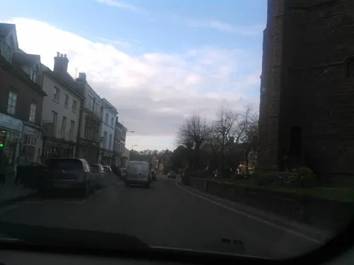
St Nicholas Church
Church · 3.2 mi
Church in Newport, Shropshire, England, UK

St Peter and Paul Church, Newport
Church · 3.3 mi
Church building in Newport, Telford and Wrekin, Shropshire, England, UK

Church of St Mary
Church · 2.2 mi
Church in Sheriffhales, Shropshire, England, UK
History
The settlement of Udecote is recorded in the Domesday Book of 1086. A family known as the "Cotes" owned land around the modern day hamlet. Woodcote was formerly a chapelry in the parish of Sheriff-Hales. In 1866 Woodcote became a separate civil parish. It was transferred along with neighbouring villages and nearby Newport into the wider Telford and Wrekin borough in the 1960s–70s. In 1971 the parish had a population of 136. On 1 April 1988 the parish was abolished and merged with Chetwynd Aston.
From the History section of Woodcote, Shropshire on Wikipedia, under CC BY-SA 4.0.
More about Woodcote
Geography
It is located on the A41 road between Newport and Albrighton and is close to the M54 motorway between Shrewsbury, Telford and Wolverhampton.
From the Wikipedia article Woodcote, Shropshire, under CC BY-SA 4.0.
Map of Woodcote
11 places. The map loads OpenStreetMap tiles when you open it.
Getting there and nearby towns
Birmingham Airport (BHX) is the nearest airport with scheduled flights listed in OpenStreetMap, 31 miles away.
- Newport 3 mi northwest, about 5 min by car
- Edgmond 4 mi northwest, about 7 min by car
- Wheaton Aston 5 mi east, about 8 min by car
- Telford 6 mi southwest, about 10 min by car
- Hadley 7 mi west, about 11 min by car
- Wellington 8 mi west, about 13 min by car
- Codsall 9 mi southeast, about 15 min by car
- Stafford 10 mi northeast, about 17 min by car
- Ironbridge 10 mi southwest, about 16 min by car
- Wolverhampton 13 mi southeast, about 22 min by car
Drive times are estimates from straight-line distance, not routes.
Towns near Woodcote


Keep exploring
Local news
Headlines from INDB.
Reviews, tips and questions
Loading what members have shared...
Sources and licences
- GeoNames (CC BY 4.0): population, coordinates, regions and time zone
- Mapillary (see each image): photos
- OpenStreetMap contributors (ODbL 1.0): places, airports, map data
- Wikidata (CC0 1.0): elevation, founding date, time zone, website, landmarks and historic places
- Wikimedia Commons (see each image): photos
- Wikipedia (CC BY-SA 4.0): overview and history text
Photo credits
- Sutherland Monument Lilleshall Panorama, Mariegriffiths, CC BY-SA 4.0
- Weston Park 2018 07, Bs0u10e01, CC BY-SA 4.0
- St Andrew's Church, Weston, Richard Law, CC BY-SA 2.0
- Stmarys, James Loach, Public domain
- Newportstpeterschurc, Novacool88 ( talk ), Public domain
- Lilleshall Abbey 2, Admiralgary, CC BY-SA 4.0
- Street-level photo, trigpoint, CC BY-SA 4.0
Page built November 10, 2026. Spotted a mistake? Tell us or suggest a place.