


Y Felinheli, United Kingdom
Y Felinheli is a town of 2,284 people in Wales, United Kingdom.
Why visit Y Felinheli
Townapedia lists 10 museums and landmarks, 6 parks and trails, 10 places to eat, 1 place to stay and 6 attractions in and around town.
Highlights include Britannia Bridge, Menai Suspension Bridge, Marquess of Anglesey's Column and Menai Heritage.
Weather in Y Felinheli
Forecast from MET Norway (CC BY 4.0). Full forecast
About Y Felinheli
Y Felinheli (), formerly known in English as Port Dinorwic, is a village and community beside the Menai Strait (Welsh: Y Fenai or Afon Menai) between Bangor and Caernarfon in Gwynedd, northwest Wales.
From the Wikipedia article Y Felinheli (this version), under CC BY-SA 4.0.
Photos of Y Felinheli


Things to do6


Menai Suspension Bridge
Bridge · 2.8 mi
Bridge between Anglesey and mainland Wales



Museums and landmarks10

Marquess of Anglesey's Column
Monument and historic site · 2.3 mi
Monument in Anglesey, Wales

Menai Heritage
Museum · 3.0 mi
Local history and technology museum in Anglesey, Wales, United Kingdom


HMS Conway
Monument and historic site · 2.7 mi
Royal Navy training school

Parks, trails and playgrounds6

Anglesey Sea Zoo
Park · 3.5 mi
British aquarium and marine research centre


Restaurants and cafes10
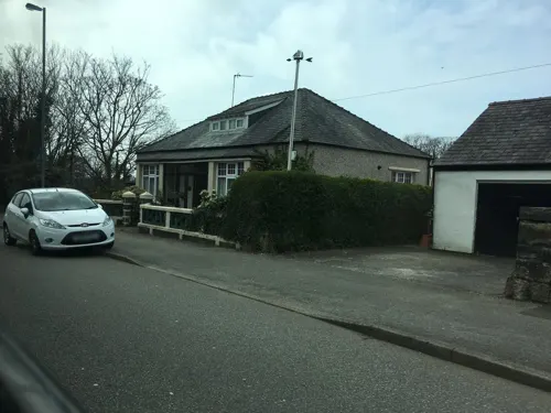
The Swellies
Cafe · Coffee Shop, Burger, Sandwich, Welsh, Homemade, Cake, Salad
Porth Y Llechen, Y Felinheli
Mo-Su 10:00-16:00
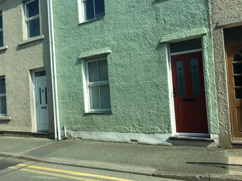
Tafarn y Fic
Bar and pub
80 Stryd Bangor
Mo-Th 15:00-23:00; Fr 14:00-00:00; Sa-Su 11:00-00:00
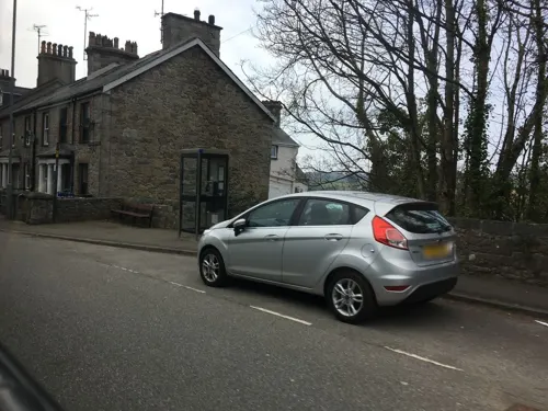
Chan's
Fast food · Chinese
78 Stryd Bangor, Y Felinheli
Mo-Tu, Th-Sa 11:30-14:00, 16:30-22:00



History
Etymologically, its name comes from the Welsh y meaning the, melin meaning mill and heli, meaning brine/salt-water/sea. An alternative interpretation is from Y Felin Heulyn, "the mill on the River Heulyn", which refers to the river that runs into the village.
Y Felinheli has its origins in two hamlets, Tafarngrisiau near St Mary's Church and Aberpwll to the north-east where there was a mill on the Afon Heulyn. The mill was rebuilt closer to the sea in 1633 and gave its name to the settlement. The area was largely agricultural until the area was transformed by slate quarrying in the 19th century. A new dock was built in 1828 when lime was extracted at Brynadda and slate and lime were loaded and culm (coal dust or anthracite slack) was brought in to fire the lime kilns.
The owners of the Vaynol Estate, the Assheton Smiths, owned most of the land in Y Felinheli and developed the Dinorwic Quarry in the late 18th century, They also built the harbour to export slate transported to the quay by the Dinorwic Railway, a narrow gauge railway that was subsequently replaced by the Padarn Railway. Industrial expansion gave Y Felinheli (Felin-hely, 1838) the alternative name Port Dinorwig or Port Dinorwic.
From the History section of Y Felinheli on Wikipedia, under CC BY-SA 4.0.
More about Y Felinheli
Arts and culture
The first National Cerdd Dant Festival was held in Y Felinheli in 1947.
The local carnival committee organises the annual Gŵyl Y Felinheli.
Education
A Welsh-language playgroup Cylch Meithrin Y Felinheli currently serves the community with the support of Mudiad Meithrin.
Ysgol Gynradd Y Felinheli provides Welsh-medium primary education to the village and the surrounding area. As of 2024, there were 171 pupils enrolled at the school.
In terms of secondary education, the village is in the catchment area of three secondary schools, namely Ysgol Tryfan, Ysgol Syr Hugh Owen and Ysgol Friars.
From the Wikipedia article Y Felinheli, under CC BY-SA 4.0.
Where to stay1
Churches and places of worship11
Schools, colleges and libraries3
Map of Y Felinheli
47 places. The map loads OpenStreetMap tiles when you open it.
Getting there and nearby towns
RAF Valley - Anglesey Airport (VLY) is the nearest airport with scheduled flights listed in OpenStreetMap, 14 miles away.
- Llanfairpwllgwyngyll 2 mi north, about 4 min by car
- Menai Bridge 3 mi northeast, about 5 min by car
- Bangor 4 mi northeast, about 7 min by car
- Gaerwen 4 mi northwest, about 6 min by car
- Caernarfon 4 mi southwest, about 7 min by car
- Tregarth 5 mi east, about 8 min by car
- Bethesda 6 mi east, about 10 min by car
- Llanberis 6 mi southeast, about 9 min by car
- Llangefni 6 mi northwest, about 10 min by car
- Beaumaris 7 mi northeast, about 11 min by car
Drive times are estimates from straight-line distance, not routes.
Towns near Y Felinheli


Keep exploring
Local news
Headlines from INDB.
Reviews, tips and questions
Loading what members have shared...
Sources and licences
- GeoNames (CC BY 4.0): population, coordinates, regions and time zone
- Mapillary (see each image): photos
- OpenStreetMap contributors (ODbL 1.0): places, airports, map data
- Wikidata (CC0 1.0): elevation, founding date, time zone, website, landmarks and historic places
- Wikimedia Commons (see each image): photos
- Wikipedia (CC BY-SA 4.0): overview and history text
Photo credits
- Y Felinheli, ger y Fenai (on the Menai Straights), Gwynedd, Cymru (Wales) 03, Llywelyn2000, CC BY-SA 4.0
- Y Felinheli, UK - panoramio (28), Alan C. Bonnici, CC BY-SA 3.0
- Y Cei yn y Felinheli 20, Llywelyn2000, CC BY-SA 3.0
- Y Cei yn y Felinheli 35, Llywelyn2000, CC BY-SA 3.0
- Y Cei yn y Felinheli 29, Llywelyn2000, CC BY-SA 3.0
- Y Cei yn y Felinheli 32, Llywelyn2000, CC BY-SA 3.0
- Y Cei yn y Felinheli 23, Llywelyn2000, CC BY-SA 3.0
- Y Cei yn y Felinheli 22, Llywelyn2000, CC BY-SA 3.0
- Y Cei yn y Felinheli 01, Llywelyn2000, CC BY-SA 3.0
- Y Cei yn y Felinheli 34, Llywelyn2000, CC BY-SA 3.0
- Y Cei yn y Felinheli 14, Llywelyn2000, CC BY-SA 3.0
- Y Cei yn y Felinheli 13, Llywelyn2000, CC BY-SA 3.0
- Y Cei yn y Felinheli 18, Llywelyn2000, CC BY-SA 3.0
- Y Cei yn y Felinheli 07, Llywelyn2000, CC BY-SA 3.0
- Y Cei yn y Felinheli 05, Llywelyn2000, CC BY-SA 3.0
- Y Cei yn y Felinheli 12, Llywelyn2000, CC BY-SA 3.0
- Y Cei yn y Felinheli 11, Llywelyn2000, CC BY-SA 3.0
- Y Cei yn y Felinheli 19, Llywelyn2000, CC BY-SA 3.0
- Y Cei yn y Felinheli 37, Llywelyn2000, CC BY-SA 3.0
- Y Cei yn y Felinheli 08, Llywelyn2000, CC BY-SA 3.0
- Y Cei yn y Felinheli 38, Llywelyn2000, CC BY-SA 3.0
- Y Cei yn y Felinheli 15, Llywelyn2000, CC BY-SA 3.0
- Y Cei yn y Felinheli 04, Llywelyn2000, CC BY-SA 3.0
- Y Cei yn y Felinheli 27, Llywelyn2000, CC BY-SA 3.0
- Y Cei yn y Felinheli 10, Llywelyn2000, CC BY-SA 3.0
- Y Cei yn y Felinheli 28, Llywelyn2000, CC BY-SA 3.0
- Y Cei yn y Felinheli 25, Llywelyn2000, CC BY-SA 3.0
- Y Cei yn y Felinheli 33, Llywelyn2000, CC BY-SA 3.0
- Y Cei yn y Felinheli 36, Llywelyn2000, CC BY-SA 3.0
- Y Cei yn y Felinheli 17, Llywelyn2000, CC BY-SA 3.0
- Y Cei yn y Felinheli 26, Llywelyn2000, CC BY-SA 3.0
- Y Cei yn y Felinheli 21, Llywelyn2000, CC BY-SA 3.0
- Y Cei yn y Felinheli 30, Llywelyn2000, CC BY-SA 3.0
- Y Cei yn y Felinheli 03, Llywelyn2000, CC BY-SA 3.0
- Y Cei yn y Felinheli 24, Llywelyn2000, CC BY-SA 3.0
- Y Cei yn y Felinheli 06, Llywelyn2000, CC BY-SA 3.0
- Y Cei yn y Felinheli 31, Llywelyn2000, CC BY-SA 3.0
- Y Cei yn y Felinheli 39, Llywelyn2000, CC BY-SA 3.0
- Brittania Bridge, Anglesey, Cymru (Wales); June 2023, Llywelyn2000, CC BY-SA 4.0
- Pont y Borth (Menai Suspension Bridge) a godwyd gan Telford, rhwng Ynys Mon a Gwynedd; Mehefin 2023 12, Llywelyn2000, CC BY-SA 4.0
- Canolfan Thomas Telford Centre, Warrenkovach, CC BY-SA 4.0
- Llanidan Old Church, Bencherlite, CC BY-SA 3.0
- The former St Deiniol's Church, Llanddaniel Fab, Eric Jones, CC BY-SA 2.0
- St Mary's Church and surrounding area, Llanfairpwllgwyngyll - y Santes Fair; Ynys Môn, Cymru Wales 01, Llywelyn2000, CC BY-SA 4.0
- Porthaethwy - Eglwys y Santes Fair Gradd II gan Cadw 04, Monsyn, CC BY-SA 4.0
- Church Of St. Tysilio, GeraintTudur2, CC BY-SA 3.0
- St Edwen's Church from Plas Newydd estate, J Scott, CC BY-SA 2.0
- Plas Newydd tŷ rhestredig Gradd I yn Llanddaniel Fab, Ynys Môn - Grade I LB - Plas Newydd country house in Llanddaniel Fab Anglesey, Wales 44, Llywelyn2000, CC BY-SA 4.0
- Colofn Ardalydd Môn, Llanfair Pwllgwyngyll, Ynys Môn - Marquess of Anglesey's Column monument in Anglesey, Wales 07, Llywelyn2000, CC BY-SA 4.0
- Plas Newydd Burial Chamber, Simon Cope, CC BY-SA 2.0
- Street-level photo, gness, CC BY-SA 4.0
- Street-level photo, trigpoint, CC BY-SA 4.0
- Street-level photo, gness, CC BY-SA 4.0
- Street-level photo, gness, CC BY-SA 4.0
- Street-level photo, gness, CC BY-SA 4.0
- Street-level photo, gness, CC BY-SA 4.0
- Street-level photo, gness, CC BY-SA 4.0


Page built November 10, 2026. Spotted a mistake? Tell us or suggest a place.