


Why visit Bindlach
Townapedia lists 82 museums and landmarks, 25 parks and trails, 254 places to eat, 22 places to stay and 32 attractions in and around town.
Highlights include Margravial Opera House, Festspielhaus, Franz-Liszt-Museum and Freimaurermuseum.
Weather in Bindlach
Forecast from MET Norway (CC BY 4.0). Full forecast
About Bindlach
Bindlach is a municipality in the district of Bayreuth in Upper Franconia in Bavaria, Germany. The town is adjacent immediately north of the town of Bayreuth. The population count of December 2006 was 7197 inhabitants.
From the Wikipedia article Bindlach (this version), under CC BY-SA 4.0.
Things to do32

Margravial Opera House
Cinema and theater · 4.9 km
UNESCO-Weltkulturerbe
14 Opernstraße, Bayreuth
Apr-Sep Mo-Su 09:00-18:00; Oct-Mar Mo-Su 10:00-16:00; Dec...


Cineplex
Cinema and theater · 5.0 km
2 Hindenburgstraße, Bayreuth
Mo-Fr 18:30-21:00+; Sa 14:00-21:00+; Su 14:00-21:00+

Bayreuth Festival Theatre
Cinema and theater · 3.4 km
Opera house and cultural heritage monument in Bayreuth, Bavaria


Dachterrasse Rathaus I
Scenic view · 4.8 km
13 Luitpoldplatz, Bayreuth
Mo,Tu,Th 10:00-16:00, We 10:00-17:00, Fr 10:00-14:30



20 more on the map.
Museums and landmarks82

Franz-Liszt-Museum
Museum · 5.1 km
9 Wahnfriedstraße, Bayreuth
Jul,Aug: Mo-Su 10:00-17:00; Sep-Jun: Mo-Su...

Freimaurermuseum
Museum · 5.1 km
1 Im Hofgarten, Bayreuth
Tu-Fr 10:00-12:00,14:00-17:00; Sa 10:00-12:00; Su 13:00-16:00


Jean-Paul-Museum
Museum · 5.0 km
1 Wahnfriedstraße, Bayreuth
Jul,Aug: Mo-Su 10:00-17:00; Sep-Jun: Mo-Su...


Kunstmuseum
Museum · 5.1 km
33 Maximilianstraße, Bayreuth
Tu-Su,PH 10:00-17:00; Jul-Aug: Mo 10:00-17:00 "während der...

Richard-Wagner-Museum
Museum · 5.1 km
48 Richard-Wagner-Straße, Bayreuth
Jul-Aug: Mo-Su 10:00-18:00, Sep-Jun: Tu-Su 10:00-18:00


Altes Schloss Eremitage
Monument and historic site · 3.7 km
4 Eremitage, Bayreuth

Grenzsäule
Monument and historic site · 1.4 km
Sandsteinsäule zur Markierung der Stadtgrenze von Bayreuth
70 more on the map.
Parks, trails and playgrounds25




Abenteuerspielplatz KiWi
Playground · 5.2 km
Mo 16:00-19:00, Tu-Th 15:00-18:00




13 more on the map.
Restaurants and cafes254

Café Florian
Cafe · Coffee Shop · 4.8 km
13 Badstraße, Bayreuth
Mo,We,Th 09:00-23:00; Fr,Sa 09:00-23:30; Su 09:00-22:00
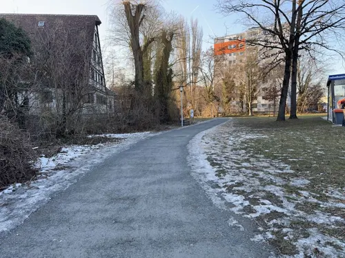

Zur Eule
Restaurant · Regional · 5.1 km
Ehemalige Künstlerkneipe der Richard-Wagner-Festspiele
8 Kirchgasse, Bayreuth
Tu-Fr 17:00-22:00, Sa,Su 11:00-14:00, Sa 17:00-22:00
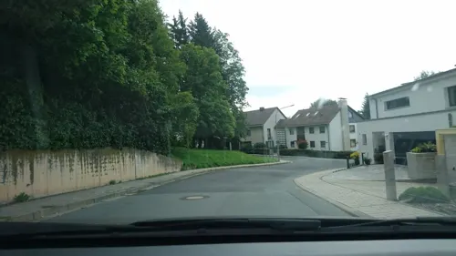
Bei Niko
Restaurant · Greek · 2.9 km
15 Eubener Straße, Bayreuth
Tu-Su 17:30-22:00, Sa,Su 11:30-14:30; Mo off

Cafe Del Sol
Restaurant · International · 2.1 km
4 Christian-Ritter-von-Langheinrich-Straße, Bayreuth
Mo-Th 09:00-01:00, Fr-Sa 09:00-02:00, Su 09:00-01:00
China-Haus
Restaurant · Chinese · 5.5 km
1-3 Himmelkronstraße, Bayreuth
Mo-Su 11:30-14:30, 17:30-23:00
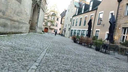


Dötzer
Restaurant · Italian · 5.2 km
22 Sophienstraße, Bayreuth
Tu-Th 17:30-23:00; Fr,Sa 11:30-14:00,17:30-23:00; Su 11:30-14:00
242 more on the map.
History
The name Bindlach is derived from the Slavic Pnetluky containing the verb tlouki which means "to chop". Thus Bindlach can be translated with "Village of the people chopping trunks" as the village is situated in an area rich with woods and a clearance had to be created prior to settlement.
More recent research traces the name back to the Old Saxon word Binutlaka meaning "Small, standing lake overgrown with juncus". Charlemagne supposedly resettled deported Saxons in the area.
Archaeological excavations have produced Celtic leftovers as well as remains from the Urnfield culture and the Bronze Age giving proof of settlement as early as 1300 BC.
The first official mentioning in modern times occurred in a private charter on April 6, 1178 as bintlvke.
Being part of the Prussian Principality of Bayreuth, Bindlach was ceded to France in 1807 following the Treaties of Tilsit. In 1810 it became part of the Kingdom of Bavaria. The town as it is known today was formed in 1818.
From the History section of Bindlach on Wikipedia, under CC BY-SA 4.0.
Where to stay22
Churches and places of worship32
Shopping66
Gas and EV charging21
Schools, colleges and libraries29
Healthcare20
Map of Bindlach
250 places. The map loads OpenStreetMap tiles when you open it.
Getting there and nearby towns
Verkehrslandeplatz Bayreuth (BYU) is the nearest airport with scheduled flights listed in OpenStreetMap, 2 km away.
- Bayreuth 5 km southwest, about 5 min by car
- Kulmbach 18 km northwest, about 18 min by car
- Speichersdorf 17 km southeast, about 17 min by car
- Mainleus 21 km northwest, about 21 min by car
- Kemnath 23 km southeast, about 23 min by car
- Hollfeld 24 km west, about 24 min by car
- Pegnitz 26 km south, about 26 min by car
- Münchberg 26 km northeast, about 26 min by car
- Pottenstein 28 km southwest, about 28 min by car
- Wunsiedel 29 km east, about 29 min by car
Drive times are estimates from straight-line distance, not routes.
Local news
Headlines from INDB.
Reviews, tips and questions
Loading what members have shared...
Sources and licences
- GeoNames (CC BY 4.0): population, coordinates, regions and time zone
- Mapillary (see each image): photos
- OpenStreetMap contributors (ODbL 1.0): places, airports, map data
- Wikidata (CC0 1.0): elevation, founding date, time zone, website, landmarks and historic places
- Wikimedia Commons (see each image): photos
- Wikipedia (CC BY-SA 4.0): overview and history text
Photo credits
- Rathaus Bindlach - panoramio, Maurice Meeden, CC BY-SA 3.0
- Bindlach, St. Bartholomäus (01), Subbass1, CC BY-SA 4.0
- Bindlach, St. Bartholomäus (19), Subbass1, CC BY-SA 4.0
- Bindlach, St. Bartholomäus (18), Subbass1, CC BY-SA 4.0
- Bindlach, St. Bartholomäus (06), Subbass1, CC BY-SA 4.0
- Bindlach, St. Bartholomäus (04), Subbass1, CC BY-SA 4.0
- Bindlach, St. Bartholomäus (03), Subbass1, CC BY-SA 4.0
- Bindlach, St. Bartholomäus (02), Subbass1, CC BY-SA 4.0
- Bindlach, St. Bartholomäus (15), Subbass1, CC BY-SA 4.0
- Bindlach, St. Bartholomäus (08), Subbass1, CC BY-SA 4.0
- Bindlach, St. Bartholomäus (13), Subbass1, CC BY-SA 4.0
- Bindlach, St. Bartholomäus (07), Subbass1, CC BY-SA 4.0
- Bindlach, St. Bartholomäus (10), Subbass1, CC BY-SA 4.0
- Bindlach, St. Bartholomäus (14), Subbass1, CC BY-SA 4.0
- Bindlach, St. Bartholomäus (09), Subbass1, CC BY-SA 4.0
- Bindlach, St. Bartholomäus (11), Subbass1, CC BY-SA 4.0
- Bindlach, St. Bartholomäus (16), Subbass1, CC BY-SA 4.0
- Bindlach, St. Bartholomäus (05), Subbass1, CC BY-SA 4.0
- Bindlach, St. Bartholomäus (12), Subbass1, CC BY-SA 4.0
- Bindlach, St. Bartholomäus (17), Subbass1, CC BY-SA 4.0
- Neubau Kreisel B2 Bindlach - panoramio, Maurice Meeden, CC BY-SA 3.0
- Aerial image of the Eremitage Bayreuth, Carsten Steger, CC BY-SA 4.0
- St. Georgen Bayreuth, PeterBraun74, CC BY-SA 3.0
- Auditorium maximum der Universität Bayreuth im Herbst 2006, H. Wurst, CC BY-SA 2.0 de
- Bindlach Bartholomäuskirche D-4-72-119-9, Benreis, CC BY 3.0
- Aerial image of Bayreuth Festspielhaus (view from the southeast, 2024), Carsten Steger, CC BY-SA 4.0
- Oschenberg, Thomas Kees (powerbiker1), CC BY-SA 3.0
- Städtisches Stadion Bayreuth, Roehrensee, CC BY-SA 3.0
- Wahnfried 1 db, Unknown author, CC BY-SA 3.0
- Bezirkskrankenhaus Bayreuth, Benutzer:Roehrensee, Public domain
- Brauerei Gebrüder Maisel, Tafkas, CC BY 3.0
- Deutsches Freimaurermuseum (Schild), User:Mattes, Public domain
- Bayreuth altes rathaus, 4077, CC BY-SA 1.0
- Karte Forst Sankt Georgen, Alabasterstein, CC BY-SA 4.0
- Dinosaurier Bayreuth 2014, El Grafo, CC BY-SA 4.0
- Krankenhaus Hohe Warte Bayreuth, Benutzer:Roehrensee, Public domain
- Bayreuth - Schlosskirche (Kirchenschiff), User:Mattes, Public domain
- Rondell im Rotmain-Center mit Brunnen, Rotmain-Center Bayreuth, CC BY-SA 4.0
- Bayreuth-Lisztmuseum, GertGrer, CC BY-SA 3.0
- Bayreuth - Historisches Museum, Außenansicht 1, User:Mattes, Public domain
- Bayreuth Eremitage Ruinentheater, 05.11.94, Bayreuth2009, CC BY 3.0
- Cineplex Bayreuth, El Grafo, CC BY-SA 3.0
- Bayreuth Mann Brau, RobThinks, CC BY-SA 4.0
- Kathl3fl, MichaelXXLF, CC BY 3.0
- Bayreuth, Erlangerstraße 29, Reformierte Kirche, 2007, Bayreuth2009, CC BY 3.0
- SC Bayreuth Nord 36352, Michael Wolf ( Webseite ), CC BY-SA 3.0
- Bayreuth Fassade, Immanuel Giel, Public domain
- Bayr Festspielhaus 1995 Frontansicht, Lothar Spurzem, CC BY-SA 2.0 de
- Bayreuth 13.09.07 Siegesturm Hohe Warte, Bayreuth2009, CC BY 3.0
- Bayreuth, Wahnfriedstraße 9 20170603 001, Tilman2007, CC BY-SA 4.0
- Bayreuth-Deutsches-Freimaurermuseum-2, GertGrer, CC BY-SA 3.0
- Bayreuth, Kirchplatz 4 20170603 001, Tilman2007, CC BY-SA 4.0
- Bayreuth, Wölfelstraße 2 20170603 001, Tilman2007, CC BY-SA 4.0
- Bayreuth Haus Chamberlain Wahnfriedstrasse 21.04.07 DSC05965, Bayreuth2009, CC BY 3.0
- Rollwenzelei, Thomas Kees ( powerbiker1 ), CC BY-SA 3.0
- Altes Schloss der Eremitage, Richard Schubert, CC BY-SA 3.0
- Bindlach Bartholomäuskirche D-4-72-119-9, Benreis, CC BY 3.0
- Nibelungenstraße 2 (Bayreuth), Bodo Kubrak, CC BY-SA 4.0
- Bayreuth 12.09.06 Sankt Johannis Evangelisch-lutherische Pfarrkirche, Bayreuth2009, CC BY 3.0
- Bayreuth, Kirchplatz 1, Evang.-Luth. Stadtpfarrkirche 20170603 009, Tilman2007, CC BY-SA 4.0
- Bayreuth, Münzgasse 2-001, Tilman2007, CC BY-SA 3.0
- Nemmersdorf IMG 2731, Roehrensee, CC BY-SA 4.0
- Hofgarten - panoramio, Vámos Sándor, CC BY-SA 3.0
- Brunnen Dammwäldchen Bayreuth, El Grafo, CC BY-SA 4.0
- Street-level photo, r66, CC BY-SA 4.0
- Street-level photo, hdmn, CC BY-SA 4.0
- Street-level photo, changchun1, CC BY-SA 4.0
- Street-level photo, Dariton, CC BY-SA 4.0
- Street-level photo, hdmn, CC BY-SA 4.0
- Street-level photo, changchun1, CC BY-SA 4.0
- Street-level photo, johkra, CC BY-SA 4.0
- Street-level photo, johkra, CC BY-SA 4.0
- Street-level photo, hdmn, CC BY-SA 4.0
- Street-level photo, changchun1, CC BY-SA 4.0
- Street-level photo, changchun1, CC BY-SA 4.0
- Street-level photo, hdmn, CC BY-SA 4.0
- Street-level photo, changchun1, CC BY-SA 4.0
- Street-level photo, changchun1, CC BY-SA 4.0
- Street-level photo, hdmn, CC BY-SA 4.0
- Street-level photo, changchun1, CC BY-SA 4.0
- Street-level photo, hdmn, CC BY-SA 4.0
- Street-level photo, georginakirrin, CC BY-SA 4.0
- Street-level photo, changchun1, CC BY-SA 4.0
- Street-level photo, plonma1, CC BY-SA 4.0
- Street-level photo, changchun1, CC BY-SA 4.0
- Street-level photo, changchun1, CC BY-SA 4.0
- Street-level photo, changchun1, CC BY-SA 4.0
- Street-level photo, voltadino, CC BY-SA 4.0
- Street-level photo, r66, CC BY-SA 4.0


Page built November 9, 2026. Spotted a mistake? Tell us or suggest a place.