


Why visit Bargoed
Townapedia lists 9 museums and landmarks, 6 parks and trails, 33 places to eat, 2 places to stay and 2 attractions in and around town.
Highlights include Blackwood Miners Welfare Institute, Hengoed Viaduct, Studio 54 and Blackwood War Memorial.
Weather in Bargoed
Forecast from MET Norway (CC BY 4.0). Full forecast
About Bargoed
Bargoed (Welsh: Bargod) is a town and community in the Rhymney Valley, Wales, one of the South Wales Valleys. It lies on the Rhymney River in the county borough of Caerphilly. It straddles the ancient boundary of Glamorgan and Monmouthshire, with Bargoed lying in Glamorgan and Aberbargoed in Monmouthshire. 'Greater Bargoed', as defined by the local authority Caerphilly County Borough Council, consists of the towns of Bargoed and Aberbargoed and the village of Gilfach. The combined population of these settlements is about 13,000.
From the Wikipedia article Bargoed (this version), under CC BY-SA 4.0.
Things to do2
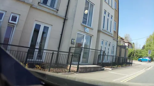
Blackwood Miners Welfare Institute
Cinema and theater · 1.9 mi
Entertainment venue in Blackwood, Caerphilly, Wales
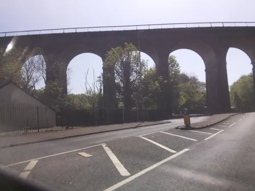
Hengoed Viaduct
Bridge · 2.6 mi
Railway viaduct in Caerphilly county borough, South Wales
Museums and landmarks9
Studio 54
Museum · 1.8 mi
High Street, Blackwood
Mo 15:00-20:00; Tu-Th 10:00-20:00; Fr Off; Sa Off; Su 10:00-18:30


Parks, trails and playgrounds6


Aberbargoed Grasslands National Nature Reserve
Hiking and trails · 0.9 mi

Restaurants and cafes33

The Square Royale
Bar and pub · 0.5 mi
Mo-Th 10:00-22:00; Fr 10:00-00:00; Sa 00:00-01:00,10:00-00:00; Su...
The Majors
Bar and pub · 1.3 mi
Fair View, Pengam
Mo off; Tu off; We off; Th off; Fr-Sa 17:00-23:30; Su 13:00-23:30

Bargoed Rugby Club
Bar and pub
95 - 97 Stryd Gilfach Street, Bargod/Bargoed

21 more on the map.
History
Originally a market town, Bargoed grew into a substantial town following the opening of a colliery in 1903. Bargoed Town Hall was originally a courthouse, completed in 1911. By 1921 Bargoed had a population of 17,901; this has been steadily declining since that time, as the general demand for Welsh coal continued to fall. The colliery, which was the subject of a painting by L. S. Lowry, closed during the 1970s, and its former site is now a country park.
Read more of the history
The town was home to a factory built by the Austin Motor Company from 1949. This was a project by Austin chairman Leonard Lord, with government funding, to employ miners suffering from pneumoconiosis, a lung disease caused by prolonged inhalation of dust. In 1945 it was estimated that 5000 miners in the South Wales region were affected by the condition to the extent that they could not work in the coal industry. The Austin factory at Bargoed became the first factory in the world where every employee was registered as disabled. Ex-miners could work at Bargoed under full-time medical supervision and with medical facilities on-site at the factory. The factory work was understandably light, with the main product being the Austin J40 children's pedal car. The success and efficiency of the factory was such that 150 men were employed by 1953 and Austin began the manufacture of small metal pressings for its full-size cars, such as dashboard parts, car registration plates and rocker covers at Bargoed. By 1965 over 500 men, all pneumoconiosis sufferers, were working at the factory. Production of the J40 pedal cars ended in 1971 but the factory's other work kept it open. Improving conditions in the mining industry and the slow reduction in the number of mines and workers in the region meant that the factory's purpose began to become redundant during the 1980s. The numbers employed slowly dropped and new workers did not have to be pneumoconiosis sufferers. The end of production of the Austin A-Series engine in 1999, the rocker cover of which was made solely in Bargoed, meant that the factory (then under the ownership of the Rover Group) employing 45 people, of which only 11 were registered as disabled, closed.
From the History section of Bargoed on Wikipedia, under CC BY-SA 4.0.
More about Bargoed
Education
Bargoed Grammar Technical School existed as the local grammar school before Heolddu Comprehensive School was formed. Some of the grammar school's buildings in Park Crescent were used from the 1980s until 2002 for the valley's first Welsh language comprehensive school, Ysgol Gyfun Cwm Rhymni, which has now moved to a new purpose-built site in Fleur-de-Lys. Primary Schools include St Gwladys Bargoed School, Park Primary School, Aberbargoed Primary School, Gilfach Fargoed Primary School and a Welsh school Ysgol Gymraeg Gilfach Fargod. Heolddu Comprehensive School serves the local area as the main secondary school.
From the Wikipedia article Bargoed, under CC BY-SA 4.0.
Notable people from Bargoed
- Alun HoddinottWelsh composer (1929–2008)
- Ivor PowellWelsh footballer, football manager (1916-2012)
- Tegan NoxWelsh professional wrestler
- Doris HareBritish actress (1905–2000)
- Tyrone PowellNew Zealand cricketer
- Bill RobertsWelsh footballer (1908–1976)
- George FisherBritish dramatist, born 1909 (1909–1970)
- David ProbertBritish jockey
- John TrippBritish poet (1927-1986)
- Albert PowellWelsh footballer
Born in Bargoed, according to Wikidata (CC0). Each name links to its Wikipedia article.
Where to stay2
Churches and places of worship23
Caersalem Welsh Baptist Chapel
Church · Baptist · 0.8 mi
Bedwellty Road, Aberbargoed
Fleur De Lis Methodist Church
Church · Methodist · 1.6 mi
Gellihaf Road, Tir-yr-Berth
Shopping5
Schools, colleges and libraries23
Healthcare5
Map of Bargoed
108 places. The map loads OpenStreetMap tiles when you open it.
Getting there and nearby towns
Cardiff Airport (CWL) is the nearest airport with scheduled flights listed in OpenStreetMap, 21 miles away.
- Gelligaer 2 mi southwest, about 3 min by car
- Nelson 3 mi southwest, about 5 min by car
- Treharris 3 mi west, about 6 min by car
- Tredegar 6 mi north, about 10 min by car
- Mountain Ash 6 mi west, about 10 min by car
- Ebbw Vale 7 mi north, about 11 min by car
- Pontypridd 7 mi southwest, about 12 min by car
- Merthyr Tydfil 8 mi northwest, about 12 min by car
- Caerphilly 8 mi south, about 12 min by car
- Risca 8 mi southeast, about 12 min by car
Drive times are estimates from straight-line distance, not routes.
Towns near Bargoed


Keep exploring
Local news
Headlines from INDB.
Reviews, tips and questions
Loading what members have shared...
Sources and licences
- GeoNames (CC BY 4.0): population, coordinates, regions and time zone
- Mapillary (see each image): photos
- OpenStreetMap contributors (ODbL 1.0): places, airports, map data
- Wikidata (CC0 1.0): elevation, founding date, time zone, website, landmarks and historic places
- Wikimedia Commons (see each image): photos
- Wikipedia (CC BY-SA 4.0): overview and history text
Photo credits
- Bargoed, High Street, Kev Griffin, CC BY-SA 2.0
- Glyndwr-michael-aberbargoed-y-dyn-na-fu-erioed, Jaggery, CC BY-SA 2.0
- Street-level photo, southglos, CC BY-SA 4.0
- Street-level photo, southglos, CC BY-SA 4.0
- Street-level photo, southglos, CC BY-SA 4.0
- Street-level photo, southglos, CC BY-SA 4.0
- Street-level photo, southglos, CC BY-SA 4.0
- Street-level photo, southglos, CC BY-SA 4.0
- Street-level photo, southglos, CC BY-SA 4.0
- Street-level photo, southglos, CC BY-SA 4.0
Page built November 10, 2026. Spotted a mistake? Tell us or suggest a place.