


Abergavenny, United Kingdom
Abergavenny is a town of 13,695 people in Wales, United Kingdom.
Why visit Abergavenny
Townapedia lists 11 museums and landmarks, 11 parks and trails, 70 places to eat, 6 places to stay and 6 attractions in and around town.
Highlights include Abergavenny Bridge, Borough Theatre, Abergavenny Museum and The Melville Centre.
Weather in Abergavenny
Forecast from MET Norway (CC BY 4.0). Full forecast
About Abergavenny
Abergavenny ( ; Welsh: Y Fenni, pronounced [ə ˈvɛni], archaically Abergafenni, 'mouth of the River Gavenny') is a market town and community in Monmouthshire, Wales. Abergavenny is promoted as a "Gateway to Wales"; it is approximately 7 miles (11 km) from the border with England (Herefordshire) and is located where the A40 trunk road and the recently upgraded A465 Heads of the Valleys road meet.
From the Wikipedia article Abergavenny (this version), under CC BY-SA 4.0.
Travel tips from other travellers: Abergavenny on Wikivoyage (CC BY-SA 4.0).
Photos of Abergavenny

Things to do6

Abergavenny Bridge
Bridge · 0.5 mi
Bridge in Abergavenny, south-east Wales


Museums and landmarks11



Pen y Clawdd Castle
Monument and historic site · 3.8 mi
Archaeological site in Crucorney, Monmouthshire, Wales, UK
King Henry VIII Grammar School 1542-1898
Monument and historic site
Henry VIII founded the grammar school here. He gave the old parish church, St John's, to house the school and granted some of the taxes...
St John's Street
Periwig Makers
Monument and historic site
In the 18th century most wealthy and professional men wore wigs. For a time, Abergavenny was known for its fashionable white periwigs...
Parks, trails and playgrounds11


Bailey Park
Park · 0.4 mi
Park in Abergavenny, Monmouthshire, Wales, UK
Abergavenny Priory Deer Park
Park · 2.5 mi
Deer park in Abergavenny, Monmouthshire


Restaurants and cafes70

Hen & Chickens
Bar and pub
7 Flannel Street, Abergavenny
Mo 10:30-22:30; Tu-Th 10:30-23:00; Fr-Sa 10:30-00:00; Su 12:00-22:30

Coach & Horses
Bar and pub
41 Cross Street, Abergavenny
Mo-Th 11:00-23:00; Fr-Sa 11:00-00:00; Su 12:00-15:00,19:00-22:30
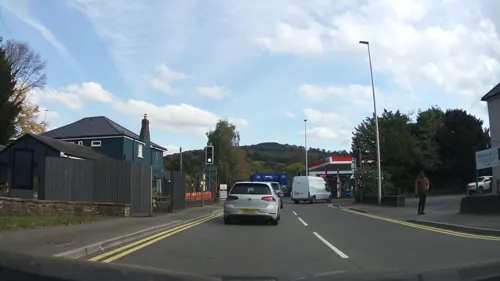
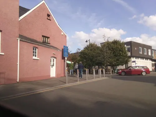
Kings Arms Hotel
Bar and pub
29 Nevill Street, Abergavenny
Mo-Th 11:00-23:00; Fr-Sa 11:00-13:00; Su 12:00-22:30
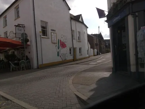
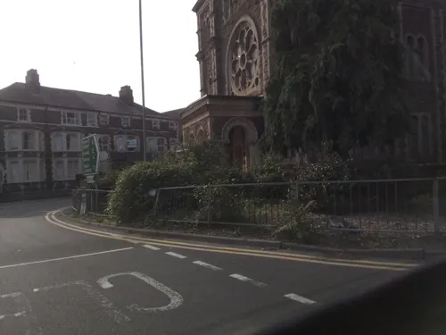

Kings Head Hotel
Bar and pub
59-60 Cross Street, Abergavenny
Mo-Sa 10:30-23:00; Su 12:00-16:00,19:00-22:30



58 more on the map.
History
Gobannium was a Roman fort guarding the road along the valley of the River Usk, which linked the legionary fortress of Burrium (Usk) and later Isca Augusta or Isca Silurum (Caerleon) in the south with Y Gaer, Brecon and Mid Wales. It was also built to keep the peace among the local British Iron Age tribe, the Silures. Cadw considers that the fort was occupied from around CE50 to CE150. Remains of the walls of this fort were discovered west of the castle when excavating the foundations for a new post office and telephone exchange building in the late 1960s.
Abergavenny grew as a town in early Norman times under the protection of the Baron Bergavenny (or Abergavenny). The first Baron was Hamelin de Balun, from Ballon, a small town with a castle in Maine near Le Mans. Today it is in the Sarthe département of France. He founded the Benedictine priory, now the Priory Church of St Mary, in the late 11th century. The Priory belonged originally to the Benedictine foundation of St. Vincent Abbaye at Le Mans. It was subsequently endowed by William de Braose, with a tithe of the profits of the castle and town. The church contains some unique alabaster effigies, church monuments and unique medieval wood carving, such as the Tree of Jesse.
Read more of the history
Owing to its geographical location, the town was frequently embroiled in the border warfare and power play of the 12th and 13th centuries in the Welsh Marches. In 1175, Abergavenny Castle was the site of a massacre of Seisyll ap Dyfnwal and his associates by William de Braose, 4th Lord of Bramber. Reference to a market at Abergavenny is found in a charter granted to the Prior by William de Braose.
Owain Glyndŵr attacked Abergavenny in 1404. According to popular legend, his raiders gained access to the walled town with the aid of a local woman who sympathised with the rebellion, letting a small party in via the Market Street gate at midnight. They were able to open the gate and allow a much larger party who set fire to the town and plundered its churches and homes leaving Abergavenny Castle intact. Market Street has been referred to as "Traitors' Lane" thereafter. In 1404 Abergavenny was declared its own nation by Ieuan ab Owain Glyndŵr, illegitimate son of Owain Glyndŵr. The arrangement lasted approximately two weeks.
At the Dissolution of the Monasteries in 1541, the priory's endowment went towards the foundation of a free grammar school, King Henry VIII Grammar School, the site itself passing to the Gunter family. During the Civil War, prior to the siege of Raglan Castle in 1645, King Charles I visited Abergavenny and presided in person over the trial of Sir Trefor Williams, 1st Baronet of Llangibby, a Royalist who changed sides, and other Parliamentarians. In 1639, Abergavenny received a charter of incorporation under the title of bailiff and burgesses. A charter with extended privileges was drafted in 1657, but appears never to have been enrolled or to have come into effect. Owing to the refusal of the chief officers of the corporation to take the oath of allegiance to William III in 1688, the charter was annulled, and the town subsequently declined in prosperity. Chapter 28 of the 1535 Act of Henry VIII, which provided that Monmouth, as county town, should return one burgess to Parliament, further stated that other ancient Monmouthshire boroughs were to contribute towards the payment of the member. In consequence of this clause Abergavenny on various occasions shared in the election, the last instance being in 1685.
The right to hold two weekly markets and three yearly fairs, beginning in the 13th century, was held ever since as confirmed in 1657. Abergavenny was celebrated for the production of Welsh flannel, and also for the manufacture, whilst the fashion prevailed, of goats' hair periwigs.
Abergavenny railway station, situated southeast of the town centre, opened on 2 January 1854 as part of the Newport, Abergavenny and Hereford Railway. The London North Western Railway sponsored the construction of the railway linking Newport station to Hereford station. The line was taken over by the West Midland Railway in 1860 before becoming part of the Great Western Railway in 1863. A railway line also ran up the valley towards Brynmawr and to Merthyr Tydfil; this was closed during the Beeching cuts in the 1960s and the line to Clydach Gorge is now a cycle track and footpath. The Baker Street drill hall was completed in 1896. Adolf Hitler's deputy, Rudolf Hess, was kept under escort at Maindiff Court Hospital during the Second World War, after his flight to Britain. In 1964, the Royal Observer Corps opened a small monitoring bunker to be used in the event of a nuclear attack. It was closed in 1968 but reopened in 1973 due to the closure of a bunker near Brynmawr. It closed in 1991 on the stand down of the ROC. It remains mostly intact.
From the History section of Abergavenny on Wikipedia, under CC BY-SA 4.0.
More about Abergavenny
Geography
The town originally developed on the high ground to the north of the floodplain of the River Usk and to the west of the valley of the much smaller Gavenny River though has since extended to the east of the latter. It has merged with the originally separate settlement of Mardy to the north but remains separate from that of Llanfoist to the south due to the presence of the river and its floodplain; nevertheless Llanfoist is in many ways a suburb of the town. The ground rises gradually in the north of the town before steepening to form the Deri and Rholben spurs of Sugar Loaf. The A4143 crossing of the Usk by means of the historic Usk Bridge is sited at the narrowest point of the floodplain, a site also chosen for the former crossing of a tramroad and the later mainline railway. The high ground at either side is formed by a legacy of the last ice age, the recessional Llanfoist moraine which underlies both the village which gives it its name, the town centre and the Nevill Hall area. The older parts of the town north of its centre are built upon a relatively flat-lying alluvial fan extending west from the area of St Mary's Priory to Cantref and of similar age to the moraine.
In the UK 2011 census, the six relevant wards (Lansdown, Grofield, Castle, Croesonen, Cantref and Priory) collectively listed Abergavenny's population as 12,515.
Arts and culture
In 2017 the town was named one of the best places to live in Wales. The town's local radio stations are currently Sunshine Radio 107.8 FM and NH Sound 1287 AM. Abergavenny is home to an award-winning brass band. Formed in Abergavenny prior to 1884, the band were joint National Welsh League Champions in 2006 and joint National Welsh League Champions in 2011. The band also operates a Junior Band training local young musicians.
The Borough Theatre in Abergavenny town centre hosts live events covering drama, opera, ballet, music, children's events, dance, comedy, storytelling, tribute bands and talks. The Melville Centre is close to the town centre and includes the Melville Theatre, which hosts a range of live events. The town held its first Abergavenny Arts Festival in 2018 and also hosts the Abergavenny Food Festival in September each year.
From the Wikipedia article Abergavenny, under CC BY-SA 4.0.
Notable people from Abergavenny
 Rebecca JamesBritish cyclist from WalesPhoto: Nicola, CC BY-SA 4.0
 Francis PymBritish politician (1922–2008)Photo: Unknown photographer, Public domain
 Thomas Jamesexplorer, ship captainPhoto: Unidentified engraver, Public domain
 Lowri ThomasBritish cyclistPhoto: Nicola, CC BY-SA 4.0
 Rachel Jamesracing cyclistPhoto: Nicola, CC BY-SA 4.0
 Dave Richardsassociation football player (born 1993)Photo: Paul W, CC BY-SA 4.0
- Henry Stafford, 2nd Duke of BuckinghamEnglish nobleman (1455-1483)
- Ethel Lina WhiteBritish writer (1876–1944)
- David LewisEnglish Jesuit Catholic priest and martyr
- David ReesEmeritus Professor of Mathematics (1918–2013)
- William GriffithsBritish field hockey player (1922–2010)
- Edwin Richardsfield hockey player
Born in Abergavenny, according to Wikidata (CC0). Each name links to its Wikipedia article.
Where to stay6
Churches and places of worship21
Shopping18
Gas and EV charging4
Schools, colleges and libraries9
King Henry VIII 3-19 School
School · 0.7 mi
Old Hereford Road, Abergavenny
Our Lady & St Michael's School
School · Catholic · 0.4 mi
14 Pen-y-Pound, Abergavenny
Llantilio Pertholey C.V. Primary School
School · 1.4 mi
Hillgrove Avenue, Mardy Abergavenny
Healthcare7
Velindre@Nevill Hall Radiotherapy Unit
Hospital · 0.8 mi
Brecon Road, Abergavenny
Map of Abergavenny
163 places. The map loads OpenStreetMap tiles when you open it.
Getting there and nearby towns
Cardiff Airport (CWL) is the nearest airport with scheduled flights listed in OpenStreetMap, 32 miles away.
- Brynmawr 7 mi west, about 12 min by car
- Pontypool 8 mi south, about 13 min by car
- Abertillery 8 mi southwest, about 13 min by car
- Ebbw Vale 9 mi west, about 14 min by car
- Tredegar 10 mi west, about 17 min by car
- Cwmbran 12 mi south, about 19 min by car
- Monmouth 13 mi east, about 21 min by car
- Bargoed 13 mi southwest, about 21 min by car
- Gelligaer 15 mi southwest, about 24 min by car
- Newport 16 mi south, about 26 min by car
Drive times are estimates from straight-line distance, not routes.
Towns near Abergavenny


Keep exploring
Local news
Headlines from INDB.
Reviews, tips and questions
Loading what members have shared...
Sources and licences
- GeoNames (CC BY 4.0): population, coordinates, regions and time zone
- Mapillary (see each image): photos
- OpenStreetMap contributors (ODbL 1.0): places, airports, map data
- Wikidata (CC0 1.0): elevation, founding date, time zone, website, landmarks and historic places
- Wikimedia Commons (see each image): photos
- Wikipedia (CC BY-SA 4.0): overview and history text
Photo credits
- Abergavenny panorama, Cornishstrongbitter at English Wikipedia, CC BY-SA 3.0
- 16 Cross Street, Abergavenny, April 2019, No Swan So Fine, CC BY-SA 4.0
- Abergavenny Castle 1, Jeremy Bolwell, CC BY-SA 2.0
- Church of Our Lady and St Michael, Abergavenny, October 2018, No Swan So Fine, CC BY-SA 4.0
- Priory Church of St Mary, Acomax, CC BY-SA 3.0
- Abergavenny Castle 2, Jeremy Bolwell, CC BY-SA 2.0
- Nevill Hall 291934 635c7783, Jennifer Luther Thomas, CC BY-SA 2.0
- The Angel 3, DIaNyf8q, CC0
- Coach and Horses, Abergavenny, August 2018, No Swan So Fine, CC BY-SA 4.0
- Kings Head Hotel, Abergavenny, March 2019, No Swan So Fine, CC BY-SA 4.0
- The Trading Post, Nevill Street, Abergavenny, October 2018 (1), No Swan So Fine, CC BY-SA 4.0
- Melville Centre, Abergavenny, October 2018 (4), No Swan So Fine, CC BY-SA 4.0
- Llanfoist Church, St Faith Monmouthshire, Alf Beard, CC0
- Hen and Chickens, Abergavenny, August 2018 (1), No Swan So Fine, CC BY-SA 4.0
- King Henry VIII 3-19 School 2nd May 2025, Mpawood, CC0
- Discover Wales Food & Countryside 2013 (10144424134), Niels Broekzitter from Piershil, The Netherlands, CC BY 2.0
- Abergavenny Bridge, South Side, WelshDave, CC BY-SA 4.0
- Castell y Fenni - 20180704-03, Pymouss, CC BY-SA 4.0
- Street-level photo, southglos, CC BY-SA 4.0
- Street-level photo, southglos, CC BY-SA 4.0
- Street-level photo, gness, CC BY-SA 4.0
- Street-level photo, southglos, CC BY-SA 4.0
- Street-level photo, southglos, CC BY-SA 4.0
- Street-level photo, southglos, CC BY-SA 4.0
- Street-level photo, editid, CC BY-SA 4.0
- Street-level photo, southglos, CC BY-SA 4.0
- Street-level photo, laye, CC BY-SA 4.0
- Street-level photo, gness, CC BY-SA 4.0
- Street-level photo, laye, CC BY-SA 4.0
- Street-level photo, richardc, CC BY-SA 4.0
- Street-level photo, russmcd, CC BY-SA 4.0
- Street-level photo, southglos, CC BY-SA 4.0


Page built November 10, 2026. Spotted a mistake? Tell us or suggest a place.