
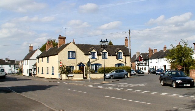


Aston-on-Trent, United Kingdom
Aston-on-Trent is a town of 2,160 people in England, United Kingdom.
Why visit Aston-on-Trent
Townapedia lists 2 museums and landmarks, 1 park or trail, 10 places to eat, 2 places to stay and 2 attractions in and around town.
Highlights include Cavendish Bridge, Melbourne Hall and Swarkestone Bridge.
Weather in Aston-on-Trent
Forecast from MET Norway (CC BY 4.0). Full forecast
About Aston-on-Trent
Aston-on-Trent is a village and civil parish in the South Derbyshire district, in the county of Derbyshire, England. The parish had a population of 1,682 at the 2011 Census. It is adjacent to Weston-on-Trent and near Chellaston, very close to the border with Leicestershire.
From the Wikipedia article Aston-on-Trent (this version), under CC BY-SA 4.0.
Photos of Aston-on-Trent


Things to do2


Museums and landmarks2

Melbourne Hall
Museum · 3.2 mi
Grade I listed historic house museum in South Derbyshire, England, UK

Swarkestone Bridge
Monument and historic site · 2.9 mi
Grade I listed bridge in Swarkestone, Derbyshire, England
Parks, trails and playgrounds1
Restaurants and cafes10

The Harrington Arms
Bar and pub · 1.5 mi
4 Grove Close, Derby
Tu 12:00-22:00; We-Th 12:00-23:00; Fr-Sa 12:00-00:00; Su 12:00-22:00
Notsa
Bar and pub
7 Derby Road, Derby
Mo-We 08:30-18:00; Th 08:30-23:00; Fr 08:30-00:00; Sa 08:30-23:00;...


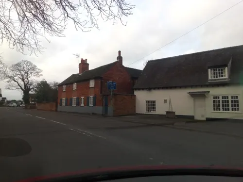



History
In 1009 Æþelræd Unræd (King Ethelred the Unready) signed a charter at the Great Council which recognised the position and boundaries of Westune. The land described in that charter included the lands now known as Shardlow, Great Wilne, Church Wilne, Crich, Smalley, Morley, Weston and Aston on Trent. Under this charter Æþelræd gave his minister, Morcar, a number of rights that made him free from tax and enabled his own rule within the manor.
This manor came under the control of the King again following Morcar being murdered in 1015 and the lands were later given to Ælfgar, the Earl of Mercia, but he lost this at the Norman Conquest. Aston is in the Domesday Book where it is mentioned as an outlying farm of Weston-on-Trent and listed amongst the lands given to Henry de Ferrers by the King. The land given to Henry included 5 acres (20,000 m2) of land that was valued at eight shillings.
The name is of Anglo-Saxon descent ('ton' an Old English suffix meaning farm). Being in the east, the name literally means 'East Farm'. The 'On-Trent' suffix of both Aston and nearby villages simply means they are near the river Trent.
Shardlow and Great Wilne were included in the parish of Aston-on-Trent until 1838, when Shardlow constructed its own church.
From the History section of Aston-on-Trent on Wikipedia, under CC BY-SA 4.0.
More about Aston-on-Trent
Arts and culture
Football in Aston is over 100 years old and in that time the village has developed at least three players who went on to play for England. Aston-on-Trent was the birthplace of three men who all played football for England within a six-year spell. They were Harry Linacre (1880–1957), who was a goalkeeper for England and Nottingham Forest, and his uncles Fred and Frank Forman. Harry was picked for England twice in 1905 helping them to victory both times. All three men were also originally signed by Derby County and then sold on to Nottingham Forest.
Today Aston-on-Trent F.C. consists of both a Saturday side playing in the Midlands Regional Alliance, and a Sunday side playing in the Derby Taverners League. 2013/14 saw the Sunday side win the cup double, building on many years' work to climb through the various divisions of the Long Eaton leagues, where they also won the Premier League and cup double.
Education
The village has its own primary school – Aston-on-Trent Primary School – and is in the catchment area of Chellaston School.
From the Wikipedia article Aston-on-Trent, under CC BY-SA 4.0.
Notable people from Aston-on-Trent
 Drury Drury-LoweBritish Army general (1830–1908)Photo: Alexander Bassano, Public domain
- Frank FormanEnglish footballer (1875-1961)
- Harry LinacreEnglish footballer (1880-1957)
- Fred FormanEnglish footballer (1873-1910)
Born in Aston-on-Trent, according to Wikidata (CC0). Each name links to its Wikipedia article.
Where to stay2
Churches and places of worship14
Gas and EV charging2
Schools, colleges and libraries4
Map of Aston-on-Trent
37 places. The map loads OpenStreetMap tiles when you open it.
Getting there and nearby towns
East Midlands Airport (EMA) is the nearest airport with scheduled flights listed in OpenStreetMap, 3 miles away.
- Sinfin 4 mi west, about 7 min by car
- Long Eaton 5 mi northeast, about 9 min by car
- Chaddesden 5 mi northwest, about 8 min by car
- Derby 6 mi northwest, about 9 min by car
- Stapleford 6 mi northeast, about 10 min by car
- Long Whatton 6 mi southeast, about 9 min by car
- Sutton Bonington 6 mi southeast, about 10 min by car
- Chilwell 7 mi northeast, about 12 min by car
- Findern 7 mi west, about 11 min by car
- Ilkeston 8 mi northeast, about 13 min by car
Drive times are estimates from straight-line distance, not routes.
Towns near Aston-on-Trent


Keep exploring
Local news
Headlines from INDB.
Reviews, tips and questions
Loading what members have shared...
Sources and licences
- GeoNames (CC BY 4.0): population, coordinates, regions and time zone
- Mapillary (see each image): photos
- OpenStreetMap contributors (ODbL 1.0): places, airports, map data
- Wikidata (CC0 1.0): elevation, founding date, time zone, website, landmarks and historic places
- Wikimedia Commons (see each image): photos
- Wikipedia (CC BY-SA 4.0): overview and history text
Photo credits
- Aston north along main st, Chris J Dixon, CC BY-SA 2.0
- Ledmore, Aston-on-Trent, Alan Murray-Rust, CC BY-SA 2.0
- 16 Weston Road, Aston-on-Trent, Alan Murray-Rust, CC BY-SA 2.0
- Bus Shelter, Aston-on-Trent, Alan Murray-Rust, CC BY-SA 2.0
- 2 and 4 Weston Road, Aston-on-Trent, Alan Murray-Rust, CC BY-SA 2.0
- 6 The Green, Aston-on-Trent, Alan Murray-Rust, CC BY-SA 2.0
- Longcroft Farmhouse, Aston-on-Trent, Alan Murray-Rust, CC BY-SA 2.0
- Cavendish Bridge over the River Trent, John M, CC BY-SA 2.0
- Melbourne Hall, Mark Anderson, CC BY-SA 2.0
- Stanton by Bridge 682646 fd93061e, Jerry Evans, CC BY-SA 2.0
- Castle Donington Methodist Church, Russ Hamer, CC BY-SA 3.0
- Elvaston, St Bartholomew, histman, CC BY 2.0
- Boulton St Mary's Church 1, Markz55, Public domain
- Stanton by Bridge, St Michael, South Derbyshire, histman, CC BY 2.0
- St Michael and St Mary, Melbourne, Tim Heaton, CC BY-SA 2.0
- Swarkestone Parish Church, histman, CC BY 2.0
- St Mary the Virgin's church, Weston on Trent 16, Cherubino, CC BY-SA 4.0
- Aston on Trent, All Saints, histman, CC BY 2.0
- Westonhall2007lk, victuallers2, CC BY 2.0
- Harrington Arms, Thulston, Chris J Dixon, CC BY-SA 2.0
- Aston on Trent important building 2, Victuallers, CC BY-SA 3.0
- Ledmore Listed building in Aston 2017, Victuallers, CC BY-SA 3.0
- Aston view, Victuallers, CC BY-SA 3.0
- Aston flood, Victuallers, CC BY-SA 3.0
- Aston water, Victuallers, CC BY-SA 3.0
- Aston shop, User:Victuallers, CC BY-SA 1.0
- Ledmore Listed building's in Aston 2017, Victuallers, CC BY-SA 3.0
- Led more Listed building in Aston on Trent, Victuallers, CC BY-SA 3.0
- Aston on Trent important building, Victuallers, CC BY-SA 3.0
- White hart aston, Victuallers, CC BY-SA 3.0
- The aston malt, Victuallers, CC BY-SA 3.0
- The Shakespeare Inn, Shardlow, Alan Murray-Rust, CC BY-SA 2.0
- St James' Church, Shardlow, Alan Murray-Rust, CC BY-SA 2.0
- War Memorial, St Stephen's Church, Borrowash, Alan Murray-Rust, CC BY-SA 2.0
- Street-level photo, adam2, CC BY-SA 4.0
- Street-level photo, southglos, CC BY-SA 4.0
- Street-level photo, adam2, CC BY-SA 4.0
- Street-level photo, mappo2, CC BY-SA 4.0
- Street-level photo, victuallers, CC BY-SA 4.0
- Street-level photo, victuallers, CC BY-SA 4.0
- Street-level photo, mappo2, CC BY-SA 4.0
- Street-level photo, trigpoint, CC BY-SA 4.0
- Street-level photo, adam2, CC BY-SA 4.0
- Street-level photo, victuallers, CC BY-SA 4.0
- Street-level photo, victuallers, CC BY-SA 4.0


Page built November 10, 2026. Spotted a mistake? Tell us or suggest a place.