


Why visit Baslow
Townapedia lists 13 museums and landmarks, 3 parks and trails, 16 places to eat, 3 places to stay and 4 attractions in and around town.
Highlights include Bakewell Bridge, Chatsworth House and Bakewell Old House Museum.
Weather in Baslow
Forecast from MET Norway (CC BY 4.0). Full forecast
About Baslow
Baslow is a village in Derbyshire, England, in the Peak District, situated between Sheffield and Bakewell, just over 1 mile (1.6 km) north of Chatsworth House. It is sited by the River Derwent, which is spanned by a 17th-century bridge, alongside which is a contemporary toll house.
From the Wikipedia article Baslow (this version), under CC BY-SA 4.0.
Things to do4

Bakewell Bridge
Bridge · 3.1 mi
Grade I listed bridge in Bakewell, Derbyshire, England



Museums and landmarks13


Bakewell Old House Museum
Museum · 3.4 mi
Grade II* listed building and museum in Bakewell, Derbyshire, England, UK


War Memorial
Monument and historic site · 3.3 mi
Grade II listed war memorial in Bakewell, Derbyshire Dales, Derbyshire, England, UK


Barbrook One
Monument and historic site · 2.5 mi
Stone circle in Derbyshire, England, UK
Great Longstone War Memorial
Monument and historic site · 3.4 mi
War memorial in Great Longstone, Derbyshire Dales, Derbyshire, England, UK
1 more on the map.
Parks, trails and playgrounds3


Restaurants and cafes16
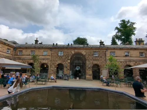
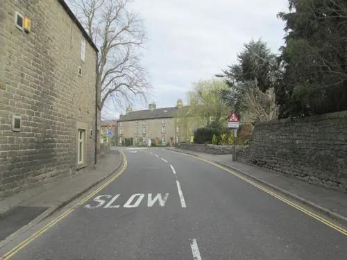
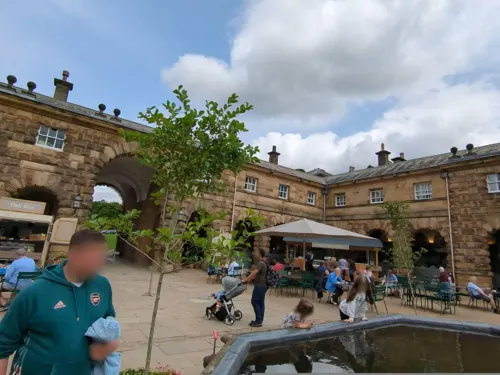
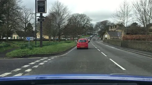

4 more on the map.
History
St Anne's Church has an Anglo-Saxon coffin lid in the porch entrance, but the oldest part of the current building, the north aisle, dates from about 1200. The tower was constructed in the 13th century but the rest of the church is newer and was the subject of an extensive restoration in the 19th century. A sundial lies in the church grounds, atop the shaft, base and steps of a cross. This may have acted as a market cross in the 17th century. A second cross lies in the graveyard, moved from Bubnell by Doctor Wrench, who erected the nearby Wellington Monument and is buried in the churchyard. This cross may historically have been known as the "Butter Cross".
Just behind the church is Baslow Bridge, a Grade I listed building and scheduled monument. At the north west end of the bridge is a stone gabled watch hut, manned daily to protect the village from bandits (not a toll booth as is frequently stated). Built in 1608, this is the oldest bridge across the Derwent never to have been destroyed by floods.
The Baslow Grand Hotel Golf Club (now defunct) was founded in 1896. The course was still appearing on Ordnance Survey maps in the 1930s.
From the History section of Baslow on Wikipedia, under CC BY-SA 4.0.
More about Baslow
Geography
Baslow village is composed of several distinct areas: Bubnell (west of the river), Bridge End (by the river crossings), Over End (north of the main road) and Nether End (adjacent to Chatsworth Park).
Bridge End is the original settlement, clustered around the church and the ancient bridge and ford across the River Derwent.
Nether End, at the eastern end of the village, has several hotels, pubs, restaurants and tea rooms. There is also a caravan site and a pedestrian entrance to Chatsworth Park. Just outside Nether End (and the village itself) are the so-called "Golden Gates", a set of gates dating from the 1st Duke's rebuilding of Chatsworth, which were moved here by Sir Joseph Paxton for William Cavendish, 6th Duke of Devonshire, in the 19th century to make a new entrance to the park, following its extension northwards towards Baslow in the 1830s. The gates are now only rarely used, most usually when large public events are held in the park.
From the Wikipedia article Baslow, under CC BY-SA 4.0.
Notable people from Baslow
- Valerie Hunter GordonBritish inventor (1921-2016)
Born in Baslow, according to Wikidata (CC0). Each name links to its Wikipedia article.
Where to stay3
Churches and places of worship11
Shopping4
Schools, colleges and libraries4
Map of Baslow
58 places. The map loads OpenStreetMap tiles when you open it.
Getting there and nearby towns
Manchester Airport (MAN) is the nearest airport with scheduled flights listed in OpenStreetMap, 28 miles away.
- Youlgreave 6 mi southwest, about 9 min by car
- Dronfield 7 mi northeast, about 11 min by car
- Tideswell 7 mi west, about 11 min by car
- Fulwood 8 mi northeast, about 12 min by car
- Matlock 8 mi south, about 13 min by car
- Chesterfield 9 mi east, about 14 min by car
- Tansley 9 mi southeast, about 15 min by car
- Sheffield 11 mi northeast, about 18 min by car
- Staveley 11 mi east, about 18 min by car
- High Peak 12 mi northwest, about 20 min by car
Drive times are estimates from straight-line distance, not routes.
Towns near Baslow


Keep exploring
Local news
Headlines from INDB.
Reviews, tips and questions
Loading what members have shared...
Sources and licences
- GeoNames (CC BY 4.0): population, coordinates, regions and time zone
- Mapillary (see each image): photos
- OpenStreetMap contributors (ODbL 1.0): places, airports, map data
- Wikidata (CC0 1.0): elevation, founding date, time zone, website, landmarks and historic places
- Wikimedia Commons (see each image): photos
- Wikipedia (CC BY-SA 4.0): overview and history text
Photo credits
- St Annes Church, Baslow, Bakewell. - panoramio, Keith Daulby, CC BY 3.0
- Chatsworth house, Rprof, CC BY-SA 3.0
- Old House Museum, Bakewell 201307 166, Elisa.rolle, CC BY-SA 4.0
- Bakewell War Memorial, Dave.Dunford, CC BY-SA 4.0
- All Saints Church, Bakewell, Rob Bendall ( Highfields ), Attribution
- Baslow, St Catherine from south, Poliphilo, CC0
- Drinking fountain near Bakewell Bridge, Dave.Dunford, CC BY-SA 4.0
- A Millstone at Baslow Edge - Flickr - Donnchadh H, Donnchadh H, CC BY 4.0
- Eyam Hall 1334913-15, Barrie Price, CC BY-SA 4.0
- Calver Mill 346670 ac4f6a9e, Chris Allen, CC BY-SA 2.0
- Street-level photo, dudone, CC BY-SA 4.0
- Street-level photo, tallguy, CC BY-SA 4.0
- Street-level photo, lvl5, CC BY-SA 4.0
- Street-level photo, dudone, CC BY-SA 4.0
- Street-level photo, jurkis, CC BY-SA 4.0
- Street-level photo, jurkis, CC BY-SA 4.0
- Street-level photo, jurkis, CC BY-SA 4.0
- Street-level photo, dudone, CC BY-SA 4.0
- Street-level photo, endszbrxns, CC BY-SA 4.0
- Street-level photo, lvl5, CC BY-SA 4.0
- Street-level photo, tallguy, CC BY-SA 4.0
- Street-level photo, lvl5, CC BY-SA 4.0
- Street-level photo, janvanbekkum, CC BY-SA 4.0
- Street-level photo, dudone, CC BY-SA 4.0
- Street-level photo, dudone, CC BY-SA 4.0
- Street-level photo, janvanbekkum, CC BY-SA 4.0
Page built November 10, 2026. Spotted a mistake? Tell us or suggest a place.