


Birstall, United Kingdom
Birstall is a town of 12,216 people in England, United Kingdom.
Why visit Birstall
Townapedia lists 28 museums and landmarks, 23 parks and trails, 72 places to eat, 2 places to stay and 8 attractions in and around town.
Highlights include Braunstone Gate Bridge, Curve, National Space Centre and Abbey Pumping Station.
Weather in Birstall
Forecast from MET Norway (CC BY 4.0). Full forecast
About Birstall
Birstall is a large village and civil parish within the Charnwood borough of Leicestershire, England. It is three miles north of Leicester city centre and is part of the wider Leicester Urban Area.
From the Wikipedia article Birstall, Leicestershire (this version), under CC BY-SA 4.0.
Photos of Birstall


Things to do8


De Montfort Hall
Cinema and theater · 2.9 mi
Music and performance venue in Leicester, United Kingdom

Leicester Haymarket Theatre
Cinema and theater · 2.1 mi
Theatre in Leicester, England

Little Theatre, Leicester
Cinema and theater · 2.5 mi
Theatre in Leicester, England, originally a Baptist chapel

Sue Townsend Theatre
Cinema and theater · 2.6 mi
Theatre and music venue in Leicester, England

Peepul Centre
Cinema and theater · 1.5 mi
Orchardson Avenue, Leicester

Museums and landmarks28


Leicester Abbey
Monument and historic site · 1.5 mi
Grade I listed building in Leicester, Leicestershire, England, UK
Abbey Park Road, Leicester
Abbey Pumping Station Museum
Museum · 1.0 mi
Local Authority Museum in the East Midlands, United Kingdom

Arch of Remembrance
Monument and historic site · 3.0 mi
War memorial in Leicester, Leicestershire, England, UK

Belgrave Hall
Museum · 0.6 mi
Queen Anne-style Grade II* listed building in Belgrave, Leicester, England, UK
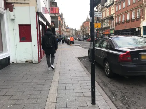
City Gallery
Museum · 2.4 mi
Contemporary art gallery in Leicester, England, UK, closed 2010

Haymarket Memorial Clock Tower
Monument and historic site · 2.2 mi
Clock tower in City of Leicester, Leicestershire, England, UK
Humber stone
Monument and historic site · 1.7 mi
Glacial boulder in Leicester, England

Jewry Wall Museum
Museum · 2.4 mi
Museum in Leicester, England, United Kingdom

King Richard III Visitor Centre
Museum · 2.4 mi
Museum in Leicester, England

16 more on the map.
Parks, trails and playgrounds23


Victoria Park
Park · 3.1 mi
Public park in Leicester, Leicestershire, England, UK



Cossington Meadows
Park · 3.1 mi
Nature reserve in Leicestershire, England
11 more on the map.
Restaurants and cafes72
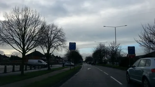
Feast India
Restaurant · Italian,india,chinese
411 Melton Road, Leicester
Mo-Fr 18:00-23:00; Sa 17:00-23:00; Su 12:30-15:00,16:00-22:00
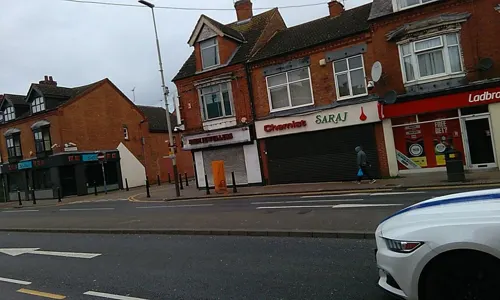
The Cake Solution
Bakery · 0.7 mi
170 Melton Road, Leicester
Mo-Sa 12:00-19:00; Su 12:00-17:00; PH 12:00-17:00
Milan Di Damao
Restaurant · Indian · 1.5 mi
32 Belgrave Road
Tu-Th 09:00-14:00,17:00-20:00; Fr-Su 09:00-20:00

Asda Café
Cafe · Coffee Shop · 1.3 mi
1 Exploration Drive, Leicester
Mo-Sa 08:30-18:00; Su 10:00-16:00

Mirch Masala
Restaurant · Asian · 1.2 mi
160 Belgrave Road, Leicester
Mo-Su 06:00-22:00
60 more on the map.
History
The village's name means lit. 'settlement built on the site of a fortification'.
Saxon remnants have been found in the village and surrounding area. The village was called Burstalle in the Domesday Book when it belonged to Hugh de Grandmesnil. Willard held these lands for Hugh and the 16 acres (65,000 m2) of meadow and a mill were said to be worth three ounces of gold. The village began its growth with the arrival of the Great Central Railway in 1899. From then onwards development has continued and still continues to-day. Between 1901 and the 2001 the population grew from 611 to over 11,000.
A new housing development called 'Hallam Fields' commenced construction in 2006. It occupies land to the west of the A6, between the 'Gates' estate and the A46. The development will take ten years to complete, consisting of up to 900 properties including schools, shops, offices, industrial units and a fire station. It has been described as a mini Poundbury. By April 2010 it had 11 streets.
From the History section of Birstall, Leicestershire on Wikipedia, under CC BY-SA 4.0.
Notable people from Birstall
- June CrebbinUK children's author 1938-
Born in Birstall, according to Wikidata (CC0). Each name links to its Wikipedia article.
Where to stay2
Churches and places of worship56
Church of the Annunciation of Our Lady of the Newarke
Church · 2.6 mi
Church of St Mary the Virgin and St John the Baptist, Rothley
Church · 3.0 mi
Shopping11
Gas and EV charging4
Schools, colleges and libraries26
Healthcare5
Leicester Renal Dialysis Centre
Clinic and pharmacy · 1.4 mi
50 Crest Rise, Leicester
Map of Birstall
235 places. The map loads OpenStreetMap tiles when you open it.
Getting there and nearby towns
East Midlands Airport (EMA) is the nearest airport with scheduled flights listed in OpenStreetMap, 14 miles away.
- Leicester 2 mi south, about 3 min by car
- Syston 2 mi northeast, about 4 min by car
- Glenfield 4 mi southwest, about 6 min by car
- Mountsorrel 4 mi north, about 6 min by car
- Braunstone 4 mi southwest, about 7 min by car
- Oadby 4 mi south, about 7 min by car
- Evington 5 mi southeast, about 8 min by car
- Glen Parva 6 mi south, about 10 min by car
- Shepshed 10 mi northwest, about 16 min by car
- Melton Mowbray 12 mi northeast, about 19 min by car
Drive times are estimates from straight-line distance, not routes.
Towns near Birstall


Keep exploring
Local news
Headlines from INDB.
Reviews, tips and questions
Loading what members have shared...
Sources and licences
- GeoNames (CC BY 4.0): population, coordinates, regions and time zone
- Mapillary (see each image): photos
- OpenStreetMap contributors (ODbL 1.0): places, airports, map data
- Wikidata (CC0 1.0): elevation, founding date, time zone, website, landmarks and historic places
- Wikimedia Commons (see each image): photos
- Wikipedia (CC BY-SA 4.0): overview and history text
Photo credits
- NCN Millennium Milepost Watermead Country Park Birstall Leicestershire, Mat Fascione, CC BY-SA 2.0
- Braunstone Gate Bridge, Tim Hallam, CC BY-SA 2.0
- Curve Leicester full panorama, NotFromUtrecht, CC BY-SA 3.0
- De Montfort Hall, NotFromUtrecht, CC BY-SA 3.0
- Leicester Haymarket Theatre entrance, Cordyceps-Zombie, CC BY-SA 4.0
- Teatr Mały w Leicester, Kris1973, CC BY-SA 4.0
- Phoenix Arts Centre Leicester, NotFromUtrecht, CC BY-SA 3.0
- Abbeyruins Leicester, Kev747 at English Wikipedia, CC BY-SA 3.0
- War Memorial Leicester, Summer 2009, NotFromUtrecht, CC BY-SA 3.0
- Leicester clock tower May2010, NotFromUtrecht, CC BY-SA 3.0
- Jewry Wall ruins panorama 3, NotFromUtrecht, CC BY-SA 3.0
- Dynasty Death and Discovery, Richard III museum entrance, RobinLeicester, CC BY-SA 4.0
- Abbey Park Leicester entrance gate, NotFromUtrecht, CC BY-SA 3.0
- Birstall Meadows 5, Dudley Miles, CC BY-SA 4.0
- Goss Meadows 7, Dudley Miles, CC BY-SA 4.0
- Humberstone Park LNR 6, Dudley Miles, CC BY-SA 4.0
- Nelson Mandela Park, Joshuajohnlee ., CC BY 3.0
- The Orchards Nature Reserve 2, Dudley Miles, CC BY-SA 4.0
- Victoria Park Leicester from Queens Road, NotFromUtrecht, CC BY-SA 3.0
- River Soar from Wanlip Meadows 2, Dudley Miles, CC BY-SA 4.0
- All Saints Church - widok od południowej strony, Kris1973, CC BY-SA 4.0
- Birstall Church, Kev747 at English Wikipedia, Public domain
- St Mark's Church, Leicester, south side, Grahamrob, CC BY-SA 3.0
- St Mary de Castro from Castle Yard, NotFromUtrecht, CC BY-SA 3.0
- Clarendon Park Congregational Church, Tom Parnell, CC BY-SA 4.0
- Abbey Pumping station, Jonnic1 at English Wikipedia, Public domain
- Watermead Country Park, Unknown author, CC BY-SA 3.0
- The Peepul Centre, Belgrave, Leicester, HIDEHIH0DIH0, CC BY-SA 4.0
- Newarke church arches DMU heritage centre, Leicester, RobinLeicester, CC BY-SA 4.0
- Soar Valley - panoramio - Tanya Dedyukhina (11), Tanya Dedyukhina, CC BY 3.0
- Soar Valley - panoramio - Tanya Dedyukhina (6), Tanya Dedyukhina, CC BY 3.0
- Soar Valley - panoramio - Tanya Dedyukhina, Tanya Dedyukhina, CC BY 3.0
- National Space Centre (28967294791), Amanda Slater from Coventry, West Midlands, UK, CC BY-SA 2.0
- Belgrave Hall, Leicester, RobinLeicester, CC BY-SA 4.0
- Street-level photo, adam2, CC BY-SA 4.0
- Street-level photo, adam2, CC BY-SA 4.0
- Street-level photo, adam2, CC BY-SA 4.0
- Street-level photo, sk53_quint, CC BY-SA 4.0
- Street-level photo, sk53_quint, CC BY-SA 4.0
- Street-level photo, toby, CC BY-SA 4.0
- Street-level photo, adam2, CC BY-SA 4.0
- Street-level photo, toby, CC BY-SA 4.0
- Street-level photo, trigpoint, CC BY-SA 4.0
- Street-level photo, southglos, CC BY-SA 4.0
- Street-level photo, adam2, CC BY-SA 4.0
- Street-level photo, adam2, CC BY-SA 4.0
- Street-level photo, sk53_quint, CC BY-SA 4.0
- Street-level photo, toby, CC BY-SA 4.0
- Street-level photo, trigpoint, CC BY-SA 4.0
- Street-level photo, cyclestreets, CC BY-SA 4.0
- Street-level photo, southglos, CC BY-SA 4.0
- Street-level photo, sk53_quint, CC BY-SA 4.0
- Street-level photo, sk53_quint, CC BY-SA 4.0
- Street-level photo, gness, CC BY-SA 4.0


Page built November 10, 2026. Spotted a mistake? Tell us or suggest a place.