


Blackwood, United Kingdom
Blackwood is a town of 15,476 people in Wales, United Kingdom.
Why visit Blackwood
Townapedia lists 4 museums and landmarks, 5 parks and trails, 46 places to eat, 2 places to stay and 5 attractions in and around town.
Highlights include Blackwood Miners Welfare Institute, Crumlin Viaduct, Blackwood Miners Institute and Blackwood War Memorial.
Weather in Blackwood
Forecast from MET Norway (CC BY 4.0). Full forecast
About Blackwood
Blackwood (Welsh: Coed Duon or Coed-duon ) is a town, community and an electoral ward on the Sirhowy River in the South Wales Valleys administered as part of Caerphilly County Borough. It is located within the historic county of Monmouthshire.
From the Wikipedia article Blackwood, Caerphilly (this version), under CC BY-SA 4.0.
Things to do5
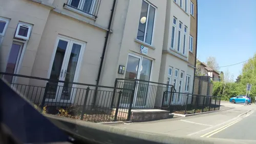
Blackwood Miners Welfare Institute
Cinema and theater · 0.5 mi
Entertainment venue in Blackwood, Caerphilly, Wales

Crumlin Viaduct
Bridge · 3.0 mi
Former viaduct crossing the Ebbw Valley
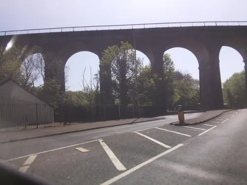
Hengoed Viaduct
Bridge · 1.6 mi
Railway viaduct in Caerphilly county borough, South Wales

Museums and landmarks4
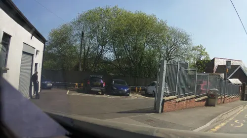


Studio 54
Museum · 0.5 mi
High Street, Blackwood
Mo 15:00-20:00; Tu-Th 10:00-20:00; Fr Off; Sa Off; Su 10:00-18:30
Parks, trails and playgrounds5



Aberbargoed Grasslands National Nature Reserve
Hiking and trails · 1.2 mi

Restaurants and cafes46
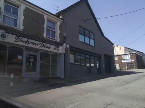
Meow's Chinese
Restaurant · Chinese, Seafood, Duck, Pork · 0.5 mi
2 Pentwyn Road, Blackwood
Mo 16:10-22:30; Tu 16:10-21:00; We-Th 16:10-22:30; Fr-Sa...
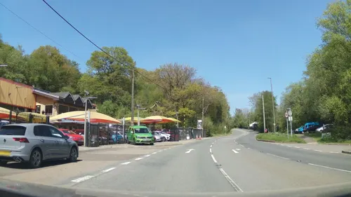
The Rock
Bar and pub · 1.2 mi
Tredegar Road, Blackwood
Mo-Th 12:00-15:00,18:00-23:00; Fr-Sa 12:00-23:00; Su 12:00-15:00

Amici
Restaurant · Italian · 0.5 mi
1 Pentwyn Road, Blackwood
Mo-Sa 12:00-15:00,16:30-22:30; Su 12:30-21:00

Big Dog Coffee
Cafe · Coffee Shop · 0.5 mi
138 High Street, Blackwood
Mo-Th 08:00-16:00; Fr 08:00-17:00; Su 10:00-16:00
Bistro 8 Blackwood
Restaurant · Bistro · 0.8 mi
Park Terrace, Blackwood
Mo-Th 12:00-14:00,17:00-22:00; Fr 12:00-14:00,17:00-22:30; Sa...
Codfather & The Pearl
Restaurant · Fish And Chips · 0.5 mi
100-102 High Street, Blackwood
Mo-Sa 10:00-21:00; Su Off
New Red Chilli
Restaurant · Indian · 0.5 mi
67 High Street, Blackwood
Mo 17:30-22:30; Tu-Su 17:30-22:45

The Sirhowy
Bar and pub · 0.5 mi
61-63 High Street, Blackwood
Mo,Tu,We,Th,Su 08:00-24:00; Fr,Sa 08:00-25:00
Caesar's Coffee
Cafe · Coffee Shop · 0.6 mi
171 High Street, Blackwood
Mo-Sa 08:00-16:30; Su Off
Linda's House
Restaurant · Chinese · 0.6 mi
166 High Street, Blackwood
Mo Off; Tu 12:00-14:00,18:00-23:30; We 18:00-23:30; Th...
34 more on the map.
History
Blackwood was founded in the early 19th century by local colliery owner John Hodder Moggridge, who lived at nearby Woodfield Park Estate: the first houses in Blackwood were built by Moggridge in an attempt to build a model village.
Deplorable working conditions at the time of the Industrial Revolution, however, led to Blackwood becoming a centre of the Chartist movement in the 1830s. The South Wales Chartist leaders John Frost, Zephaniah Williams (a Blackwood man) and William Jones met regularly at the Coach and Horses public house in Blackwood, which was demolished in 1958, but has its former location marked with a plaque. Their march on Newport, in what became known as the Newport Rising in 1839, was intended to coincide with a Britain-wide 'revolution' against the Government, the gentry and the Establishment.
When the insurrection erupted in November a large contingent of insurgents gathered at Blackwood. Upon meeting their comrades from the upper Sirhowy Valley the rebels armed themselves with makeshift weapons and marched south to Newport to demand the adoption of the People's Charter and the release of Henry Vincent from Monmouth County Gaol. However, the South Wales Movement were the only ones to march and the national rising failed and its leaders were sentenced to death (later commuted to deportation to Tasmania).
Read more of the history
In 1912 the Titanic's distress signals were picked up by amateur wireless enthusiast Artie Moore who resided at the Old Mill, Gelligroes, just outside the town. Moore went on to work as a senior scientist for Marconi and was involved with the invention of the transistor for telecommunications.
The former Penllwyn House on the outskirts of the town was originally part of the Lord Tredegar Estates and is believed to be the original home of the family of Henry Morgan (c. 1635 – 1688), a privateer and Governor of Jamaica. The building is now a public house The town is home to the Maes Manor Hotel, located in a grand old manor house known as Maesrudded. The house was formerly home to the Lord Lieutenant of Monmouthshire.
Evan James (Ieuan ap Iago, 1809–93) was a weaver and wool merchant by profession and owner of the Ancient Druid Inn in Hollybush, in the parish of Bedwellty, Monmouthshire. He moved to Pontypridd when his son James (Iago ap Ieuan, 1833–1902) was a young boy. Evan James and his son James are credited with composing the Welsh national anthem, 'Hen Wlad fy Nhadau' ('Land of my Fathers') in 1856. Evan was a poet and it is believed that he wrote the words while his son James composed the tune. The song was published in the volume 'Gems of Welsh Melody' (1860) and soon became extremely popular. It is not certain when the song was first adopted as the Welsh national anthem. A memorial, designed by W. Goscombe John, was erected in honour of Evan and James James in Ynysangharad Park, Pontypridd, in 1930.
The decline of the coal mining industry throughout the later part of the twentieth century affected South Wales, the major source of employment was lost and the landscape left daily reminders of what had been. State backed rejuvenation schemes have gone some way to rejuvenate the wider Blackwood area, including the relief road and various light industrial areas.
From the History section of Blackwood, Caerphilly on Wikipedia, under CC BY-SA 4.0.
More about Blackwood
Education
There is a network of primary schools, junior schools and secondary schools. The town is provided for by two local comprehensive schools all with between 800 – 1200 pupils. The Secondary schools are Blackwood Comprehensive School and Islwyn High School. Until the mid-1990s Blackwood comprehensive had separate uniforms for senior and junior pupils. A number of Blackwood pupils have been to Oxbridge and to other leading educational institutions.
An increase in demand for Welsh language medium education has led to the establishment of two Welsh Medium Infants and Primary schools. Ysgol Trelyn is located in the community of Pengam to the west of Blackwood and the newly opened Ysgol Cwm Derwen is located in the village of Oakdale to the east of the town. Both schools are 'feeder' schools to the Secondary School Ysgol Gyfun Cwm Rhymni located in Fleur de Lys, a village adjacent to Pengam to the west of Blackwood.
From the Wikipedia article Blackwood, Caerphilly, under CC BY-SA 4.0.
Notable people from Blackwood
 Nicky WireWelsh musician and songwriterPhoto: Gergely Csatari, CC BY-SA 2.0
 Paul BarrettBritish singer, songwriter, actor, agent and manager (1940-2019)Photo: 21stCenturyGreenstuff ( talk ), CC BY 3.0
- Richey EdwardsWelsh guitarist (1967–1995)
- Margaret PriceWelsh opera singer (1941-2011)
- Lauren WilliamsBritish taekwondo practitioner
- Gwyn JonesBritish writer (1907–1999)
- Mark KendallBritish footballer (1958-2008)
- Brayley ReynoldsWelsh footballer (born 1935)
- David JamesWelsh rugby league footballer (1985-)
- Allan WatsonWelsh player of association and American football
- Ieuan Jonesrugby player
- Owen WilliamsWelsh rugby union player
Born in Blackwood, according to Wikidata (CC0). Each name links to its Wikipedia article.
Where to stay2
Churches and places of worship15
Fleur De Lis Methodist Church
Church · Methodist · 0.7 mi
Gellihaf Road, Tir-yr-Berth
Blackwood Spiritualist Church
Place of worship · 0.7 mi
204 High Street, Blackwood
Shopping7
Gas and EV charging5
Schools, colleges and libraries20
Map of Blackwood
109 places. The map loads OpenStreetMap tiles when you open it.
Getting there and nearby towns
Cardiff Airport (CWL) is the nearest airport with scheduled flights listed in OpenStreetMap, 19 miles away.
- Bargoed 2 mi northwest, about 2 min by car
- Gelligaer 2 mi west, about 3 min by car
- Nelson 3 mi west, about 6 min by car
- Abercarn 3 mi southeast, about 6 min by car
- Treharris 4 mi west, about 7 min by car
- Abertillery 5 mi northeast, about 9 min by car
- Risca 6 mi southeast, about 10 min by car
- Caerphilly 6 mi south, about 10 min by car
- Pontypool 7 mi east, about 12 min by car
- Pontypridd 7 mi southwest, about 12 min by car
Drive times are estimates from straight-line distance, not routes.
Towns near Blackwood


Keep exploring
Local news
Headlines from INDB.
Reviews, tips and questions
Loading what members have shared...
Sources and licences
- GeoNames (CC BY 4.0): population, coordinates, regions and time zone
- Mapillary (see each image): photos
- OpenStreetMap contributors (ODbL 1.0): places, airports, map data
- Wikidata (CC0 1.0): elevation, founding date, time zone, website, landmarks and historic places
- Wikimedia Commons (see each image): photos
- Wikipedia (CC BY-SA 4.0): overview and history text
Photo credits
- Blackwood from the air, cwpritchard, CC BY-SA 2.0
- Crumlin Viaduct. [graphic] / On the Taff Vale extension of the West Midland Railway - constructed exclusively of iron - length 1658 feet - height 200 feet - designed and erected by T. W. Kenard Esqr., Unknown author, Public domain
- Street-level photo, southglos, CC BY-SA 4.0
- Street-level photo, southglos, CC BY-SA 4.0
- Street-level photo, southglos, CC BY-SA 4.0
- Street-level photo, southglos, CC BY-SA 4.0
- Street-level photo, southglos, CC BY-SA 4.0
- Street-level photo, southglos, CC BY-SA 4.0
- Street-level photo, southglos, CC BY-SA 4.0
- Street-level photo, southglos, CC BY-SA 4.0
- Street-level photo, southglos, CC BY-SA 4.0
- Street-level photo, southglos, CC BY-SA 4.0
- Street-level photo, southglos, CC BY-SA 4.0
Page built November 10, 2026. Spotted a mistake? Tell us or suggest a place.