


Bodedern, United Kingdom
Bodedern is a town of 1,051 people in Wales, United Kingdom, founded in April 1, 1974.
Why visit Bodedern
Townapedia lists 8 museums and landmarks, 2 parks and trails, 12 places to eat, 4 places to stay and 1 attraction in and around town.
Highlights include Presaddfed Burial Chamber, Presaddfed Chambered Tomb, Valley Wetlands and Penrhos Country Park.
Weather in Bodedern
Forecast from MET Norway (CC BY 4.0). Full forecast
About Bodedern
Bodedern is a village and community in the west of Anglesey, Wales. At the 2001 census, it had a population of 1,074, decreasing slightly to 1,051 at the 2011 census. The community includes the settlements of Llanllibio and Pen-llyn.
From the Wikipedia article Bodedern (this version), under CC BY-SA 4.0.
Photos of Bodedern


Things to do1

Museums and landmarks8

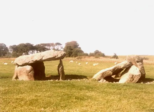
Presaddfed Chambered Tomb
Monument and historic site · 1.0 mi
Neolithic burial chamber in Anglesey, Wales


Parks, trails and playgrounds2

Valley Wetlands
Park · 2.3 mi
RSPB nature reserve in the United Kingdom

Penrhos Country Park
Park · 3.9 mi
Country park near Penrhos, Anglesey
Restaurants and cafes12
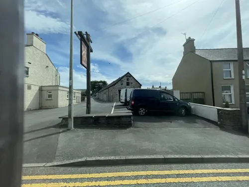
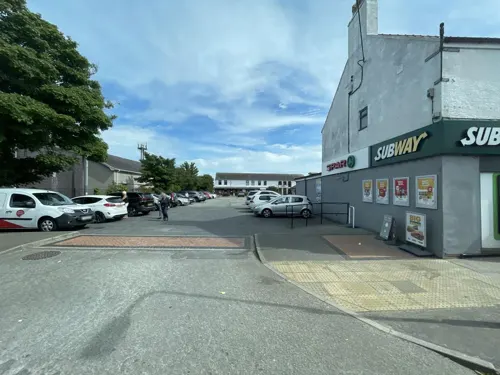
Sergio's Fish and Chips
Fast food · Fish And Chips · 2.5 mi
Station Road, Y Fali / Valley
Mo-Sa 11:30-21:00
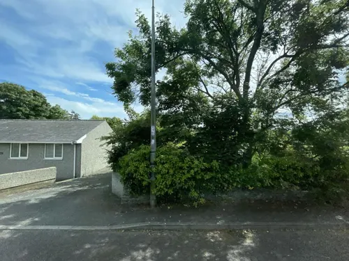
Lee's Garden
Fast food · Chinese · 1.9 mi
Ffordd Caergybi, Caergeiliog


Catch 22
Restaurant · 2.5 mi
London Road, Holyhead
We-Fr 10:30-14:00,17:00-21:00; Sa 10:30-14:30,17:00-21:00; Su 10:30-20:00

Enochs Fish and Chips
Fast food · Fish And Chips · 2.5 mi
London Road, Holyhead
Su-Th 12:00-20:30; Fr,Sa 12:00-21:00
Sergio's
Fast food · Fish And Chips · 2.4 mi
1 The Square, Holyhead
Su-Th 16:00-22:00; Fr,Sa 16:00-23:00
Sunny Valley
Fast food · Chinese · 2.5 mi
London Road, Holyhead
We,Th,Su,Mo 16:00-22:30; Fr,Sa 16:00-23:00
More about Bodedern
Education
A Welsh-language playgroup Cylch Meithrin Bodedern currently serves the community with the support of Mudiad Meithrin.
Ysgol Gynradd Bodedern provides Welsh-medium primary education to the village and the surrounding rural area. As of 2024, there were 98 pupils enrolled at the school. 66.3 per cent of pupils speak Welsh at home.
A Welsh-medium secondary school, Ysgol Uwchradd Bodedern, is located in the village.
From the Wikipedia article Bodedern, under CC BY-SA 4.0.
Notable people from Bodedern
 Hugh Owen ThomasWelsh surgeon (1834–1891)Photo: Henry Keet, Public domain
 William RobertsBritish 19th-century physicianPhoto: Elliott & Fry, CC BY 4.0
- Dion DonohueBritish association football player (born 1993)
- William David OwenBritish writer (1874–1925)
Born in Bodedern, according to Wikidata (CC0). Each name links to its Wikipedia article.
Where to stay4
Churches and places of worship23
Old Church of St Afran, St Ieuan and St Sannan, Llantrisant
Church · 2.6 mi
Shopping2
Schools, colleges and libraries4
Healthcare3
Map of Bodedern
59 places. The map loads OpenStreetMap tiles when you open it.
Getting there and nearby towns
RAF Valley - Anglesey Airport (VLY) is the nearest airport with scheduled flights listed in OpenStreetMap, 3 miles away.
- Valley 3 mi west, about 4 min by car
- Rhosneigr 4 mi south, about 7 min by car
- Holyhead 5 mi west, about 9 min by car
- Llanerchymedd 6 mi northeast, about 9 min by car
- Llangefni 8 mi east, about 13 min by car
- Cemaes Bay 9 mi north, about 14 min by car
- Gaerwen 11 mi southeast, about 17 min by car
- Llanfairpwllgwyngyll 13 mi east, about 21 min by car
- Caernarfon 14 mi southeast, about 23 min by car
- Bangor 16 mi east, about 26 min by car
Drive times are estimates from straight-line distance, not routes.
Towns near Bodedern


Keep exploring
Local news
Headlines from INDB.
Reviews, tips and questions
Loading what members have shared...
Sources and licences
- GeoNames (CC BY 4.0): population, coordinates, regions and time zone
- Mapillary (see each image): photos
- OpenStreetMap contributors (ODbL 1.0): places, airports, map data
- Openverse (see each image): photos
- Wikidata (CC0 1.0): elevation, founding date, time zone, website, landmarks and historic places
- Wikimedia Commons (see each image): photos
- Wikipedia (CC BY-SA 4.0): overview and history text
Photo credits
- LlynPenrhyn, Porius1, CC BY-SA 3.0
- Eglwys Cynfarwy Sant, Llechcynfarwy, Eric Jones, CC BY-SA 2.0
- Sant Maethlu Church, Nigel Williams, CC BY-SA 2.0
- Eglwys St Mihangel's Church, Stephen Elwyn RODDICK, CC BY-SA 2.0
- Gwalchmai, Church of St Morhaiarn, RobinLeicester, CC BY-SA 3.0
- Eglwys Peulan Sant, Llanbeulan, Eric Jones, CC BY-SA 2.0
- Both Presaddfed chambers, Beep boop beep, CC BY-SA 4.0
- Tregwehelydd Standing Stone, RobinLeicester, CC BY-SA 3.0
- Presaddfed, Porius1, CC BY-SA 3.0
- Eglwys Edern Sant, Eric Jones, CC BY-SA 2.0
- St. Edeyrn's Church, Bodedrern, Gwynedd, Wales 19, Llywelyn2000, CC BY-SA 4.0
- St. Edeyrn's Church, Bodedrern, Gwynedd, Wales 21, Llywelyn2000, CC BY-SA 4.0
- St. Edeyrn's Church, Bodedrern, Gwynedd, Wales 24, Llywelyn2000, CC BY-SA 4.0
- St. Edeyrn's Church, Bodedrern, Gwynedd, Wales 31, Llywelyn2000, CC BY-SA 4.0
- St. Edeyrn's Church, Bodedrern, Gwynedd, Wales 34, Llywelyn2000, CC BY-SA 4.0
- St. Edeyrn's Church, Bodedrern, Gwynedd, Wales 28, Llywelyn2000, CC BY-SA 4.0
- St. Edeyrn's Church, Bodedrern, Gwynedd, Wales 15, Llywelyn2000, CC BY-SA 4.0
- St. Edeyrn's Church, Bodedrern, Gwynedd, Wales 29, Llywelyn2000, CC BY-SA 4.0
- St. Edeyrn's Church, Bodedrern, Gwynedd, Wales 26, Llywelyn2000, CC BY-SA 4.0
- St. Edeyrn's Church, Bodedrern, Gwynedd, Wales 32, Llywelyn2000, CC BY-SA 4.0
- St. Edeyrn's Church, Bodedrern, Gwynedd, Wales 14, Llywelyn2000, CC BY-SA 4.0
- St Beuno's Church, Botwnnog 10, Llywelyn2000, CC BY-SA 4.0
- St. Edeyrn's Church, Bodedrern, Gwynedd, Wales 08, Llywelyn2000, CC BY-SA 4.0
- St. Edeyrn's Church, Bodedrern, Gwynedd, Wales 25, Llywelyn2000, CC BY-SA 4.0
- St. Edeyrn's Church, Bodedrern, Gwynedd, Wales 17, Llywelyn2000, CC BY-SA 4.0
- Presaddfed Burial Chamber, Bodedern, Humphrey Bolton, CC BY-SA 2.0
- Street-level photo, debigc, CC BY-SA 4.0
- Street-level photo, debigc, CC BY-SA 4.0
- Street-level photo, debigc, CC BY-SA 4.0
- Street-level photo, debigc, CC BY-SA 4.0
- Street-level photo, debigc, CC BY-SA 4.0


Page built November 10, 2026. Spotted a mistake? Tell us or suggest a place.