


Chilworth, United Kingdom
Chilworth is a town of 1,852 people in England, United Kingdom.
Why visit Chilworth
Townapedia lists 18 museums and landmarks, 7 parks and trails, 8 places to eat, 2 places to stay and 8 attractions in and around town.
Highlights include Electric Theatre, Yvonne Arnaud Theatre, Clandon Park and Guildford Castle.
Weather in Chilworth
Forecast from MET Norway (CC BY 4.0). Full forecast
About Chilworth
Chilworth is a village in the Guildford borough of Surrey, England. It is located in the Tillingbourne valley, southeast of Guildford.
From the Wikipedia article Chilworth, Surrey (this version), under CC BY-SA 4.0.
Things to do8

Electric Theatre
Cinema and theater · 2.4 mi
Theatre in Guildford, England

Yvonne Arnaud Theatre
Cinema and theater · 2.2 mi
Theatre in Guildford, England


Museums and landmarks18

Clandon Park
Museum · 2.6 mi
Country house and museum in Surrey, England, UK

Guildford Castle
Museum · 2.2 mi
Castle in Guildford, Surrey, England, UK
Guildford House
Museum · 2.2 mi
House in Guildford, Surrey, England, UK
Guildford Museum
Museum · 2.2 mi
Local museum in Guildford, England, United Kingdom

Lewis Elton Gallery
Museum · 3.1 mi
Art gallery at the University of Surrey's Guildford campus

Loseley Park
Museum · 3.2 mi
Grade I listed historic house museum in Artington, United Kingdom


Chilworth Gunpowder Mills
Monument and historic site
Chilworth Gunpowder Works produced gunpowder from c. 1600-1916. The works now consists of a series of ruined and restored buildings.
6 more on the map.
Parks, trails and playgrounds7


St Martha's Hill and Colyer's Hanger
Park · 0.6 mi
Nature reserve in Surrey, England, UK

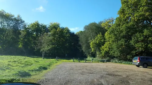
Natural Play Area
Playground · 1.0 mi
Tree trunks forming a zig-zag trail above the grass

Restaurants and cafes8


History
Chilworth, as a landholding, appears in Domesday Book as Celeorde. It was held by Odo of Bayeux the Bishop of Bayeux. Its Domesday assets were: 1 mill worth 7s, 3 ploughs. It rendered £3 10s 0d.
The settlement has a rich industrial past. At various times in history it has been the location of a wire mill, paper mill and gunpowder factory. The wireworks were built in 1603 by Thomas Steere and others, who seduced workmen from the Tintern wireworks of the Company of Mineral and Battery Works. This infringed the latter company's patent and enabled it to have the wireworks suppressed in 1606.
Before the railway was built, Chilworth was a hamlet of a few cottages around the bridge over the Tillingbourne on the direct lane to Guildford via Tyting, where the main entrance to the gunpowder works was located. The second nucleus of settlement was the railway station, with its pub. A third nucleus was around a post office on the A248 in Shalford CP, which was known as "Shalford Hamlet" until around the Second World War.
Since 2011 Benedictine monks have inhabited a hilltop monastery in the southern extreme of the parish of St Martha's, straddling northern Wonersh. Saint Augustine's Abbey, designed by Frederick Walters, was founded as a Franciscan friary in 1892.
Read more of the history
The Chilworth gunpowder mills were established in 1625 by the East India Company. They are located north of the village by the river Tillingbourne.
They were worked by a number of private companies, and became an important supplier of gunpowder to the Government. The Mills closed in 1920 after the 1914-18 war.
Today, a number of ruined buildings belonging to the gunpowder factory can still be found. The buildings and area are now partially looked after by Guildford Borough Council and English Heritage. The gunpowder works are listed as a scheduled monument.
From the History section of Chilworth, Surrey on Wikipedia, under CC BY-SA 4.0.
More about Chilworth
Geography
The village is in the Surrey Hills AONB and most of its land is outside the settlement boundary within the Metropolitan Green Belt. The village occupies both sides of the Tillingbourne between those areas of the Greensand Ridge to the south, such as Tangley Hill, and the steep knoll called St Martha's Hill, with St Martha's Church on the summit, to the north. The North Downs are immediately north, east and west of that knoll. Footpaths, including the North Downs Way, lead through fields and long-established hillside woodlands along the ranges of hills. Chilworth is split between two civil parishes, Shalford to the west and the largely uninhabited St Martha's to the east, and is in the south-east of the borough of Guildford in the mid-west of Surrey.
Unlike most Surrey districts, the borough has no Air Quality Management Areas. Flooding from the Tillingbourne (alluvial flooding) is a rare occurrence with small parts of the north and west having been identified by the Borough Council as being at risk.
From the Wikipedia article Chilworth, Surrey, under CC BY-SA 4.0.
Notable people from Chilworth
- Edmund Godwin AustenEnglish cricketer (1854-1932)
Born in Chilworth, according to Wikidata (CC0). Each name links to its Wikipedia article.
Where to stay2
Churches and places of worship14
St Augustine's Abbey Benedictine Monastery
Church · Roman Catholic · 0.6 mi
Sample Oak Lane, Chilworth
Schools, colleges and libraries4
Healthcare1
Map of Chilworth
62 places. The map loads OpenStreetMap tiles when you open it.
Getting there and nearby towns
Farnborough Airport (FAB) is the nearest airport with scheduled flights listed in OpenStreetMap, 11 miles away.
- Guildford 2 mi northwest, about 4 min by car
- Godalming 4 mi southwest, about 7 min by car
- West Horsley 4 mi northeast, about 7 min by car
- Cranleigh 6 mi south, about 9 min by car
- Ewhurst 6 mi southeast, about 9 min by car
- Ripley 6 mi north, about 10 min by car
- Woking 7 mi north, about 12 min by car
- Normandy 7 mi northwest, about 11 min by car
- Great Bookham 8 mi northeast, about 13 min by car
- Dorking 9 mi east, about 14 min by car
Drive times are estimates from straight-line distance, not routes.
Towns near Chilworth


Keep exploring
Local news
Headlines from INDB.
Reviews, tips and questions
Loading what members have shared...
Sources and licences
- GeoNames (CC BY 4.0): population, coordinates, regions and time zone
- Mapillary (see each image): photos
- OpenStreetMap contributors (ODbL 1.0): places, airports, map data
- Wikidata (CC0 1.0): elevation, founding date, time zone, website, landmarks and historic places
- Wikimedia Commons (see each image): photos
- Wikipedia (CC BY-SA 4.0): overview and history text
Photo credits
- Electric Theatre, Guildford, Weydonian ( talk ), CC BY 3.0
- Yvonne Arnaud Theatre View 2016, Jack1956, CC0
- Clandon House, Murraypaul at English Wikipedia, Public domain
- Guildford castle 1, SuzanneKn at English Wikipedia, Public domain
- Lewis Elton Gallery, Murgatroyd49, CC BY-SA 4.0
- Loseley Park 03, Andrew Wilkinson from London, CC BY-SA 2.0
- Cucknell's Wood (1), Dudley Miles, CC BY-SA 4.0
- Riverside Park, Guildford, view of the lake, AndyScott, CC BY-SA 4.0
- St Martha Hill, Colin Smith, CC BY-SA 2.0
- Surrey county show 20040531, SGBailey, CC BY-SA 3.0
- Christ Church, Cranleigh Road, Shamley Green (May 2014) (2), Hassocks5489, CC0
- Guildford Holy Trinity fr NE GeoUK 2639999, Paul Gillett, CC BY-SA 2.0
- Meadrow Unitarian Chapel, Meadrow, Godalming (April 2015) (3), Hassocks5489, CC0
- Old St Peter and Paul Albury view from south-east, BabelStone, CC BY-SA 4.0
- St Mary's Church, Quarry Street, Guildford (April 2014) (1), Hassocks5489, CC0
- St Nicholas' Church, Bury Street, Guildford (April 2014, from Northwest) (1), Hassocks5489, CC0
- UniSSoM, Mark Boyce, CC BY-SA 3.0
- A bird's eye view of St Augustine's Abbey, Chilworth, UK, Richytheman, CC BY-SA 4.0
- Church of St. Thomas Chilworth Surrey 20200926 2I8A 7441wiki, Flickrway, CC BY-SA 4.0
- St Peter and St Paul's Church, Church Lane, Albury (March 2014, from Southeast) (2), Hassocks5489, CC0
- Blackheath, St Martin's Church, AndyScott, CC BY-SA 4.0
- Chinthurst Hill Tower 1, Margaret Anne Clarke, CC BY-SA 4.0
- RGS Guildford Bradstone Brook, Phil Griffith, CC BY-SA 3.0
- Street-level photo, richardc, CC BY-SA 4.0
- Street-level photo, richardc, CC BY-SA 4.0
- Street-level photo, richardc, CC BY-SA 4.0
- Street-level photo, richardc, CC BY-SA 4.0
- Street-level photo, richardc, CC BY-SA 4.0
- Street-level photo, richardc, CC BY-SA 4.0
- Street-level photo, richardc, CC BY-SA 4.0
- Street-level photo, richardc, CC BY-SA 4.0
- Street-level photo, richardc, CC BY-SA 4.0
- Street-level photo, richardc, CC BY-SA 4.0
- Street-level photo, richardc, CC BY-SA 4.0
- Street-level photo, 4004, CC BY-SA 4.0
- Street-level photo, adam2, CC BY-SA 4.0
- Street-level photo, richardc, CC BY-SA 4.0
- Street-level photo, richardc, CC BY-SA 4.0
- Street-level photo, themadcabbie, CC BY-SA 4.0


Page built November 10, 2026. Spotted a mistake? Tell us or suggest a place.