


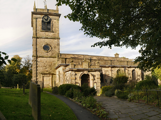

Why visit Chinley
Townapedia lists 2 museums and landmarks, 2 parks and trails, 24 places to eat, 1 place to stay and 7 attractions in and around town.
Highlights include Eccles Pike and Chestnut Centre.
Weather in Chinley
Forecast from MET Norway (CC BY 4.0). Full forecast
About Chinley
Chinley is a rural village in the High Peak Borough of Derbyshire, England, with a population of 2,796 at the 2011 Census. Most of the civil parish (called Chinley, Buxworth and Brownside) is within the Peak District National Park. Historically, before the coming of the railway, the area was economically dominated by agriculture. Nowadays most inhabitants commute out of the village to work; accessible centres of work include Stockport, Sheffield and Manchester.
From the Wikipedia article Chinley (this version), under CC BY-SA 4.0.
Photos of Chinley


Things to do7


Chestnut Centre
Zoo and aquarium · 2.2 mi
Former wildlife park near Chapel-en-le-Frith, Derbyshire

Railway Bridge
Bridge · 2.1 mi
Grade II listed railway bridge in Whaley Bridge, High Peak, Derbyshire, England, UK


Museums and landmarks2

Parks, trails and playgrounds2


Restaurants and cafes24

Starbucks
Cafe · Coffee Shop · 1.4 mi
Foresters Way
Mo-Fr 06:00-21:00; Sa 06:30-21:00; Su,PH 07:00-21:00


Rems Cafe Bar & Restaurant
Restaurant · Tapas · 1.5 mi
29 Market Street
Mo-Th 11:30-24:30, Fr-Sa 11:30-25:00, Su 12:00-24:00

The Old Cell Ale Bar
Bar and pub · 1.5 mi
10-12 Market Place
Mo-Th 17:00-23:00; Fr 16:00-23:00; Sa 14:00-23:00; Su 12:00-23:00

Twig Coffee House
Cafe · Coffee Shop · 1.5 mi
4-6 Market Place
Mo-Fr 07:30-17:00; Sa 08:30-17:00; Su 09:30-16:00
Chinley Bar & Lounge
Bar and pub
23 Lower Lane, High Peak
Mo,Tu 17:00-22:00; We,Th 16:00-23:00; Fr 14:00-23:30; Sa...
12 more on the map.
Notable people from Chinley
- Mike Stevensoncricketer (1927-1994)
Born in Chinley, according to Wikidata (CC0). Each name links to its Wikipedia article.
Where to stay1
Churches and places of worship7
Shopping7
Gas and EV charging2
Schools, colleges and libraries4
Healthcare2
Goyt Valley Medical & Dental Practice
Clinic and pharmacy · 1.4 mi
Eccles Road, High Peak
Map of Chinley
58 places. The map loads OpenStreetMap tiles when you open it.
Getting there and nearby towns
Manchester Airport (MAN) is the nearest airport with scheduled flights listed in OpenStreetMap, 14 miles away.
- New Mills 3 mi northwest, about 5 min by car
- High Peak 4 mi northeast, about 7 min by car
- Dove Holes 4 mi southeast, about 6 min by car
- Buxton 6 mi south, about 9 min by car
- Marple 6 mi northwest, about 10 min by car
- Glossop 7 mi north, about 11 min by car
- Poynton 7 mi west, about 12 min by car
- Hazel Grove 8 mi west, about 13 min by car
- Macclesfield 9 mi southwest, about 15 min by car
- Bredbury 9 mi northwest, about 15 min by car
Drive times are estimates from straight-line distance, not routes.
Towns near Chinley


Keep exploring
Local news
Headlines from INDB.
Reviews, tips and questions
Loading what members have shared...
Sources and licences
- GeoNames (CC BY 4.0): population, coordinates, regions and time zone
- Mapillary (see each image): photos
- OpenStreetMap contributors (ODbL 1.0): places, airports, map data
- Wikidata (CC0 1.0): elevation, founding date, time zone, website, landmarks and historic places
- Wikimedia Commons (see each image): photos
- Wikipedia (CC BY-SA 4.0): overview and history text
Photo credits
- Chinley station 5311, Photograph by Clem Rutter, Rochester, Kent. ( www.clemrutter.net )., CC BY-SA 3.0
- St Matthews church hayfield 021599 df40975f, Alan Fleming, CC BY-SA 2.0
- St James' Church, Buxworth, Benjamin Shaw, CC BY-SA 4.0
- Eccles Pike from Bagshaw, Dave.Dunford, CC BY-SA 4.0
- Church of St Thomas of Canterbury, Chapel-en-le-Frith, David Dixon, CC BY-SA 2.0
- Royal Oak, Chapel-en-le-Frith, Dave.Dunford, CC BY-SA 4.0
- Old Hall Inn, Whitehough, Dave.Dunford, CC BY-SA 4.0
- Lichen - Flickr - drelliott0net, David Elliott from UK, CC BY 2.0
- Shieldbug nymph (35414034134), David Elliott from UK, CC BY 2.0
- Bark galleries (19358059442), David Elliott from UK, CC BY 2.0
- Tramway truck at Bugsworth Canal Basin, Derbyshire, Benjamin Shaw, CC BY-SA 4.0
- Street-level photo, jerome_pietri, CC BY-SA 4.0
- Street-level photo, mappo2, CC BY-SA 4.0
- Street-level photo, emerald-deepen-coherent, CC BY-SA 4.0
- Street-level photo, wasd42, CC BY-SA 4.0
- Street-level photo, emerald-deepen-coherent, CC BY-SA 4.0
- Street-level photo, jerome_pietri, CC BY-SA 4.0
- Street-level photo, emerald-deepen-coherent, CC BY-SA 4.0
- Street-level photo, mappo2, CC BY-SA 4.0
- Street-level photo, wasd42, CC BY-SA 4.0
Page built November 10, 2026. Spotted a mistake? Tell us or suggest a place.