


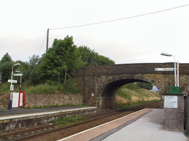


Dove Holes, United Kingdom
Dove Holes is a town of 1,113 people in England, United Kingdom.
Why visit Dove Holes
Townapedia lists 5 museums and landmarks, 1 park or trail, 3 places to eat and 8 attractions in and around town.
Highlights include Buxton Opera House, Pavilion Arts Centre, Buxton Museum and Art Gallery and Lismore Fields Mesolithic and Neolithic settlement.
Weather in Dove Holes
Forecast from MET Norway (CC BY 4.0). Full forecast
About Dove Holes
Dove Holes is a village in the High Peak district of Derbyshire, England. It has a population of about 1,200 (2001), shown in the 2011 Census as being included in the population of Chapel-en-le-Frith. It straddles the A6 road, approximately three miles north of Buxton and three miles south of Chapel-en-le-Frith.
From the Wikipedia article Dove Holes (this version), under CC BY-SA 4.0.
Things to do8

Buxton Opera House
Cinema and theater · 3.0 mi
Opera house in Buxton, England

Pavilion Arts Centre
Cinema and theater · 3.0 mi
Theatre and arts centre in Buxton, England, formerly also a cinema

Chestnut Centre
Zoo and aquarium · 2.5 mi
Former wildlife park near Chapel-en-le-Frith, Derbyshire

Museums and landmarks5

Buxton Museum and Art Gallery
Museum · 3.1 mi
Museum and gallery in Buxton, Derbyshire, England, United Kingdom

Lismore Fields Mesolithic and Neolithic settlement
Monument and historic site · 3.3 mi
Archaeological site in Buxton, High Peak, England, UK

The Bull Ring
Monument and historic site
Neolithic henge monument in Derbyshire, England, UK

Parks, trails and playgrounds1

Buxton Pavilion Gardens
Park · 3.2 mi
Park in Buxton, Derbyshire, England, UK
Restaurants and cafes3
History
Evidence of human occupation at Dove Holes can be traced back to the Neolithic period (late Stone Age) because of the existence of a henge, known locally as The Bull Ring, and an adjoining tumulus. In the Middle Ages, the area was used as the royal hunting Forest of High Peak (now known as Peak Forest), an area set aside as a royal hunting forest. The village's name is believed to derive from the Celtic word dwfr (dŵr in modern Welsh), which means water, hence Water Holes or Dove Holes. The same word is the origin of the name Dover for the famous Channel ferry port.
In 1650, a General Survey of the Manor of High Peak was made to assess the property of the late King Charles. This recorded that people were burning limestone around the village and that there were 14 kilns thereabouts, the burnt lime (quicklime) being slaked and used by farmers to condition the soil in their fields. At that time, lime kilns could be built and demolished without authority.
Read more of the history
With the coming of the Industrial Revolution, and the opening of the Peak Forest Tramway in 1796, the limestone quarries were commercialised. The first of these was at nearby Loads Knowl and others quickly followed along Dove Holes Dale. Undoubtedly, the opening of the tramway and the consequent expansion of commercial limestone quarries contributed greatly to the expansion of the village. For the first time, there was an outlet for limestone in Manchester via the tramway, Bugsworth Basin, the Peak Forest Canal and the Ashton Canal.
From the History section of Dove Holes on Wikipedia, under CC BY-SA 4.0.
Notable people from Dove Holes
- David MillnerEnglish cricketer (born 1938)
Born in Dove Holes, according to Wikidata (CC0). Each name links to its Wikipedia article.
Churches and places of worship3
Schools, colleges and libraries2
Map of Dove Holes
22 places. The map loads OpenStreetMap tiles when you open it.
Getting there and nearby towns
Manchester Airport (MAN) is the nearest airport with scheduled flights listed in OpenStreetMap, 17 miles away.
- Buxton 3 mi south, about 5 min by car
- High Peak 5 mi north, about 8 min by car
- Tideswell 5 mi east, about 8 min by car
- New Mills 7 mi northwest, about 11 min by car
- Macclesfield 10 mi west, about 16 min by car
- Marple 10 mi northwest, about 16 min by car
- Poynton 10 mi west, about 16 min by car
- Glossop 10 mi north, about 17 min by car
- Hazel Grove 11 mi northwest, about 18 min by car
- Stockport 14 mi northwest, about 22 min by car
Drive times are estimates from straight-line distance, not routes.
Towns near Dove Holes


Keep exploring
Local news
Headlines from INDB.
Reviews, tips and questions
Loading what members have shared...
Sources and licences
- GeoNames (CC BY 4.0): population, coordinates, regions and time zone
- Mapillary (see each image): photos
- OpenStreetMap contributors (ODbL 1.0): places, airports, map data
- Wikidata (CC0 1.0): elevation, founding date, time zone, website, landmarks and historic places
- Wikimedia Commons (see each image): photos
- Wikipedia (CC BY-SA 4.0): overview and history text
Photo credits
- DoveHoles, Dave.Dunford, CC BY-SA 3.0
- Dove Holes War Memorial, Beep boop beep, CC BY-SA 4.0
- Dove Holes Station, Roger May, CC BY-SA 2.0
- Buxton Opera House, Dave Pape, Public domain
- Buxton Cinema at the Pavilion Arts Centre, Douglal, CC BY-SA 4.0
- Buxton Museum and Art Gallery - June 2020, Douglal, CC BY-SA 4.0
- Lismore Fields Stone Age Site at Buxton, Douglal, CC BY-SA 4.0
- Benkid77 Pavilion Gardens, Buxton 2 080809, Rept0n1x, CC BY-SA 3.0
- St Anne's Church on Bath Road, Higher Buxton, Douglal, CC BY-SA 4.0
- Church of St. John the Baptist, Charlesdrakew, Public domain
- BullRingDoveHoles, Dave.Dunford, CC BY-SA 3.0
- Combs Reservoir from Castle Naze, Douglal, CC BY-SA 4.0
- Street-level photo, southglos, CC BY-SA 4.0
- Street-level photo, mappo2, CC BY-SA 4.0
- Street-level photo, southglos, CC BY-SA 4.0


Page built November 10, 2026. Spotted a mistake? Tell us or suggest a place.