


Why visit Chorley
Townapedia lists 37 museums and landmarks, 21 parks and trails, 155 places to eat, 7 places to stay and 6 attractions in and around town.
Highlights include Chorley Theatre, Yarrow Bridge, Astley Hall and Chorcliffe House.
Weather in Chorley
Forecast from MET Norway (CC BY 4.0). Full forecast
About Chorley
Chorley is a town and the administrative centre of the wider Borough of Chorley in Lancashire, England, 8 miles (13 km) north of Wigan, 11 miles (18 km) south west of Blackburn, 11 miles (18 km) north west of Bolton, 12 miles (19 km) south of Preston and 20 miles (32 km) north west of Manchester. The town's wealth came principally from the cotton industry. In 2021, it had a population of 39,523.
From the Wikipedia article Chorley (this version), under CC BY-SA 4.0.
Travel tips from other travellers: Chorley on Wikivoyage (CC BY-SA 4.0).
Photos of Chorley


Things to do6

Chorley Theatre
Cinema and theater · 0.7 mi
Independent venue opened in 1910, with live plays, comedy, music, family shows and films and event cinema. Run by volunteers.
10 Dole Lane, Chorley
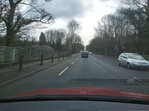
Yarrow Bridge
Bridge · International · 0.6 mi
Road bridge in Lancashire, England, UK
Bolton Road, Chorley



Museums and landmarks37



25 more on the map.
Parks, trails and playgrounds21


Yarrow Valley Park
Park · 1.5 mi
Country park in Chorley, Lancashire, England, UK





9 more on the map.
Restaurants and cafes155
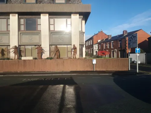
Cafe Latte
Cafe · Coffee Shop · 0.6 mi
61 Union Street, Chorley
Mo-Fr 09:00-16:00; Sa 09:00-17:00; Su 10:00-16:00
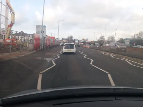
Calico Lounge
Restaurant · International · 0.5 mi
8 Market Walk Extension, Chorley
Su-Th 09:00-23:00; Fr,Sa 09:00-24:00
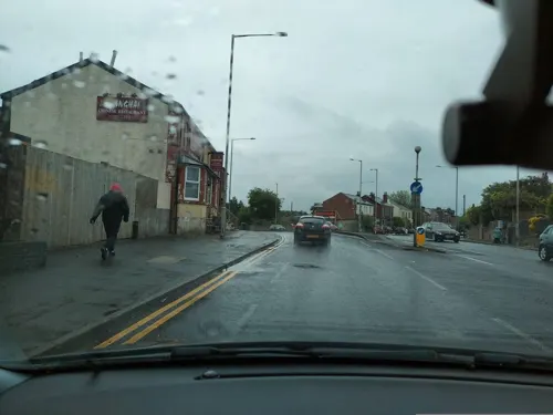
Starbucks
Cafe · Coffee Shop · 1.0 mi
Preston Road, Chorley
Mo-Fr 06:30-21:00; Sa 07:00-21:00; Su 08:00-20:00


The Prince of Wales
Bar and pub · 0.6 mi
New Market Street, Chorley
Mo,We 10:00-23:00;Tu 08:00-23:00;Th 10:00-02:00;Fr-Sa 10:00-02:30;...

House of Steak
Restaurant · Steak House · 1.5 mi
294 Moor Road, Chorley
Mo-Th 17:00-22:30;Fr 17:00-23:00; Sa 16:00-23:00;Su 12:00-21:30
Seven Seas Fish & Chip Restaurant
Restaurant · Fish And Chips · 0.6 mi
110A Market Street, Chorley
Mo-Sa 11:00-23:00; Su 12:00-19:00
Artisan Ale House
Bar and pub · 0.5 mi
101 Anderton Street, Chorley
Th 12:00-21:00; Fr,Sa 12:00-22:00; Su 14:00-20:15
143 more on the map.
History
The name Chorley comes from two Anglo-Saxon words, ċeorl and lēah, probably meaning "the peasants' clearing". Ley (also lēah or leigh) is a common element of place-name, meaning a clearing in a woodland; ċeorl refers to a person of status similar to a freeman or a yeoman.
There was no known occupation in Chorley until the Middle Ages, though archaeological evidence has shown that the area around the town has been inhabited since at least the Bronze Age. There are various remains of prehistoric occupation on the nearby Anglezarke Moor, including the Round Loaf tumulus which is believed to date from 3500 BC.
A pottery burial urn from this period was discovered in 1963 on land next to Astley Hall Farm and later excavation in the 1970s revealed another burial urn and four cremation pits dating from the Bronze Age.
During the Roman era a Roman road ran near Chorley between Wigan and Walton-le-Dale. Hoards dating from the Roman period have also been found nearby at Whittle-le-Woods and Heapey.
Chorley was not listed in the Domesday Book of 1086, though it is thought to be one of the twelve berewicks in the Leyland Hundred.
Read more of the history
Chorley first appears in historical records in the mid thirteenth century as part of the portion of the Croston Lordship acquired by William de Ferrers, Earl of Derby, around 1250. The Earl established Chorley as a small borough comprising a two-row settlement arranged along what later became Market Street. It appears that the borough was short lived, as it does not appear in a report of a commission on the Leyland Hundred in 1341. It is most likely that the borough was sacked by the Scots during the Great Raid of 1322, with Chorley being one of the southernmost points reached in Northern England. This led to the construction of a Peel tower, which said to have been located somewhere close to Duxbury Hall.
The manorial history of Chorley is complex. The manor had no single lord throughout most of this period, as it had been split into moieties and was managed by several different families. This led to Chorley having several manorial halls, which in this period included Chorley Hall, which was built in the 14th century by the de Chorley family but was demolished in the 19th or 20th century. Very little is known of Chorley Hall, although, according to what the painter John Bird depicted in 1795, its location to where it once stood is said to have been where The Parish of St Laurence Church of England Primary School now stands, with phantom steps near to the school within Astley Park being the only physical clue to the hall's existence. There is also Lower Chorley Hall, which was owned by the Gillibrand family from 1583 (later rebuilt in the 19th century as Gillibrand Hall). It is believed the borough of Chorley was not a success in this period because of the lack of manorial leadership and the dispersed nature of the small population.
St Laurence's Church is the oldest remaining building in Chorley and first appears in historical records when it was dedicated in 1362. However, it is believed there was already an earlier Anglo-Saxon chapel on the site, which was a daughter foundation of Croston Parish Church. It is believed that the church is named after Saint Laurence, an Irish saint who died in Normandy in the 12th century, whose bones were conveyed to the church by local noble Sir Rowland Standish of Duxbury, an ancestor of Myles Standish (an English military officer hired by the Pilgrims as military adviser for their Plymouth expedition to the New World).
As happened in many other instances following the Dissolution of the Monasteries, these relics went missing in the turmoil of the English Reformation under the rule of Henry VIII.
Chorley was granted a market charter by Henry VII in 1498 and have since held it every Tuesday. Before the reformation, it would coincide with a fair that was held annually on the feast of St Lawrence.
Chorley, like most Lancashire towns, gained its wealth from the Industrial Revolution of the 19th century which was also responsible for the town's growth. Chorley was a vital cotton town with many mills littering the skyline up to the late twentieth century. Most mills were demolished between the 1950s and 2000s with those remaining converted for modern business purposes. Today only a minority remain in use for actual manufacturing, and the last mill to stop producing textiles was Lawrence's in 2009.
Also, given its location on the edge of Lancashire Coalfield, Chorley was vital in coal mining. Several pits existed in Duxbury Woods, the Gillibrand area and more numerously in Coppull. Chisnall Hall Colliery at Coppull was considered the biggest Lancashire pit outside of Wigan and one of many located in the Chorley suburb. The last pit in the area to close was the Ellerbeck Colliery in 1987 which was located south of Chorley, between Coppull and Adlington.
The town played an important role during the Second World War, when it was home to the Royal Ordnance Factory, a large munitions manufacturer in the village of Euxton about 2 miles (3 km) from the town centre. A smaller factory was also built near the railway line of Blackburn–Wigan in Heapey.
From the History section of Chorley on Wikipedia, under CC BY-SA 4.0.
More about Chorley
Geography
The principal river in the town is the Yarrow. The Black Brook is a tributary of the Yarrow. The name of the River Chor was back-formed from Chorley and runs not far from the centre of the town, notably through Astley Park. Chorley is located at the foot of the West Pennine Moors and is overlooked by Healey Nab, a small hill which is part of the West Pennine Moors. It is the seat for the Borough of Chorley, which is made up of Chorley and its surrounding villages.
Chorley had a population of 33,424 at the 2001 census, with the wider borough of Chorley having a population of 101,991. Chorley forms a conurbation with Preston and Leyland and was once proposed as being designated part of the Central Lancashire New Town under the New Towns Act, a proposal which was eventually scaled back.
Economy
The first signs of industry, as with many towns in Lancashire, was mining; evidence of which can be seen by the various abandoned quarries on the outskirts of the town. One of these is Anglezarke Quarry, between Chorley and Horwich. Remnants of mining include an old railway bridge from the Duxbury Mine off Wigan Lane. Eventually, the mining industry was replaced by cotton mills.
Manufacture of trucks was inherited from the neighbouring town of Leyland. A large factory on Pilling Lane produced, including military vehicles and tanks during the Second World War.
After the Second World War, production was reduced and the final part of the site was closed in 2008 by BAE Systems. A large part of the site has been redeveloped for residential and industrial use as Buckshaw Village.
Through the twentieth century, especially the latter half, Chorley suffered the loss of much of its manufacturing capacity with great losses in or the complete disappearance of its coal, textiles, motor vehicles and armaments industries.
Leyland Trucks and BAE Systems are Central Lancashire's largest employers, with their sites in Leyland and Samlesbury respectively.
DXC Technology has two locations: one in Euxton and the other in Clayton-le-Woods, north of Chorley
Multipart Solutions Limited, successor to the parts arm of the Leyland DAF
Porter Lancastrian is a manufacturer of beer pumps, under the Porta brand
Education
Chorley is home to numerous primary schools, both council and church supported. The town has the following six high schools:
Some independent schools are also present just outside the borough. Most Chorley children go on to attend the nearby Runshaw College in Leyland. Runshaw College had also expanded into the former administration site of ROF Chorley and was using, amongst others, the main administration building. It is no longer using the site.
Lancashire College, based in Chorley, is a part of Lancashire County Council's Lancashire Adult Learning, offering a wide range of courses, a speciality being intensive residential language courses. From 1905 to 1981, the town was home to Chorley Training College (from the 1960s known as Chorley 'Day' Training College), designed by the Victorian and Edwardian architect Henry Cheers, and the town centre building now occupying this site is now Chorley Public Library.
From the Wikipedia article Chorley, under CC BY-SA 4.0.
Notable people from Chorley
 Joe GilgunEnglish actorPhoto: Gage Skidmore, CC BY-SA 3.0
 Anna HopkinEnglish swimmerPhoto: Fédération Internationale du Sport..., CC BY 3.0
 John FoxxEnglish musician and singerPhoto: Grueslayer, CC BY-SA 4.0
 David Unsworthassociation football player from England (born 1973)Photo: Everton Football Club, CC BY 3.0
 Phil ParkinsonEnglish association football player and manager (born 1967)Photo: Timmy96, CC0
 Jeanette BrakewellequestrianPhoto: Henry Bucklow/Lazy Photography ( Sffubs ), CC BY-SA 3.0
 Esther RoperEnglish suffragist, editorPhoto: Unknown author Unknown author, Public domain
- Norman HaworthBritish chemist (1883-1950)
- Charles LightollerBritish sailor (1874–1952)
- Sir Henry TateEnglish sugar merchant and philanthropist (1819–1899)
- Adam NagaitisBritish actor
- Michael BarnesEnglish footballer (born 1988)
Born in Chorley, according to Wikidata (CC0). Each name links to its Wikipedia article.
Where to stay7
Churches and places of worship32
Shopping12
Gas and EV charging3
Schools, colleges and libraries26
Chorley All Saints Church of England Primary School and Nursery Unit
School · Anglican · 1.1 mi
Moor Road, Chorley
St Mary's Catholic Primary School and Nursery, Chorley
School · Roman Catholic · 1.3 mi
Hornchurch Drive, Chorley
The Parish of Saint Laurence Church of England Primary School
School · Anglican · 0.9 mi
Highfield Road South, Chorley
Healthcare14
Chorley & South Ribble District General Hospital
Hospital · 1.3 mi
Preston Road, Chorley
Map of Chorley
250 places. The map loads OpenStreetMap tiles when you open it.
Getting there and nearby towns
Warton Aerodrome (WRT) is the nearest airport with scheduled flights listed in OpenStreetMap, 13 miles away.
- Clayton-le-Woods 4 mi northwest, about 6 min by car
- Leyland 4 mi northwest, about 7 min by car
- Horwich 4 mi southeast, about 7 min by car
- Wigan 7 mi south, about 12 min by car
- Darwen 7 mi northeast, about 11 min by car
- Westhoughton 8 mi southeast, about 13 min by car
- Hindley 8 mi south, about 13 min by car
- Preston 9 mi northwest, about 14 min by car
- Blackburn 9 mi northeast, about 14 min by car
- Bolton 9 mi southeast, about 14 min by car
Drive times are estimates from straight-line distance, not routes.
Towns near Chorley


Keep exploring
Local news
Headlines from INDB.
Reviews, tips and questions
Loading what members have shared...
Sources and licences
- GeoNames (CC BY 4.0): population, coordinates, regions and time zone
- Mapillary (see each image): photos
- OpenStreetMap contributors (ODbL 1.0): places, airports, map data
- Wikidata (CC0 1.0): elevation, founding date, time zone, website, landmarks and historic places
- Wikimedia Commons (see each image): photos
- Wikipedia (CC BY-SA 4.0): overview and history text
Photo credits
- Entering Chorley Town Centre, Karl1587, Public domain
- 25th July St. James's Church, Brooke Street, Chorley, U.K, dickinsonjohn02, Public domain
- 1st August 2015 The Prince of Wales, Cowling Brow, Chorley U.K, dickinsonjohn02, Public domain
- 11th July Stagecoach Bus Garage, Silverdale Road entrance, Chorley U.K, dickinsonjohn02, Public domain
- 10th January 2015 Shepherds Arms, Eaves Lane, Chorley U.K, dickinsonjohn02, Public domain
- 47331 PX06FYB Optare Solo at Chorley Depot repainted in revised livery, dickinsonjohn02, Public domain
- Dennis Darts 34745 and 34744. Chorley Depot Body Shop, dickinsonjohn02, Public domain
- Chorley Little Theatre, ChorleyRobbie, CC BY-SA 3.0
- Astley Hall after restoration, Kevin Waterhouse, CC BY-SA 2.0
- Yarrow Valley Park, PopUpPirate at English Wikipedia, CC BY-SA 3.0
- Christ Church, Adlington, Plucas58, CC BY-SA 4.0
- Chorley-Georgian terrace and church, ProfDEH, CC BY-SA 4.0
- St Laurence's Church, Chorley, Karl1587, Public domain
- The Manor House, Chorley-2, Barrie Price, CC BY-SA 4.0
- Wigan Lodge, Duxbury Park, Chorley, Plucas58, CC BY-SA 4.0
- Gamekeeper's Cottage, Anglezarke, Plucas58, CC BY-SA 4.0
- Duxbury Hall stables, Plucas58, CC BY-SA 4.0
- Chorley, UK - panoramio, jim walton, CC BY 3.0
- 10th February 2015 Sacred Heart Church, Brooke Street, Chorley, Lancashire, dickinsonjohn02, Public domain
- St Peter's Church, Chorley, David Dixon, CC BY-SA 2.0
- Park House Wesley House, Chorley-1, Barrie Price, CC BY-SA 4.0
- St George's Church, Chorley, David Dixon, CC BY-SA 2.0
- 29th April 2015 Cowling Brow, dickinsonjohn02, Public domain
- 6th April 2015 Former Eaves Lane Wesleyan Methodist Churchj8, dickinsonjohn02, Public domain
- 13th March 2015 St. James's Church Institute, Eaves Lane, dickinsonjohn02, Public domain
- 10th January 2020 Shepherds Arms converted into flats, dickinsonjohn02, Public domain
- 12th April 2015 Stagecoach Bus Depot,Eaves Lane, dickinsonjohn02, Public domain
- 22nd March 2015 Tatton Bowling Green looking towards Rosklyn Road and Worthy Street, dickinsonjohn02, Public domain
- 19th September 2015 Chorcliffe House. Hollinshead Street, Chorley U.K, dickinsonjohn02, Public domain
- 20th June Halliwells Farm, Yarrow Gate, Chorley U.K. Built 1667, dickinsonjohn02, Public domain
- 21st April 2015 The Fountain, Astley Park. Chorley, U.K, dickinsonjohn02, Public domain
- 28th June St. James Church Walking Day. Grey Heights View. Chorley U.K, dickinsonjohn02, Public domain
- Street-level photo, tonys999, CC BY-SA 4.0
- Street-level photo, tonys999, CC BY-SA 4.0
- Street-level photo, tonys999, CC BY-SA 4.0
- Street-level photo, tonys999, CC BY-SA 4.0
- Street-level photo, tonys999, CC BY-SA 4.0
- Street-level photo, tonys999, CC BY-SA 4.0
- Street-level photo, tonys999, CC BY-SA 4.0
- Street-level photo, tonys999, CC BY-SA 4.0
- Street-level photo, tonys999, CC BY-SA 4.0
- Street-level photo, tonys999, CC BY-SA 4.0
- Street-level photo, tonys999, CC BY-SA 4.0
- Street-level photo, tonys999, CC BY-SA 4.0
- Street-level photo, tonys999, CC BY-SA 4.0
- Street-level photo, tonys999, CC BY-SA 4.0
- Street-level photo, tonys999, CC BY-SA 4.0


Page built November 10, 2026. Spotted a mistake? Tell us or suggest a place.