


Ewyas Harold, United Kingdom
Ewyas Harold is a town of 1,007 people in England, United Kingdom.
Why visit Ewyas Harold
Townapedia lists 2 museums and landmarks, 2 parks and trails, 4 places to eat and 1 place to stay in and around town.
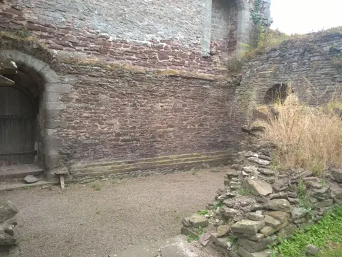
Highlights include Ewyas Harold Castle, Ewyas Harold Meadows and The Parks.
Weather in Ewyas Harold
Forecast from MET Norway (CC BY 4.0). Full forecast
About Ewyas Harold
Ewyas Harold () is a village and civil parish in the Golden Valley in Herefordshire, England, near the Wales-England border about halfway between Abergavenny, Monmouthshire, and Hereford. The population of this civil parish at the 2011 census was 883. It lies on the Dulas brook, and is contiguous with the neighbouring village of Pontrilas.
From the Wikipedia article Ewyas Harold (this version), under CC BY-SA 4.0.
Museums and landmarks2

Parks, trails and playgrounds2

Ewyas Harold Meadows
Park · 0.6 mi
Nature reserve in Herefordshire, England, UK

Restaurants and cafes4


Where to stay1

Churches and places of worship10
Shopping2
Schools, colleges and libraries1
Map of Ewyas Harold
22 places. The map loads OpenStreetMap tiles when you open it.
Getting there and nearby towns
Gloucestershire Airport (GLO) is the nearest airport with scheduled flights listed in OpenStreetMap, 31 miles away.
- Hereford 10 mi northeast, about 17 min by car
- Abergavenny 11 mi southwest, about 17 min by car
- Monmouth 12 mi southeast, about 20 min by car
- Ross on Wye 14 mi east, about 23 min by car
- Brynmawr 16 mi southwest, about 26 min by car
- Ebbw Vale 18 mi southwest, about 29 min by car
- Pontypool 19 mi south, about 30 min by car
- Abertillery 19 mi southwest, about 30 min by car
- Cinderford 19 mi southeast, about 31 min by car
- Tredegar 20 mi southwest, about 32 min by car
Drive times are estimates from straight-line distance, not routes.
Towns near Ewyas Harold


Keep exploring
Local news
Headlines from INDB.
Reviews, tips and questions
Loading what members have shared...
Sources and licences
- GeoNames (CC BY 4.0): population, coordinates, regions and time zone
- Mapillary (see each image): photos
- OpenStreetMap contributors (ODbL 1.0): places, airports, map data
- Wikidata (CC0 1.0): elevation, founding date, time zone, website, landmarks and historic places
- Wikimedia Commons (see each image): photos
- Wikipedia (CC BY-SA 4.0): overview and history text
Photo credits
- Ewyas Harold church, Linda Billinger, CC BY-SA 2.0
- St Peter's Church, Llancillo, Philip Pankhurst, CC BY-SA 2.0
- P1080007 The church of St James at Llangua, Monmouthshire, Ceratostigma, CC BY-SA 4.0
- The Church of St Nicolas, Grosmont (5953890590), Robert Cutts from Bristol, England, UK, CC BY-SA 2.0
- Abbey Dore, Richard Waller, CC BY-SA 4.0
- Street-level photo, southglos, CC BY-SA 4.0
- Street-level photo, toby, CC BY-SA 4.0
Page built November 10, 2026. Spotted a mistake? Tell us or suggest a place.