


Muswell Hill, United Kingdom
Muswell Hill is a town of 27,992 people in England, United Kingdom.
Why visit Muswell Hill
Townapedia lists 55 museums and landmarks, 87 parks and trails, 199 places to eat, 16 places to stay and 18 attractions in and around town.
Highlights include Everyman Cinema, Upstairs at the Gatehouse, Alexandra Palace and Jacksons Lane.
Weather in Muswell Hill
Forecast from MET Norway (CC BY 4.0). Full forecast
About Muswell Hill
Muswell Hill is a district of the London Borough of Haringey, in north London, England. The hill, which reaches over 100 m (330 ft) above sea level, is situated 5+1⁄2 mi (9 km) north of Charing Cross. It has many streets with Edwardian architecture. Neighbouring areas include Highgate, Hampstead Garden Suburb, East Finchley and Crouch End.
From the Wikipedia article Muswell Hill (this version), under CC BY-SA 4.0.
Photos of Muswell Hill


Things to do18
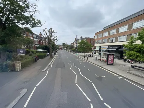
Everyman Cinema
Cinema and theater
Art deco cinema
Fortis Green Road, London
Mo-Su 12:00-23:00
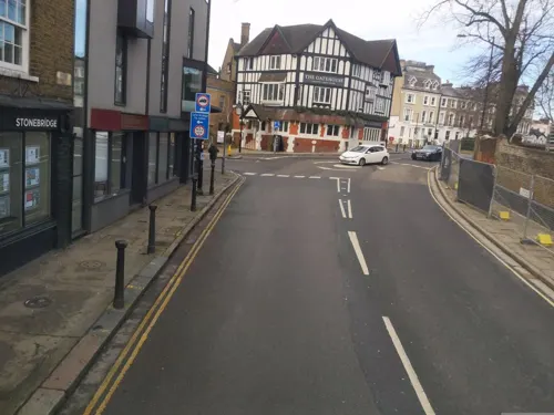


Hornsey Town Hall
Cinema and theater · 1.2 mi
A public building and former town hall in Crouch End area of Hornsey, London

Middle Lane Market
Farm and orchard · 0.9 mi
226 Middle Lane, London
Mo-Tu 09:00-16:00; We-Th, Sa 09:00-19:00; Fr 09:00-20:00; Su 09:00-17:00


Golders Green Hippodrome
Cinema and theater · 2.5 mi
Theatre in London, England, UK


Crouch End Hippodrome
Cinema and theater · 1.1 mi
Former theatre in Tottenham Lane, Crouch End, Haringey, London
Everyman Cinema
Cinema and theater · 2.8 mi
Cinema and former theatre in Hampstead, London, England
Intimate Theatre
Cinema and theater · 2.9 mi
Theatre in Palmers Green, London
6 more on the map.
Museums and landmarks55

Alexandra Palace
Monument and historic site · 0.5 mi
Entertainment venue in Alexandra Park, London
Alexandra Palace Way, London


2 Willow Road
Museum · 2.6 mi
Heritage Museum in London, United Kingdom


Fenton House
Museum · 2.7 mi
17th-century house with walled garden in Hampstead, London, UK

Francis Skaryna Belarusian Library and Museum
Museum · 2.5 mi
Library

Freud Museum London
Museum · 3.3 mi
Historic house museum in London, England, United Kingdom

Golders Green War Memorial
Monument and historic site · 2.6 mi
War memorial in London

Hampstead War Memorial
Monument and historic site · 2.5 mi
War memorial in London


Burgh House and Hampstead Museum
Museum · 2.6 mi
Local museum in Camden, London, England, United Kingdom
43 more on the map.
Parks, trails and playgrounds87


Brent Park
Park · 3.0 mi
Park in London Borough of Barnet, United Kingdom

Stationers Park
Park · 1.5 mi
A 1.5-hectare park in the London Borough of Haringey
Mayfield Road, London
24/7

Little Dinosaurs
Playground
Alexandra Palace Way, London
Mo-Th 09:30-17:30; Fr 09:30-18:30; Sa-Su 10:00-18:00

Alexandra Palace Pitch & Putt
Golf course · 0.7 mi
10 hole Pitch & Putt course, par 3 course
Alexandra Palace Way, London
75 more on the map.
Restaurants and cafes199

The Bull
Bar and pub · British · 1.1 mi
13 North Hill, London
Mo-Th 12:00-23:00; Fr-Sa 12:00-24:00; Su 12:00-22:30


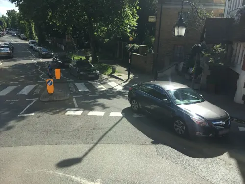
The Gatehouse
Bar and pub · 1.4 mi
1 North Road, London
Mo-Th 11:00-23:30; Fr 11:00-00:00; Sa 10:00-00:00; Su 11:00-22:30
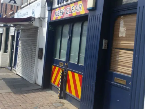
The Great Northern Railway Tavern
Bar and pub · 1.1 mi
67 High Street, London
Mo-Th 12:00-23:00; Fr-Sa 12:00-00:00; Su 12:00-22:30

The Mossy Well
Bar and pub · Usual Wetherspoons Selection
258-260 Muswell Hill Broadway, London
Mo 08:00-23:30; Tu-We 08:00-24:00; Th-Su 08:00-01:00

The Queens
Bar and pub · British, Pub, Roast · 1.1 mi
26 Tottenham Lane, London
Mo-Th 12:00-23:00; Fr-Sa 12:00-24:00; Su 12:00-23:00

The Starting Gate
Bar and pub · 1.1 mi
Station Road, London
Mo-Th 12:00-23:00; Fr 12:00-24:00; Sa 11:00-24:00; Su 11:00-22:30;...
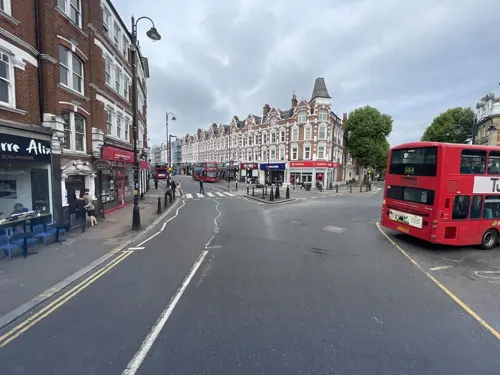
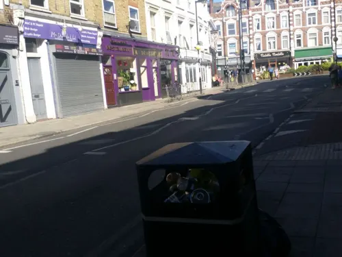
Bar Esteban
Restaurant · Spanish, Tapas · 1.0 mi
29 Park Road, London
Tu-Th 18:00-22:00; Fr-Sa 17:00-23:00
Barbers Bazaar
Restaurant · Indian · 1.2 mi
37 Tottenham Lane, London
Mo off; Tu-Fr 17:00-22:30; Sa-Su 12:00-22:30
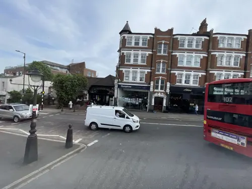
Franco Manca
Restaurant · Pizza
278 Muswell Hill Broadway, London
Mo-Th 12:00-22:30; Fr,Sa 12:00-23:00; Su 12:00-22:00
187 more on the map.
History
Ancient Roman presence in the area has been attested to through the discovery of Roman coins near Southwood Lane and Muswell Hill Road.
The earliest records of Muswell Hill date from the 12th century. The Bishop of London, who was the Lord of the Manor of Haringey, owned the area and granted 26 ha (64 acres), located to the east of Colney Hatch Lane, to a newly formed order of nuns. The nuns built a chapel on the site and called it Our Lady of Muswell.
The name Muswell is believed to come from a natural spring or well (the "Mossy Well"), said to have miraculous properties. A traditional story tells that Scottish king Malcolm IV was cured of disease after drinking the water. The area became a place of pilgrimage for healing during medieval times. The River Moselle, which has its source in Muswell Hill and Highgate, derives its name from this district; it was originally known as the Mosa or Mosella. Until the 1950s, the town's name was often pronounced "Muzzle Hill".
Read more of the history
In the 18th century, Muswell Hill was a scattered village consisting mainly of detached villas with large gardens. In 1787, one commentator wrote that nowhere within 100 miles (160 km) of London was there a village so pleasant or with such varied views. Little had changed by the middle of the 19th century. One of the houses of the time was The Limes, which occupied the angle of Muswell Hill Road with Colney Hatch Lane; it was a three-storeyed house, with portico and two-storeyed wing, approached by a double carriage drive through impressive gateways. The large grounds of the house extended to Tetherdown and included a lake. Opposite The Limes was Muswell Hill pond and, beyond that, the Green Man inn, which was built of stone and likely dating to at least 1552. Colney Hatch Lane itself was part of an ancient route from London to the north; it was once known as Muswell Hill Lane.
Further down the hill past the Green Man was The Elms, a squat three-storeyed house, later improved by Thomas Cubitt standing in 11 acres (4.5 ha); part of the grounds of which were laid out by Joseph Paxton. A short distance down the north side of Muswell Hill was The Grove, which was three storeys high and had nine bays, with pedimented projections at each end. It stood in 7.9 acres (3.2 ha) of grounds, which contained a 184 m (201 yd) avenue of oaks. In 1774, the house was occupied by Topham Beauclerk. The Elms was demolished in 1900 to make way for Dukes Avenue.
A little farther down the hill stood Grove Lodge, also in wooded grounds. Altogether there were eight properties in Muswell Hill worthy of note in 1817.
Parallel with Muswell Hill was a track known as St James's Lane, which ran across a triangle of wasteland. By the middle of the 19th century, houses were already dispersed along the lane at the foot of which was Lalla Rookh, a two-storeyed villa with a wide verandah. Other buildings included cottages or huts, both single and in terraces.
It was not until the end of the 19th century that Muswell Hill began to be developed more densely from a collection of country houses to the London suburb that it is today. The development was spurred by the opening in 1873 of Alexandra Palace, a large pleasure pavilion built on the most easterly of north London's gravel hills and intended as the counterpart to the Crystal Palace on Sydenham Hill in south London. Alexandra Palace was served by the Edgware, Highgate and London Railway from Highgate and Finsbury Park, with intermediary stations at Muswell Hill and Cranley Gardens. The foot of Alexandra Palace was served by another railway line, with connecting services to Finsbury Park and Kings Cross stations.
Most development was initiated in the early 20th century, when the current street pattern was set out and elegant Edwardian retail parades were constructed. The shopping centre is based on roads that form three sides of a square: Fortis Green Road, Muswell Hill Broadway and the extension of the Broadway into Colney Hatch Lane. At each node point is a church: United Reformed, Church of England, Methodist and Roman Catholic; one of the nodes, opposite St James CoE, was also the site of the Athenaeum music hall (later demolished with the site redeveloped as a supermarket), opposite which a surviving art deco Odeon cinema was built in the 1930s. The site of the Ritz, a cinema formerly at the top of Muswell Hill on the next node to the east, has been redeveloped as offices.
The Edgware, Highgate and London Railway was closed in 1954. It had been intended to integrate this route into the London Underground's Northern line, under the Northern Heights plan; some contemporary tube maps (e.g. the 1948 map) showed the line as being under construction. However, this plan was cancelled after the Second World War and the railway line was abandoned. The line was later converted to become the Parkland Walk rail trail.
In 1979, Wetherspoons opened their first pub, on Colney Hatch Lane.
In 2013 and 2020, Muswell Hill was named one of the five most desirable places to live in London in the Sunday Times' "Best Places To Live" guide.
From the History section of Muswell Hill on Wikipedia, under CC BY-SA 4.0.
More about Muswell Hill
Geography
Close to Alexandra Park and Highgate Wood, Muswell Hill's architecture is predominantly Edwardian. Muswell Hill Broadway and Fortis Green Road, the main shopping streets, still maintain their historic character with most of the original facades preserved above street level. The area has a synagogue and six churches, one of which has been converted into a steak house.
Education
Blanche Nevile School: for deaf and hearing impaired children, based on the sites of Highgate Primary and Fortismere Schools.
TreeHouse School: based at the Pears National Centre for Autism Education.
From the Wikipedia article Muswell Hill, under CC BY-SA 4.0.
Notable people from Muswell Hill
 Michael KiwanukaEnglish singer-songwriterPhoto: Raph_PH, CC BY 2.0
 John WhiteheadEnglish explorer and naturalist (1860–1899)Photo: Unknown author Unknown author, Public domain
 Ozwald BoatengEnglish fashion designer (born 1967)Photo: https://www.flickr.com/photos/financialtimes/, CC BY 2.0
 Gillian TriggsAustralian legal scholarPhoto: Australian Human Rights Commission, CC BY 2.0
- Dave DaviesEnglish musician
- Keith LeveneEnglish musician (1957–2022)
- Wil JohnsonEnglish actor
- Dilys LayeBritish actress (1934–2009)
- Tom BarnettEnglish footballer (born 1936)
- Mary TreadgoldBritish writer
- Mary CoombsBritish computer programmer, first female commercial programmer
- Gwen NelsonBritish actress (1901-1990)
Born in Muswell Hill, according to Wikidata (CC0). Each name links to its Wikipedia article.
Where to stay16
Churches and places of worship78
Braemar Avenue Baptist Church
Church · Baptist · 1.3 mi
Braemar Avenue, London
Shopping95
Gas and EV charging17
Schools, colleges and libraries50
St Mary's Church of England Primary School (nursery to year 2)
School · Anglican · 1.2 mi
Church Lane, London
St Mary's Church of England Primary School (Years 3-6)
School · Anglican · 0.9 mi
Rectory Gardens, London
Healthcare31
Map of Muswell Hill
250 places. The map loads OpenStreetMap tiles when you open it.
Getting there and nearby towns
London City Airport (LCY) is the nearest airport with scheduled flights listed in OpenStreetMap, 11 miles away.
- Hornsey 1 mi east, about 1 min by car
- Wood Green 1 mi northeast, about 2 min by car
- Archway 2 mi south, about 3 min by car
- Friern Barnet 2 mi northwest, about 3 min by car
- Highgate 2 mi southwest, about 3 min by car
- Palmers Green 2 mi northeast, about 4 min by car
- Southgate 3 mi northeast, about 4 min by car
- Tottenham 3 mi east, about 5 min by car
- Chalk Farm 3 mi south, about 5 min by car
- Highbury 3 mi southeast, about 5 min by car
Drive times are estimates from straight-line distance, not routes.
Towns near Muswell Hill


Keep exploring
Local news
Headlines from INDB.
Reviews, tips and questions
Loading what members have shared...
Sources and licences
- GeoNames (CC BY 4.0): population, coordinates, regions and time zone
- Mapillary (see each image): photos
- OpenStreetMap contributors (ODbL 1.0): places, airports, map data
- Wikidata (CC0 1.0): elevation, founding date, time zone, website, landmarks and historic places
- Wikimedia Commons (see each image): photos
- Wikipedia (CC BY-SA 4.0): overview and history text
Photo credits
- Muswell hill broadway, photo by Salimfadhley, CC BY-SA 3.0
- The Mossy Well pub, Muswell Hill - 2022-09-02, The wub, CC BY-SA 4.0
- Kinleigh Folkard & Hayward, Muswell Hill Broadway 2026-05-10, Keith Page, CC BY-SA 4.0
- Summerland Gardens, Muswell Hill N10, Philafrenzy, CC BY-SA 4.0
- Muswell Hill, North London 1982 - 12056783544, beareye2010, CC0
- T792 Muswell Hill Broadway 2025-11-02, kp-snaps, CC BY-SA 4.0
- Hamptons International Lettings Muswell Hill, Hamptonsinternational, CC BY-SA 4.0
- Hamptons International Sales Muswell Hill, Hamptonsinternational, CC BY-SA 4.0
- HLX 462 Muswell Hill Broadway 2025-11-02, kp-snaps, CC BY-SA 4.0
- Village, Muswell Hill, N10 (7963828168), Ewan Munro from London, UK, CC BY-SA 2.0
- RM848 Muswell Hill Broadway, 2025-11-02, kp-snaps, CC BY-SA 4.0
- RM848 Muswell Hill Broadway 2025-11-02, kp-snaps, CC BY-SA 4.0
- Muswell Hill, North London 1982 - 12056488675, beareye2010, CC0
- Muswell Hill, North London 1982 - 12056487375, beareye2010, CC0
- RM848 Muswell Hill Broadway - 2025-11-02, kp-snaps, CC BY-SA 4.0
- RM848 - Muswell Hill Broadway - 2025-11-02, kp-snaps, CC BY-SA 4.0
- 266 Muswell Hill Broadway Cafe Loco, Muswell Hill, N10, Ewan Munro, CC BY-SA 2.0
- Socialite Bar, Muswell Hill, N10 (7963947032), Ewan Munro from London, UK, CC BY-SA 2.0
- Lock 17 Market Bar, Camden Town, NW1 (6800612358), Ewan Munro from London, UK, CC BY-SA 2.0
- APalace 1, Jack Rose, CC BY-SA 4.0
- 1-3 Willow Road, Steve Cadman from London, U.K., CC BY-SA 2.0
- Bruce Castle front 2024-02-24 (2), The wub, CC BY-SA 4.0
- Fenton House Hampstead front February 2006, Unknown author, CC BY-SA 2.0
- Belarusian library London, Aleksandrs Čaičics, Public domain
- Freud Museum London 2, Rup11, CC BY-SA 3.0
- War memorial at Golders Green (12465422183), Ian Wright, CC BY-SA 2.0
- Hampstead War Memorial, Heath Street, Gareth E. Kegg, CC BY-SA 4.0
- Priory Park 2006, Pterre, CC BY-SA 3.0
- Adelaide Nature Reserve 1, Dudley Miles, CC BY-SA 3.0
- Belsize Wood south end 2, Dudley Miles, CC BY-SA 3.0
- River Brent in Brent Park, Dudley Miles, CC BY-SA 3.0
- Braemar Avenue Baptist Church, Wood Green 02, Philafrenzy, CC BY-SA 4.0
- St Aloysius' College, Highgate, London, Mx. Granger, CC0
- Flickr - Duncan~ - The Queens, Duncan Harris from Nottingham, UK, CC BY 2.0
- Flask, Highgate, N6 (2883805442), Ewan Munro from London, UK, CC BY-SA 2.0
- Parish Church of St. Michael Wood Green 10, Philafrenzy, CC BY-SA 4.0
- GOC Ally Pally 077 The Starting Gate pub, Wood Green (28935949052), Peter O'Connor aka anemoneprojectors, CC BY-SA 2.0
- Muswell Hill Library 02, Philafrenzy, CC BY-SA 4.0
- St Michaels Primary School, Highgate, https://www.geograph.org.uk/profile/11136 Jim Osley and licensed for reuse under this Creative Commons Licence https://creativecommons.org/licenses/by-sa/2.0/ (Image cropped and enhanced by Rupples), CC BY-SA 4.0
- Bull, Highgate, N6 (7285705742), Ewan Munro from London, UK, CC BY-SA 2.0
- East Finchley Library 01, Philafrenzy, CC BY-SA 4.0
- Muswell Hill Baptist Church 04, Philafrenzy, CC BY-SA 4.0
- W. Martyn grocers shop 01, Philafrenzy, CC BY-SA 4.0
- All Saints' Church, East Finchley 05, Philafrenzy, CC BY-SA 4.0
- East Finchley Baptist Church Sept 2016, Philafrenzy, CC BY-SA 4.0
- Arthouse Cinema, Tottenham Lane - panoramio, N19±, CC BY-SA 3.0
- Abney Park 3, Mx. Granger, CC0
- Greig City Academy, Mx. Granger, CC0
- Islington Chapel, Mark Kobayashi-Hillary, CC BY 2.0
- Cherry tree woods finchley, G ri m 2 3 ★, CC BY-SA 3.0
- Ashley Lane, Dudley Miles, Public domain
- St James' Church, Muswell Hill, Philafrenzy, CC BY-SA 4.0
- O'Neill's pub, Muswell Hill 07, Philafrenzy, CC BY-SA 4.0
- Stage Machinery at Alexandra Palace Theatre, CuriosityScribe, CC BY-SA 4.0
- Hornsey Town Hall 2026-03-26, Tom Page, CC BY-SA 4.0
- Middle Lane Market 2026-03-19, Keith Page, CC BY-SA 4.0
- Golders Green Hippodrome North End Road London NW11 7RP, Spudgun67, CC BY-SA 4.0
- Jacksons Lane Arts Centre 2026-09-19, Matt Brown, CC BY 4.0
- Highgate School Museum 2026-09-19, Matt Brown, CC BY 4.0
- London from Alexandra Park in the early morning (2012) - panoramio, Alexander Kachkaev, CC BY 3.0
- Flickr - Duncan~ - St Joseph's from Waterlow Park, Duncan Harris from Nottingham, UK, CC BY 2.0
- Street-level photo, matth81, CC BY-SA 4.0
- Street-level photo, gness, CC BY-SA 4.0
- Street-level photo, zymurgic, CC BY-SA 4.0
- Street-level photo, erias, CC BY-SA 4.0
- Street-level photo, erias, CC BY-SA 4.0
- Street-level photo, gness, CC BY-SA 4.0
- Street-level photo, harry_wood, CC BY-SA 4.0
- Street-level photo, gness, CC BY-SA 4.0
- Street-level photo, gness, CC BY-SA 4.0
- Street-level photo, matth81, CC BY-SA 4.0
- Street-level photo, gness, CC BY-SA 4.0
- Street-level photo, gness, CC BY-SA 4.0
- Street-level photo, gness, CC BY-SA 4.0
- Street-level photo, gness, CC BY-SA 4.0
- Street-level photo, matth81, CC BY-SA 4.0
- Street-level photo, laye, CC BY-SA 4.0
- Street-level photo, matth81, CC BY-SA 4.0
- Street-level photo, matth81, CC BY-SA 4.0
- Street-level photo, matth81, CC BY-SA 4.0
- Street-level photo, matth81, CC BY-SA 4.0
- Street-level photo, asturksever, CC BY-SA 4.0
- Street-level photo, asturksever, CC BY-SA 4.0
- Street-level photo, matth81, CC BY-SA 4.0
- Street-level photo, asturksever, CC BY-SA 4.0
- Street-level photo, gness, CC BY-SA 4.0
- Street-level photo, asturksever, CC BY-SA 4.0


Page built November 10, 2026. Spotted a mistake? Tell us or suggest a place.