


Guilden Sutton, United Kingdom
Guilden Sutton is a town of 1,467 people in England, United Kingdom.
Why visit Guilden Sutton
Townapedia lists 12 museums and landmarks, 11 parks and trails, 10 places to eat, 7 places to stay and 11 attractions in and around town.
Highlights include Bridge of Sighs, Bridgegate, Castra Deva Victrix and Cenotaph to Matthew Henry.
Weather in Guilden Sutton
Forecast from MET Norway (CC BY 4.0). Full forecast
About Guilden Sutton
Guilden Sutton is a civil parish and village in the unitary authority of Cheshire West and Chester and the ceremonial county of Cheshire, England. The village lies approximately 3 miles (5 km) to the east of Chester and is south of the village of Mickle Trafford. The community consists of a church, a primary school, a post office, a pub, a village hall and several local businesses.
From the Wikipedia article Guilden Sutton (this version), under CC BY-SA 4.0.
Things to do11


Chester Storyhouse
Cinema and theater · 2.8 mi
Arts centre (theatre, cinema, library) in Chester, England, incorporating the former Odeon Cinema

Chester Zoo
Zoo and aquarium · 2.6 mi
Zoological garden at Upton-by-Chester, in Cheshire, England

Grosvenor Bridge
Bridge · 3.2 mi
Grade I listed bridge in Chester, England

Newgate, Chester
Bridge · 2.8 mi
Grade II listed gateway in Chester, UK


Old Dee Bridge
Bridge · 2.9 mi
Grade I listed bridge in Chester, England

Watergate, Chester
Bridge · 3.1 mi
City gate and bridge in Chester, England

Gateway Theatre
Cinema and theater · 2.9 mi
Former theatre in Chester, England
Grosvenor Park Open Air Theatre
Cinema and theater · 2.5 mi
Open-air theatre in Chester, England
Museums and landmarks12

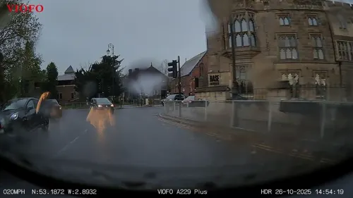
Cenotaph to Matthew Henry
Monument and historic site · 3.0 mi
Grade II listed memorial in Chester, UK

Cheshire Military Museum
Museum · 3.0 mi
Military museum in Chester, United Kingdom

Chester Roman Amphitheatre
Monument and historic site · 2.7 mi
Roman amphitheatre in Chester, Cheshire, England, UK
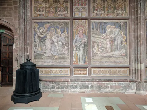
Chester War Memorial
Monument and historic site · 2.8 mi
War memorial in Chester, UK
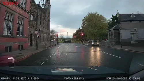
Grosvenor Museum
Museum · 3.0 mi
Natural history museum in Chester, UK

Minerva's Shrine, Chester
Monument and historic site · 3.0 mi
Grade I listed Roman carved shrine in Chester, United Kingdom

Sick To Death
Museum · 2.9 mi
Visitor attraction in Chester, England, UK


Phoenix Tower, Chester
Museum · 2.7 mi
Grade I listed building in Cheshire West and Chester, Cheshire, England, UK

Parks, trails and playgrounds11


Hockenhull Platts
Park · 2.4 mi
Nature reserve and group of bridges in Cheshire, UK

Countess of Chester Country Park
Park · 3.0 mi
Country park in Upton, Cheshire, England


Restaurants and cafes10
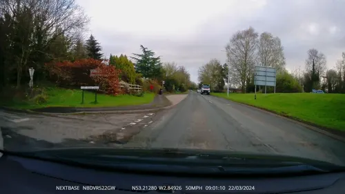
Toby Carvery
Restaurant · British · 0.8 mi
Warrington Road, Chester
Mo-Sa 08:00-23:00; PH,Su 08:00-22:00



Ruby Fish & Chip Shop
Fast food · Fish And Chips · 1.3 mi
7 Cedar Grove, Chester
Sheradon Grill & Wok Bar
Fast food · Chinese · 1.3 mi
50 Green Lane, Chester
Sun Do
Fast food · Chinese, Fish And Chips · 1.5 mi
32 Vicars Cross Road, Chester
History
The likely meaning of the name Guilden Sutton is "golden south farm or settlement", derived from the Old English gylden (golden, rich) - sūð (south/southern) - tūn (a settlement, enclosure or farmstead).
This could perhaps be in reference to being at the southern extremity of the then Wilaveston Hundred.
Since the twelfth century, across a period of five hundred years, the name of the village has been spelt in different ways; such as Guldesocton, Guyldenesutton, Sutton-Gelders and Gilen Sutton.
Guilden Sutton was mentioned in the Domesday Book as Sudtone, under the ownership of the Bishop of Chester and Robert FitzHugh.
Several archaeological artefacts have been found in the vicinity of the village: a bronze coin of Licinius I (AD 307–324) was discovered behind the 'Bird in Hand' public house, a mediaeval lead spindle whorl, four 17th-century swords found in a house cellar, and a cannonball.
Always an agricultural community, the parish even employed the services of a man to prevent cattle straying in the eighteenth century. Although electricity was available from 1925, other essential utilities such as a piped water supply did not extend to the main part of the village until 1945 and gas did not arrive until as late as 1968.
Read more of the history
The population of the parish grew considerably in the latter part of the twentieth century, from 442 in 1951 to 1,525 by 2001, due to boundary changes and significant residential development, such as the Oaklands estate by 1970. In the 1950s a large part of the neighbouring civil parish of Hoole was transferred to Guilden Sutton, adding another 209 inhabitants. More boundary changes occurred in 2015, further enlarging the Guilden Sutton civil parish.
From the History section of Guilden Sutton on Wikipedia, under CC BY-SA 4.0.
Where to stay7
Churches and places of worship39
Shopping1
Gas and EV charging2
Schools, colleges and libraries8
Healthcare1
Map of Guilden Sutton
102 places. The map loads OpenStreetMap tiles when you open it.
Getting there and nearby towns
Hawarden Airport (CEG) is the nearest airport with scheduled flights listed in OpenStreetMap, 6 miles away.
- Mickle Trafford 1 mi north, about 1 min by car
- Hoole 2 mi west, about 3 min by car
- Chester 3 mi southwest, about 5 min by car
- Blacon 4 mi west, about 6 min by car
- Ellesmere Port Town 6 mi northwest, about 9 min by car
- Hawarden 8 mi west, about 13 min by car
- Kingsley 8 mi northeast, about 13 min by car
- Deeside 9 mi west, about 14 min by car
- Speke 9 mi north, about 15 min by car
- Runcorn 10 mi northeast, about 16 min by car
Drive times are estimates from straight-line distance, not routes.
Towns near Guilden Sutton


Keep exploring
Local news
Headlines from INDB.
Reviews, tips and questions
Loading what members have shared...
Sources and licences
- GeoNames (CC BY 4.0): population, coordinates, regions and time zone
- Mapillary (see each image): photos
- OpenStreetMap contributors (ODbL 1.0): places, airports, map data
- Wikidata (CC0 1.0): elevation, founding date, time zone, website, landmarks and historic places
- Wikimedia Commons (see each image): photos
- Wikipedia (CC BY-SA 4.0): overview and history text
Photo credits
- St John's Church, Guilden Sutton, Dennis Turner, CC BY-SA 2.0
- Bridge of Sighs Chester 392, RHaworth, CC BY 2.5
- Bridgegate, John S Turner, CC BY-SA 2.0
- Former Odeon Cinema, Chester, Rept0n1x, CC BY-SA 3.0
- Chester Zoo 2016 010 - Islands, Photograph by Mike Peel ( www.mikepeel.net )., CC BY-SA 4.0
- Grosvenor Bridge Chester4, Nabokov at English Wikipedia, CC BY-SA 3.0
- Newgate, Chester (2), Rept0n1x, CC BY-SA 3.0
- Northgate, Chester, chestertouristcom, CC BY-SA 2.0
- Old Dee Bridge 2019-2, Rodhullandemu, CC BY-SA 4.0
- Watergate, Chester, John S Turner, CC BY-SA 2.0
- DevaMinervaPlan(bq), Łukasz Nurczyński, CC BY-SA 4.0
- Chester Castle - outer bailey - A Block, Worm That Turned, CC BY-SA 3.0
- Chester amphitheatre, Nadia from Sydney, Australia, CC BY-SA 2.0
- Minerva's Shrine, John S Turner, CC BY-SA 2.0
- Sick-to-death-church, Jakc98, CC BY-SA 4.0
- ChesterGrosvPark1, Łukasz Nurczyński, CC BY-SA 4.0
- Hockenhull Platts EM, Peter I. Vardy, Public domain
- Hoole, Chester (9), Rept0n1x, CC BY-SA 3.0
- Chapel at the Countess of Chester Hospital, Bugsybanana, CC BY-SA 4.0
- University of Chester Chapel, Georgemorris94, CC BY-SA 3.0
- English Presbyterian Church of Wales, Chester, Rodhullandemu, CC BY-SA 4.0
- Guildhall, Watergate Street, Chester (1), Rept0n1x, CC BY-SA 3.0
- St Andrew's Church, Tarvin 02, Dave.Dunford, CC BY-SA 4.0
- St Barnabas1, Peter I. Vardy, CC BY-SA 3.0
- St Bartholomew, Barrow, John Lord, CC BY-SA 2.0
- St Plegmund's well, Dennis Turner, CC BY-SA 2.0
- Former St Andrew's United Reformed Church, Newgate Street, Chester (NHLE Code 1376325) (September 2026) (3), User:Hassocks5489, CC0
- Street-level photo, RyanBush, CC BY-SA 4.0
- Street-level photo, RyanBush, CC BY-SA 4.0
- Street-level photo, RyanBush, CC BY-SA 4.0
- Street-level photo, RyanBush, CC BY-SA 4.0
- Street-level photo, davidsong, CC BY-SA 4.0
- Street-level photo, RyanBush, CC BY-SA 4.0
- Street-level photo, RyanBush, CC BY-SA 4.0
- Street-level photo, RyanBush, CC BY-SA 4.0
- Street-level photo, sk53_quint, CC BY-SA 4.0
- Street-level photo, coljay72, CC BY-SA 4.0
- Street-level photo, RyanBush, CC BY-SA 4.0
- Street-level photo, RyanBush, CC BY-SA 4.0
- Street-level photo, janvanbekkum, CC BY-SA 4.0
- Street-level photo, RyanBush, CC BY-SA 4.0


Page built November 10, 2026. Spotted a mistake? Tell us or suggest a place.