


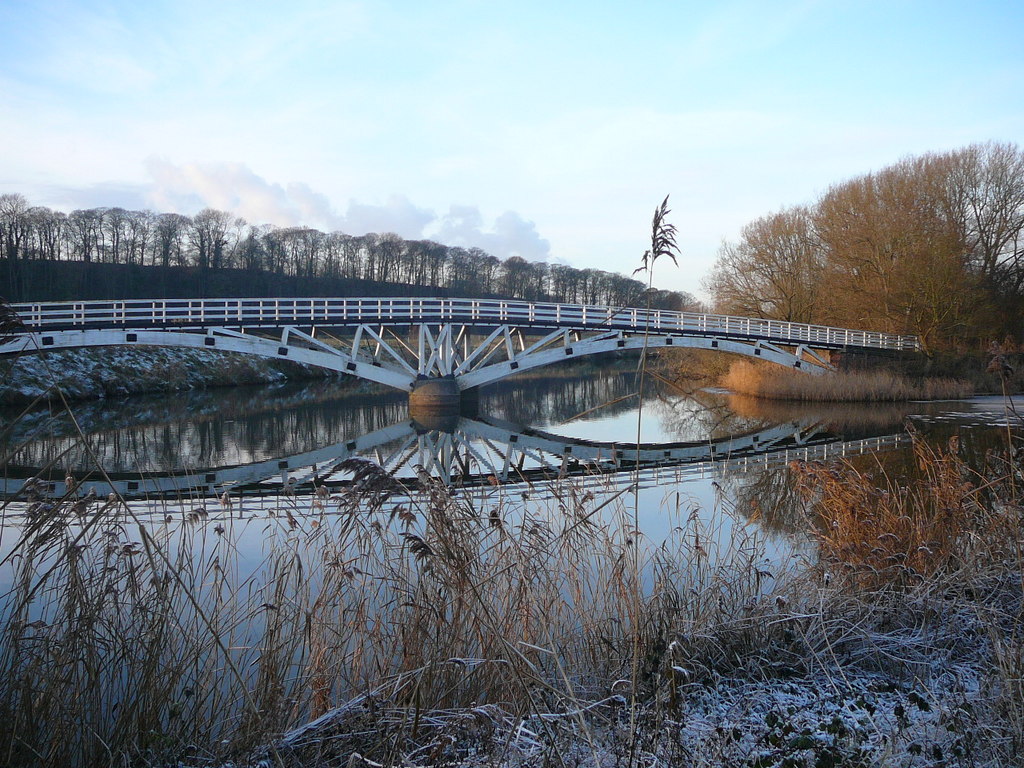

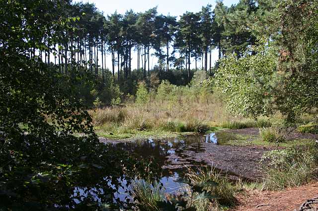

Why visit Kingsley
Townapedia lists 13 museums and landmarks, 7 parks and trails, 2 places to eat, 3 places to stay and 2 attractions in and around town.
Highlights include Acton swing bridge, Dutton Horse Bridge, Eddisbury hill fort and Crowton War Memorial.
Weather in Kingsley
Forecast from MET Norway (CC BY 4.0). Full forecast
About Kingsley
Kingsley is a civil parish and a village in the unitary authority of Cheshire West and Chester and the ceremonial county of Cheshire, England. Situated approximately 5 miles south east of the town of Frodsham and 2.5 miles north of Delamere Forest, the village lies within a rural stretch of mid-Cheshire countryside characterised by sandstone farmland, ancient woodland and open fields.
From the Wikipedia article Kingsley, Cheshire (this version), under CC BY-SA 4.0.
Things to do2


Dutton Horse Bridge
Bridge · 2.2 mi
Grade II listed bridge in Cheshire, England, UK
Museums and landmarks13

Eddisbury hill fort
Monument and historic site · 3.3 mi
Hillfort in Cheshire West and Chester, Cheshire, England, UK


1 more on the map.
Parks, trails and playgrounds7



Dutton Park Farm Nature Reserve
Park · 1.8 mi
Nature reserve northwest of Weaverham, Cheshire, England
Hunter's Wood Nature Reserve
Park · 1.1 mi
Park in Kingsley, United Kingdom
Restaurants and cafes2

History
Kingsley is first listed in the Domesday Book of 1086 as Chingeslie in the Roelau Hundred. The village is listed as having been held from Earl Hugh d'Avranches by a Saxon named Dunning. It has land for two ploughs, and home to five serfs, one villein, and three bordars. It also mentioned one and a half fisheries, four hays for roe deer, and a hawk's eyrie. The earl brought the woodland of one league long and one league wide into his forest. The forest mentioned was the ancient forest of Mara and Mondrem which was greatly reduced in size subsequently and is now known as Delamere Forest.
In 1260, the village was listed as Kingisleg. The name of the village ultimately derives from "king's lea" – the meadow of the king.
The village was for a long time known for its independence, as shown in its early Quaker meeting house, as well as its siding with the Parliamentarians during the English Civil War.
From the History section of Kingsley, Cheshire on Wikipedia, under CC BY-SA 4.0.
More about Kingsley
Geography
Kingsley lies within a rural stretch of mid-Cheshire countryside, situated on the northern edge of the Mid Cheshire Ridge, also known as the Cheshire Sandstone Ridge, a landscape of rolling sandstone hills, ancient woodland and enclosed farmland that stretches southward through the county toward Malpas. The ridge was shortlisted for designation as an Area of Outstanding Natural Beauty in 2021.
The village sits approximately 5 miles (8 km) south-east of Frodsham and 2.5 miles (4 km) north of Delamere Forest, the largest area of woodland in Cheshire. The surrounding countryside is characterised by small-to-medium fields bounded by hedgerows, scattered farms and ponds typical of the wider Cheshire Plain landscape.
Education
Kingsley has two primary schools. Kingsley Community Primary and Nursery School is a community school serving children aged 2 to 11, offering wraparound childcare provision. Kingsley St John's Church of England Primary School is a Church of England school in the Diocese of Chester, also serving children aged 3 to 11, situated on Hollow Lane in the village centre.
Secondary age pupils generally transfer to schools in Frodsham and the surrounding area, including Weaverham High School.
From the Wikipedia article Kingsley, Cheshire, under CC BY-SA 4.0.
Notable people from Kingsley
 Luke BrowningBritish racing driver (born 2002)Photo: Yu Chu Chin, CC BY-SA 4.0
 George WaringBritish footballer (born 1994)Photo: biddleofnowhere, CC BY-SA 2.0
- David JonesEnglish football forward born 1940
Born in Kingsley, according to Wikidata (CC0). Each name links to its Wikipedia article.
Where to stay3
Churches and places of worship10
Shopping1
Gas and EV charging1
Schools, colleges and libraries3
Healthcare1
Map of Kingsley
43 places. The map loads OpenStreetMap tiles when you open it.
Getting there and nearby towns
Liverpool John Lennon Airport (LPL) is the nearest airport with scheduled flights listed in OpenStreetMap, 9 miles away.
- Runcorn 6 mi northwest, about 9 min by car
- Northwich 6 mi east, about 10 min by car
- Widnes 7 mi northwest, about 11 min by car
- Winsford 8 mi southeast, about 13 min by car
- Mickle Trafford 8 mi southwest, about 12 min by car
- Warrington 9 mi north, about 15 min by car
- Great Sankey 9 mi north, about 14 min by car
- Speke 9 mi northwest, about 14 min by car
- Halewood 9 mi northwest, about 15 min by car
- Ellesmere Port Town 10 mi west, about 16 min by car
Drive times are estimates from straight-line distance, not routes.
Towns near Kingsley


Keep exploring
Local news
Headlines from INDB.
Reviews, tips and questions
Loading what members have shared...
Sources and licences
- GeoNames (CC BY 4.0): population, coordinates, regions and time zone
- OpenStreetMap contributors (ODbL 1.0): places, airports, map data
- Wikidata (CC0 1.0): elevation, founding date, time zone, website, landmarks and historic places
- Wikimedia Commons (see each image): photos
- Wikipedia (CC BY-SA 4.0): overview and history text
Photo credits
- Kingsley - Cheshire - Village Store and post office, Lizzie, CC BY-SA 2.0
- Acton swing bridge, Joopercoopers, CC BY 3.0
- Dutton Horse Bridge, Cheshire, Colin Park, CC BY-SA 2.0
- Eddisbury fort, Peter I. Vardy, Public domain
- Black Lake Delamere, Dave.Dunford, CC BY-SA 3.0
- Hatchmere2, Yacov Lev, Public domain
- Christ Church, Crowton 2, Peter I. Vardy, CC BY-SA 3.0
- St Laurence Frodsham exterior, Peter I. Vardy, Public domain
- Aston St Peter 4, Peter I. Vardy, Public domain
- Mar10 - Norley Church A(PI)h, Gammock, CC BY-SA 4.0
- Crowton War Memorial, Steve Richardson, CC BY-SA 4.0


Page built November 10, 2026. Spotted a mistake? Tell us or suggest a place.