


Hathersage, United Kingdom
Hathersage is a town of 2,018 people in England, United Kingdom.
Why visit Hathersage
Townapedia lists 10 museums and landmarks, 3 parks and trails, 18 places to eat, 6 places to stay and 7 attractions in and around town.
Highlights include Stanedge Pole, Eyam Hall and Eyam Museum.
Weather in Hathersage
Forecast from MET Norway (CC BY 4.0). Full forecast
About Hathersage
Hathersage is a village and civil parish in the Peak District in Derbyshire, England. It lies slightly to the north of the River Derwent, approximately 10 miles (16.1 km) south-west of Sheffield.
From the Wikipedia article Hathersage (this version), under CC BY-SA 4.0.
Travel tips from other travellers: Hathersage on Wikivoyage (CC BY-SA 4.0).
Photos of Hathersage

Things to do7

Stanedge Pole
Monument and historic site · 2.0 mi
Ancient boundary marker dividing Derbyshire and South Yorkshire, England, UK



Museums and landmarks10


Navio Roman fort
Monument and historic site · 3.2 mi
Fort in Hope, High Peak, England, UK

Padley Hall
Monument and historic site · 1.9 mi
House in Grindleford, Derbyshire, England, UK



David Mellor Visitor Centre
Monument and historic site · 0.4 mi
Leadmill, Hope Valley
Mo-Sa 10:00-17:00; Su 11:00-17:00; Dec 25-26 off; Jan 01 off
Embanked stone circle known as Wet Withens, and adjacent cairn
Monument and historic site · 1.6 mi
Stone circle in Derbyshire, England, UK
Parks, trails and playgrounds3


Restaurants and cafes18
Riverside Cafe
Cafe · 1.2 mi
Castleton Road, Hope Valley
Mo-Fr 10:00-16:00; Sa 10:00-16:30; Su 10:00-15:30
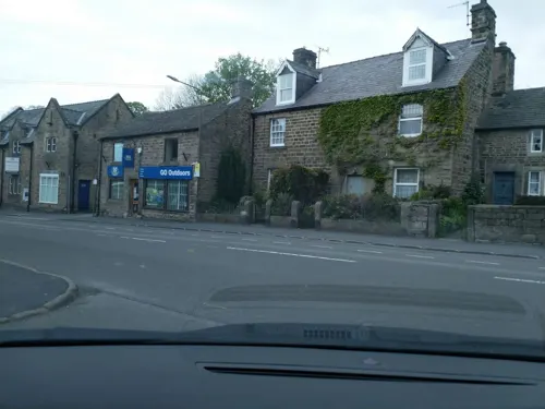
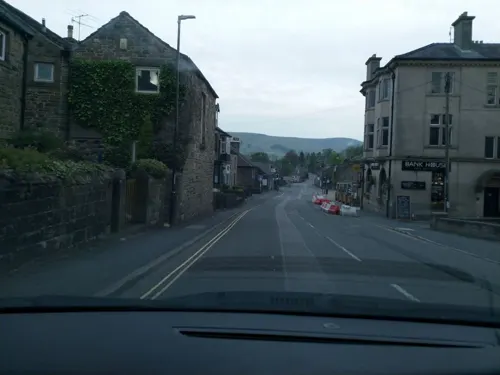


6 more on the map.
History
Mesolithic microliths have been found below Stanage Edge, indicating ancient occupation of the area.
In the Outseats area, there is evidence of Bronze Age field system, settlement and burial cairn at Dennis Knoll. Close to a now recumbent 2.3m high boundary marker on Bamford Moor is an embanked stone circle or possibly a ring cairn between 11m and 10m diameter.
There are remains of a Romano-British settlement, possibly a farmstead at a location known as the Warren in the Outseats area. Finds from this site include Roman period pottery and a gritstone quern. An early lead smelting site, variously interpreted as Roman or early Medieval, has been found at Bole Hill.
The Domesday Book records that, in 1066, Hathersage was held by Leofric and his brother Leofnoth. By 1086, Ralph son of Hubert is listed as both Lord and Tenant-in-chief. The population in 1086 was 8 villagers and 2 smallholders.
Read more of the history
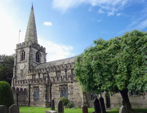
The earliest recorded church was built by Richard Bassett, son of Ralph Bassett, Chancellor of England in the reign of Henry I. The present Grade-I-listed structure dates mainly from the late 14th and early 15th centuries. The church, St Michael and All Angels', has a stained-glass window by Charles Kempe, which was removed from Derwent Chapel before it was submerged under the Ladybower Reservoir. Near the church is an earthwork called Camp Green, thought to have been constructed during the Danish occupation. It is also scheduled as a Norman ringwork castle of the 11th/12th century. In the graveyard lies the base and lower shaft of a plain early Saxon cross.
In 1566, Christopher Schutz, a German immigrant, who invented a process for drawing wire, set up a works in Hathersage. This became important in sieves used by miners and later developed into pin and needle production. This led to one of the first Factory Acts, because inhalation of grinding dust resulted in a life expectancy of only thirty years. In the mid-18th century, Hathersage became famous for its brass buttons. Some of the mill buildings from this era have been converted into flats.
In 1728, Daniel Defoe recorded how the moors around Hathersage were the source of building stones and millstones. Millstones were used in wood-pulping industries in the area and were also exported to North America, Russia and Scandinavia for the same purpose. Locally, the millstones were also used for crushing lead ore and the ingredients for paint. In Dorset, Peak stones were used for farm meal and barley crushing. The local gritstone tended to discolour bread, so were not generally used to grind wheat.
There is evidence of a post-medieval lime kiln, possibly constructed 1830s in the Outseats area. In the 18th century, the village was connected to Sheffield by the Sheffield to Hathersage Turnpike.
From the History section of Hathersage on Wikipedia, under CC BY-SA 4.0.
More about Hathersage
Economy
Hathersage is a tourist destination because of the scenery of the Hope and Derwent valleys, its literary connections and easy access by train or road from Sheffield and Manchester. Its visitors come to swim (open-air heated swimming pool, with cafe open all year), climb (Stanage Edge, which with other nearby edges have been the nursery for many famous British rock and mountain climbers) or ramble in its river valleys or hillwalk on its open moors. Hathersage Moor is the site of the Carl Wark hillfort and Higger Tor; both are now within the Sheffield boundary.
In 1990, the cutler David Mellor opened the Round Building built on the site of a former gasometer as a cutlery factory in the village. The building was designed by architect Sir Michael Hopkins. In 2007, an extension to the old retort house on the site was opened as a design museum. Mellor's wife, Fiona MacCarthy, continued to live in Hathersage.
Hathersage has two business parks: Hathersage Business Park and Hathersage Hall Business Centre.
Education
The village is served by Hathersage St Michael's C of E (A) Primary School which offers education from Nursery up to Year 6. The school was rated as 'good' in its November 2016 Ofsted report.
From the Wikipedia article Hathersage, under CC BY-SA 4.0.
Notable people from Hathersage
- Lizzie BallBritish musician and concert producer
Born in Hathersage, according to Wikidata (CC0). Each name links to its Wikipedia article.
Where to stay6
Churches and places of worship7
Shopping4
Gas and EV charging1
Schools, colleges and libraries1
Map of Hathersage
57 places. The map loads OpenStreetMap tiles when you open it.
Getting there and nearby towns
Manchester Airport (MAN) is the nearest airport with scheduled flights listed in OpenStreetMap, 26 miles away.
- Fulwood 5 mi east, about 7 min by car
- Baslow 6 mi south, about 9 min by car
- Tideswell 6 mi southwest, about 10 min by car
- Dronfield 8 mi east, about 12 min by car
- High Peak 8 mi west, about 13 min by car
- Sheffield 9 mi northeast, about 14 min by car
- Burngreave 9 mi northeast, about 15 min by car
- Chesterfield 11 mi southeast, about 18 min by car
- Stocksbridge 11 mi north, about 17 min by car
- Buxton 12 mi southwest, about 19 min by car
Drive times are estimates from straight-line distance, not routes.
Towns near Hathersage


Keep exploring
Local news
Headlines from INDB.
Reviews, tips and questions
Loading what members have shared...
Sources and licences
- GeoNames (CC BY 4.0): population, coordinates, regions and time zone
- Mapillary (see each image): photos
- OpenStreetMap contributors (ODbL 1.0): places, airports, map data
- Wikidata (CC0 1.0): elevation, founding date, time zone, website, landmarks and historic places
- Wikimedia Commons (see each image): photos
- Wikipedia (CC BY-SA 4.0): overview and history text
Photo credits
- Broomfield, Hathersage, Dave.Dunford, CC BY-SA 4.0
- Bank Cottages, Hathersage, Michael Dibb, CC BY-SA 2.0
- Hathersage George Lawrence plaque (47368682032), George Wolfe from Calver, GB, CC BY 2.0
- Stanedge Pole and Long Causeway, Mick Knapton, CC BY-SA 3.0
- Eyam Museum 866338 d051faf2, Alan Heardman, CC BY-SA 2.0
- Padley Chapel, Peak District 0, Photograph by Mike Peel ( www.mikepeel.net )., CC BY-SA 4.0
- Padley House or Chapel 641954 6a41d1b7, Colin Park, CC BY-SA 2.0
- Bamford church, Geoff Pick, CC BY-SA 2.0
- Hathersage Church, SMJ, CC BY-SA 2.0
- Offerton Hall, Dave.Dunford, CC BY-SA 4.0
- St Michael and All Angels, Hathersage 1, Photograph by Mike Peel ( www.mikepeel.net )., CC BY-SA 4.0
- Over Owler Tor - panoramio, PJMarriott, CC BY 3.0
- Surprise View, Owler Tor (Unsplash), Shane Rounce shanerounce, CC0
- Eyam Hall 1334913-15, Barrie Price, CC BY-SA 4.0
- PNFS 1908 signpost to Navio Roman Fort, Douglal, CC BY-SA 4.0
- Camp Green ringwork, Hathersage, Dave.Dunford, CC BY-SA 4.0
- Street-level photo, laye, CC BY-SA 4.0
- Street-level photo, laye, CC BY-SA 4.0
- Street-level photo, laye, CC BY-SA 4.0
- Street-level photo, laye, CC BY-SA 4.0
- Street-level photo, dudone, CC BY-SA 4.0
- Street-level photo, dudone, CC BY-SA 4.0
- Street-level photo, laye, CC BY-SA 4.0
- Street-level photo, dudone, CC BY-SA 4.0
- Street-level photo, dudone, CC BY-SA 4.0
- Street-level photo, laye, CC BY-SA 4.0
- Street-level photo, laye, CC BY-SA 4.0
- Street-level photo, laye, CC BY-SA 4.0
- Street-level photo, laye, CC BY-SA 4.0
- Street-level photo, coljay72, CC BY-SA 4.0
- Street-level photo, laye, CC BY-SA 4.0
- Street-level photo, laye, CC BY-SA 4.0
- Street-level photo, laye, CC BY-SA 4.0


Page built November 10, 2026. Spotted a mistake? Tell us or suggest a place.