


Isles of Scilly, United Kingdom
Isles of Scilly is a town of 2,224 people in England, United Kingdom.
Why visit Isles of Scilly
Townapedia lists 30 museums and landmarks, 29 parks and trails, 24 places to eat, 14 places to stay and 17 attractions in and around town.
Highlights include Peninnis Lighthouse, Peninnis Head Lighthouse, Porth Hellick Down Burial Chamber and Bant's Carn.
Weather in Isles of Scilly
Forecast from MET Norway (CC BY 4.0). Full forecast
About Isles of Scilly
The Isles of Scilly (, SIL-ee; Cornish: Syllan) are a small archipelago in Cornwall, England, approximately 45 km (28 mi) south-west of Land's End. One of the islands, St Agnes, is over four miles (six kilometres) further south than the most southerly point of the British mainland at Lizard Point, and has the southernmost inhabited settlement in Cornwall and the UK, Troy Town.
From the Wikipedia article Isles of Scilly (this version), under CC BY-SA 4.0.
Travel tips from other travellers: Isles of Scilly on Wikivoyage (CC BY-SA 4.0).
Photos of Isles of Scilly


Things to do17

Peninnis Lighthouse
Lighthouse · 1.4 mi
Lighthouse in St Mary's, England



Round Island Lighthouse
Lighthouse · 3.9 mi
Lighthouse in Tresco, Isles of Scilly, Cornwall, England, UK
St Agnes Lighthouse
Lighthouse · 3.1 mi
Lighthouse in Cornwall, England, UK

5 more on the map.
Museums and landmarks30
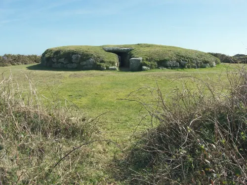
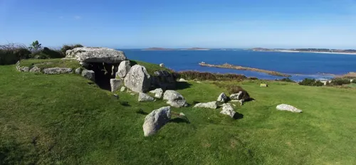
Bant's Carn
Monument and historic site · 0.5 mi
Bronze Age burial mound with entrance passage and inner chamber. .
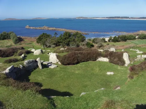
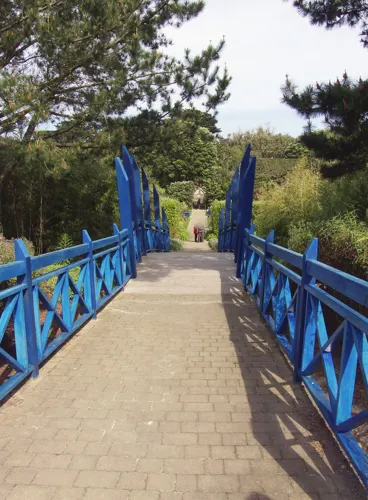

HMS Colossus
Monument and historic site · 1.9 mi
1787 Courageux-class third-rate ship of the line


Hollandia
Monument and historic site · 3.5 mi
Ship of the Dutch East India Company, wrecked in 1743 on her maiden voyage

Isles of Scilly Museum
Museum · 1.0 mi
Museum in Isles of Scilly, England, United Kingdom
Church Street, Hugh Town

Bartholomew Ledges Wreck
Monument and historic site · 2.0 mi
Shipwreck in St Mary's Sound, Isles of Scilly, Cornwall, England, UK
18 more on the map.
Parks, trails and playgrounds29






17 more on the map.
Restaurants and cafes24



Ned & Fin's
Cafe · Coffee Shop, Sausage Rolls & Hom Made Various · 1.0 mi
The Parade, Hugh Town
09:30 - 16:00

12 more on the map.
History
The islands may correspond to the Cassiterides ("Tin Isles"), believed by some to have been visited by the Phoenicians and mentioned by the Greeks. While Cornwall is an ancient tin-mining region, there is no evidence of this having taken place substantially on the islands.
During the Late Roman Empire, the islands may have been a place of exile. At least one person, one Tiberianus from Hispania, is known to have been condemned c. 385 to banishment on the isles, as well as the bishop Instantius, as part of the prosecution of the Priscillianists.
The isles were part of the Brittonic Celtic kingdom of Dumnonia. In the later Sub-Roman period, c. 7th century AD, the remaining Britons were split into three separate regions: the West (Cornwall), Wales and Cumbria–Ystrad Clyd (Strathclyde). The isles may have been a part of these polities until a short-lived conquest, by the English, in the 10th century was cut short by the Norman Conquest.
Read more of the history
It is likely that, until relatively recent times, the islands were much larger, and perhaps conjoined into one island named Ennor. Rising sea levels flooded the central plain around 400–500 AD, forming the current 55 islands and islets (if an island is defined as "land surrounded by water at high tide and supporting land vegetation"). The word Ennor is a contraction of the Old Cornish En Noer (Doer, mutated to Noer), meaning 'the land' or 'the great island'.
A description, written during Ancient Roman times, designates Scilly "Scillonia insula" in the singular, indicating either a single island or an island much bigger than any of the others.
Remains of a prehistoric farm have been found on Nornour (now a small, rocky skerry far too small for farming). There once was an Iron Age British community here that continued into Roman times. This community was likely formed by immigrants from Brittany—probably the Veneti—who were active in the tin trade that originated in mining activity in Cornwall and Devon.
At certain low tides, the sea becomes shallow enough for people to walk between some of the islands. This is possibly one of the sources for stories of "drowned lands", e.g. Lyonesse.
Ancient field walls are visible below the high tideline off some of the islands, such as Samson.
Some of the Cornish-language place names also appear to reflect historical shorelines and former land areas.
The whole of southern England has been steadily sinking, in opposition to post-glacial rebound in Scotland: this has caused the rias (drowned river valleys) on the southern Cornish coast, e.g. River Fal and the Tamar Estuary.
Offshore, midway between Land's End and the Isles of Scilly, is the supposed location of the mythical lost land of Lyonesse, referred to in Arthurian literature (of which Tristan is said to have been a prince). This may be a folk memory of inundated lands, but this legend is also common among the Brythonic peoples; the legend of Ys is a parallel and cognate legend in Brittany, as is that of Cantre'r Gwaelod in Wales.
In 995, Olaf Tryggvason became King Olaf I of Norway. Born c. 960, Olaf had raided various European cities and fought in several wars. In 986 he met a Christian seer on the Isles of Scilly. He was probably a follower of Priscillian and part of the tiny Christian community that was exiled here from Spain by Emperor Maximus for Priscillianism. In Snorri Sturluson's Royal Sagas of Norway, it is stated that this seer told him:
Thou wilt become a renowned king, and do celebrated deeds. Many men wilt thou bring to faith and baptism, and both to thy own and others' good; and that thou mayst have no doubt of the truth of this answer, listen to these tokens. When thou comest to thy ships many of thy people will conspire against thee, and then a battle will follow in which many of thy men will fall, and thou wilt be wounded almost to death, and carried upon a shield to thy ship; yet after seven days thou shalt be well of thy wounds, and immediately thou shalt let thyself be baptised.
The legend continues that, as the seer foretold, Olaf was attacked by a group of mutineers upon returning to his ships. As soon as he had recovered from his wounds, he let himself be baptised. He then stopped raiding Christian cities, and lived in England and Ireland. In 995, he used an opportunity to return to Norway. When he arrived, the Haakon Jarl was facing a revolt. Olaf Tryggvason persuaded the rebels to accept him as their king, and Jarl Haakon was murdered by his own slave, while he was hiding from the rebels in a pig sty.
With the Norman Conquest, the Isles of Scilly came more under centralised Norman control. About 20 years later, the Domesday survey was conducted. The islands would have formed part of the "Exeter Domesday" circuit, which included Cornwall, Devon, Dorset, Somerset, and Wiltshire.
In the mid-12th century, there was reportedly a Viking attack on the Isles of Scilly, called Syllingar by the Norse, recorded in the Orkneyinga saga—Sweyn Asleifsson "went south, under Ireland, and seized a barge belonging to some monks in Syllingar and plundered it." (Chap LXXIII)
... the three chiefs—Swein, Þorbjörn and Eirik—went out on a plundering expedition. They went first to the Suðreyar [Hebrides], and all along the west to the Syllingar, where they gained a great victory in Maríuhöfn on Columba's-mass [9 June], and took much booty. Then they returned to the Orkneys.
"Maríuhöfn" literally means "Mary's Harbour/Haven". The name does not make it clear if it referred to a harbour on a larger island than today's St Mary's, or a whole island.
It is generally considered that Cornwall, and possibly the Isles of Scilly, came under the dominion of the English Crown for a period until the Norman conquest, late in the reign of Æthelstan (r. 924–939). In early times one group of islands was in the possession of a confederacy of hermits. King Henry I (r. 1100–1135) gave it to the abbey of Tavistock who established a priory on Tresco, which was abolished at the Reformation.
From the History section of Isles of Scilly on Wikipedia, under CC BY-SA 4.0.
More about Isles of Scilly
Geography
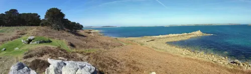
The Isles of Scilly form an archipelago of five inhabited islands (six if Gugh is counted separately from St Agnes) and numerous other small rocky islets (around 140 in total) lying 45 kilometres (24+1⁄2 nautical miles) off Land's End. Troy Town Farm (Troytown Farm) on the southern part of the southernmost inhabited isle, St Agnes, is the southernmost settlement of the United Kingdom.
The islands' position produces a place of great contrast; the ameliorating effect of the sea, greatly influenced by the North Atlantic Current, means they rarely have frost or snow, which allows local farmers to grow flowers well ahead of those in mainland Britain. The chief agricultural product is cut flowers, mostly daffodils. Exposure to Atlantic winds also means that spectacular winter gales lash the islands from time to time. This is reflected in the landscape, most clearly seen on Tresco where the lush Abbey Gardens on the sheltered southern end of the island contrast with the low heather and bare rock sculpted by the wind on the exposed northern end.
Natural England has designated the Isles of Scilly as National Character Area 158. As part of a 2002 marketing campaign, the plant conservation charity Plantlife chose sea thrift (Armeria maritima) as the "county flower" of the islands.
Economy
Since the mid-18th century the Scillonian economy has relied on trade with the mainland and beyond as a means of sustaining its population. Over the years the nature of this trade has varied, due to wider economic and political factors that have seen the rise and fall of industries, such as kelp harvesting, pilotage, smuggling, fishing, shipbuilding and, latterly flower farming. In a 1987 study of the Scillonian economy, Neate found that many farms on the islands were struggling to remain profitable due to increasing costs and strong competition from overseas producers, with resulting diversification into tourism. Statistics suggest that agriculture on the islands now represents less than 2% of all employment.
Today, tourism is estimated to account for 85% of the islands' income. The islands have been successful in attracting this investment due to their special environment, favourable summer climate, relaxed culture, efficient co-ordination of tourism providers and good transport links by sea and air to the mainland, uncommon in scale to similar-sized island communities.
Arts and culture
According to the 2001 UK census, 97% of the population of the islands are white British, with nearly 93% of the inhabitants born in the islands, in mainland Cornwall or elsewhere in England. Following EU enlargement in 2004, a number of central Europeans moved to the island, joining the Australians, New Zealanders and South Africans who traditionally made up most of the islands' overseas workers. In 2005, their numbers were estimated at nearly 100 out of a total population of just over 2,000. The Isles have also been referred to as "the land that crime forgot", reflecting lower crime levels than national averages.
One continuing legacy of the isles' past is Cornish gig racing, wherein fast rowing boats ("gigs") with crews of six (or in one case, seven) race between the main islands. Gig racing has been said to derive from the race to collect salvage from shipwrecks on the rocks around Scilly, but the race was actually to deliver a pilot onto incoming vessels, to guide them through the hazardous reefs and shallows. (The boats are correctly termed "pilot gigs"). The World Pilot Gig Championships are held annually over the May Day bank holiday weekend. The event originally involved crews from the Islands and a few crews from mainland Cornwall, but in the intervening years the number of gigs attending has increased, with crews coming from all over the South-West and further afield.
Education
Education is available on the islands up to age 16. There is one school, the Five Islands Academy, which provides primary schooling at sites on St Agnes, St Mary's, St Martin's and Tresco, and secondary schooling at a site on St Mary's, with secondary students from outside St Mary's living at a school boarding house (Mundesley House) during the week. Sixteen- to eighteen-year-olds are entitled to a free sixth form place at a state school or sixth form college on the mainland, and are provided with free flights and a grant towards accommodation.
From the Wikipedia article Isles of Scilly, under CC BY-SA 4.0.
Notable people from Isles of Scilly
 Sir Frederick Hervey-Bathurst, 3rd Baronetcricketer (1807-1881)Photo: 45ossington ( talk ), CC0
- Stella TurkBritish zoologist
Born in Isles of Scilly, according to Wikidata (CC0). Each name links to its Wikipedia article.
Where to stay14
Churches and places of worship14
Shopping13
Schools, colleges and libraries2
Healthcare2
Isles of Scilly Pharmacy
Clinic and pharmacy · 1.0 mi
King Edward's Road, St. Mary's
Map of Isles of Scilly
145 places. The map loads OpenStreetMap tiles when you open it.
Getting there and nearby towns
St Mary's Airport (ISC) is the nearest airport with scheduled flights listed in OpenStreetMap, 1 miles away.
- St Mary's 1 mi south, about 1 min by car
- Hugh Town 1 mi southwest, about 1 min by car
- Penzance 36 mi east, about 59 min by car
- Marazion 39 mi east, about 1 h by car
- Uny Lelant 42 mi northeast, about 1 h 15 min by car
- Helston 47 mi east, about 1 h 15 min by car
- Mullion 47 mi east, about 1 h 15 min by car
- Camborne 49 mi northeast, about 1 h 15 min by car
- Four Lanes 51 mi northeast, about 1 h 15 min by car
- Redruth 52 mi northeast, about 1 h 30 min by car
Drive times are estimates from straight-line distance, not routes.
Towns near Isles of Scilly


Keep exploring
Local news
Headlines from INDB.
Reviews, tips and questions
Loading what members have shared...
Sources and licences
- GeoNames (CC BY 4.0): population, coordinates, regions and time zone
- Mapillary (see each image): photos
- OpenStreetMap contributors (ODbL 1.0): places, airports, map data
- Wikidata (CC0 1.0): elevation, founding date, time zone, website, landmarks and historic places
- Wikimedia Commons (see each image): photos
- Wikipedia (CC BY-SA 4.0): overview and history text
Photo credits
- Isles of Scilly NASA, ISS Crew Earth Observations experiment and the Image Science & Analysis Laboratory, Johnson Space Center, Public domain
- 'Colossus' (1787), 'Leviathan' (1790), 'Carnatic' (1783), 'Minotaur' (1793) RMG J3066, Navy Office, John Williams; Edward Hunt, Public domain
- Hollandia, Pvt pauline, CC BY-SA 3.0
- BryherChurch, Andrewrabbott at English Wikipedia, Public domain
- Former Bible Christian Chapel, St Agnes, Isles of Scilly, Andrewrabbott, CC BY-SA 4.0
- Old Wesleyan Chapel, Hugh Town, Isles of Scilly, Andrewrabbott, CC BY-SA 4.0
- StAgnesChurch, Andrewrabbott at English Wikipedia, Public domain
- StMartinsChurchScilly4, Andrewrabbott ( talk ), Public domain
- Isles of Scilly, St Mary's Parish Church, Andrewrabbott, CC BY-SA 3.0
- OldChurchStMarys, Andrewrabbott at English Wikipedia, Public domain
- TrescoAbbeyGardens, Andrewrabbott at English Wikipedia, Public domain
- Porth Arlo beach, St Marys, Scilly, Professorbeach, CC BY-SA 4.0
- Sir Cloudesley Shovell, in the Association, with the Eagle, Rumñy, and the Firebrand, Lost on the Rocks of Scilly, October, 22, 1707 (cropped), William Rayner, Public domain
- Five Islands Academy, HenryTemplo, CC BY-SA 4.0
- Stone art studio (Unsplash), Annie Spratt anniespratt, CC0
- Coastguard's Lookout Tower 01, andrewrabbott, CC BY-SA 4.0
- Golden Dawn, Mike Brown, CC BY-SA 4.0
- Scilly Valentine, Mikescilly, CC BY-SA 3.0
- Royal Fern (2981395008), Giles Watson from Oxfordshire, England, CC BY-SA 2.0
- Coastguard's Lookout Tower 03, andrewrabbott, CC BY-SA 4.0
- Coastguard's Lookout Tower 02, andrewrabbott, CC BY-SA 4.0
- Carn Thomas Secondary School, St. Mary's, Bob Embleton, CC BY-SA 2.0
- Peninnis Lighthouse, Jowaninpensans, CC BY-SA 4.0
- Buzza Hill Dolmen, David Stanley from Nanaimo, Canada, CC BY 2.0
- Cruther's Hill - Campion Anther Smut, Jowaninpensans, CC BY-SA 4.0
- Street-level photo, coljay72, CC BY-SA 4.0
- Street-level photo, coljay72, CC BY-SA 4.0
- Street-level photo, coljay72, CC BY-SA 4.0
- Street-level photo, coljay72, CC BY-SA 4.0
- Street-level photo, coljay72, CC BY-SA 4.0
- Street-level photo, coljay72, CC BY-SA 4.0
- Street-level photo, coljay72, CC BY-SA 4.0


Page built November 10, 2026. Spotted a mistake? Tell us or suggest a place.