


Llandrindod Wells, United Kingdom
Llandrindod Wells is a town of 5,309 people in Wales, United Kingdom.
Why visit Llandrindod Wells
Townapedia lists 5 museums and landmarks, 5 parks and trails, 15 places to eat, 7 places to stay and 2 attractions in and around town.
Highlights include National Cycle Museum and Radnorshire Museum.
Weather in Llandrindod Wells
Forecast from MET Norway (CC BY 4.0). Full forecast
About Llandrindod Wells
Llandrindod Wells (; locally /ɬænˌdrɪndɒd-/; Welsh: Llandrindod [ɬanˈdɾindɔd] ; lit. 'trinity parish') is a town and community in Powys, Wales. It serves as the seat of Powys County Council, and is therefore the administrative centre of Powys. The town was historically in Radnorshire.
From the Wikipedia article Llandrindod Wells (this version), under CC BY-SA 4.0.
Travel tips from other travellers: Llandrindod Wells on Wikivoyage (CC BY-SA 4.0).
Things to do2

Museums and landmarks5



Parks, trails and playgrounds5




Restaurants and cafes15
Arvon Ale House
Bar and pub
Temple Street, Llandrindod Wells
Mo-Tu Closed; We-Th 16:00-22:00; Fr 16:00-23:00; Sa 13:00-23:00;...
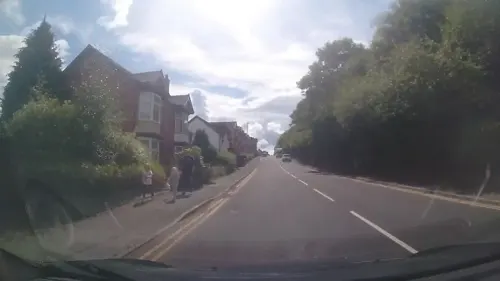
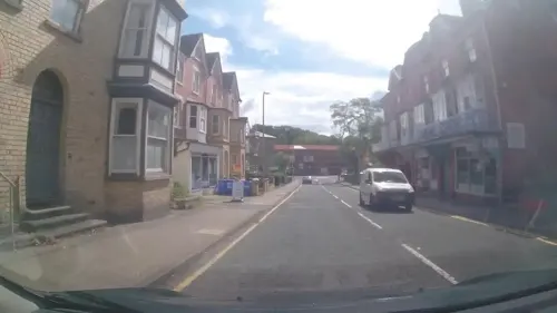




3 more on the map.
History
During the mid-18th century, the 'healing qualities' of the local spring waters attracted visitors to the area resulting in an economic boom with the building of a 'splendid' hotel at Llandrindod Hall. The medicinal qualities of the springs was first described in detail by the self-proclaimed physician Diederich Wessel Linden.
The most famous of the springs was Cwmygof Well, in the rocky valley of Dolysgallog Farm. The farm became a boarding house in the 1820s to accommodate the growing numbers of visitors. Later, the area of land which was to become 'Rock Park' was set aside for exercise and recreation.
A period of relative decline during the late 18th and early 19th centuries was reversed with the construction of the Heart of Wales line making Llandrindod accessible from south Wales, the Midlands and northwest England. Enclosure of the common in 1862 enabled the expansion of the town with the construction of new streets, hotels, shops and houses.
Read more of the history
During the 'season' between May and mid-September, visitors would take the waters at the pump rooms at the Rock Park and Pump House Hotel, entertained by orchestras. Hotels, boarding houses and shops—including the Central Wales Emporium on the corner of Temple Street and Station Crescent—provided for the visitors. In the early 1870s, an ornamental lake was formed by draining marshland near the Pump House Hotel (on the current site of the Council offices), and in 1893 a 9-hole golf course was opened on the common beside the lake (later replaced by the present 18-hole course on the hills above). Horse races (and later air displays) were held on the Rock Ddole meadow beside the river.
In 1893, Archdeacon Henry de Winton, who had responsibility for the area at the time, had Llandrindod old church and Cefnllys church unroofed in order to persuade the congregations to attend the new church in the centre of the town. Both churches were later restored in 1895 following protest.
Llandrindod was the place of the election of the first Archbishop of Wales in 1920, which occurred at the Old Parish Church. Elections for every Archbishop since have continued to be held in Llandrindod, now at Holy Trinity Church in the Town Centre. In 1907, a Catholic church was founded in the town, Our Lady of Ransom and the Holy Souls Church.
The town has maintained an important profile in the world of motoring and motorsport. Apart from two of its most symbolic recent buildings being the Tom Norton's Automobile Palace and Pritchard's Garage, it served as the base for many International motorcycle events such as the International Six Days Trial ISDT starting in 1933 with the last visit taking place in 1961, often drawing in crowds of thousands to watch.
The town's boom continued until the First World War during which time soldiers on training courses were billeted in hotels and boarding houses, and refugees and wounded soldiers were accommodated in the town. The Great Depression of the late-1920s and 1930s led to many hotels and boarding houses being turned into private homes and flats. During the Second World War the town was again used for military hospitals and billets, followed by a slump in the post-war years. The Beeching Axe resulted in the closure in the mid-1960s of the Mid-Wales line and with it Llandrindod's connection from nearby Builth Wells direct to Cardiff and to north and west Wales. The town does retain connections to Swansea and Shrewsbury from Llandrindod railway station on the Heart of Wales line.
Prior to 1974, the town housed much of the administration of Radnorshire, although the official county town was Presteigne. The reorganisation of local government in 1974 resulted in Llandrindod becoming the county town of the newly formed administrative county of Powys. This led to an influx of people employed by the new bureaucracies, on salaries determined by national pay scales. The new County Hall was based on Spa Road East in Llandrindod Wells.
From the History section of Llandrindod Wells on Wikipedia, under CC BY-SA 4.0.
More about Llandrindod Wells
Arts and culture
Llandrindod Wells Victorian Festival is held in the town every year at the end of August. Many locals and some visitors dress in Victorian, Edwardian or other antique costumes, and many of the town's shops and other high-street businesses dress their windows or otherwise join in the spirit of the event. The festival typically offers open-air and street theatre and music, a fairground, a craft fair, an historical re-enactment, entertainments at The Albert Hall and exhibitions of "things old-time".
In a 2017 survey undertaken by Rightmove, Llandrindod was voted the Happiest Place in Wales. A survey by the Royal Mail over the Easter 2018 period showed that Llandrindod had the highest online shopping rates for that period in the whole of the country.
There is a wide range of entertainment available in the town each year. The Albert Hall, Llandrindod Wells is the town's Victorian Theatre, owned and run by the community of Llandrindod. The Theatre is managed by a group of volunteers from the local area. The theatre hosts a wide range of performances and activities suitable for all. Many local organisation's events are held at the Theatre.
Pavilion Mid Wales (formerly known as The Grand Pavilion) is the largest venue in Llandrindod Wells, and hosts a wide range of entertainments, including Arts, Music, Conferences, and Markets.
Education
Llandrindod has two primary schools and one secondary school:
Llandrindod Wells CP School – Cefnllys (Ysgol Cefnllys) is an English Medium Local Authority Primary school. Llandrindod Wells Church in Wales School – Ysgol Trefonnen is an English and Welsh Medium Local Authority Primary School.
Ysgol Calon Cymru is the town's Local Authority secondary school. The school has two campuses, which replaced the former Llandrindod High School (and Builth Wells High School) and opened in September 2018. The Llandrindod site provides an English-medium education for 11 to 18 year olds.
From the Wikipedia article Llandrindod Wells, under CC BY-SA 4.0.
Notable people from Llandrindod Wells
 Carl RobinsonWelsh football manager (born 1976)Photo: The Vancouver Herald, CC BY-SA 4.0
- Gerry Humphreyssound engineer (1931-2006)
- Bryn Jonesassociation football player (born 1948)
- Wendy PriceWelsh lawn bowls player
- Betty MorganWelsh bowler
Born in Llandrindod Wells, according to Wikidata (CC0). Each name links to its Wikipedia article.
Where to stay7
Llandrindod Hall Caravan and Camp Site
Campground · 0.8 mi
3 Lakeside Ave, Llandrindod Wells LD1 5NT, United Kingdom
Churches and places of worship14
Our Lady of Ransom and The Holy Souls Roman Catholic Church
Church · Roman Catholic
Victoria Road, Llandrindod Wells
Shopping4
Gas and EV charging2
Schools, colleges and libraries5
Healthcare3
Map of Llandrindod Wells
62 places. The map loads OpenStreetMap tiles when you open it.
Getting there and nearby towns
Swansea Airport (SWS) is the nearest airport with scheduled flights listed in OpenStreetMap, 53 miles away.
- Rhayader 7 mi northwest, about 11 min by car
- Kington 15 mi east, about 24 min by car
- Llanidloes 16 mi northwest, about 26 min by car
- Presteigne 16 mi east, about 26 min by car
- Talgarth 18 mi south, about 29 min by car
- Newtown 19 mi north, about 31 min by car
- Bishop's Castle 23 mi northeast, about 38 min by car
- Tregaron 24 mi west, about 38 min by car
- Leominster 27 mi east, about 43 min by car
- Hereford 31 mi southeast, about 50 min by car
Drive times are estimates from straight-line distance, not routes.
Towns near Llandrindod Wells


Keep exploring
Local news
Headlines from INDB.
Reviews, tips and questions
Loading what members have shared...
Sources and licences
- GeoNames (CC BY 4.0): population, coordinates, regions and time zone
- Mapillary (see each image): photos
- OpenStreetMap contributors (ODbL 1.0): places, airports, map data
- Wikidata (CC0 1.0): elevation, founding date, time zone, website, landmarks and historic places
- Wikimedia Commons (see each image): photos
- Wikipedia (CC BY-SA 4.0): overview and history text
Photo credits
- Llandrindod Wells-Junction of South Crescent with Temple Street, Penny Mayes, CC BY-SA 2.0
- Llandrindod Wells (26048331151), Alex Liivet from Chester, United Kingdom, CC0
- St Michael's Church at Cefnllys, Bill Nicholls, CC BY-SA 2.0
- St Cewydd, Disserth, Monjo hakashi, CC BY-SA 3.0
- Automobile Palace, Llandrindod 02, Ham, CC BY-SA 3.0
- Group outside Llandrindod Wells Golf Club pavilion, with a lady golfer being presented with a cup (3450263407), Llyfrgell Genedlaethol Cymru / The National Library of Wales from Wales/Cymru, CC0
- Metropole Temple Gardens, P.khiao, CC BY-SA 4.0
- Street-level photo, trigpoint, CC BY-SA 4.0
- Street-level photo, trigpoint, CC BY-SA 4.0
- Street-level photo, trigpoint, CC BY-SA 4.0
- Street-level photo, trigpoint, CC BY-SA 4.0
- Street-level photo, trigpoint, CC BY-SA 4.0
- Street-level photo, trigpoint, CC BY-SA 4.0
- Street-level photo, trigpoint, CC BY-SA 4.0
- Street-level photo, trigpoint, CC BY-SA 4.0
- Street-level photo, trigpoint, CC BY-SA 4.0
- Street-level photo, trigpoint, CC BY-SA 4.0
- Street-level photo, trigpoint, CC BY-SA 4.0
- Street-level photo, trigpoint, CC BY-SA 4.0
- Street-level photo, trigpoint, CC BY-SA 4.0
- Street-level photo, trigpoint, CC BY-SA 4.0
Page built November 10, 2026. Spotted a mistake? Tell us or suggest a place.