


Why visit Maryport
Townapedia lists 7 museums and landmarks, 3 parks and trails, 33 places to eat, 5 places to stay and 6 attractions in and around town.
Highlights include Maryport New Lighthouse, Maryport Old Lighthouse, Senhouse Roman Museum and Alauna.
Weather in Maryport
Forecast from MET Norway (CC BY 4.0). Full forecast
About Maryport
Maryport is a town and civil parish in the Cumberland district of Cumbria, England. The town is on the coast of the Solway Firth and lies at the northern end of the former Cumberland Coalfield. Maryport lies approximately 5 miles (8 km) north-west of the Lake District National Park. It includes the site of the Roman settlement of Alauna.
From the Wikipedia article Maryport (this version), under CC BY-SA 4.0.
Things to do6





Museums and landmarks7

Senhouse Roman Museum
Museum · 0.5 mi
The Promenade, Maryport
Jan-Mar,Nov-Dec Fr-Su 10:30-16:00; Apr-Oct 11:00-17:00

Alauna
Monument and historic site · 0.6 mi
Roman fort and settlement on the site of present-day Maryport in Cumbria, England, UK


Parks, trails and playgrounds3



Restaurants and cafes33
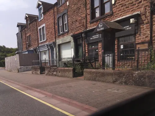
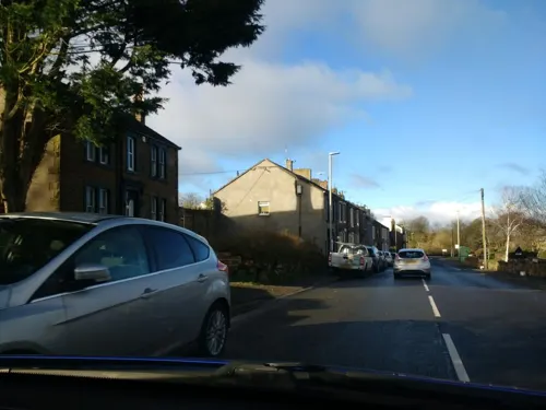


Redby Coffee
Cafe
19 Senhouse Street, Maryport
Mo-Fr 08:00-15:30; Sa 09:00-15:00; Su 10:00-15:00

21 more on the map.
History
Evidence for Final Palaeolithic and Mesolithic occupation was found at Netherhall Road. This was the first located archaeological evidence of tuff exploitation in the Lake District.
The town was established around 122 AD as one of several Roman localities called Alauna. It was a command and supply base for the coastal defences at the western extremity of Hadrian's Wall. The town contains substantial remains of the Roman fort, which was the last in a series that stretched southwards along the coast from the wall to prevent it being avoided by crossing the Solway Firth. Geomagnetic surveys have revealed a large Roman town surrounding the fort. A Romano-British (native) settlement located directly beside the fort may even have supplied the fort with food, possibly in exchange for goods like pottery.
The Senhouse Roman Museum adjoins the site of Alauna, and has a replica wooden watch-tower overlooking the fort and the sea. The museum houses a large collection of Roman altar stones found at the site.
On Castle Hill are the earthworks and buried remains of a 12th-century motte-and-bailey castle. On the summit are the foundations of a World War II gun emplacement.
Read more of the history
To the north are the ruins of Netherhall Estate. The only remains of this once grand manor are stables and a 14th-century pele tower, largely built of dressed Roman stones presumably from Alauna Roman fort nearby. The tower was formerly part of a large house of later date which was demolished in 1979 following a fire.
The area was historically called Ellenfoot (meaning [settlement] at the foot of the river Ellen) but the name was changed by Humphrey Senhouse as he began developing the port and new town, following the example of Whitehaven. In 1749 an act of Parliament, the Maryport Harbour Act 1748 (22 Geo. 2. c. 6), was passed to allow the creation of the present town. Humphrey Senhouse named the new town after his wife Mary. The Senhouse family were landowners in the area and responsible for the development of the town and excavation of its Roman past. The family also had interests in the West Indies. In 1770, Humphrey Senhouse's son, William, was appointed Surveyor General of Customs in Barbados where he purchased a sugar plantation and managed another for Sir James Lowther of Whitehaven. William's brother, Joseph, had a coffee plantation in Dominica. Both men were considerable slave-owners.
It was during this period that the town's lighthouse was built.
The town quickly developed as an industrial centre throughout the 19th century. An iron foundry opened and the port developed as did shipyards, such as Wood's yard and Ritson's yard, which was famous for launching ships broadside into the River Ellen because it was not wide enough to allow ships to be launched the usual way.
The Maryport and Carlisle Railway, opened in the 1840s, with George Stephenson as its engineer, made the transport of coal much easier. Large new mines were sunk in the Aspatria area and almost all their production passed through the port. In 1846, 213,152 tons of coal were shipped from Maryport and by 1857 this had risen to more than 340,000 tons. Much of the coal produced in the area was turned into coke for the local iron and steel industry. By 1890, the Allerdale Coal Company had thirty Beehive coke ovens working on its site at Buckhill, Broughton Moor.
In 1874, the owners announced a cut of 10% in the miners' wages. A strike began in the Aspatria pits and then the owners made a further cut of 15%. By December, the strike had spread to the whole area with 2,000 men involved. The strike lasted until March 1875. There was violence when some 'blacklegs' were assaulted and many colliers left the area to seek work elsewhere.
In 1894, John Osmaston who operated the Dearham Colliery became insolvent and the bank took over his pits. Two groups of local miners formed co-operatives and leased the mines at Crosshow and Townhead from the Lowthers. They found it impossible to compete with the other wealthy coal-owners in a tight market and also had serious problems with drainage. This unique experiment ended in 1903 when both companies went into liquidation.
During the early years of the 20th century, trade in the docks remained steady but was badly affected by the 1926 General Strike. Then, in 1927, a new deep-water dock was opened in Workington. Previously, the Workington Iron and Steel works had imported much of their raw material through Maryport but all of this trade was immediately transferred to the new facility. The local Solway Blast Furnaces also closed.
Maryport became a ghost town. The government declared West Cumberland a ‘Special Area' but, by 1933, 57.3% of the town's insured workforce was unemployed. 1,684 men were out of work. Maryport was “for the most part, living on public funds”. In 1936 twenty unemployed men marched from Maryport to join the Jarrow Crusade to London. Known as the Maryport Marchers, they were joined by two marchers from Cleator Moor and two marchers from Frizington. The Maryport Marchers Council organised this.
Despite a minor boom during the Second World War, when coal from North East England was diverted to the port, Maryport never recovered. The docks were closed to cargo ships in the 1960s. The last deep pit in the area, at Risehow, closed in 1966.
Today, after a series of major regeneration projects such as the yacht marina in the local harbour, prospects for the town are starting to look better. It is expected that tourism will play a major role in the future of the town.
In October 2018, it was announced that the Netherhall School community swimming pool was to close.
From the History section of Maryport on Wikipedia, under CC BY-SA 4.0.
More about Maryport
Economy
The economy of the area and the emergence of the industrial capacity of the town itself developed largely because of mining and sea trade, but these industries have since declined and the town now relies on tourism as the basis of its economy. There is an aquarium, Maryport Maritime Museum (housed in a former pub on the harbour, and established as a museum in 1975) and a Roman museum. The last houses numerous Roman artefacts, most notably a series of altars to Jupiter Optimus Maximus, which were excavated in the vicinity of the Roman fort. In July 2008, a new tourism venue, the Wave Centre, opened its doors. The Wave Centre is a theatre and conference facility, an interactive heritage exhibition on the local history of Maryport, the Tourist Information Centre for Maryport and a gift shop and bistro.
The town has two industrial estates, the Glasson Industrial Estate and the Solway Industrial Estate, which are home to many small local businesses. It was formerly home to a factory belonging to the Bata company which closed in the early 1980s.
Arts and culture
The town is a major name on the blues music scene, holding the "Maryport Blues Festival" every summer. This has previously attracted names such as Jools Holland, Dionne Warwick, Elkie Brooks, Buddy Guy, Jethro Tull, Van Morrison, Robert Cray and Chuck Berry.
The three-day event usually takes place on the last weekend of July, attracting both local and international artists. The 2018 Maryport Blues Festival was cancelled.
Maryport also holds the annual Taste of The Sea food festival where visitors can enjoy food from all over Cumbria, such as Rum Butter and Kendal Mint Cake.
The town has a Scout Group (2nd Maryport) that has been in the town for over 70 years and incorporates most sections within the Scouting Movement. The group was visited by the Bishop of Carlisle to mark the centenary of Scouting in 2008.
The town also has a Girl Guiding Group, a Young Archaeology Society, and a local wildlife conservation society.
Maryport Golf Club, a 18-hole course, was formed on 21 January 1905.
From the Wikipedia article Maryport, under CC BY-SA 4.0.
Notable people from Maryport
 Daniel BewleyBritish speedway riderPhoto: Hubczaj, CC BY-SA 4.0
 William HarrisonBritish merchant navy officer, born 1812Photo: Robert Howlett (died 1858), Public domain
- Glenn MurrayBritish footballer (born 1983)
- Thomas Henry IsmayBritish businessman (1837-1899)
- Jack ConnorEnglish footballer (1934-2010)
- Tony ChiltonEnglish footballer (born 1965)
- Thomas AshbridgeEnglish footballer (1890-1964)
- William HeaneyFootballer (born 1990)
- John Baines JohnstonBritish diplomat (1918-2005)
- Thomas EnglishMayor of Adelaide (1862–63)
- Tom SmithEnglish footballer born 1876
- Josiah Kelsallassociation football player (1892-1974)
Born in Maryport, according to Wikidata (CC0). Each name links to its Wikipedia article.
Where to stay5
Churches and places of worship8
Shopping12
Gas and EV charging1
Schools, colleges and libraries8
Our Lady and St Patrick's Catholic Primary School
School · Roman Catholic · 0.5 mi
Ennerdale Road, Maryport
Healthcare2
Map of Maryport
85 places. The map loads OpenStreetMap tiles when you open it.
Getting there and nearby towns
Carlisle Lake District Airport (CAX) is the nearest airport with scheduled flights listed in OpenStreetMap, 32 miles away.
- Dearham 2 mi east, about 3 min by car
- Workington 5 mi south, about 9 min by car
- Cockermouth 6 mi southeast, about 10 min by car
- Aspatria 8 mi northeast, about 12 min by car
- Whitehaven 12 mi south, about 19 min by car
- Silloth 12 mi north, about 19 min by car
- Cleator Moor 13 mi south, about 21 min by car
- Egremont 16 mi south, about 26 min by car
- Saint Bees 16 mi south, about 25 min by car
- Keswick 17 mi southeast, about 27 min by car
Drive times are estimates from straight-line distance, not routes.
Towns near Maryport


Keep exploring
Local news
Headlines from INDB.
Reviews, tips and questions
Loading what members have shared...
Sources and licences
- GeoNames (CC BY 4.0): population, coordinates, regions and time zone
- Mapillary (see each image): photos
- OpenStreetMap contributors (ODbL 1.0): places, airports, map data
- Wikidata (CC0 1.0): elevation, founding date, time zone, website, landmarks and historic places
- Wikimedia Commons (see each image): photos
- Wikipedia (CC BY-SA 4.0): overview and history text
Photo credits
- Senhouse Museum, Maryport, UK (38440864335), Carole Raddato from Frankfurt, Germany, CC BY-SA 2.0
- St Mungo's Church, Dearham, Alexander P Kapp, CC BY-SA 2.0
- Maryport Lighthouse - panoramio, Michael Walsh, CC BY 3.0
- Senhouse Museum, Maryport, UK (38440840105), Carole Raddato from Frankfurt, Germany, CC BY-SA 2.0
- Former Co-operative Store (31104233027), Reading Tom from Reading, UK, CC BY 2.0
- Maryport Old Lighthouse 2021 01, Julian Herzog ( Website ), CC BY 4.0
- Maryport Marina. - panoramio, grumpylumixuser, CC BY 3.0
- Street-level photo, southglos, CC BY-SA 4.0
- Street-level photo, blind_leader, CC BY-SA 4.0
- Street-level photo, jethro10, CC BY-SA 4.0
- Street-level photo, southglos, CC BY-SA 4.0
- Street-level photo, southglos, CC BY-SA 4.0
- Street-level photo, southglos, CC BY-SA 4.0
- Street-level photo, southglos, CC BY-SA 4.0
- Street-level photo, southglos, CC BY-SA 4.0
- Street-level photo, southglos, CC BY-SA 4.0
- Street-level photo, blind_leader, CC BY-SA 4.0
Page built November 10, 2026. Spotted a mistake? Tell us or suggest a place.