


Why visit Newbridge
Townapedia lists 3 museums and landmarks, 3 parks and trails, 22 places to eat, 3 places to stay and 2 attractions in and around town.
Highlights include Blackwood Miners Welfare Institute, Crumlin Viaduct, Navigation Colliery and Jelly Totz Play Centre.
Weather in Newbridge
Forecast from MET Norway (CC BY 4.0). Full forecast
About Newbridge
Newbridge (Welsh: Trecelyn) is a town and community in the county borough of Caerphilly, south Wales. It lies within the historic boundaries of the county of Monmouthshire.
From the Wikipedia article Newbridge, Caerphilly (this version), under CC BY-SA 4.0.
Things to do2
Blackwood Miners Welfare Institute
Cinema and theater · 2.7 mi
Entertainment venue in Blackwood, Caerphilly, Wales

Crumlin Viaduct
Bridge · 1.0 mi
Former viaduct crossing the Ebbw Valley
Museums and landmarks3

The Wash
Monument and historic site · 2.1 mi
“washery” structure, built for washing mined coal before transport

Parks, trails and playgrounds3


Restaurants and cafes22
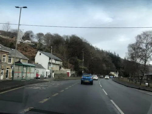

Marmaris Grill
Restaurant · Kebab, Grill · 0.5 mi
9 High Street, Caerphilly
Mo-Fr 16:00-23:00; Sa 15:00-23:00; Su 16:00-23:00
Masala Indian Takeaway
Restaurant · Indian · 0.5 mi
16 Victoria Terrace, Caerphilly
Mo 17:30-23:00; Tu Off; We-Th 17:30-23:00; Fr-Sa 17:30-23:30; Su...

Three Horseshoes
Bar and pub · 1.4 mi
High Street, Caerphilly
Mo-Su 12:00-23:00
The Patriot
Bar and pub · 0.8 mi
Main Street, Crumlin
Mo Off, Tu Off; We Off, Th 20:00-23:00; Fr 19:00-00:00; Sa...

Terrace Cafe
Cafe · Breakfast, Sandwich, Cake · 0.5 mi
10 Victoria Terrace, Caerphilly
Mo-Fr 09:00-15:00; Sa 09:00-14:00; Su Off
The New Forge
Bar and pub · 1.8 mi
Penywaun Close, Caerphilly
Mo-Th 09:30-23:00; Fr-Sa 09:30-00:00; Su 09:30-22:30
At A.M
Cafe · Coffee Shop, Bakery, Doughnut, Sandwich · 1.7 mi
Darren Drive, Abercarn
Mo-We 08:00-15:00; Th-Fr 08:00-18:00; Sa 09:00-16:00; Su 10:00-16:00
Cwtchers
Bar and pub · 1.5 mi
45-47 High Street, Caerphilly
Mo 19:00-00:00; Tu Off; We 19:00-00:00; Th Off; Fr 19:00-00:00; Sa...
Newbridge Hotel
Bar and pub · 0.6 mi
High Street, Caerphilly
Mo-Th 12:00-23:00; Fr-Sa 12:00-00:00; Su 12:00-19:30
Market Tavern
Bar and pub · 1.3 mi
Market Place, Newport
Mo-We 11:00-23:00; Th 11:00-22:00; Fr 11:00-24:00; Sa 12:00-24:00;...
10 more on the map.
History
The town is located within the historic boundaries of Monmouthshire, considered by some to be a part of England until the late 20th century.
In medieval times what are now the separate townships of Abercarn, Cwmcarn and Newbridge were known as Abercarne, a manorial title which goes back to the Norman period. Until quite recently the three townships were also within the boundaries of the ancient parish of Mynyddislwyn.
Newbridge, as its name implies, was the name of land around the "new bridge" built across the Ebbw River towards the end of the 18th century. Newbridge was then a predominantly Welsh agrarian community of rural farms and sheep pasture with a low population.
In the valley, the chief farms were Ty-Llydd, where the new vicarage now stands, Tynewydd, where the Newbridge Hotel stands, Ty-hir, the house which stands next to the Beaufort Arms, and the Newbridge corn mill which stood near the South Celynen Colliery. The modern road pattern did not exist—all activity and commerce took place along the mountain tracks, which led over Mynyddislwyn and Mynydd Maen. Adjacent to the tracks were the more prosperous farms, Hyfod Fach, Glanshon and Cillonydd.
From the History section of Newbridge, Caerphilly on Wikipedia, under CC BY-SA 4.0.
More about Newbridge
Education
Newbridge Secondary School (formerly known as Newbridge Comprehensive School and Newbridge Grammar School before that) is located in the town, catering for ~1000 pupils aged 11 to 16.
Tynewydd Primary School in Greenfield, Pantside Primary School, and Pentwynmawr Primary School cater for 4-11 year olds.
From the Wikipedia article Newbridge, Caerphilly, under CC BY-SA 4.0.
Notable people from Newbridge
 Steve StrangeWelsh singer (1959–2015)Photo: Logan Sky, CC BY-SA 4.0
 Kim SimmondsBritish rock musician (1947–2022)Photo: Jim Summaria, CC BY-SA 3.0
 Lee WalkerWelsh snooker playerPhoto: Benutzer:Bill da Flute, CC BY-SA 3.0
 Jack DixonWelsh rugby union playerPhoto: Stefano Delfrate, CC BY-SA 2.0
- Angus McBeanBritish photographer (1904-1990)
- Llew SmithWelsh Labour politician (1944-2021)
- William MarshWelsh cricketer (1917-1978)
- Paul SheppardWelsh racing cyclist
- Jack JenkinsWelsh rugby union player (1880-1971)
- George ParsonsWelsh rugby union and rugby league footballer (1926–2009)
- Paul TurnerWelsh rugby union footballer and coach
- John JenkinsWelsh rugby union and rugby league footballer (1880-1971)
Born in Newbridge, according to Wikidata (CC0). Each name links to its Wikipedia article.
Where to stay3
Churches and places of worship12
Shopping2
Gas and EV charging1
Schools, colleges and libraries11
Healthcare1
Map of Newbridge
60 places. The map loads OpenStreetMap tiles when you open it.
Getting there and nearby towns
Cardiff Airport (CWL) is the nearest airport with scheduled flights listed in OpenStreetMap, 21 miles away.
- Abercarn 1 mi south, about 2 min by car
- Blackwood 3 mi west, about 5 min by car
- Risca 4 mi south, about 7 min by car
- Pontypool 4 mi northeast, about 7 min by car
- Abertillery 4 mi north, about 7 min by car
- Bargoed 4 mi west, about 7 min by car
- Cwmbran 5 mi east, about 8 min by car
- Gelligaer 5 mi west, about 8 min by car
- Nelson 7 mi west, about 11 min by car
- Newport 8 mi southeast, about 13 min by car
Drive times are estimates from straight-line distance, not routes.
Towns near Newbridge


Keep exploring
Local news
Headlines from INDB.
Reviews, tips and questions
Loading what members have shared...
Sources and licences
- GeoNames (CC BY 4.0): population, coordinates, regions and time zone
- Mapillary (see each image): photos
- OpenStreetMap contributors (ODbL 1.0): places, airports, map data
- Wikidata (CC0 1.0): elevation, founding date, time zone, website, landmarks and historic places
- Wikimedia Commons (see each image): photos
- Wikipedia (CC BY-SA 4.0): overview and history text
Photo credits
- Newbridge, Older housing, Graham Horn, CC BY-SA 2.0
- Crumlin Viaduct. [graphic] / On the Taff Vale extension of the West Midland Railway - constructed exclusively of iron - length 1658 feet - height 200 feet - designed and erected by T. W. Kenard Esqr., Unknown author, Public domain
- St Luke's Church, Abercarn 062, Lewis Hulbert, CC BY-SA 3.0
- Crumlin Navigation Colliery - Chimney, Powerhouse and North Winding House, Lauratrefor, CC BY-SA 4.0
- Street-level photo, laye, CC BY-SA 4.0
- Street-level photo, laye, CC BY-SA 4.0
- Street-level photo, southglos, CC BY-SA 4.0
- Street-level photo, laye, CC BY-SA 4.0
- Street-level photo, southglos, CC BY-SA 4.0
- Street-level photo, laye, CC BY-SA 4.0
- Street-level photo, southglos, CC BY-SA 4.0
- Street-level photo, laye, CC BY-SA 4.0
Page built November 10, 2026. Spotted a mistake? Tell us or suggest a place.