




Why visit Peaslake
Townapedia lists 2 museums and landmarks, 7 parks and trails, 4 places to eat, 2 places to stay and 1 attraction in and around town.
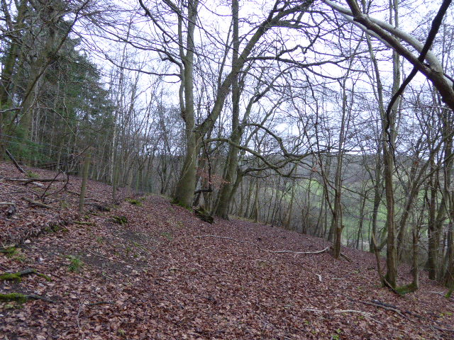
Highlights include Abinger Common War Memorial, Colekitchen Down and Cucknell's Wood.
Weather in Peaslake
Forecast from MET Norway (CC BY 4.0). Full forecast
About Peaslake
Peaslake, Hoe and Colman's Hill are in the centre of the Surrey Hills National Landscape and mid-west of the Greensand Ridge about 5 miles (8.0 km) ESE of Guildford. Surrounded by denser pine and other coniferous forest-clad hills, the three conjoined settlements have a small core in Peaslake itself with the amenities of a village, but are otherwise lightly scattered settlements at a higher elevation than the centre of Shere, the civil parish.
From the Wikipedia article Peaslake (this version), under CC BY-SA 4.0.
Things to do1

Museums and landmarks2

Abinger Common War Memorial
Monument and historic site · 1.9 mi
War memorial in Abinger, Mole Valley, Surrey, England, UK

Parks, trails and playgrounds7




Restaurants and cafes4

Hurtwood Hideout Cafe
Cafe · 1.1 mi
Radnor Lane, Holmbury St Mary
We-Su 09:00-16:00

History
The earliest mention of Peaslake was in 1784, when Francis Haybitle, a farm labourer "of Peaslake", left (to the vestry) a rentcharge of 15s. a year on a cottage in Shere to provide bread for the poor.
Peaslake School was founded by George Cubitt (the 1st Lord Ashcombe), Mr. Justice Bray, the Misses Spottiswoode, and others in 1870. John Bartholomew mentions the place in his gazetteer of 1887 as a village in Shere parish, Surrey "4½ miles SE. of Guildford". In the last decade of the 19th century a road from Ewhurst, practicable for wheeled vehicles, was the first one brought into Peaslake as district councils were instituted. It was formerly accessible from the north, but was on the edge of the accessible country with no real road beyond. A Working Men's Institute that no longer exists was built in 1891 by the Misses Spottiswoode of Drydown, multiple benefactors to the neighbourhood. Most of the oldest extant houses were built in the brief Edwardian period (1901–1911).
The writer, Ralph Lawrence, recalls hearing the guns on the Western Front while walking in Hurtwood in the First World War.
From the History section of Peaslake on Wikipedia, under CC BY-SA 4.0.
More about Peaslake
Geography
Peaslake is set in rolling meadows and forests in terms of topography, soil type and land use. Access to the village by car can only be gained by using roads which are at some point single track, which gives visitors the feel that it is more remote than it is, and which makes it quieter than the villages closer to the A25. The position, in one of the most uniformly forested parts of the Greensand Ridge, provides a variety of trees on varying terrain.
The scattered settlement with a core at Peaslake is between 110 and 210 m (360 and 690 ft) above sea level. All three adjoining small settlements are in the centre of the Surrey Hills and about 5 miles (8.0 km) from Guildford.
The Law Brook, a tributary of the Tillingbourne, has a source within the parish.
In total, with 3,000 acres (1,200 ha) of surrounding forest, the Hurtwood comprises: Holmbury Hill, Pitch Hill, Winterfold, Shere Heath, Farley Heath and part of Blackheath Common. It is largely common land and is maintained by the Friends of the Hurtwood. Three of the nine car parks within Hurtwood are closest to Peaslake.
Almost 1 mile (1.6 km) east of Pitch Hill, wholly within Shere parish bounds and slightly closer to Holmbury St Mary, is Holmbury Hill – this is a Bronze Age multivallate hill fort; its elevation is 261 m (856 ft) AOD. Further to the east is Wotton and Abinger Commons.
From the Wikipedia article Peaslake, under CC BY-SA 4.0.
Notable people from Peaslake
- Jocelyn Frere AdburghamEnglish architect and town planner (1900–1979)
Born in Peaslake, according to Wikidata (CC0). Each name links to its Wikipedia article.
Where to stay2
Churches and places of worship6
Shopping1
Schools, colleges and libraries3
Map of Peaslake
26 places. The map loads OpenStreetMap tiles when you open it.
Getting there and nearby towns
London Gatwick Airport (LGW) is the nearest airport with scheduled flights listed in OpenStreetMap, 11 miles away.
- Ewhurst 3 mi south, about 4 min by car
- Cranleigh 4 mi southwest, about 6 min by car
- Westcott 4 mi northeast, about 6 min by car
- Chilworth 4 mi northwest, about 7 min by car
- West Horsley 5 mi north, about 8 min by car
- Dorking 6 mi northeast, about 9 min by car
- Guildford 6 mi northwest, about 10 min by car
- Capel 6 mi southeast, about 10 min by car
- Great Bookham 7 mi northeast, about 11 min by car
- Godalming 7 mi west, about 12 min by car
Drive times are estimates from straight-line distance, not routes.
Towns near Peaslake


Keep exploring
Local news
Headlines from INDB.
Reviews, tips and questions
Loading what members have shared...
Sources and licences
- GeoNames (CC BY 4.0): population, coordinates, regions and time zone
- Mapillary (see each image): photos
- OpenStreetMap contributors (ODbL 1.0): places, airports, map data
- Wikidata (CC0 1.0): elevation, founding date, time zone, website, landmarks and historic places
- Wikimedia Commons (see each image): photos
- Wikipedia (CC BY-SA 4.0): overview and history text
Photo credits
- Peaslake War Memorial, Peaslake Lane, Peaslake, Surrey 02, Mertbiol, CC0
- Peaslake War Memorial, Peaslake Lane, Peaslake, Surrey 01, Mertbiol, CC0
- Abinger Common War Memorial, Abinger Lane, Abinger Common, Surrey 01, Mertbiol, CC0
- Colekitchen Down (4), Dudley Miles, CC BY-SA 4.0
- Cucknell's Wood (1), Dudley Miles, CC BY-SA 4.0
- Sayer's Croft (2), Dudley Miles, CC BY-SA 4.0
- Christ Church, Cranleigh Road, Shamley Green (May 2014) (2), Hassocks5489, CC0
- Old St Peter and Paul Albury view from south-east, BabelStone, CC BY-SA 4.0
- St Mary the Virgin's Church, Horsham Road, Holmbury St Mary (March 2014, from North) (2), Hassocks5489, CC0
- Peaslake, St Mark's Church, view, AndyScott, CC BY-SA 4.0
- Oxmoorcopse, Suzanne Knights at en.wikipedia, Public domain
- Street-level photo, richardc, CC BY-SA 4.0


Page built November 10, 2026. Spotted a mistake? Tell us or suggest a place.