


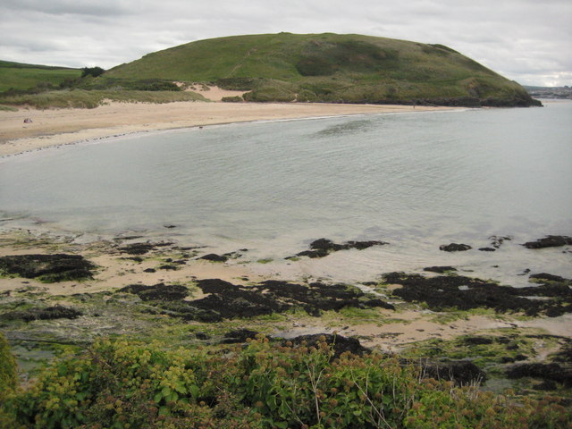

Why visit Polzeath
Townapedia lists 3 museums and landmarks, 9 parks and trails, 13 places to eat, 9 places to stay and 2 attractions in and around town.
Highlights include Brea Hill, Prideaux Place, Whitewater Contemporary and Daymer Bay.
Weather in Polzeath
Forecast from MET Norway (CC BY 4.0). Full forecast
About Polzeath
Polzeath (; Cornish: Pollsygh, lit. 'dry pool') is a small seaside resort village in the civil parish of St Minver in Cornwall, England, United Kingdom. It is approximately 6 miles (9.7 km) north west of Wadebridge on the Atlantic coast.
From the Wikipedia article Polzeath (this version), under CC BY-SA 4.0.
Photos of Polzeath


Things to do2


Museums and landmarks3

Prideaux Place
Museum · 2.2 mi
Grade I listed historic house museum in Padstow, United Kingdom

Parks, trails and playgrounds9




Restaurants and cafes13
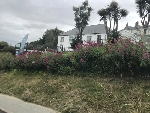
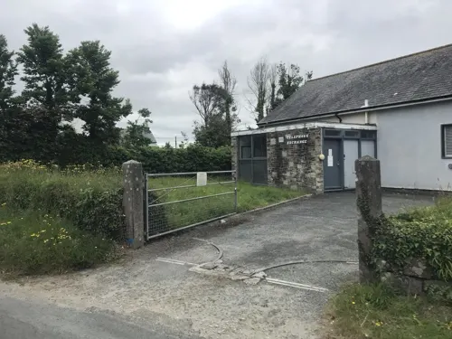
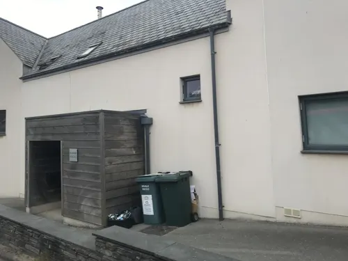
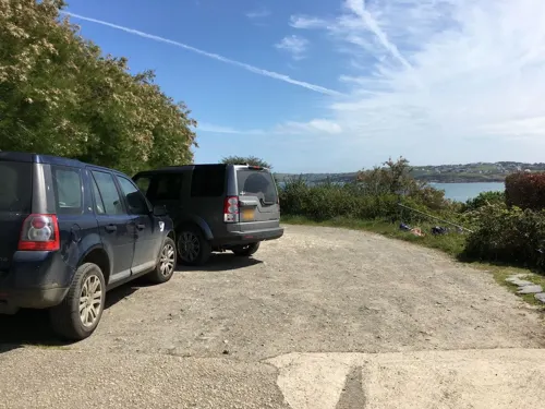


1 more on the map.
History
In 1911, a Methodist chapel was built on the road towards Trebetherick at Chapel Corner. The original building was demolished in 1932, when the village street was widened and a new chapel was opened on 15 April 1933. Since 2006, the chapel has been called the Tubestation, and is an active church with services every Sunday. The rest of the week it is a surfers cafe.
Until 1934, the main street through the village crossed the stream by means of a ford and a footbridge was provided for pedestrians, although this was sometimes washed away by winter storms. For vehicles, the road surface stopped short of the ford, and cars splashed through the water on a sandy area, occasionally causing vehicles to become stuck in the sand. In 1934, the current road bridge was built, with a low wall separating the road from the sandy beach.
During World War II, the beach would, alongside other beaches in Cornwall, have barbed wire on it in preparation for a German naval invasion.
The winter storms of 2014 changed the topography of the beach, creating a sand bar up to 1m high, located at approximately the high tide mark, a feature that was not previously recorded. This was gradually washed away, so that by 2019, the beach had returned to the even slope visible in pictures up to 2014.
From the History section of Polzeath on Wikipedia, under CC BY-SA 4.0.
More about Polzeath
Geography
The catchment surrounding Polzeath is approximately 40,900 hectares and is drained by several streams. The Polzeath Brook stream rises near St Minver 2 miles (3.2 km) to the east, and with several tributaries drains farmland before flowing through the middle of the Valley Caravan Park campsite and into the sea across Polzeath beach. The Trenant Stream is 900m long and also crosses the beach, this time entering from the north-east corner. There is also a small stream 1.5 kilometres long, which flows onto Pentireglaze beach (also known as Baby Bay) which is at the northern end of Polzeath beach but is separated from it at high tide by Slipper Point.
Shilla Mill at the edge of Polzeath, stands at the confluence of the streams. Built around 1590, it ceased working as a mill in 1885 and was converted into a house.
Economy
Tourism developed in the 19th and 20th centuries to be the most significant part of the local economy. UK Prime Minister David Cameron and his wife holidayed there between 2010 and 2015.
The beach is a favourite destination for wealthy teenagers from independent schools who often engage in anti-social behaviour. In July 2022, police imposed a two-day 10pm curfew after drunken late-night beach parties of around 200 teenagers consistently got out of hand. Residents found broken prosecco bottles littering the beach, bonfires on the beach that were made from benches, fences and shed doors stolen from local houses and emergency life-saving equipment was vandalised. Local resident Andy Stewart, a former police officer, said the teenagers were often children of million-pound second home owners in the nearby village of Rock. He said, "They don't realise there is excessive drinking, cocaine, nitrous oxide, underage sex and big fires." Stewart has refused to identify the schools where many of the teenagers study, though he has been in contact with their senior staff. In 2023 a CCTV camera system was installed to watch the beach, along with rechargeable floodlights.
From the Wikipedia article Polzeath, under CC BY-SA 4.0.
Notable people from Polzeath
- Patrick Howard Nowell-Smithphilosopher, 1914-2006
Born in Polzeath, according to Wikidata (CC0). Each name links to its Wikipedia article.
Where to stay9
Churches and places of worship3
Shopping4
Gas and EV charging1
Schools, colleges and libraries1
Map of Polzeath
45 places. The map loads OpenStreetMap tiles when you open it.
Getting there and nearby towns
Cornwall Airport Newquay (NQY) is the nearest airport with scheduled flights listed in OpenStreetMap, 9 miles away.
- Delabole 9 mi northeast, about 14 min by car
- Tintagel 10 mi northeast, about 16 min by car
- Bodmin 11 mi southeast, about 17 min by car
- Newquay 13 mi southwest, about 20 min by car
- St Austell 17 mi south, about 27 min by car
- Truro 22 mi south, about 35 min by car
- Pensilva 23 mi east, about 36 min by car
- Polperro 24 mi southeast, about 39 min by car
- Redruth 27 mi southwest, about 43 min by car
- Falmouth 29 mi south, about 47 min by car
Drive times are estimates from straight-line distance, not routes.
Towns near Polzeath


Keep exploring
Local news
Headlines from INDB.
Reviews, tips and questions
Loading what members have shared...
Sources and licences
- GeoNames (CC BY 4.0): population, coordinates, regions and time zone
- Mapillary (see each image): photos
- OpenStreetMap contributors (ODbL 1.0): places, airports, map data
- Wikidata (CC0 1.0): elevation, founding date, time zone, website, landmarks and historic places
- Wikimedia Commons (see each image): photos
- Wikipedia (CC BY-SA 4.0): overview and history text
Photo credits
- Polzeath November 2011 - panoramio, westernworld, CC BY 3.0
- Padstow Prideaux Place 01, Olaf Tausch, CC BY 3.0
- St Enodoc's Church, Trebetheric, Cornwall 01, Matthew Lemin, CC BY-SA 3.0
- Daymer Bay, myself, CC BY-SA 3.0
- DaymerBayBreaHillCornwallUK, Philip Halling, CC BY-SA 2.0
- My spare tyre (4446778293), DeepBluC from Bristol, U.K., CC BY 2.0
- Limonium britannicum Ssp.britannicum (6306241171), Len Worthington, CC BY-SA 2.0
- Cornwall air ambulance - take-off from putting green - August 2008, Tagishsimon, CC BY-SA 3.0
- DSC08321 (9659148324), Steve Elliott from UK, CC BY-SA 2.0
- DSC08290 (9659146084), Steve Elliott from UK, CC BY-SA 2.0
- Pentireglaze Haven. - panoramio, Bob&Anne Powell, CC BY-SA 3.0
- Street-level photo, miguel_andrade, CC BY-SA 4.0
- Street-level photo, miguel_andrade, CC BY-SA 4.0
- Street-level photo, miguel_andrade, CC BY-SA 4.0
- Street-level photo, miguel_andrade, CC BY-SA 4.0
- Street-level photo, miguel_andrade, CC BY-SA 4.0
- Street-level photo, miguel_andrade, CC BY-SA 4.0
- Street-level photo, miguel_andrade, CC BY-SA 4.0
- Street-level photo, miguel_andrade, CC BY-SA 4.0
- Street-level photo, miguel_andrade, CC BY-SA 4.0
- Street-level photo, miguel_andrade, CC BY-SA 4.0
- Street-level photo, miguel_andrade, CC BY-SA 4.0
- Street-level photo, miguel_andrade, CC BY-SA 4.0
- Street-level photo, geow, CC BY-SA 4.0
- Street-level photo, miguel_andrade, CC BY-SA 4.0
- Street-level photo, WaggyDog, CC BY-SA 4.0
- Street-level photo, miguel_andrade, CC BY-SA 4.0
- Street-level photo, miguel_andrade, CC BY-SA 4.0
- Street-level photo, miguel_andrade, CC BY-SA 4.0
Page built November 10, 2026. Spotted a mistake? Tell us or suggest a place.