


Porthleven, United Kingdom
Porthleven is a town of 3,059 people in England, United Kingdom.
Why visit Porthleven
Townapedia lists 5 museums and landmarks, 6 parks and trails, 23 places to eat, 7 places to stay and 1 attraction in and around town.
Highlights include The Flambards Experience, Monument to H M Grylls and Museum of Cornish Life.
Weather in Porthleven
Forecast from MET Norway (CC BY 4.0). Full forecast
About Porthleven
Porthleven (; Cornish: Porthelvan [pɔrθˈɛlvan] (cove of St Elvan) or sometimes Porthlynn [pɔrθlɪnː] (cove of the lake)) is a town, civil parish and fishing port in Cornwall, UK. The most southerly port in Great Britain, it was a harbour of refuge when this part of the Cornish coastline was infamous for wrecks in the days of sail. The South West Coast Path from Somerset to Dorset passes through the town. At the 2021 census, the population of the parish was 3,117.
From the Wikipedia article Porthleven (this version), under CC BY-SA 4.0.
Travel tips from other travellers: Porthleven on Wikivoyage (CC BY-SA 4.0).
Photos of Porthleven


Things to do1

The Flambards Experience
Monument and historic site · 2.6 mi
Amusement park in Cornwall, England
Museums and landmarks5

Monument to H M Grylls
Monument and historic site · 1.9 mi
Monument in Helston, United Kingdom

Museum of Cornish Life
Museum · 2.1 mi
Local museum in Helston, Cornwall, England, UK
Loe Bar Wreck
Monument and historic site · 1.9 mi
Shipwreck in Cornwall, England, UK
Parks, trails and playgrounds6


Restaurants and cafes23




Harbour View Cafe
Restaurant · Fish
Mount Pleasant Road, Helston
11 more on the map.
History
Methleigh was the site of a fair and annual market from the year 1066. After the Norman Conquest, the Bishop of Exeter held the manor of Methleigh, but the Earl of Cornwall possessed the right to hold the fair. At the time of the Domesday Survey there were 15 acres (6.1 ha) of arable land, 40 acres (16 ha) of pasture and 60 acres (24 ha) of underbrush. The population consisted of 15 villeins, 4 smallholders and 3 serfs.
Until 1844 Porthleven was within the parish of Sithney. The parish Church of St Bartholomew was built in 1842. The name Porthleven is probably connected with St Elwen or Elwyn, whose chapel existed here before 1270. It was rebuilt about 1510, but destroyed in 1549. There were also chapels at Higher Penrose and Lanner Veor (the latter founded in 1377) and a holy well at Venton-Vedna. The Vicar of Porthleven in the 1850s was the Rev. Thomas Lockyer Williams, a Tractarian who introduced practices into the parish which provoked dislike in the Rev. Canon John Rogers of Penrose, Rector of Mawnan and a canon of Exeter.
Read more of the history
Porthleven's most recognisable building is the Bickford-Smith Institute next to the pier and harbour entrance. It was built on the site of the old Fisherman's Arms and was opened on 16 December 1884. The clock tower on the west corner is 70 feet (21 m) high. The building originally had a reading room, a committee room, a curator's living room and two bedrooms. The Institute was grade II listed on 18 March 1991 and currently houses the town council and a snooker club. It featured (along with various other scenes from the town) as the incident room in an episode of the TV detective series Wycliffe. A picture of the building against a large breaking wave sometimes appears in the background of BBC UK weather forecasts, particularly when windy conditions and rough seas are expected. The Institute has a plaque to Guy Gibson VC, leader of the Dambuster Raid, on the wall facing the harbour. Gibson was born in India, but saw Porthleven – his mother's home town, where his parents were married – as a home town as well. He visited there while on leave during the war, sometimes attending the Porthleven Methodist Church. His name is marked on the community's war memorial (he was killed in 1944) and a street (Gibson Way) is named after him.
William Cookworthy acquired leases on the Tregonning Hill quarries and shipped china clay to his porcelain factory in Plymouth. In 1826, 150 tons of china stone and 30 tons of china clay were exported, and in 1838, 500 tons of china stone. By 1876, 970 tons were exported and in 1883, 1002 tons. Granite was also exported, from the quarries at Coverack Bridges and Sithney.
Fifty-two fishing boats were built between 1877 and 1883, employing at times up to twenty people. They ranged in length from 22 feet (6.7 m) to 55 feet (17 m) and were built not only for Mount's Bay ports, but for others in the UK and in South Africa.
Overnight on 12–13 December 1978, Police Constables Joseph James Childs and Martin Ross Reid of Devon and Cornwall Police were killed when their patrol car was swept into the harbour during a heavy storm. A stone memorial was erected on the south-facing harbour wall.
Due to the prevailing westerly winds, it was easy for a ship under sail to be trapped in Mount's Bay and wrecked nearby. The Royal National Lifeboat Institution opened Porthleven Lifeboat Station in 1863. A boat house was built at Breageside, from where the boat was taken to the water on a carriage. The Agar Robartes was replaced by the Charles Henry Wright (named after the donor) in November 1882. A boat house on the west side of the harbour entrance was opened in 1894, with a slipway to ease launching. The station was closed in 1929, as the neighbouring stations at The Lizard and Penlee had been equipped with motor lifeboats that could cover the whole bay. The slipway was dismantled and the boat house used as a store for a while. It has since become the Shipwreck Centre museum.
From the History section of Porthleven on Wikipedia, under CC BY-SA 4.0.
Notable people from Porthleven
- Chris CraftBritish racing driver and engineer
- Augustine Podmore WilliamsEnglish sailor
- Pender Hodge CudlipEnglish clergyman, theologian and writer
- Claude Ernest DolmanCanadian microbiologist
Born in Porthleven, according to Wikidata (CC0). Each name links to its Wikipedia article.
Where to stay7
Churches and places of worship4
Shopping3
Schools, colleges and libraries1
Healthcare1
Map of Porthleven
51 places. The map loads OpenStreetMap tiles when you open it.
Getting there and nearby towns
Land's End Airport (LEQ) is the nearest airport with scheduled flights listed in OpenStreetMap, 16 miles away.
- Helston 2 mi northeast, about 4 min by car
- Mullion 5 mi southeast, about 8 min by car
- Marazion 8 mi west, about 12 min by car
- Camborne 9 mi north, about 14 min by car
- Four Lanes 9 mi northeast, about 14 min by car
- Uny Lelant 9 mi northwest, about 14 min by car
- Penzance 10 mi west, about 16 min by car
- Redruth 11 mi north, about 18 min by car
- Falmouth 12 mi northeast, about 19 min by car
- Mylor Bridge 12 mi northeast, about 20 min by car
Drive times are estimates from straight-line distance, not routes.
Towns near Porthleven


Keep exploring
Local news
Headlines from INDB.
Reviews, tips and questions
Loading what members have shared...
Sources and licences
- GeoNames (CC BY 4.0): population, coordinates, regions and time zone
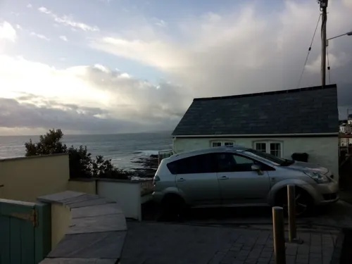
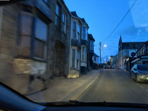
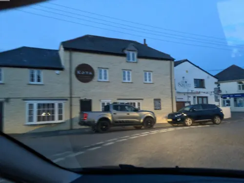
- Mapillary (see each image): photos
- OpenStreetMap contributors (ODbL 1.0): places, airports, map data
- Wikidata (CC0 1.0): elevation, founding date, time zone, website, landmarks and historic places
- Wikimedia Commons (see each image): photos
- Wikipedia (CC BY-SA 4.0): overview and history text
Photo credits
- Moonflower Chinese restaurant, Fore Street, Porthleven, November 2024, Gazamp, CC BY-SA 4.0
- Street signs for Church Row, Porthleven, November 2024, Gazamp, CC BY-SA 4.0
- Kitto's Field car park, Porthleven, November 2024, Gazamp, CC BY-SA 4.0
- Christadelphian Hall, Porthleven, November 2024 (1), Gazamp, CC BY-SA 4.0
- Christadelphian Hall, Porthleven, November 2024 (2), Gazamp, CC BY-SA 4.0
- St Bartholomew's Church, Porthleven, November 2024 (1), Gazamp, CC BY-SA 4.0
- St Bartholomew's Church, Porthleven, November 2024 (4), Gazamp, CC BY-SA 4.0
- Fore Street, Porthleven, November 2024, Gazamp, CC BY-SA 4.0
- St Bartholomew's Church, Porthleven, November 2024 (3), Gazamp, CC BY-SA 4.0
- St Bartholomew's Church, Porthleven, November 2024 (2), Gazamp, CC BY-SA 4.0
- Grylls Monument, Helston (4942350267), Tim Green from Bradford, CC BY 2.0
- Museum of Cornish Life, Market Place, Helston, Cornwall - August 2024, Mutney, CC0
- Breage Parish Church (Taken by Flickr user 13th August 2013), Flickr user:Tim Green aka atouch, CC BY 2.0
- TheHarbourInn, Hanton01, CC BY-SA 4.0
- St. Bartholomew, Porthleven (9565426500), Tim Green from Bradford, CC BY 2.0
- Memorial Lamp To King George V, Peter Glyn, CC BY-SA 3.0
- DSC 6716-HDR-Edit-1, Hanton01, CC BY-SA 4.0
- Former Smithy, Now Part Of The Ship Inn, Peter Glyn, CC BY-SA 3.0
- Street-level photo, livingwithdragons, CC BY-SA 4.0
- Street-level photo, WaggyDog, CC BY-SA 4.0
- Street-level photo, WaggyDog, CC BY-SA 4.0
- Street-level photo, WaggyDog, CC BY-SA 4.0
- Street-level photo, WaggyDog, CC BY-SA 4.0
- Street-level photo, WaggyDog, CC BY-SA 4.0
- Street-level photo, WaggyDog, CC BY-SA 4.0
- Street-level photo, WaggyDog, CC BY-SA 4.0
- Street-level photo, WaggyDog, CC BY-SA 4.0
- Street-level photo, WaggyDog, CC BY-SA 4.0
- Street-level photo, livingwithdragons, CC BY-SA 4.0
- Street-level photo, WaggyDog, CC BY-SA 4.0
- Street-level photo, WaggyDog, CC BY-SA 4.0
- Street-level photo, livingwithdragons, CC BY-SA 4.0
- Street-level photo, WaggyDog, CC BY-SA 4.0
- Street-level photo, livingwithdragons, CC BY-SA 4.0
- Street-level photo, livingwithdragons, CC BY-SA 4.0


Page built November 10, 2026. Spotted a mistake? Tell us or suggest a place.