


Why visit Rake
Townapedia lists 1 museum or landmark, 4 parks and trails, 11 places to eat and 2 attractions in and around town.
Highlights include Liss War Memorial, Liss Riverside Railway Walk North and Liss Riverside Railway Walk South.
Weather in Rake
Forecast from MET Norway (CC BY 4.0). Full forecast
About Rake
Rake is a small rural village lying astride the B2070 road and the border between West Sussex and Hampshire in southeast England. The B2070 was formerly the A3 London to Portsmouth trunk road, but Rake, several other villages, and the town of Petersfield, are now by-passed. Rake lies between the villages of Liphook and Hill Brow. Part of the village is in East Hampshire District and part in Chichester District; similarly the village is served by two civil parish councils, Liss and Rogate, and by two ecclesiastical parishes.
From the Wikipedia article Rake, West Sussex (this version), under CC BY-SA 4.0.
Things to do2


Museums and landmarks1

Parks, trails and playgrounds4


Restaurants and cafes11
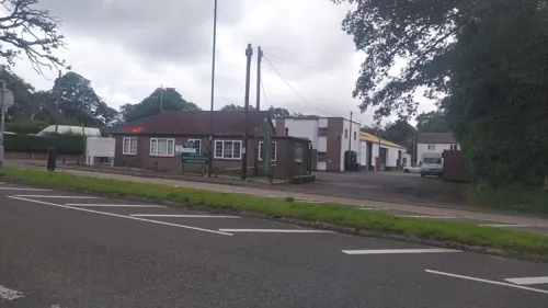
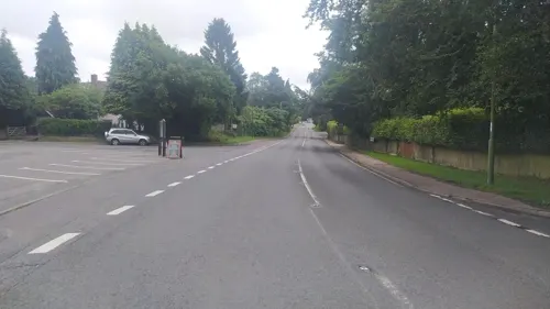
The Flying Bull
Bar and pub
London Road, Rake, Liss
Mo-Th 12:00-14:30,17:00-22:00; Fr,Sa 12:00-22:00; Su 12:00-17:00
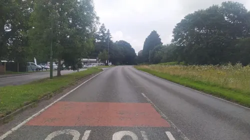

Turtle Bean Cafe
Cafe · Coffee Shop · 1.5 mi
41-43 Station Road, Liss
Mo-Fr 08:00-16:00; Sa 09:00-16:00; Sa 09:00-13:00. Closed Bank...



Sea Salt
Fast food · Fish And Chips · 1.5 mi
Telephone orders welcome.
49-51 Station Road, Liss
Mo-Th 11:30-14:00,17:00-22:00;Fr-Sa 11:30-14:00,16:30-22:00; PH 17:00-22:00
Chef China
Fast food · Chinese · 1.4 mi
4 Station Road, Liss
Su, Tu-Th 17:00-22:30; Fr-Sa 17:00-23:00; PH 17:00-22:30 || "Open...
History
Mail coaches travelled the road through Rake from 1784, and Charles Harper opined that there was "no road so wild and lonely as the Portsmouth Road". Most of the journey would have been through commons, wasteland and woods, and Rake was no exception.
There were several pubs in Rake owing to the importance of the route between London and Portsmouth. The Flying Bull pub, which straddles the border between West Sussex and Hampshire, had been in operation for some years (occupier Mr Eames, who was retiring) when the Hampshire Chronicle advertised its sale in 1775, on the great Post and Turnpike Road from London to Portsmouth, with 2 Stables and other convenient Buildings, all in exceeding good repair, a large pleasant Garden, and two Acres of Land adjoining. Also a Blacksmith’s Shop on the Premises, which is all Freehold. The Stock of Liquors and Brewing Utensils to be taken at a fair Appraisement. Across the road was the Red Lion, which was the scene of a murder in 1748 committed by members of the Hawkhurst Gang. The innkeeper, named Scardefield, was sympathetic to the gang. The gang buried one of their victims in the sand, possibly still alive, near the inn, which is now a private residence. The Sun Inn had existed at least as early as 1786, when the murderers of the Unknown Sailor were apprehended there the following day, trying to sell his bloodstained jacket.
Read more of the history
In the 18th century, highway robbery was rife, whether petty thieving, robbery or even murder. A coach carrying cash for sailors' wages worth several thousand pounds overturned on Rake Hill, and would have been robbed had the boxes not been so heavy. A party of marines intervened, eventually.
Large private properties were built in Rake, particularly on the hill towards Hill Brow, by and for people of means ("pretentious country residences", according to Charles Harper). Some of these subsequently became care homes. The road had been turnpiked mid-century, and there was a toll-house near The Flying Bull.
In 1986 there was a double murder on Chapel Common, Rake, where Peter Thurgood and Lindy Benstead were shot. It remains unsolved, despite an appeal by the BBC in 2021, and is one of Britain's oldest cold cases.
Amenities in the 20th century were various - Rake working Men's Club existed from 1920 to 1979; The George Street Trust for Milland and Rake was set up in 1962 for the prevention and relief of poverty; a police house existed in the village for most of the 20th century; Rake Store existed at least from 2005 to 2012, then from 2013 to 2015, when it closed permanently. For part of this time it hosted the village post office, but this was transferred to a Post Office Outreach Service at the garden centre, but this was withdrawn in 2025.
The former Sun Inn closed in 2011, and became residential. The former Red Lion pub was renamed Court Barn and for 50 years had housed a greyhound-rehoming trust, but closed in 2025. In 2021, properties in the village averaged £687,000. The Flying Bull pub and hotel was advertised for sale in February 2026 for £625,000.
In what was declared to be a record planning application, plans to build 68 new homes on the site of the closed Heathmount Nursing Home and two neighbouring care homes were being considered in 2025. Heathmount had recently been used for police dog training; the entire site covers 2.7 ha.
From the History section of Rake, West Sussex on Wikipedia, under CC BY-SA 4.0.
More about Rake
Geography
Rake is split between two counties (Hampshire and West Sussex), two parishes (Liss and Rogate) and two district councils (East Hampshire and Chichester). A detailed GENUKI map shows the splits, and the extent of housing and amenities in the village. Most of the developments along the main road are in West Sussex, though most of the properties at the end of the 19th century were on the Hampshire side of the road.
The village lies within the South Downs National Park and features in its development plans for 2021-2033 and 2017-2035.
There are considerable areas of woodland and common land surrounding the village, which has an elevation range of 122 to 160m. The village is on the Serpent Trail.
From the Wikipedia article Rake, West Sussex, under CC BY-SA 4.0.
Churches and places of worship5
Schools, colleges and libraries3
Healthcare1
Map of Rake
27 places. The map loads OpenStreetMap tiles when you open it.
Getting there and nearby towns
Goodwood Aerodrome (QUG) is the nearest airport with scheduled flights listed in OpenStreetMap, 14 miles away.
- Petersfield 4 mi southwest, about 7 min by car
- Bordon 5 mi north, about 8 min by car
- South Harting 5 mi south, about 8 min by car
- Haslemere 7 mi northeast, about 12 min by car
- Alton 9 mi northwest, about 14 min by car
- Farnham 12 mi north, about 19 min by car
- Waterlooville 14 mi southwest, about 22 min by car
- Havant 14 mi southwest, about 23 min by car
- Emsworth 14 mi south, about 22 min by car
- Aldershot 15 mi north, about 24 min by car
Drive times are estimates from straight-line distance, not routes.
Towns near Rake


Keep exploring
Local news
Headlines from INDB.
Reviews, tips and questions
Loading what members have shared...
Sources and licences
- GeoNames (CC BY 4.0): population, coordinates, regions and time zone
- Mapillary (see each image): photos
- OpenStreetMap contributors (ODbL 1.0): places, airports, map data
- Wikidata (CC0 1.0): elevation, founding date, time zone, website, landmarks and historic places
- Wikimedia Commons (see each image): photos
- Wikipedia (CC BY-SA 4.0): overview and history text
Photo credits
- Tuxlith Chapel, Milland 1, Simon Burchell, CC BY-SA 3.0
- St. Luke's Church, Milland 2, Simon Burchell, CC BY-SA 3.0
- Street-level photo, noid, CC BY-SA 4.0
- Street-level photo, noid, CC BY-SA 4.0
- Street-level photo, noid, CC BY-SA 4.0
- Street-level photo, noid, CC BY-SA 4.0
- Street-level photo, noid, CC BY-SA 4.0
Page built November 10, 2026. Spotted a mistake? Tell us or suggest a place.