


Why visit Rock
Townapedia lists 4 museums and landmarks, 6 parks and trails, 14 places to eat, 8 places to stay and 1 attraction in and around town.
Highlights include Brea Hill, Prideaux Place, The National Lobster Hatchery and Daymer Bay.
Weather in Rock
Forecast from MET Norway (CC BY 4.0). Full forecast
About Rock
Rock (Cornish: Pennmeyn, meaning headland of stones) is a coastal fishing village in Cornwall, England, United Kingdom. It is opposite Padstow on the north-east bank of the River Camel estuary. The village is in the civil parish of St Minver Lowlands
From the Wikipedia article Rock, Cornwall (this version), under CC BY-SA 4.0.
Travel tips from other travellers: Rock on Wikivoyage (CC BY-SA 4.0).
Photos of Rock


Things to do1

Museums and landmarks4

Prideaux Place
Museum · 1.9 mi
Grade I listed historic house museum in Padstow, United Kingdom

Parks, trails and playgrounds6



Restaurants and cafes14
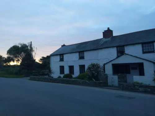





2 more on the map.
More about Rock
Geography
The main residential area is set back from the coast along the road from Pityme and St Minver. To the northeast, Rock is contiguous with the settlements of Splatt and Pityme. Stoptide is a southern extension of Rock. Rock is best known for its estuary frontage. To the northwest, the road runs beside the estuary as a cul de sac giving access to the ferry boarding point and an intertidal beach backed by sand dunes which at low water extend for two miles past Brea Hill to Daymer Bay. To the south is the small coastal settlement of Porthilly with St Michael's Church situated on the bank of Porthilly Cove.
Rock Dunes, sand dunes to the west of the village on the banks of the River Camel, are designated a Site of Special Scientific Interest for their flora and geology. These include various vegetation found in these embryo dunes as well as various types of slate.
Arts and culture
Rock is popular with holidaymakers and in 1881 the hotel was enlarged, a new sea-wall built and a bathing house erected on the beach. In the same year Silvanus Trevail designed and built two large villas. It is now a well-established centre for water sports including dinghy racing, waterskiing, windsurfing, and sailing. Rock Sailing Club's headquarters, in a converted warehouse on a wharf, is a local landmark. Rock Lifeboat Station was established in 1994. Rock has Cornwall's highest proportion of second homes in the county.
The Black Tor Ferry operates across the river to the town of Padstow, and this is a major source of tourist traffic through Rock. The early 21st century has seen extensive building work and increased prosperity for Rock. There are a large number of holiday homes, as well as a number of retail outlets. Rock is also home to Sharp's Brewery, a real ale brewery established as an independent in the mid-1990s, but taken over by Molson Coors in 2011 to secure the Doom Bar bitter brand.
Rock has been referred to as 'Britain's Saint-Tropez' and the 'Kensington of Cornwall' due to its popularity with affluent holidaymakers. The Daily Telegraph has also called it Chelsea-on-Sea and stated that David Cameron's favourite beer is brewed there.
Affluent visitors such as the late Mohamed Al-Fayed and Jay Kay of Jamiroquai would often arrive by helicopter.
From the Wikipedia article Rock, Cornwall, under CC BY-SA 4.0.
Where to stay8
Churches and places of worship5
Shopping10
Gas and EV charging1
Schools, colleges and libraries1
Map of Rock
50 places. The map loads OpenStreetMap tiles when you open it.
Getting there and nearby towns
Cornwall Airport Newquay (NQY) is the nearest airport with scheduled flights listed in OpenStreetMap, 9 miles away.
- Delabole 9 mi northeast, about 15 min by car
- Bodmin 10 mi southeast, about 15 min by car
- Tintagel 10 mi northeast, about 17 min by car
- Newquay 12 mi southwest, about 19 min by car
- St Austell 15 mi south, about 25 min by car
- Truro 21 mi south, about 33 min by car
- Pensilva 22 mi east, about 35 min by car
- Polperro 23 mi southeast, about 36 min by car
- Redruth 26 mi southwest, about 42 min by car
- Falmouth 28 mi south, about 46 min by car
Drive times are estimates from straight-line distance, not routes.
Towns near Rock


Keep exploring
Local news
Headlines from INDB.
Reviews, tips and questions
Loading what members have shared...
Sources and licences
- GeoNames (CC BY 4.0): population, coordinates, regions and time zone
- Mapillary (see each image): photos
- OpenStreetMap contributors (ODbL 1.0): places, airports, map data
- Wikidata (CC0 1.0): elevation, founding date, time zone, website, landmarks and historic places
- Wikimedia Commons (see each image): photos
- Wikipedia (CC BY-SA 4.0): overview and history text
Photo credits
- Rock 01, Olaf Tausch, CC BY 3.0
- Rock-cornwall-england-tobefree-20150714-201423-3, Tobias ToBeFree Frei, CC BY 4.0
- Rock-cornwall-england-tobefree-20150714-201423, Tobias ToBeFree Frei, CC BY 4.0
- Rock-cornwall-england-tobefree-20150714-201423-2, Tobias ToBeFree Frei, CC BY 4.0
- Rock-cornwall-england-tobefree-20150715-185329, Tobias ToBeFree Frei, CC BY 4.0
- Rock-cornwall-england-tobefree-20150715-185301, Tobias ToBeFree Frei, CC BY 4.0
- Rock-cornwall-england-tobefree-20150715-185418, Tobias ToBeFree Frei, CC BY 4.0
- Rock-cornwall-england-tobefree-20150714-201722, Tobias ToBeFree Frei, CC BY 4.0
- Rock-cornwall-england-tobefree-20150717-035948, Tobias ToBeFree Frei, CC BY 4.0
- Rock-cornwall-england-tobefree-20150717-040107, Tobias ToBeFree Frei, CC BY 4.0
- Rock-cornwall-england-tobefree-20150717-040042, Tobias ToBeFree Frei, CC BY 4.0
- Rock-cornwall-england-tobefree-20150717-035937, Tobias ToBeFree Frei, CC BY 4.0
- Rock-cornwall-england-tobefree-20150717-035958, Tobias ToBeFree Frei, CC BY 4.0
- Rock-cornwall-england-tobefree-20150717-040024, Tobias ToBeFree Frei, CC BY 4.0
- Rock-cornwall-england-tobefree-20150715-185448, Tobias ToBeFree Frei, CC BY 4.0
- Padstow Prideaux Place 01, Olaf Tausch, CC BY 3.0
- St Enodoc's Church, Trebetheric, Cornwall 01, Matthew Lemin, CC BY-SA 3.0
- Daymer Bay, myself, CC BY-SA 3.0
- DaymerBayBreaHillCornwallUK, Philip Halling, CC BY-SA 2.0
- Street-level photo, WaggyDog, CC BY-SA 4.0
- Street-level photo, WaggyDog, CC BY-SA 4.0
- Street-level photo, miguel_andrade, CC BY-SA 4.0
- Street-level photo, miguel_andrade, CC BY-SA 4.0
- Street-level photo, miguel_andrade, CC BY-SA 4.0
- Street-level photo, miguel_andrade, CC BY-SA 4.0
- Street-level photo, WaggyDog, CC BY-SA 4.0
- Street-level photo, miguel_andrade, CC BY-SA 4.0
- Street-level photo, miguel_andrade, CC BY-SA 4.0
- Street-level photo, geow, CC BY-SA 4.0
- Street-level photo, geow, CC BY-SA 4.0
- Street-level photo, miguel_andrade, CC BY-SA 4.0


Page built November 10, 2026. Spotted a mistake? Tell us or suggest a place.