


South Petherton, United Kingdom
South Petherton is a town of 3,064 people in England, United Kingdom.
Why visit South Petherton
Townapedia lists 4 museums and landmarks, 2 parks and trails, 18 places to eat and 3 places to stay in and around town.
Highlights include Barrington Court, Ham Hill and East Lambrook Manor Gardens.
Weather in South Petherton
Forecast from MET Norway (CC BY 4.0). Full forecast
About South Petherton
South Petherton is a large village and civil parish in Somerset, England, located 5 miles (8 km) east of Ilminster and 5 miles (8 km) north of Crewkerne. The parish had a population of 3,737 in 2021 and includes the smaller village of Over Stratton and the hamlets of Compton Durville, Drayton, Wigborough and Yeabridge. The River Parrett forms the eastern boundary of the parish. The village is approximately 2 miles (3 km) from East Lambrook, Martock and Lopen.
From the Wikipedia article South Petherton (this version), under CC BY-SA 4.0.
Photos of South Petherton

Museums and landmarks4

Barrington Court
Museum · 2.4 mi
Grade I listed historic house museum in South Somerset, England, UK

Ham Hill
Monument and historic site · 3.0 mi
Hillfort in Somerset, England, UK


Treasurer's House
Museum · 2.1 mi
Grade I listed historic house museum in South Somerset, England, UK
Parks, trails and playgrounds2

Restaurants and cafes18

Lopen Raj
Restaurant · Indian, Steak House, Thai · 1.3 mi
Lopen Head


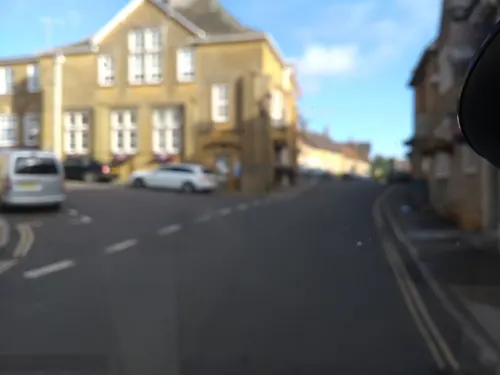
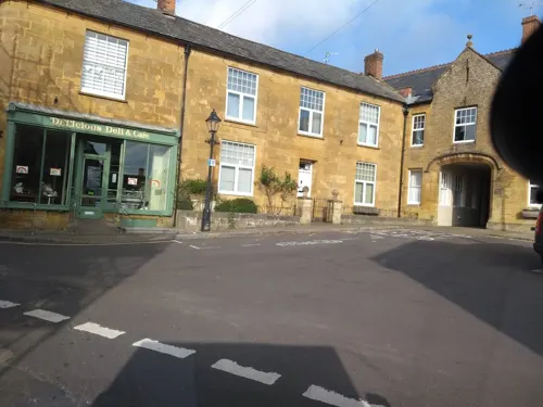
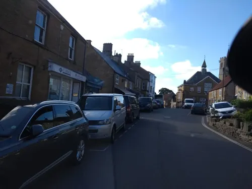
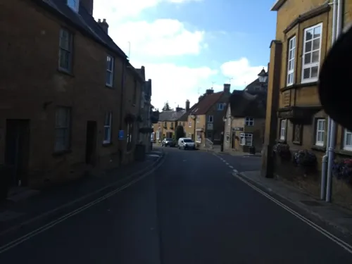


6 more on the map.
Where to stay3

History
The village's name may come from the Old English word Pared meaning boundary and the Saxon word ton meaning settlement, forming ’Paredton’.
A site on Lightgate Road, north of the present village, has produced Iron Age occupation material, though archaeological evidence of any structures have not yet been discovered. Roman material, mostly consisting of coins, has also been discovered locally and, as it is only 2 miles (3 km) from the Fosse Way, Roman occupation is likely, although it may have been abandoned between the 4th and 8th centuries.
The Anglo-Saxon Chronicle of 680 refers to a major battle on the site of the village and the Saxon Ine of Wessex of the Kingdom of Wessex built a palace on present day Silver Street.
Read more of the history
A large royal estate of South Petherton was created and the Saxon settlement, Sudperetone (the southern tun on the Parrett), included a minster church, a royal palace and a short-lived 11th century mint. Most of the royal estate passed directly to William the Conqueror and was still a possession of the Crown in 1086. The parish was part of the South Petherton Hundred. Part of the estate was also held by Bruton Abbey from the 12th century until the Dissolution of the Monasteries, then becoming known as the manor of Hele. In 1213 a royal warrant by King John was granted for a market and fair, but by 1243 the main manor had been granted away from the Crown under Henry II and by 1243 South Petherton manor was owned outright by the Daubeney family, who continued to hold it until the late 15th century, the family dying out after Henry Daubeney acquired the earldom of Bridgwater and then failed to produce an heir to succeed him.
The manor reverted to the Crown in 1553, before passing into the ownership of Charles Arundell (d. 1587), who left it to his brother Matthew Arundell, in whose family it remained until 1792, when it was sold to John Baker Edmonds. Edmonds also acquired the rectory estate of South Petherton (known also as the manor of Hele), which had had a complicated history of ownership, including purchase in 1753 by Henry Hele, a successful physician from Salisbury.
Another estate (known as the Manor of Wigborough) was shared by members of the Brome Family from 1581 to 1615, when it passed to the family of Hele of Flete (unconnected to the Henry Hele referred to above) who held it for most of the 17th century.
During the English Civil War troops from both sides occupied the town during 1644 and 1645. The town also had a role in the Monmouth Rebellion of 1680 and two townsmen were among those who prosecuted in the Bloody Assizes.
It was also recently discovered that South Petherton was, during the 17th century, one of the main centres of bronze cauldron and skillet production. These cooking vessels were used all over the UK.
From the History section of South Petherton on Wikipedia, under CC BY-SA 4.0.
More about South Petherton
Geography
South Petherton is situated between the Blackdown Hills to the west, the flat wetland area of the Somerset Levels and Moors to the north, and the hills of Dorset to the south. 3 miles (4.8 km) to the east, on the other side of the Parrett valley, is Ham Hill, the source of much of the village's building stone.
It lies on low lying undulating land of Yeovil Sands at the foot of a limestone ridge, which has been quarried for Petherton stone, and for sands and clays suitable for brick and tile making.
Economy
Agriculture has traditionally been an important local industry, although South Petherton has also been a centre for glove making, cider production and other cottage industries at various points in its history.
Cloth manufacture, continued into the late 18th and 19th century although this was largely replaced by sailcloth and then leather working. The importance of this industry can be seen by the number of mills which remain including; the former flax mill or granary in Hayes End, Joylers Mill, Shutlers Mill, and the former flax mill immediately north of Flaxdrayton Farmhouse.
From the Wikipedia article South Petherton, under CC BY-SA 4.0.
Notable people from South Petherton
 Jordan StoreyEnglish association football playerPhoto: Timmy96, CC0
- John Harding, 1st Baron Harding of PethertonBritish Army officer (1896-1989)
- Samuel HillAnglican cleric; (1648-1716)
Born in South Petherton, according to Wikidata (CC0). Each name links to its Wikipedia article.
Churches and places of worship24
Shopping5
Gas and EV charging1
Schools, colleges and libraries3
South Petherton Church of England Infants and Pre School
School · Anglican
Church Path, South Petherton
Healthcare3
South Petherton Pharmacy
Clinic and pharmacy · 0.4 mi
Bernard Way, South Petherton
Map of South Petherton
63 places. The map loads OpenStreetMap tiles when you open it.
Getting there and nearby towns
Royal Naval Air Station Yeovilton (YEO) is the nearest airport with scheduled flights listed in OpenStreetMap, 8 miles away.
- Merriott 3 mi south, about 4 min by car
- Stoke-sub-Hamdon 3 mi east, about 4 min by car
- West Coker 6 mi east, about 9 min by car
- Curry Rivel 6 mi northwest, about 9 min by car
- Ilchester 7 mi northeast, about 11 min by car
- Yeovil 8 mi east, about 12 min by car
- Chard 9 mi southwest, about 14 min by car
- Yetminster 11 mi east, about 17 min by car
- Street 13 mi north, about 20 min by car
- Taunton 14 mi west, about 22 min by car
Drive times are estimates from straight-line distance, not routes.
Towns near South Petherton


Keep exploring
Local news
Headlines from INDB.
Reviews, tips and questions
Loading what members have shared...
Sources and licences
- GeoNames (CC BY 4.0): population, coordinates, regions and time zone
- Mapillary (see each image): photos
- OpenStreetMap contributors (ODbL 1.0): places, airports, map data
- Wikidata (CC0 1.0): elevation, founding date, time zone, website, landmarks and historic places
- Wikimedia Commons (see each image): photos
- Wikipedia (CC BY-SA 4.0): overview and history text
Photo credits
- South Petherton Church, Stevekeiretsu, CC BY-SA 4.0
- Bakers, South Petherton, grassrootsgroundswell, CC BY 2.0
- Barrington Court, South facade, Martinvl, CC BY-SA 4.0
- Somerset Panorama 6, Ham Hill (338485474), bixentro, CC BY 2.0
- Coke Memorial Methodist Church, South Petherton, Stevekeiretsu, CC BY-SA 4.0
- All Saints Merriot, Sarah Smith, CC BY-SA 2.0
- Lopen church, Stevekeiretsu, CC BY-SA 4.0
- Martockchurch, David Bown, CC BY 3.0
- Hintonstgchurch, Dbown100, CC BY 3.0
- St Mary church Barrington, Martin Bodman, CC BY-SA 2.0
- Stoke sub Hamdon church, Mike Searle, CC BY-SA 2.0
- Brewers Arms, South Petherton, Stevekeiretsu, CC BY-SA 4.0
- Rose and Crown pub, East Lambrook, Somerset, Stevekeiretsu, CC BY-SA 4.0
- 12-14 Roundwell Street, Stevekeiretsu, CC BY-SA 4.0
- David Hall, South Petherton, Stevekeiretsu, CC BY-SA 4.0
- Royal Oak inn, Over Stratton, Somerset, Stevekeiretsu, CC BY-SA 4.0
- Street-level photo, ukchris, CC BY-SA 4.0
- Street-level photo, ukchris, CC BY-SA 4.0
- Street-level photo, ukchris, CC BY-SA 4.0
- Street-level photo, ukchris, CC BY-SA 4.0
- Street-level photo, richardc, CC BY-SA 4.0
- Street-level photo, ukchris, CC BY-SA 4.0
- Street-level photo, ukchris, CC BY-SA 4.0
- Street-level photo, aidan573, CC BY-SA 4.0
- Street-level photo, ukchris, CC BY-SA 4.0
- Street-level photo, ukchris, CC BY-SA 4.0
- Street-level photo, ukchris, CC BY-SA 4.0
- Street-level photo, ukchris, CC BY-SA 4.0
- Street-level photo, ukchris, CC BY-SA 4.0
- Street-level photo, ukchris, CC BY-SA 4.0
- Street-level photo, ukchris, CC BY-SA 4.0
- Street-level photo, ukchris, CC BY-SA 4.0
- Street-level photo, ukchris, CC BY-SA 4.0
- Street-level photo, ukchris, CC BY-SA 4.0
- Street-level photo, ukchris, CC BY-SA 4.0
- Street-level photo, ukchris, CC BY-SA 4.0
- Street-level photo, southglos, CC BY-SA 4.0


Page built November 10, 2026. Spotted a mistake? Tell us or suggest a place.