


Why visit Tarvin
Townapedia lists 2 museums and landmarks, 1 park or trail, 9 places to eat and 1 place to stay in and around town.
Highlights include Platts Lane, Tarvin War Memorial and Hockenhull Platts.
Weather in Tarvin
Forecast from MET Norway (CC BY 4.0). Full forecast
About Tarvin
Tarvin is a village in the unitary authority of Cheshire West and Chester and the ceremonial county of Cheshire, England. It had a population of 2,693 people at the 2001 UK census, rising to 2,728 at the 2011 census, and the ward covers about 17 square miles (44 km2).
From the Wikipedia article Tarvin (this version), under CC BY-SA 4.0.
Photos of Tarvin

Museums and landmarks2


Parks, trails and playgrounds1
Hockenhull Platts
Park · 1.1 mi
Nature reserve and group of bridges in Cheshire, UK
Restaurants and cafes9



King Loui's Fish and Chips (Chinese)
Fast food · Fish And Chips
54 High Street, Chester


Where to stay1

Churches and places of worship13
Shopping2
Gas and EV charging2
Schools, colleges and libraries1
Healthcare1
Map of Tarvin
32 places. The map loads OpenStreetMap tiles when you open it.
Getting there and nearby towns
Hawarden Airport (CEG) is the nearest airport with scheduled flights listed in OpenStreetMap, 9 miles away.
- Guilden Sutton 3 mi west, about 4 min by car
- Mickle Trafford 3 mi northwest, about 5 min by car
- Chester 5 mi west, about 8 min by car
- Hoole 5 mi west, about 7 min by car
- Tattenhall 5 mi south, about 8 min by car
- Kingsley 6 mi northeast, about 10 min by car
- Blacon 7 mi west, about 11 min by car
- Bunbury 7 mi southeast, about 12 min by car
- Ellesmere Port Town 8 mi northwest, about 13 min by car
- Runcorn 10 mi north, about 16 min by car
Drive times are estimates from straight-line distance, not routes.
Towns near Tarvin


Keep exploring
Local news
Headlines from INDB.
Reviews, tips and questions
Loading what members have shared...
Sources and licences
- GeoNames (CC BY 4.0): population, coordinates, regions and time zone
- Mapillary (see each image): photos
- OpenStreetMap contributors (ODbL 1.0): places, airports, map data
- Wikidata (CC0 1.0): elevation, founding date, time zone, website, landmarks and historic places
- Wikimedia Commons (see each image): photos
- Wikipedia (CC BY-SA 4.0): overview and history text
Photo credits
- TarvinCheshire, Dave.Dunford, Public domain
- Red Lion, Tarvin, Dave.Dunford, CC BY-SA 4.0
- 51HighStreetTarvin, Steve Richardson, CC BY-SA 4.0
- 51 High Street, Tarvin 01, Dave.Dunford, CC BY-SA 4.0
- Tarvin Hall, Dave.Dunford, CC BY-SA 4.0
- RodeHouseTarvin, Steve Richardson, CC BY-SA 4.0
- Church Street, Tarvin, Colin Pyle, CC BY-SA 2.0
- St James' Church, Christleton, Sue Adair, CC BY-SA 2.0
- St John's Church, Guilden Sutton, Dennis Turner, CC BY-SA 2.0
- Ashton Hayes St John 1, Peter I. Vardy, Public domain
- St Peter's Church, Hargrave, Peter I. Vardy, Public domain
- St Peter's Church, Plemstall, Dennis Turner, CC BY-SA 2.0
- St Peter's Church, Waverton, Stephen Charles, CC BY-SA 2.0
- St Philip's Church, Kelsall, Rept0n1x, CC BY-SA 3.0
- Hockenhull Platts EM, Peter I. Vardy, Public domain
- St Andrew's Church, Tarvin 02, Dave.Dunford, CC BY-SA 4.0
- St Bartholomew, Barrow, John Lord, CC BY-SA 2.0
- 54, High Street, Tarvin, Dave.Dunford, CC BY-SA 4.0
- TarvinWarMemorial1, Steve Richardson, CC BY-SA 4.0
- Cornichon, Tarvin, Dave.Dunford, CC BY-SA 4.0
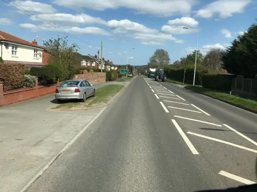
- Street-level photo, ricorico, CC BY-SA 4.0
- Street-level photo, ricorico, CC BY-SA 4.0
- Street-level photo, ricorico, CC BY-SA 4.0
- Street-level photo, rossa, CC BY-SA 4.0


Page built November 10, 2026. Spotted a mistake? Tell us or suggest a place.