

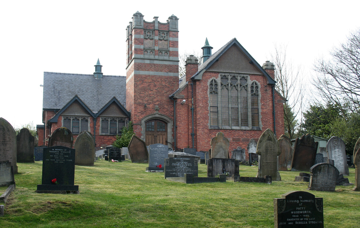


Tattenhall, United Kingdom
Tattenhall is a town of 1,950 people in England, United Kingdom.
Why visit Tattenhall
Townapedia lists 1 museum or landmark, 3 parks and trails, 9 places to eat, 1 place to stay and 1 attraction in and around town.
Highlights include The Ice Cream Farm.
Weather in Tattenhall
Forecast from MET Norway (CC BY 4.0). Full forecast
About Tattenhall
Tattenhall is a village and former civil parish, now in the parish of Tattenhall and District, 8 miles (13 km) south-east of Chester, in the unitary authority area of Cheshire West and Chester and the ceremonial county of Cheshire, England. In the 2001 census, the population was recorded as 1,986, increasing to 2,079 by the 2011 census.
From the Wikipedia article Tattenhall (this version), under CC BY-SA 4.0.
Travel tips from other travellers: Tattenhall on Wikivoyage (CC BY-SA 4.0).
Photos of Tattenhall


Things to do1

Museums and landmarks1

The Ice Cream Farm
Monument and historic site · 0.9 mi
Newton Lane, Chester
Mo-Su 09:30-18:00; Dec 25-26 off; Jan 01 off
Parks, trails and playgrounds3

Tattenhall Park Playground
Playground
Large new playground suitable for a large age range. Includes equipment such as a zipwire and net crawl along with traditional equipment...

Restaurants and cafes9

The Sportsmans Arms
Bar and pub · Regional
93 Burwardsley Road, Chester
Su-Th 12:00-23:00; Fr-Sa 12:00-00:00




Fish & Chips @ No. 3
Fast food · Fish And Chips, Burger, Pizza, Chicken, Kebab
3-6 High Street, Chester
Mo-Sa 16:30-21:30; Fr 11:30-13:30
History
The settlement of Tatenale was recorded in the Domesday Book of 1086.
The name is believed to be derived from the Old English personal name Tata and halh, meaning "a meadow" or "nook of land".
The spelling of the village has altered over the centuries: Tatenhala (1280), Tattenhall (1289), Tatnall (1473), Tottenhall (1553) and Tettenhall (1649).
The village was a self-sustained settlement in the fifteenth and sixteenth centuries.
The building of the Chester Canal (now part of the Shropshire Union Canal) provided an economic boost to the village, improving transportation and allowing local produce to be exported. Tattenhall Road railway station opened in 1840 and linked Tattenhall to Chester and Crewe.
Tattenhall railway station opened in 1872, linking the village with Whitchurch. The railways led to the establishment of industries including the manufacture of glue, gelatine, fertiliser and bricks.
Tattenhall railway station closed in 1957, as did the Whitchurch and Tattenhall Railway between Chester and Whitchurch. Tattenhall Road railway station closed in 1966 as part of the Beeching cuts. New housing developments saw the village expand through the second half of the twentieth century.
Read more of the history
Tattenhall was a township and parish within Broxton Hundred, which became a civil parish in 1866. The population was recorded at 606 in 1801, 982 in 1851, 975 in 1901, 1,049 in 1951 and 1,986 in 2001. The civil parish was abolished on 1 April 2015 to form "Tattenhall and District".
From the History section of Tattenhall on Wikipedia, under CC BY-SA 4.0.
Notable people from Tattenhall
- Alban ArnoldEnglish cricketer (1892-1916)
- John TilneyBritish businessman and Conservative politician
- Leslie JonesEnglish cricketer (1891-1962)
- Ronald DuttonEnglish cricketer (1902-1999)
- Thomas Hooke Pearsonarmy officer
- Harry ThreadgoldFootballer (1924-1996)
Born in Tattenhall, according to Wikidata (CC0). Each name links to its Wikipedia article.
Where to stay1
Churches and places of worship11
Schools, colleges and libraries3
Healthcare1
Map of Tattenhall
30 places. The map loads OpenStreetMap tiles when you open it.
Getting there and nearby towns
Hawarden Airport (CEG) is the nearest airport with scheduled flights listed in OpenStreetMap, 9 miles away.
- Bunbury 5 mi east, about 8 min by car
- Guilden Sutton 6 mi northwest, about 10 min by car
- Chester 7 mi northwest, about 11 min by car
- Hoole 7 mi northwest, about 11 min by car
- Mickle Trafford 7 mi north, about 12 min by car
- Malpas 7 mi south, about 12 min by car
- Blacon 9 mi northwest, about 14 min by car
- Wrexham 11 mi southwest, about 17 min by car
- Winsford 11 mi northeast, about 18 min by car
- Nantwich 11 mi east, about 18 min by car
Drive times are estimates from straight-line distance, not routes.
Towns near Tattenhall


Keep exploring
Local news
Headlines from INDB.
Reviews, tips and questions
Loading what members have shared...
Sources and licences
- GeoNames (CC BY 4.0): population, coordinates, regions and time zone
- OpenStreetMap contributors (ODbL 1.0): places, airports, map data
- Wikidata (CC0 1.0): elevation, founding date, time zone, website, landmarks and historic places
- Wikimedia Commons (see each image): photos
- Wikipedia (CC BY-SA 4.0): overview and history text
Photo credits
- All Saints Church, Harthill, Peter I. Vardy, Public domain
- Brown Knowl Church, Espresso Addict, CC BY-SA 3.0
- St John's Church, Burwardsley, Peter I. Vardy, Public domain
- St Mary's Church, Bruera, Stephen Charles, CC BY-SA 2.0
- St Mary's Church, Coddington, John S Turner, CC BY-SA 2.0
- St Peter's Church, Hargrave, Peter I. Vardy, Public domain
- St Peter's Church, Waverton, Stephen Charles, CC BY-SA 2.0
- St Alban's Church, Tattenhall, Peter I. Vardy, Public domain
- All Saints Church, Handley, Geoff Pick, CC BY-SA 2.0
- View from the bench (OpenBenches 6340-2), sjorford, CC BY-SA 4.0
- Long shot of the bench (OpenBenches 6340-1), sjorford, CC BY-SA 4.0
- Close-up of the inscription (OpenBenches 6340), sjorford, CC BY-SA 4.0
- Long shot of the bench (OpenBenches 6341-1), sjorford, CC BY-SA 4.0
- View from the bench (OpenBenches 6341-2), sjorford, CC BY-SA 4.0
- Close-up of the inscription (OpenBenches 6341), sjorford, CC BY-SA 4.0
- Celtic cross war memorial, Whysports, CC BY-SA 4.0
- Ice cream farm, Alan Murray-Rust, CC BY-SA 2.0


Page built November 10, 2026. Spotted a mistake? Tell us or suggest a place.