


Wanborough, United Kingdom
Wanborough is a town of 2,268 people in England, United Kingdom.
Why visit Wanborough
Townapedia lists 3 museums and landmarks, 3 parks and trails and 9 places to eat in and around town.
Highlights include Day House Lane Stone Circle, Durocornovium, Coate Water Country Park and The Coombes.
Weather in Wanborough
Forecast from MET Norway (CC BY 4.0). Full forecast
About Wanborough
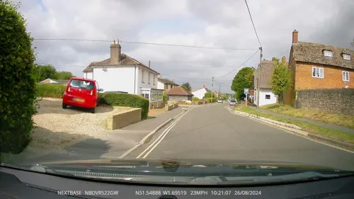
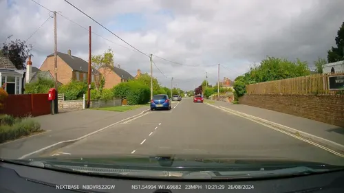
Wanborough is a large village and civil parish in the borough of Swindon, Wiltshire, England. The village is about 3.5 miles (5.6 km) southeast of Swindon town centre. The settlement along the High Street is Lower Wanborough, while Upper Wanborough is on higher ground to the southwest. The parish includes Redlands Grove and the hamlets of Horpit (a short distance north of Wanborough) and Foxhill, 1.5 miles (2.4 km) to the southeast.
From the Wikipedia article Wanborough, Wiltshire (this version), under CC BY-SA 4.0.
Museums and landmarks3

Day House Lane Stone Circle
Monument and historic site · 1.8 mi
Stone circle in South Swindon, Wiltshire, England, UK
Durocornovium
Monument and historic site · 2.0 mi
Small Roman settlement in Britain
Fir Clump Stone Circle
Monument and historic site · 3.0 mi
Destroyed prehistoric sandstone megalith circle
Parks, trails and playgrounds3

Coate Water Country Park
Park · 2.0 mi
Country park in Wiltshire, England


Restaurants and cafes9



Churches and places of worship6

Christ Church
Church · 3.4 mi
Church in Swindon, Wiltshire, England, UK

St Andrew's Church, Wanborough
Church
Grade I listed church in Wanborough, Swindon, Wiltshire, England, UK

History
There was a Roman settlement, Durocornovium, slightly northwest of the current village, at a road junction mentioned in the Antonine Itinerary. Being the last vicus on Ermin Way before the scarp slope of the Marlborough Downs, Durocornovium was a site where horses were watered before the steep climb off the Oxfordshire plain. Wanborough is just off the Ridgeway National Trail. Development in a strip along the road frontages characterised the village, which reached maximum development in the 4th century.
Wanborough has been suggested as the site of the fortress of Guinnion, the eighth of the twelve battles of Arthur listed by Nennius in Historia Brittonum
In three charters of the ninth century Wanborough is recorded as Wenbeorg. In the Domesday Book it is Wemberge, the 'm' being an evident mistake for 'n'.
The Anglo-Saxon Chronicle records that a battle was fought in 592 AD between Ceawlin, King of Wessex and the Britons, at a place called Woddesbeorge or Wodnesbeorge, ("Woden's borough"). This has given rise to considerable speculation as to whether the battle took place at Wanborough in Wessex, or in Staffordshire at Wednesbury (Wodnesbeorge, or "Woden's borough").
Read more of the history
The antiquarian and historian W. H. Duignan stated in 1902: "Now it is impossible it can be Wanborough [...] 'Wen' [in Wenbeorg], in the ninth century, could not represent an original Woden. There is only one Wednesbury in England[...]and I suggest that the Woddesbeorge of three versions of the Chronicle is an error for Wodnesbeorge." Modern place-name scholarship tends to agree that the battle took place at Wednesbury. The alternative view is that the battle took place at Adam's Grave near Alton Barnes.
From the History section of Wanborough, Wiltshire on Wikipedia, under CC BY-SA 4.0.
Notable people from Wanborough
 Louise HuntBritish wheelchair tennis playerPhoto: N1CKchooseanothername, CC BY 3.0
- William Goslingrecipient of the Victoria Cross (1892–1945)
Born in Wanborough, according to Wikidata (CC0). Each name links to its Wikipedia article.
Schools, colleges and libraries5
Healthcare4
Map of Wanborough
30 places. The map loads OpenStreetMap tiles when you open it.
Getting there and nearby towns
RAF Fairford (FFD) is the nearest airport with scheduled flights listed in OpenStreetMap, 11 miles away.
- Swindon 4 mi west, about 6 min by car
- Aldbourne 5 mi southeast, about 9 min by car
- Broad Blunsdon 6 mi northwest, about 10 min by car
- Lydiard Millicent 7 mi west, about 12 min by car
- Ramsbury 8 mi southeast, about 13 min by car
- Royal Wootton Bassett 9 mi west, about 14 min by car
- Wantage 12 mi east, about 20 min by car
- Great Bedwyn 12 mi south, about 19 min by car
- Ashton Keynes 12 mi northwest, about 20 min by car
- Calne 15 mi southwest, about 24 min by car
Drive times are estimates from straight-line distance, not routes.
Towns near Wanborough


Keep exploring
Local news
Headlines from INDB.
Reviews, tips and questions
Loading what members have shared...
Sources and licences
- GeoNames (CC BY 4.0): population, coordinates, regions and time zone
- Mapillary (see each image): photos
- OpenStreetMap contributors (ODbL 1.0): places, airports, map data
- Wikidata (CC0 1.0): elevation, founding date, time zone, website, landmarks and historic places
- Wikimedia Commons (see each image): photos
- Wikipedia (CC BY-SA 4.0): overview and history text
Photo credits
- Knowle House, Upper Wanborough, Sionk, CC BY-SA 4.0
- England 259, My another account ( talk ), CC0
- St Andrew's Church, Wanborough, Brian Robert Marshall, CC BY-SA 2.0
- Science Museum Library & Archives at Wroughton, C rnelian, CC BY-SA 3.0
- Coate Water Country Park, Swindon, Delta 51, CC BY-SA 4.0
- Street-level photo, RyanBush, CC BY-SA 4.0
- Street-level photo, RyanBush, CC BY-SA 4.0
- Street-level photo, RyanBush, CC BY-SA 4.0
- Street-level photo, RyanBush, CC BY-SA 4.0
Page built November 10, 2026. Spotted a mistake? Tell us or suggest a place.