


Dartford, United Kingdom
Dartford is a town of 51,240 people in England, United Kingdom.
Why visit Dartford
Townapedia lists 17 museums and landmarks, 31 parks and trails, 123 places to eat, 3 places to stay and 5 attractions in and around town.
Highlights include Orchard Theatre, Queen Elizabeth II Bridge, Dartford Library and Hall Place and Gardens.
Weather in Dartford
Forecast from MET Norway (CC BY 4.0). Full forecast
About Dartford
Dartford is the principal town in the Borough of Dartford, Kent, England. It is located 18 mi (29 km) south-east of Central London and is situated adjacent to the London Borough of Bexley to its west. To its north, across the Thames Estuary, is Thurrock in Essex, which can be reached via the Dartford Crossing. To its east lies the Borough of Gravesham and to the south the district of Sevenoaks.
From the Wikipedia article Dartford (this version), under CC BY-SA 4.0.
Travel tips from other travellers: Dartford on Wikivoyage (CC BY-SA 4.0).
Photos of Dartford


Things to do5

Orchard Theatre
Cinema and theater
Theatre in Dartford, Kent, England

Queen Elizabeth II Bridge
Bridge · 2.3 mi
Bridge across the River Thames in south east England

Erith Playhouse
Cinema and theater · 2.9 mi
Theatre in Erith, Bexley, London, England, formerly a cinema
Orchard West Theatre
Cinema and theater
Temporary replacement for Orchard Theatre which is closed while the "aero" concrete is replaced
Museums and landmarks17

Dartford Library
Museum
Public library and museum in Dartford, Kent, England, UK

Hall Place and Gardens
Museum · 2.4 mi
Grade I listed house and museum in Bexley, Greater London, England, United Kingdom



Welsh Tavern
Monument and historic site · 1.5 mi
Built from 1827 and closed in 2022, the building suffered a major fire in June 2025. Proposals for 14 flats were withdrawn in 2023.
161-163 London Road, Stone
Orchard Hospital
Monument and historic site · 1.4 mi
The Orchard Hospital was erected by the Metropolitan Asylums Board in 1902 to provide temporary acocommodation during the smallpox...
5 more on the map.
Parks, trails and playgrounds31


Rainham Marshes Nature Reserve
Park · 3.0 mi
Marshland nature reserve in Greater London and Essex, England, UK



19 more on the map.
Restaurants and cafes123
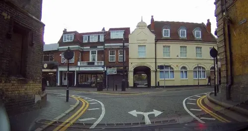
The Adaalat Lounge
Restaurant · Indian
Was previously a pub, The Court House, then the Wig and Gown. Former County Court building
43 Spital Street, Dartford


111 more on the map.
History
In prehistoric times, the first people appeared in the Dartford area around 250,000 years ago: a tribe of prehistoric hunter-gatherers whose exemplar is called Swanscombe Man. Many other archaeological investigations have revealed a good picture of occupation of the district with important finds from the Stone Age, the Bronze Age and the Iron Age.
When the Romans engineered the Dover to London road (afterwards named Watling Street), it was necessary to cross the River Darent by ford, giving the settlement its name. Roman villas were built along the Darent Valley, and at Noviomagus (Crayford), close by. The Saxons may have established the first settlement where Dartford now stands. Dartford manor is mentioned in the Domesday Book, compiled in 1086, after the Norman conquest. It was then owned by the king.
Read more of the history
During the medieval period Dartford was an important waypoint for pilgrims and travellers en route to Canterbury and the Continent, and various religious orders established themselves in the area. In the 12th century the Knights Templar had possession of the manor of Dartford; the National Trust property at Sutton-at-Hone, to the south of the town, is a remaining piece of that history. In the 14th century, a priory was established here, and two groups of friars—the Dominicans and the Franciscans—built hospitals here for the care of the sick. At this time the town became a small but important market town.
Wat Tyler, a key figure in the Peasants' Revolt, may have been from Dartford, though three other towns in Kent also claim him, and there are some doubts about the strength of Tyler's connection to Dartford. It is, however, probable that Dartford was a key meeting point early in the Peasants' Revolt, with a detachment of Essex rebels marching south to join Kentish rebels at Dartford before accompanying them to Rochester and Canterbury in the first week of June 1381. Although lacking a leader, Kentishmen had assembled at Dartford around 5 June through a sense of county solidarity at the mistreatment of Robert Belling, a man claimed as a serf by Sir Simon Burley. Burley had abused his royal court connections to invoke the arrest of Belling and, despite a compromise being proposed by bailiffs in Gravesend, continued to demand the impossible £300 of silver for Belling's release. Having left for Rochester and Canterbury on 5 June, the rebels passed back through Dartford in greater numbers on 12 June on their way to London.
In the 15th century, two kings of England became part of the town's history. Henry V marched through Dartford in November 1415 with his troops after fighting the French at the Battle of Agincourt; in 1422 Henry's body was taken to Holy Trinity Church by Edmund Lacey, Bishop of Exeter, who conducted a funeral. In March 1452, Richard, Duke of York, camped at the Brent allegedly with ten thousand men, waiting for a confrontation with King Henry VI. The Duke surrendered to the king in Dartford. The place of the camp is marked today by York Road, Dartford.
The 16th century saw significant changes to the hitherto agrarian basis of the market in Dartford, as new industries began to take shape (see below). The priory was destroyed in 1538 during the Dissolution of the Monasteries and a new manor house was subsequently constructed by King Henry VIII. In 1545, Henry held a series of meetings of his Privy Council in the town, and from 21 to 25 June 1545 Dartford was the seat of the national government. Henry's fourth wife Anne of Cleves lived at the new priory for four years before her death in 1557.
Many Protestants were executed during the reigns of Queen Mary (1553–1554) and Philip and Mary (1554–1558), including Christopher Wade, a Dartford linen-weaver who was burnt at the stake on the Brent in 1555. The Martyrs' Memorial on East Hill commemorates Wade and other Kentish Martyrs. In 1576 Dartford Grammar School was founded, part of the Tudor emphasis on education for ordinary people.
The earliest industries were those connected with agriculture, such as the brewing of traditional beers and ales. Lime-burning and chalk-mining also had their place. Fulling was another: the cleansing of wool needed a great deal of water, which the river could provide. This led to other water-based industries, using hydropower to operate machinery.
Upon his return in 1578 from Frobisher Bay in the Canadian Arctic with a reputed cargo of gold-bearing ore, Sir Martin Frobisher had the refining done on Powder Mill Lane in Dartford. Assiduous efforts to extract gold were made over five years, but the ore proved to be a valueless rock containing hornblende and was eventually salvaged for road metalling and wall construction. Sir John Spielman set up the first paper mill in England at Dartford in 1588 on a site near Powder Mill Lane, and soon some 600 employees worked there, providing an invaluable source of local employment. Iron-making on the Weald was in full operation at this time, and iron ingots were sent to Dartford, to England's first iron-slitting mill, set up by the Darent at Dartford Creek in 1595 by Godfrey Box, an immigrant from the Low Countries. In 1785, John Hall, a millwright set up a workshop in Lowfield Street and began to make engines, boilers and machinery (some of it for the local gunpowder factory run by Miles Peter Andrews and the Pigou family), marking the foundation of J & E Hall, an engineering firm specialising in heavy engineering, and later refrigerating equipment, and, for 20 years from 1906, vehicle production, plus lifts and escalators.
From the History section of Dartford on Wikipedia, under CC BY-SA 4.0.
More about Dartford
Geography
Dartford lies within the area known as the London Basin. The low-lying marsh to the north of the town consists of London Clay and the alluvium brought down by the two rivers—the Darent and the Cray—whose confluence is in this area. The higher land on which the town stands and through which the narrow Darent valley runs, consists of chalk surmounted by the Blackheath Beds of sand and gravel.
As a human settlement, Dartford became established as a river crossing-point with the arrival of the Romans, and as a focal point between two routes: that from west to east being part of the main route connecting London with the Continent, and the southerly route following the Darent valley. As a result, the town's main road pattern makes the shape of letter 'T'. The Dartford Marshes to the north and the proximity of Crayford in the London Borough of Bexley to the west, mean that the town's growth is to the south and east. Wilmington is contiguous with the town to the south, whilst the almost continuous Thames Gateway development means that there is little to mark the town boundary to the east.
Economy
Some of Dartford's key industries, including brewing, paper-making, flour milling and the manufacture of cement, suffered extreme decline in the 20th century, causing redundancies and unemployment. Western Quarry (now redeveloped into Bluewater shopping centre) was closed by Blue Circle in 1990. This industry had been an economic boon to the area, but left behind a lot of derelict land and pollution. In 1990 Dartford contained around 1,700 acres (6.9 km2) of spoiled land resulting from extractive industries, and cement-dust pollution from local cement works was a regular subject of complaint in the local press throughout the 20th century.
Arts and culture
The Orchard Theatre is a professional theatre in the town centre, with a schedule including drama, dance, music and entertainment. The Mick Jagger Centre, within the grounds of Dartford Grammar School on Shepherds Lane, was completed in 2000 and provides facilities for community arts. library and Museum are located on Market Street.
Central Park, in the town centre, is used for various community events. It comprises 26 acres (110,000 m2) of land.
Dartford F.C. play at Princes Park Stadium and compete in the Isthmian League. There are also three other senior clubs based in Dartford, two of them in the Kent County Football League: Fleetdown United, who play at Heath Lane Lower, and Kent United, who play at Glentworth Sports Club, the former home of Kent Football United (now defunct). Southern Counties East Football League side Halls AFC play at the Community Stadium at Princes Park.
From the Wikipedia article Dartford, under CC BY-SA 4.0.
Notable people from Dartford
 Mick JaggerBritish singer and songwriter; vocalist of The Rolling StonesPhoto: Raph_PH, CC BY 2.0
 Keith RichardsBritish musician, guitarist of the Rolling StonesPhoto: Raph_PH, CC BY 2.0
 Andrea ArnoldEnglish film director and actressPhoto: Kevin Payravi, CC BY-SA 4.0
 Jamie O'HaraEnglish association football playerPhoto: https://www.flickr.com/photos/joncandy/, CC BY-SA 2.0
 Malcolm AllisonEnglish footballer and manager (1927-2010)Photo: Joseph1891, CC BY-SA 4.0
 Martin CrimpBritish playwright and translatorPhoto: Leafar - Raphaël Labbé, CC BY-SA 3.0
 Robert MaynardRoyal Navy officer (1684-1751)Photo: Jean Leon Gerome Ferris, Public domain
 Tara McDonaldBritish singer-songwriterPhoto: Georges Biard, CC BY-SA 3.0
- Peter BlakeBritish artist (1932-)
- Adam CurtisBritish documentary filmmaker (born 1955)
- Dick TaylorEnglish musician
- Pete TongEnglish DJ, music producer and radio presenter
Born in Dartford, according to Wikidata (CC0). Each name links to its Wikipedia article.
Where to stay3
Churches and places of worship34
Shopping21
Gas and EV charging9
Schools, colleges and libraries32
Healthcare14
Map of Dartford
250 places. The map loads OpenStreetMap tiles when you open it.
Getting there and nearby towns
London City Airport (LCY) is the nearest airport with scheduled flights listed in OpenStreetMap, 8 miles away.
- Bexley 3 mi west, about 5 min by car
- Swanley 4 mi southwest, about 6 min by car
- Swanscombe 4 mi east, about 7 min by car
- Welling 5 mi west, about 8 min by car
- Grays 5 mi northeast, about 8 min by car
- Rainham 5 mi north, about 8 min by car
- South Ockendon 5 mi northeast, about 8 min by car
- Longfield 5 mi southeast, about 8 min by car
- Sidcup 5 mi west, about 8 min by car
- Abbey Wood 5 mi northwest, about 9 min by car
Drive times are estimates from straight-line distance, not routes.
Towns near Dartford


Keep exploring
Local news
Headlines from INDB.
Reviews, tips and questions
Loading what members have shared...
Sources and licences
- GeoNames (CC BY 4.0): population, coordinates, regions and time zone
- Mapillary (see each image): photos
- OpenStreetMap contributors (ODbL 1.0): places, airports, map data
- Wikidata (CC0 1.0): elevation, founding date, time zone, website, landmarks and historic places
- Wikimedia Commons (see each image): photos
- Wikipedia (CC BY-SA 4.0): overview and history text
Photo credits
- DartfordProspect4870c, Clem Rutter, Rochester Kent, CC BY-SA 3.0
- DartfordProspect4868, Clem Rutter, Rochester Kent, CC BY-SA 3.0
- Priory Farmhouse, Dartford 02, Paul the Archivist, CC BY-SA 4.0
- Priory Farmhouse, Dartford 01, Paul the Archivist, CC BY-SA 4.0
- DartfordManorHouse4861, Clem Rutter, Rochester Kent, CC BY-SA 3.0
- DartfordManorHouse4866, Clem Rutter, Rochester Kent, CC BY-SA 3.0
- The Wig & Gown, Dartford, Paul the Archivist, CC BY-SA 4.0
- DartfordOrchard4885, Clem Rutter, Rochester Kent, CC BY-SA 3.0
- DartfordMuseumLibrary3791, Clem Rutter, Rochester Kent, CC BY-SA 3.0
- HallPlace, Wellingwebsite at English Wikipedia Later versions were uploaded by P Ingerson at en.wikipedia ., Public domain
- Wansunt Pit, Dudley Miles, CC BY-SA 3.0
- Rainham Marshes LNR 5, Dudley Miles, CC BY-SA 3.0
- Northwest View of the Church of Saint Paulinus, Crayford (01), Doyle of London, CC BY-SA 4.0
- Dartford3799, Clem Rutter, Rochester Kent, CC BY-SA 3.0
- Princes Park, Dartford, South Stand, Steveboswell at English Wikipedia, CC BY-SA 3.0
- Dartford Grammar School, Paul the Archivist, CC BY-SA 4.0
- Martyr's Monument, St Edmund's Pleasance, Dartford 01, Paul the Archivist, CC BY-SA 4.0
- The Bridge House, Dartford, Paul the Archivist, CC BY-SA 4.0
- Methodist Church, Dartford (as seen from the south), Ethan Doyle White, CC BY-SA 4.0
- Southern Side of Christ Church, Dartford (I), Ethan Doyle White, CC BY-SA 4.0
- St. Alban's Church, Dartford, Kent, David Anstiss, CC BY-SA 2.0
- The War Memorial in Dartford (V), Ethan Doyle White, CC BY-SA 4.0
- Dartford Heath along Rochester Way, Ethan Doyle White, CC BY-SA 4.0
- Kent 156, OathOn, CC BY-SA 4.0
- Queen Elizabeth II bridge Penny Mayes, Penny Mayes, CC BY-SA 2.0
- Street-level photo, jjhaslanded, CC BY-SA 4.0
- Street-level photo, tallguy, CC BY-SA 4.0
- Street-level photo, tallguy, CC BY-SA 4.0
- Street-level photo, jjhaslanded, CC BY-SA 4.0
- Street-level photo, tallguy, CC BY-SA 4.0
- Street-level photo, tallguy, CC BY-SA 4.0
- Street-level photo, tallguy, CC BY-SA 4.0
- Street-level photo, jjhaslanded, CC BY-SA 4.0
- Street-level photo, tallguy, CC BY-SA 4.0
- Street-level photo, tallguy, CC BY-SA 4.0
- Street-level photo, tallguy, CC BY-SA 4.0
- Street-level photo, paulbiv, CC BY-SA 4.0
- Street-level photo, jjhaslanded, CC BY-SA 4.0
- Street-level photo, tallguy, CC BY-SA 4.0
- Street-level photo, tallguy, CC BY-SA 4.0
- Street-level photo, tallguy, CC BY-SA 4.0
- Street-level photo, jjhaslanded, CC BY-SA 4.0
- Street-level photo, wasd42, CC BY-SA 4.0
- Street-level photo, tallguy, CC BY-SA 4.0
- Street-level photo, tallguy, CC BY-SA 4.0


Page built November 10, 2026. Spotted a mistake? Tell us or suggest a place.