


Why visit Eltham
Townapedia lists 30 museums and landmarks, 56 parks and trails, 148 places to eat, 2 places to stay and 7 attractions in and around town.
Highlights include Bob Hope Theatre, Broadway Theatre, Eltham Palace and Severndroog Castle.
Weather in Eltham
Forecast from MET Norway (CC BY 4.0). Full forecast
About Eltham
Eltham is a district of southeast London, England, within the Royal Borough of Greenwich. It is 8.7 miles (14.0 km) east-southeast of Charing Cross, and is identified in the London Plan as one of 35 major centres in Greater London. The three wards of Eltham North, South and West have a total population of 35,459. 88,000 people live in Eltham.
From the Wikipedia article Eltham (this version), under CC BY-SA 4.0.
Things to do7

Bob Hope Theatre
Cinema and theater
Community theatre in Eltham, Royal Borough of Greenwich, London, England

Broadway Theatre
Cinema and theater · 3.2 mi
Theatre and former cinema in Catford, Lewisham, London, England

Bromley Little Theatre
Cinema and theater · 3.4 mi
Community theatre in London Borough of Bromley, England

Greenwich Theatre
Cinema and theater · 3.3 mi
Theatre in Greenwich, London, England


Museums and landmarks30

Eltham Palace
Monument and historic site
Historic house museum
Court Yard, London
Apr-Oct Mo-Su 10:00-17:00; Nov-Feb Sa-Su 10:00-16:00; Mar We-Su...


Baltic Exchange Memorial Glass
Monument and historic site · 3.2 mi
Stained glass war memorial windows

Danson House
Museum · 2.9 mi
Grade I listed historic house museum in London Borough of Bexley, United Kingdom


Greenwich Heritage Centre
Museum · 3.1 mi
Former museum in local history resource centre in Woolwich, London, UK

National Maritime Museum
Museum · 3.3 mi
Museum in London, England, United Kingdom

Old Royal Naval College
Monument and historic site · 3.4 mi
Architectural landmark in Greenwich, London and UNESCO World Heritage Site


Red House
Museum · 3.4 mi
Grade I listed historic house museum, former home of William Morris


Metropolitan Police Museum
Museum · 2.4 mi
Law enforcement museum in London, England
18 more on the map.
Parks, trails and playgrounds56


Brookmill Park
Park · 3.4 mi
Park in London Borough of Lewisham, United Kingdom

Brookmill Road Local Nature Reserve
Park · 3.4 mi
Nature reserve in Lewisham, London, England


Chinbrook Meadows
Park · 1.8 mi
Park in London Borough of Lewisham, United Kingdom

Charlton Park, Greenwich
Park · 2.1 mi
Park in Royal Borough of Greenwich, United Kingdom
44 more on the map.
Restaurants and cafes148
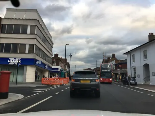
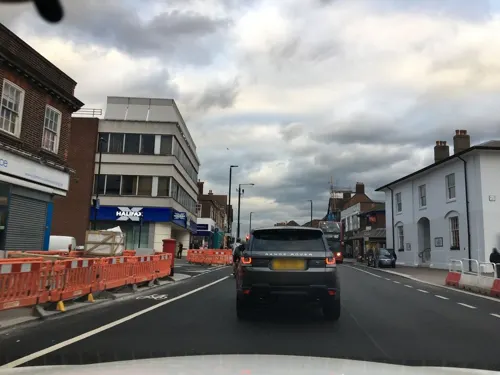
PizzaExpress
Restaurant · Pizza
168-176 Eltham High Street, London
Mo-Th 11:30-22:00; Fr-Sa 11:30-23:00; Su 11:30-22:00
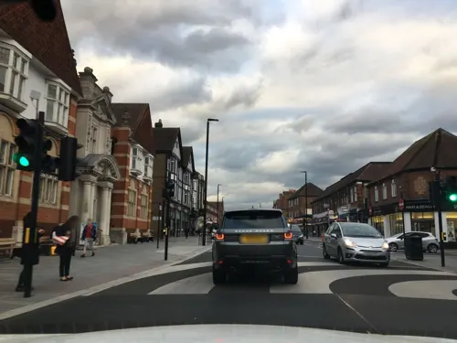
Rox
Restaurant · Mediterranean, Turkish
190-194 Eltham High Street, London
Mo-Th 12:00-22:00; Fr-Sa 12:00-23:00; Su 09:30-22:00
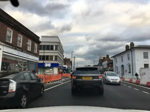
M'Arks Sky Bar
Bar and pub
168 Eltham High Street, London
Tu-Th 15:00-24:00, Fr,Sa 15:00-01:00, Su 12:00-21:00

The Depot
Bar and pub · 1.3 mi
7 Pegler Square, London
Mo-Th 10:00-23:00; Fr-Sa 10:00-24:00; Su 10:00-22:00
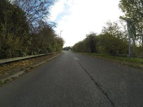
The Falcon Harvester
Diner · American · 1.3 mi
Lingfield Crescent, London
Mo-Sa 09:00-23:00; Su 09:00-22:00
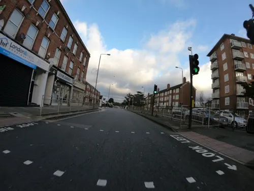
The Last Drop Inn
Bar and pub · 0.5 mi
279 Eltham High Street, London
Tu-Th 17:00-22:30; Fr 17:00-23:00; Sa 14:00-23:00; Su 14:00-22:30
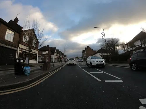
The Long Pond
Bar and pub · 0.5 mi
110 Westmount Road, London
Mo 17:00-22:00; Tu-We 11:30-14:30,17:00-22:00; Th-Fr 11:30-14:30,...
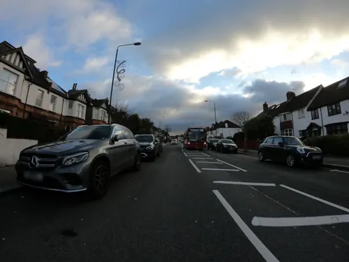
Hill Top Coffee Shop
Cafe · Coffee Shop · 1.4 mi
151 Shooters Hill, London
Mo-Fr 07:30-15:30; Sa 08:00-15:00; Su 09:00-15:00

136 more on the map.
History
Eltham developed along part of the road from London to Maidstone, and lies 3 miles (4.8 km) almost due south of Woolwich. Mottingham, to the south, became part of the parish on the abolition of all extra-parochial areas, which were rare anomalies in the parish system. Eltham College and other parts of Mottingham were therefore not within Eltham's boundaries, even before the 1860s.
From the sixth century Eltham was in the ancient Lathe of Sutton at Hone. In the Domesday Book of 1086 its hundred was named Gren[u/v]iz (Greenwich), which by 1166 was renamed Blachehedfeld (Blackheath) because it had become the location of the annual or more frequent hundred gathering.
Eltham lies in the hundred of Blackheath, at the distance of eight miles from London, on the road to Maidstone. The parish is bounded by Woolwich, Plumsted, and the extraparochial hamlet of Kidbrooke, on the north; by Bexley on the east and south east; by Chislehurst on the south; by the extraparochial hamlet of Mottingham, on the south-west, and by Lee on the west. It contains about 2,880 acres (11.7 km2): of which about 360 are woodland; about 60 waste; about three fifths of the cultivated land are arable. ....This place had formerly a market on Tuesdays, and two fairs; one at the festival of the Holy Trinity, and the other at that of St. Peter and St. Paul; both of which have been long discontinued.
Read more of the history
By the 1880s the lathes and hundreds of Kent had become obsolete, with the civil parishes and other districts assuming modern governmental functions.
Eltham was a civil parish of Kent until 1889 when it became part of the County of London and from 1900 formed part of the Metropolitan Borough of Woolwich. On 31 March 1930 the parish was abolished to form Borough of Woolwich. At the 1921 census (the last before the abolition of the parish), Eltham St John the Baptist had a population of 28,308. The metropolitan borough was abolished in 1965 and Eltham then became part of the then London (now Royal) Borough of Greenwich.
Eltham today is one of the largest suburban developments in the borough with a population of almost 88,000 people.
Eltham lies on a high, sandy plateau which gave it a strategic significance. That, and the fact of its position close to the main route to the English Channel ports in Kent, led to the creation of the moated medieval Eltham Palace, still its most notable landmark. Daniel Lysons described its origins.
The Kings of England had a palace at Eltham at a very early period ... Henry the Third, in the year 1270, kept a public Christmas at his palace of Eltham, being accompanied by the Queen, and all the great men of the realm. Anthony Bec, Bishop of Durham, and Patriarch of Jerusalem, bestowed great cost, we are told, on the buildings at this place, and died there on the 28th of March 1311, having, as it is said, some time before given Eltham-house to Edward the Second, or, as some say, to Queen Isabel.... Edward frequently resided here. In 1315, his Queen was brought to bed of a son in this palace, called, from that circumstance, John of Eltham. Edward the Third held a Parliament at Eltham in 1329, and again in 1375.
The nearby manor of Well Hall was home to Sir John Pulteney, four times Lord Mayor of London, and later to wealthy Catholic William Roper and his wife Margaret (daughter of Sir Thomas More, known to Catholics as Saint Thomas More, Chancellor to King Henry VIII). In 1733 Sir Gregory Page bought this estate for £19,000 and demolished Roper House, building Page House – later known as Well Hall House – on the site. Until its demolition in 1931, Well Hall House variously served as a home to watchmaker John Arnold, and later to socialist Hubert Bland and author Edith Nesbit.
Also of note is Avery Hill Park and its former mansion, accessed from Bexley Road and at various points along the three miles (5 km) of other streets that surround the park. Avery Hill was the home of Colonel North, who made his fortune working in the Chilean nitrate industry. A hothouse is still open to the public and contains temperate and tropical plants. There are also remnants of the formal gardens in the public park. The mansion was part of the University of Greenwich, which had a significant presence on two sites in the area. However, in 2014 the university announced its intentions to withdraw from the site and has now done so.
The village streets adjacent to the Palace, and the surrounding land, remained rural until Archibald Cameron Corbett bought the Eltham Park Estate and developed it with well-built suburban housing between 1900 and 1914. The Bexley Heath Railway (see below) had opened what came to be known as the Bexleyheath Line in 1895. Suburban development of the district accelerated when the Government, through His Majesty's Office of Works, built the Progress Estate in Well Hall and large estates of temporary hutments in 1915, to house the vastly increased numbers of wartime workers in the Royal Arsenal at Woolwich. In the early years it was called, rather pretentiously, "Well Hall Garden City". Its name was changed to "Progress Estate" when it was purchased by the Royal Arsenal Co-operative Society in 1925. It compares well with later groups of municipal housing in south London – which is surprising given the fact that it was constructed rapidly between February and December 1915 and is sub-divided by the South Circular Road and (until about 1988) by the even busier A2 Trunk Road. The Progress Estate was made a Conservation Area in 2007.
From the History section of Eltham on Wikipedia, under CC BY-SA 4.0.
More about Eltham
Geography
Eltham has a varied topography. Map 6 shows contours, spot heights and water courses. The centre of Eltham is on a plateau at about the 60m level with the High Street running along its centre. There is a scarp slope to the west of the plateau from the top of which are unrestricted views across South London. Eltham Palace occupies a commanding position on the edge of the scarp. Eltham Hill offers the steepest descent from the plateau, starting at Eltham High Street and descending 30m over 1 km due west at the Yorkshire Grey (now a McDonald's outlet). The land to the north of Eltham rises to form the southern slope of Shooter's Hill, one of the highest points in London at a height of 430 feet (130 m). The recently (2014) restored 18th century belvedere Severndroog Castle offers wide views from its observation platform which is 490 feet (150 m) above sea level.
From Eltham Church at 200 feet (60 m) the High Street rises gently to 233 feet (71 m) and continues east as Bexley Road at a slightly lower level.
To the south the plateau slopes gently downwards to Mottingham (at 163 feet (49.6 m)) and New Eltham (at 151 feet (46.1 m))
Arts and culture
Eltham has an unusually high quotient of green space, with large areas of woodland to the north and east, including the historic woodland of Shooters Hill and Oxleas Wood, the Woodlands Farm community holding, Eltham Parks north and south and extensive parkland heading into Avery Hill park. Thus it is both 'suburban' and 'urban', and it forms part of the Royal Borough of Greenwich, an Inner London borough.
The town centre supports a loyal core of shoppers, diners, and drinkers, but the nightlife is modest. In recent years there has been great effort by local town centre businesses and other important Eltham stakeholders, to drive business, community and tourism improvements, that will help sustain the town centre. These efforts resulted in the formation of an Eltham town centre partnership (ETCP), chaired by an elected local stakeholder. Greenwich council had a member and officer representatives along with the University of Greenwich. The ETCP encouraged the development of A new town centre commerce Association – The Association of Commerce for Eltham (ACE). ACE established a new Town Centre web portal, which offered a basic business directory and tried to increase interaction between business and community groups. Both were offline as of June 2023.
Education
Primary schools in Eltham include: Alderwood, Christ Church (Shooters Hill Rd), Deansfield, Gordon, Middle Park, Ealdham, Eltham C of E (Founded 1814), Gordon, Haimo, Henwick, Kidbrooke Park, St Mary's, St Thomas More and Wingfield.
Secondary schools in Eltham include Harris Academy Greenwich, St Thomas More Catholic School, Eltham Hill School for Girls, and Stationers' Crown Woods Academy (built upon the land of King Henry VIII's hunting grounds, and until 2011 named Crown Woods School).
One campus of the University of Greenwich was in Avery Hill Park, on the borders of Eltham and New Eltham, but has closed.
From the Wikipedia article Eltham, under CC BY-SA 4.0.
Notable people from Eltham
 Boy GeorgeBritish musician (born 1961)Photo: Sven Mandel, CC BY-SA 4.0
 Bernardine EvaristoBritish author and academic (1959-)Photo: Acthom123, CC BY-SA 4.0
 Liz Saville RobertsWelsh politician (born 1964)Photo: Richard Townshend, CC BY 3.0
 Kevin O'NeillEnglish comic book illustrator (1953–2022)Photo: Luigi Novi, CC BY 3.0
 Richard Harries, Baron Harries of Pentregarthbishop of the Church of EnglandPhoto: House of Lords / photography by Roger Harris, CC BY 3.0
 Eric TeichmanBritish diplomatPhoto: Unknown author Unknown author, Public domain
- John LathamEnglish physician, naturalist and author (1740-1837)
- Delroy LindoBritish-born American actor (born 1952)
- Alan GardinerEnglish Egyptologist and philologist (1879–1963)
- Bryan SykesBritish geneticist and science writer (1947–2020)
- Steve Peregrin TookEnglish musician (1949–1980)
- Gavin PeacockEnglish footballer (born 1967)
Born in Eltham, according to Wikidata (CC0). Each name links to its Wikipedia article.
Where to stay2
Churches and places of worship48
Shopping21
Gas and EV charging13
Schools, colleges and libraries43
Healthcare12
Map of Eltham
250 places. The map loads OpenStreetMap tiles when you open it.
Getting there and nearby towns
London City Airport (LCY) is the nearest airport with scheduled flights listed in OpenStreetMap, 4 miles away.
- Kidbrooke 2 mi northwest, about 3 min by car
- Lee 2 mi west, about 3 min by car
- Blackheath 2 mi northwest, about 3 min by car
- Chislehurst 2 mi south, about 4 min by car
- Charlton 2 mi north, about 4 min by car
- Welling 3 mi east, about 4 min by car
- Plumstead 3 mi northeast, about 4 min by car
- Sidcup 3 mi southeast, about 4 min by car
- Ladywell 3 mi west, about 5 min by car
- Abbey Wood 3 mi northeast, about 6 min by car
Drive times are estimates from straight-line distance, not routes.
Towns near Eltham


Keep exploring
Local news
Headlines from INDB.
Reviews, tips and questions
Loading what members have shared...
Sources and licences
- GeoNames (CC BY 4.0): population, coordinates, regions and time zone
- Mapillary (see each image): photos
- OpenStreetMap contributors (ODbL 1.0): places, airports, map data
- Wikidata (CC0 1.0): elevation, founding date, time zone, website, landmarks and historic places
- Wikimedia Commons (see each image): photos
- Wikipedia (CC BY-SA 4.0): overview and history text
Photo credits
- 2016 London-Shooters Hill, view from Severndroogh Castle - 4, Kleon3, CC BY-SA 4.0
- St John the Baptist Church Tower in Eltham, Chris Roberts, CC BY-SA 4.0
- EMUS at Eltham, Elsie esq., CC BY 2.0
- Eltham highstreet 3, PeterEltham, CC BY-SA 3.0
- Broadway Theatre - Catford, Steve Cadman derivative work: MrPanyGoff, CC BY-SA 2.0
- Greenwichtheatre, Burnley, CC BY-SA 3.0
- 1212906 II Star ELTHAM COURT (ELTHAM PALACE), COURT YARD, from SW Greenwich London 20250610 0005, Tilman2007, CC BY-SA 4.0
- Stained glass window from Baltic Exchange, Heidi De Vries, CC BY 2.0
- Danson Mansion, Stacey Harris, CC BY-SA 2.0
- The Fan Museum (3400819225), Visit Greenwich from Greenwich, United Kingdom, CC BY 2.0
- Flickr - davehighbury - Royal Arsenal Woolwich London 039 (cropped), DAVID HOLT from London, England, CC BY-SA 2.0
- EH1211481 National Maritime Museum 10 (cropped), Katie Chan, CC BY-SA 3.0
- RNCpano, © Bill Bertram (Pixel8) 2007-08, CC BY-SA 3.0
- Greenwich London, Vladimír Procházka, CC BY-SA 4.0
- The Red House, Bexleyheath, Velela, Public domain
- Horn Park playground, Carlwev, CC BY-SA 4.0
- Birdbrook Road Nature Reserve 4, Dudley Miles, CC BY-SA 4.0
- Burnt Ash Pond, Dudley Miles, CC BY-SA 3.0
- AllSaints Blackheath, Taken by Mark Duwe, Vbloke at English Wikipedia, Public domain
- Greater London - Church of St Michael and All Angels, JENABZ, CC BY-SA 4.0
- Church of St Nicholas plumstead, Simon Armstrong, CC BY-SA 3.0
- Severndroog, Veghead, Public domain
- Ark Greenwich Free School buildings, Paul W, CC BY-SA 4.0
- Memorial Hospital, Woolwich, Secretlondon, CC BY-SA 4.0
- Christ Church, Shooter's Hill, Ethan Doyle White, CC BY-SA 4.0
- Eltham Common path, Dudley Miles, CC BY-SA 3.0
- Brookmill Road LNR 1, Dudley Miles, CC BY-SA 3.0
- Pond in the Tarn, Mottingham (I), Ethan Doyle White, CC BY-SA 4.0
- Bromley Blues Club at the Bromley Little Theatre, Back ache, CC BY-SA 4.0
- London, Woolwich-Shooter's Hill, Eaglesfield park03, Kleon3, CC BY-SA 4.0
- London-Woolwich, Rotunda 06, Kleon3, CC BY-SA 4.0
- Sutcliffe Park 1, Dudley Miles, CC BY-SA 3.0
- Brookmill Park, London Borough of Lewisham, SE8, Ewan-M, CC BY-SA 2.0
- Chinbrook Meadows (6887366056), rjp from London, UK, CC BY 2.0
- Depot, Kidbrooke, SE3, Ewan-M, CC BY-SA 2.0
- Street-level photo, wibbit, CC BY-SA 4.0
- Street-level photo, wasd42, CC BY-SA 4.0
- Street-level photo, wibbit, CC BY-SA 4.0
- Street-level photo, wibbit, CC BY-SA 4.0
- Street-level photo, wibbit, CC BY-SA 4.0
- Street-level photo, wibbit, CC BY-SA 4.0
- Street-level photo, wibbit, CC BY-SA 4.0
- Street-level photo, zymurgic, CC BY-SA 4.0
- Street-level photo, wasd42, CC BY-SA 4.0
- Street-level photo, jjhaslanded, CC BY-SA 4.0
- Street-level photo, wasd42, CC BY-SA 4.0
- Street-level photo, wibbit, CC BY-SA 4.0
- Street-level photo, wibbit, CC BY-SA 4.0
- Street-level photo, wibbit, CC BY-SA 4.0
- Street-level photo, wasd42, CC BY-SA 4.0
- Street-level photo, wasd42, CC BY-SA 4.0
- Street-level photo, wasd42, CC BY-SA 4.0
- Street-level photo, tallguy, CC BY-SA 4.0
- Street-level photo, jjhaslanded, CC BY-SA 4.0
- Street-level photo, wibbit, CC BY-SA 4.0
- Street-level photo, tallguy, CC BY-SA 4.0
- Street-level photo, tallguy, CC BY-SA 4.0
- Street-level photo, deemcee, CC BY-SA 4.0
- Street-level photo, jjhaslanded, CC BY-SA 4.0
- Street-level photo, jjhaslanded, CC BY-SA 4.0
- Street-level photo, richlv, CC BY-SA 4.0
- Street-level photo, jjhaslanded, CC BY-SA 4.0


Page built November 10, 2026. Spotted a mistake? Tell us or suggest a place.