


Queniborough, United Kingdom
Queniborough is a town of 2,307 people in England, United Kingdom.
Why visit Queniborough
Townapedia lists 6 museums and landmarks, 7 parks and trails, 24 places to eat and 1 place to stay in and around town.
Highlights include Birstall Meadows and Wanlip Meadows.
Weather in Queniborough
Forecast from MET Norway (CC BY 4.0). Full forecast
About Queniborough
Queniborough is an English village in the county of Leicestershire 1.1 miles (1.8 km) north-east of the town of Syston and of 6.2 miles (10 km) north-east of the city of Leicester. Its 972 properties housed 1,878 registered electors in 2003. The population increased to 2,326 at the 2011 census. It forms part of the Leicester Urban Area due to its proximity.
From the Wikipedia article Queniborough (this version), under CC BY-SA 4.0.
Museums and landmarks6

Parks, trails and playgrounds7



Cossington Meadows
Park · 3.0 mi
Nature reserve in Leicestershire, England

Restaurants and cafes24


Grosvenor Snooker Bar & Lounge
Bar and pub · 1.1 mi
1269 Melton Road, Leicester
Mo-Sa 10:00-23:00; Su 10:30-22:30
The Pharmacie Arms
Bar and pub · 1.2 mi
3 High Street, Leicester
Mo off; Tu,We 17:00-23:00; Th 16:00-23:00; Fr 15:00-23:00; Sa...

12 more on the map.
Where to stay1

History
The place-name 'Queniborough' first appears in the Domesday Book of 1086, as Cuinburg. It is listed as Quenburg in about 1125, in the Leicestershire Survey in J. H. Round's Feudal England. It appears as Queningburc in 1236 and as Queniburg in 1242 in the Book of Fees. The name is thought to be the Old English Cwēne-burg, meaning "the queen's manor".
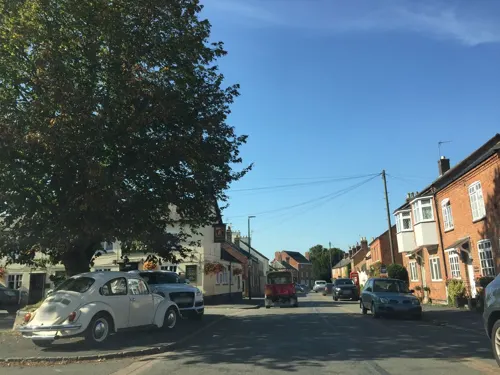
The old part of the village, along Main Street, has a mixture of 16th–20th century houses, some of them thatched.
The Grade II*-listed Queniborough Old Hall in Coppice Lane is a large two-storey country house built in 1675–1676 of brick with Swithland slate roofs, to an originally H-shaped plan.
The newer Queniborough Hall in Main Street was built about 1820 with later additions. It has two storeys of stuccoed brick with a four-bay frontage. Until the First World War it was still occupied by the Lord of the Manor, but it has now been converted into flats.
What is now known as Wetherby House was built about 1850 and is believed to have been known as The Beeches. It stands on Syston Road. The house is built of brick with a pitched Swithland slate roof and is listed as of local interest.
Read more of the history
There was no school in the village open to ordinary villagers until 1847. The earlier school, in a small building to the rear of No. 28, Main Street, was only for children whose parents worked on the Queniborough Hall estate. Nos 22–28, Main Street were built between 1790 and 1810 as workers' cottages. The schoolmaster lived at No. 28. The row is still occupied, and the old village school, part of No. 28, now serves as a dining room with a 15-foot (4.6 m) vaulted ceiling.
The school built in 1847 stands beside the Horse and Groom pub. This was a free school from the outset, available to children of all villagers. It now holds a small swimming pool for the new primary school built in the 1970s. A junior school was built in Coppice Lane and opened in September 1954.
George Shingler (1882–1946), county cricketer, died in Queniborough.
From the History section of Queniborough on Wikipedia, under CC BY-SA 4.0.
Churches and places of worship18
Shopping4
Gas and EV charging2
Schools, colleges and libraries6
St Michael & All Angels Church of England Primary School
School · Anglican · 1.4 mi
Brookside, Leicester
Healthcare2
Map of Queniborough
70 places. The map loads OpenStreetMap tiles when you open it.
Getting there and nearby towns
East Midlands Airport (EMA) is the nearest airport with scheduled flights listed in OpenStreetMap, 14 miles away.
- Syston 2 mi southwest, about 3 min by car
- Birstall 4 mi southwest, about 6 min by car
- Mountsorrel 4 mi west, about 7 min by car
- Belgrave 5 mi southwest, about 8 min by car
- Leicester 6 mi southwest, about 9 min by car
- Oadby 7 mi south, about 11 min by car
- Evington 7 mi south, about 12 min by car
- Glenfield 7 mi southwest, about 12 min by car
- Loughborough 8 mi northwest, about 12 min by car
- Melton Mowbray 8 mi northeast, about 13 min by car
Drive times are estimates from straight-line distance, not routes.
Towns near Queniborough


Keep exploring
Local news
Headlines from INDB.
Reviews, tips and questions
Loading what members have shared...
Sources and licences
- GeoNames (CC BY 4.0): population, coordinates, regions and time zone
- Mapillary (see each image): photos
- OpenStreetMap contributors (ODbL 1.0): places, airports, map data
- Wikidata (CC0 1.0): elevation, founding date, time zone, website, landmarks and historic places
- Wikimedia Commons (see each image): photos
- Wikipedia (CC BY-SA 4.0): overview and history text
Photo credits
- Thatched Cottage Queniborough Leicester, Russ Hamer, CC BY-SA 3.0
- Birstall Meadows 5, Dudley Miles, CC BY-SA 4.0
- River Soar from Wanlip Meadows 2, Dudley Miles, CC BY-SA 4.0
- Primitive Methodist Church, Sileby, Andrewrabbott, CC BY-SA 4.0
- Wesleyan Methodist Church, Sileby, Andrewrabbott, CC BY-SA 4.0
- Watermead Country Park, Unknown author, CC BY-SA 3.0
- Street-level photo, chrisw100, CC BY-SA 4.0
- Street-level photo, chrisw100, CC BY-SA 4.0
- Street-level photo, chrisw100, CC BY-SA 4.0
- Street-level photo, adam2, CC BY-SA 4.0
Page built November 10, 2026. Spotted a mistake? Tell us or suggest a place.