


Why visit Repton
Townapedia lists 4 museums and landmarks, 5 parks and trails, 22 places to eat, 1 place to stay and 3 attractions in and around town.
Highlights include Monks Bridge, Betty's Farm Shop, Claymills Victorian Pumping Station and Heath Wood barrow cemetery.
Weather in Repton
Forecast from MET Norway (CC BY 4.0). Full forecast
About Repton
Repton is a village and civil parish in the South Derbyshire district of Derbyshire, England. It lies on the edge of the River Trent floodplain, approximately 5 miles (8 km) north of Swadlincote and about 5 miles (8 km) northeast of Burton upon Trent, close to the county boundary with Staffordshire.
From the Wikipedia article Repton (this version), under CC BY-SA 4.0.
Things to do3

Monks Bridge
Bridge · 2.2 mi
Bridge across the River Dove between Stretton (Staffordshire) and Egginton (Derbyshire), in the United Kingdom

Betty's Farm Shop
Farm and orchard · 1.5 mi
The Castle Way, Derby
Mo-Sa 09:00-17:00

Museums and landmarks4


Claymills Victorian Pumping Station
Museum · 2.6 mi
Pumping station in Burton, Staffordshire, England, UK

Heath Wood barrow cemetery
Monument and historic site · 2.5 mi
Viking burial site near Ingleby, Derbyshire, England
Parks, trails and playgrounds5



Restaurants and cafes22
Boat Street
Cafe · Coffee Shop, Sandwich · 1.5 mi
Cafe on a narrowboat, with seats onboard and outside on the canalside.
Tu-Fr 10:00-14:00; Sa-Su 10:00-16:00
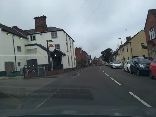
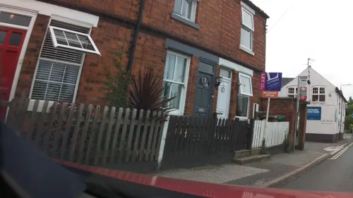
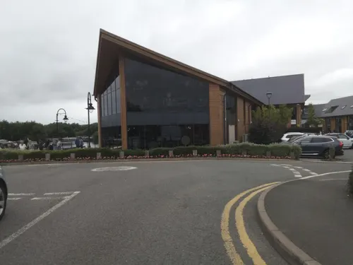
The Boardwalk Bar & Dining
Restaurant · 1.5 mi
Findern Lane, Derby
Mo-Th 10:30-22:00; Fr 10:30-23:00; Sa 10:00-23:00; Su 10:00-21:00
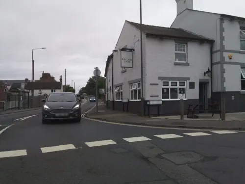
Toast Coffee House
Cafe · Coffee Shop · 1.1 mi
Cafe, breakfast, lunch, coffee.
5 The Green, Derby

10 more on the map.
History
Archaeological evidence indicates human activity at Repton from the late Mesolithic and Neolithic periods. Cropmarks and enclosure features suggest continued occupation into the Roman and early Anglo-Saxon periods, reflecting long-term settlement in the Trent valley region.
Christianity was reintroduced to the Midlands at Repton, where members of the Mercian royal family under Peada were baptised in AD 653. A double monastery under an abbess was subsequently established.
In 669 St Chad, Bishop of Mercia, transferred his episcopal see from Repton to Lichfield. Later, under King Offa, Lichfield briefly became an archiepiscopal centre, with Repton forming part of the ecclesiastical development that led to the short-lived archdiocese of Lichfield.
At the centre of the village is the Church of England parish church dedicated to Wystan (or Wigstan) of Mercia.
The Anglo-Saxon Chronicle records that in 873–874 the Great Heathen Army overwintered at Repton. Archaeological investigations led by Martin and Birthe Biddle identified a D-shaped earthwork and associated burials, though interpretations of its scale and function have since been debated.
Subsequent excavations by Cat Jarman and Mark Horton from 2015 onwards revealed additional structures and graves, including artefacts consistent with Viking activity.
Read more of the history
A mass burial containing at least 264 individuals has been interpreted as linked to the Viking presence, with artefacts and radiocarbon evidence supporting a late 9th-century date.
An early account records that in the 17th century Thomas Walker uncovered a burial mound containing human remains, later associated with the same archaeological complex.
Repton remained a predominantly rural settlement after the medieval period, with agriculture forming the basis of its economy. Parliamentary enclosure of Repton Common in 1766 formalised the redistribution of common land into private holdings.
In the 19th century, improved regional infrastructure transformed connectivity, particularly following the development of river crossings and the opening of nearby railway facilities at Willington in 1839. These changes supported the expansion of Repton School, which developed significantly under Steuart Adolphus Pears.
The historic core of Repton is now designated a conservation area reflecting its exceptional architectural and archaeological continuity.
From the History section of Repton on Wikipedia, under CC BY-SA 4.0.
More about Repton
Geography
Repton is located in south Derbyshire on the northern edge of the River Trent floodplain, within gently undulating lowland countryside characteristic of the Trent valley. The village lies approximately 5 miles (8 km) north of Swadlincote and around 5 miles (8 km) northeast of Burton upon Trent, close to the boundary with Staffordshire.
The surrounding landscape is predominantly agricultural, with mixed arable and pasture land interspersed with hedgerows and small woodland areas. The lower-lying ground towards the River Trent is subject to periodic flooding, while the village itself occupies slightly elevated terrain.
From the Wikipedia article Repton, under CC BY-SA 4.0.
Notable people from Repton
- Russell OsmanEnglish footballer (born 1959)
- Neville Fordcricketer (1906-2000)
- Robin SharmanEnglish racing cyclist
- Jane WelchBritish writer
- Frederick PeachEnglish cricketer (1882-1965)
- Samuel CrowbrowBritish archdeacon
Born in Repton, according to Wikidata (CC0). Each name links to its Wikipedia article.
Where to stay1
Churches and places of worship13
Repton United Reformed Church
Church · United Reformed · 0.4 mi
Pinfold Lane, Derby
Shopping2
Schools, colleges and libraries4
Healthcare4
Map of Repton
58 places. The map loads OpenStreetMap tiles when you open it.
Getting there and nearby towns
East Midlands Airport (EMA) is the nearest airport with scheduled flights listed in OpenStreetMap, 9 miles away.
- Findern 2 mi north, about 3 min by car
- Sinfin 4 mi northeast, about 6 min by car
- Burton upon Trent 4 mi southwest, about 7 min by car
- Swadlincote 5 mi south, about 7 min by car
- Derby 7 mi northeast, about 10 min by car
- Ashby-de-la-Zouch 7 mi southeast, about 12 min by car
- Aston-on-Trent 7 mi east, about 11 min by car
- Moira 7 mi south, about 11 min by car
- Chaddesden 8 mi northeast, about 13 min by car
- Donisthorpe 8 mi south, about 13 min by car
Drive times are estimates from straight-line distance, not routes.
Towns near Repton


Keep exploring
Local news
Headlines from INDB.
Reviews, tips and questions
Loading what members have shared...
Sources and licences
- GeoNames (CC BY 4.0): population, coordinates, regions and time zone
- Mapillary (see each image): photos
- OpenStreetMap contributors (ODbL 1.0): places, airports, map data
- Wikidata (CC0 1.0): elevation, founding date, time zone, website, landmarks and historic places
- Wikimedia Commons (see each image): photos
- Wikipedia (CC BY-SA 4.0): overview and history text
Photo credits
- Repton 020, Jellyman, Public domain
- Newton Solney St Mary's Church, Gammock, CC BY-SA 4.0
- Winshill St Marks Gates, mikejamestaylor, Public domain
- Foremark, St Saviour, South Derbyshire, histman, CC BY 2.0
- Church of St Wystan, Repton, Tim Heaton, CC BY-SA 2.0
- St Michaels Church, Willington, Derbyshire, Nick Moyes, CC BY-SA 4.0
- ReptonSchool2007, Victuallers, Public domain
- Repton Market Cross, Russ Hamer, CC BY-SA 3.0
- 2021-04-10 Mercia Marina, Trent and Mersey Canal, Willington, Derbyshire, Malcolm Neal, CC BY-SA 2.0
- Street-level photo, adam2, CC BY-SA 4.0
- Street-level photo, southglos, CC BY-SA 4.0
- Street-level photo, adam2, CC BY-SA 4.0
- Street-level photo, adam2, CC BY-SA 4.0
- Street-level photo, southglos, CC BY-SA 4.0
- Street-level photo, southglos, CC BY-SA 4.0
- Street-level photo, southglos, CC BY-SA 4.0
- Street-level photo, southglos, CC BY-SA 4.0
- Street-level photo, victuallers, CC BY-SA 4.0
- Street-level photo, southglos, CC BY-SA 4.0
- Street-level photo, adam2, CC BY-SA 4.0
- Street-level photo, southglos, CC BY-SA 4.0
- Street-level photo, southglos, CC BY-SA 4.0
- Street-level photo, southglos, CC BY-SA 4.0
- Street-level photo, southglos, CC BY-SA 4.0
- Street-level photo, southglos, CC BY-SA 4.0
- Street-level photo, southglos, CC BY-SA 4.0
- Street-level photo, southglos, CC BY-SA 4.0
- Street-level photo, adam2, CC BY-SA 4.0

Page built November 10, 2026. Spotted a mistake? Tell us or suggest a place.