


Rostrevor, United Kingdom
Rostrevor is a town of 2,515 people in Northern Ireland, United Kingdom.
Why visit Rostrevor
Townapedia lists 9 museums and landmarks, 5 parks and trails, 12 places to eat, 6 places to stay and 1 attraction in and around town.
Highlights include James McCormack's Hooping Stone, The Big Stone (Cloughmore), Kilbroney Park and Rostrevor Oakwood National Nature Reserve.
Weather in Rostrevor
Forecast from MET Norway (CC BY 4.0). Full forecast
About Rostrevor
Rostrevor (Irish: Ros Treabhair) is a village and townland in County Down, Northern Ireland. It lies at the foot of Slieve Martin on the coast of Carlingford Lough, near Warrenpoint. The Kilbroney River flows through the village and Rostrevor Forest is nearby. 7.5 miles (12 km) south-east of Newry, the village is within the Newry, Mourne and Down local government district.
From the Wikipedia article Rostrevor (this version), under CC BY-SA 4.0.
Things to do1

Museums and landmarks9

James McCormack's Hooping Stone
Monument and historic site
Hooping stone worked by blacksmith James McCormack, Water Street, Rostrevor 1800-1958


Parks, trails and playgrounds5



Restaurants and cafes12
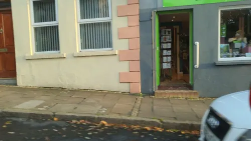
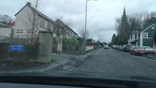
The Shack
Fast food · Pizza, Kebab
Church Street, Rostrevor
Su 13:00-20:00; Mo-We off; Th 16:00-20:00; Fr 15:00-21:30; Sa 13:00-21:00

Synge & Byrne, Kilbroney Forest Park
Cafe · Coffee Shop, Sandwich, Ice Cream, Salad, Cake, Dessert · 0.5 mi
80 Shore Road, Rostrevor
Mo-Su 09:00-17:00



More about Rostrevor
Arts and culture
Since 1987, Rostrevor has hosted the Fiddler's Green International Festival, an annual multi-day event celebrating folk music and the arts. The festival features up to 200 events, including concerts, workshops, dances, art exhibitions, and nature walks. Activities take place at various venues throughout the village, such as local schools and churches, the social club of St Bronaghʼs GAA, YWAM An Cuan, a temporary open-air stage in the village centre, and a meadow in Kilbroney Park known locally as Fiddler's Green.
Education
Schools in the area include Kilbroney Integrated Primary School, Killowen Primary School, St. Bronagh's Primary School and YWAM (Youth With a Mission) An Cuan.
From the Wikipedia article Rostrevor, under CC BY-SA 4.0.
Notable people from Rostrevor
 Robert RossAnglo-Irish officer in the British ArmyPhoto: Unknown author Unknown author, Public domain
 Catherine McGrathNorthern Irish singer and songwriterPhoto: Conall from Downpatrick, Northern Ireland, CC BY 2.0
- T. K. WhitakerIrish economist and politician (1916-2017)
- Ben DunneIrish businessman (1908–1983)
- Eibhlis FarrellIrish composer
- Daniel CrillyBritish politician and journalist
- Laurence McGivernNorthern Ireland/Republic of Ireland swimmer
- Guy William PriceBritish flying ace (1895–1918)
Born in Rostrevor, according to Wikidata (CC0). Each name links to its Wikipedia article.
Where to stay6
Churches and places of worship3
Shopping2
Gas and EV charging1
Schools, colleges and libraries2
Map of Rostrevor
41 places. The map loads OpenStreetMap tiles when you open it.
Getting there and nearby towns
Belfast International Airport (BFS) is the nearest airport with scheduled flights listed in OpenStreetMap, 38 miles away.
- Warrenpoint 2 mi west, about 4 min by car
- Newry 8 mi northwest, about 12 min by car
- Banbridge 18 mi north, about 28 min by car
- Tandragee 20 mi northwest, about 32 min by car
- Portadown 24 mi northwest, about 39 min by car
- Craigavon 25 mi north, about 40 min by car
- Downpatrick 25 mi northeast, about 40 min by car
- Armagh 26 mi northwest, about 41 min by car
- Lisburn 30 mi north, about 48 min by car
- Belfast 36 mi north, about 58 min by car
Drive times are estimates from straight-line distance, not routes.
Towns near Rostrevor


Keep exploring
Local news
Headlines from INDB.
Reviews, tips and questions
Loading what members have shared...
Sources and licences
- GeoNames (CC BY 4.0): population, coordinates, regions and time zone
- Mapillary (see each image): photos
- OpenStreetMap contributors (ODbL 1.0): places, airports, map data
- Wikidata (CC0 1.0): elevation, founding date, time zone, website, landmarks and historic places
- Wikimedia Commons (see each image): photos
- Wikipedia (CC BY-SA 4.0): overview and history text
Photo credits
- Tram Cars, Rostrevor, Co. Down (5761246847), Robert French, Public domain
- Rostrevor street scene with tram, Robert French, Public domain
- Rostrevor street scene with tram (cropped), Robert French, Public domain
- Robert French - Rush hour in Rostrevor, National Library of Ireland on The Commons, Public domain
- Cloughmore Stone, Oisin obrien at English Wikipedia, Public domain
- James McCormack's Hooping Stone, Jonnymccullagh, CC BY-SA 4.0
- Street-level photo, jonnymccullagh, CC BY-SA 4.0
- Street-level photo, imapthestigmatised, CC BY-SA 4.0
- Street-level photo, yannakis, CC BY-SA 4.0
- Street-level photo, nickmilleruk, CC BY-SA 4.0
- Street-level photo, nickmilleruk, CC BY-SA 4.0
- Street-level photo, nickmilleruk, CC BY-SA 4.0
- Street-level photo, jonnymccullagh, CC BY-SA 4.0
- Street-level photo, nickmilleruk, CC BY-SA 4.0
- Street-level photo, imapthestigmatised, CC BY-SA 4.0
- Street-level photo, jonnymccullagh, CC BY-SA 4.0
- Street-level photo, jonnymccullagh, CC BY-SA 4.0
- Street-level photo, imapthestigmatised, CC BY-SA 4.0
- Street-level photo, jonnymccullagh, CC BY-SA 4.0
- Street-level photo, nickmilleruk, CC BY-SA 4.0
- Street-level photo, nickmilleruk, CC BY-SA 4.0
- Street-level photo, nickmilleruk, CC BY-SA 4.0
- Street-level photo, imapthestigmatised, CC BY-SA 4.0
- Street-level photo, imapthestigmatised, CC BY-SA 4.0
- Street-level photo, jonnymccullagh, CC BY-SA 4.0
Page built November 10, 2026. Spotted a mistake? Tell us or suggest a place.