


Why visit St Just
Townapedia lists 71 museums and landmarks, 12 parks and trails, 24 places to eat, 18 places to stay and 11 attractions in and around town.
Highlights include Longships Lighthouse, Pendeen, Mine Shaft and Geevor Tin Mine.
Weather in St Just
Forecast from MET Norway (CC BY 4.0). Full forecast
About St Just
St Just (Cornish: Lannust [ˈlanːʏst] ), also known as St Just in Penwith, is a town and civil parish in Cornwall, England, United Kingdom. It lies along the B3306 road which connects St Ives to the A30 road. The parish encompasses the town of St Just and the nearby settlements of Trewellard, Pendeen and Kelynack: it is bounded by the parishes of Morvah to the north-east, Sancreed and Madron to the east, St Buryan and Sennen to the south and by the sea in the west. The parish consists of 7,622 acres (3,085 ha) of land, 12 acres (4.9 ha) of water and 117 acres (47.3 ha) of foreshore.
From the Wikipedia article St Just in Penwith (this version), under CC BY-SA 4.0.
Travel tips from other travellers: St Just on Wikivoyage (CC BY-SA 4.0).
Photos of St Just


Things to do11

Longships Lighthouse
Lighthouse · 4.9 mi
Lighthouse in Cornwall, England

Pendeen Lighthouse
Lighthouse · 2.9 mi
Lighthouse in Cornwall, England




Museums and landmarks71
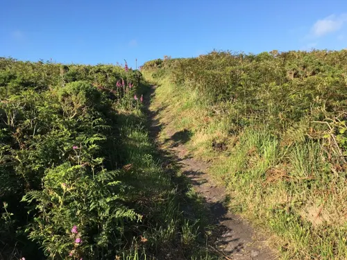


Carn Euny
Monument and historic site · 2.5 mi
Archaeological site near Sancreed, Cornwall, England


Boscawen-Un
Monument and historic site · 3.6 mi
Stone circle in Cornwall

Boskednan stone circle
Monument and historic site · 4.6 mi
Stone circle in Cornwall, England, UK

Caer Bran
Monument and historic site · 2.7 mi
Archaeological site in Cornwall, UK
Tregeseal East stone circle
Monument and historic site · 1.2 mi
Tregeseal East is a prehistoric stone circle near the town of St Just in Cornwall, UK
Bartinney Castle
Monument and historic site · 2.0 mi
Iron Age enclosure in Cornwall, England, UK
59 more on the map.
Parks, trails and playgrounds12





Restaurants and cafes24
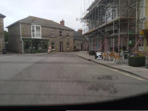
Moonmaid Ice Cream St Just
Cafe · Ice Cream, Coffee Shop, Cake, Breakfast, Dessert, Sandwich
1 Market Square, St Just
Mo-Su 09:00-17:00
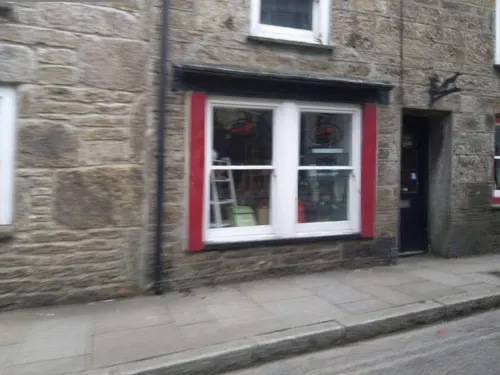
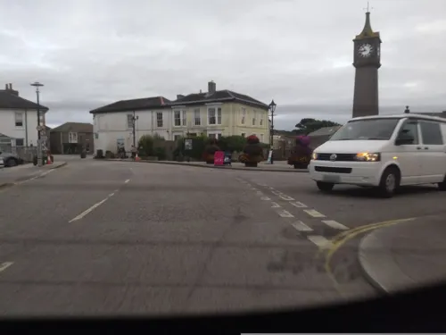
Dog and Rabbit
Cafe · Cake, Regional
North Row, St Just
Tu-Sa 09:00-16:00

Jeremy's Fish & Chips
Restaurant · Regional
Air conditioned restaurant Fresh local fish Cornish produce
2 Market Square, St Just



12 more on the map.
History
The identity of Saint Just is not known. Cornwall's long resistance to the edicts of Canterbury and Rome makes it most unlikely that the saint was Archbishop Justus of Canterbury, as some sources claim. Another possibility is the 6th- or 7th-century Saint Iestyn, who is said to have been the son of Geraint ab Erbin, a ruler of Dumnonia. In 1478 William of Worcester found that the church was believed to contain the bones of Justus of Trieste.
Among the prehistoric antiquities nearby is Ballowall Barrow, a chambered tomb. St Just is one of the most ancient mining districts in Cornwall, and remains of ancient pre-industrial and more modern mining activity have had a considerable impact on the nearby landscape.
Bosworlas, in St Just parish, was said by Henry Jenner to have been named as 'the Dwelling of Gorlois' after Gorlois, the legendary duke of Cornwall, who he believed was a real fifth or sixth century figure, either a petty chief and vassal of the Royal House of Dumnonia, or of the line of the original chiefs of the Dumnonii if the kings of Dumnonia were the leaders of the Britons displaced by the Saxons. He notes its closeness to Bosigran 'the Dwelling of Igerna', Gorlois's wife in Arthurian legend.
Read more of the history
The parish church of St Just is a fine 15th-century building. In 1336 the church was rebuilt and dedicated by John Grandisson, Bishop of Exeter; however only the chancel of this church survives and the nave and aisles are 15th-century in date. There are two Methodist chapels.
St Just is the home of Cape Cornwall School which also serves Sennen, Sancreed, Pendeen, St Buryan and other places in the district.
There are eight Cornish crosses in the parish, including two in the vicarage garden and one built into the church wall. Other crosses are at Leswidden, Nanquidno, Kenidjack (two) and Cot Valley. Boslow Cross is 550 yds (500 m) NW of Boslow Farm (ref. no. 1003110).
The ancient settlement has a strong mining history and was during the 19th century one of the most important mining districts in Cornwall both for copper and for tin. Mines within the area included Boscaswell Downs, Balleswidden, Parknoweth, Boscean, Wheal Owles, Wheal Boys, Levant, Botallack and Geevor (which closed in 1990). Geevor mine is now a tourist attraction which allows visitors to explore Cornish mining heritage. The boom in 19th-century mining saw a dramatic increase in the population of St Just, the 1861 census records the population figure as being 9,290; however, like other areas in Cornwall the population declined with the collapse in the tin trade in the 19th century. The town also suffered from the decision of the Great Western Railway to abandon its plans to make St Just the terminus of the London mainline to Cornwall. It was announced in July 2006 that the St Just mining district and the rest of the historic mining areas of Cornwall had become the Cornwall and West Devon Mining Landscape World Heritage Site.
From the History section of St Just in Penwith on Wikipedia, under CC BY-SA 4.0.
More about St Just
Geography
The stream in the nearby Cot Valley meets the Atlantic at Porth Nanven, sometimes called Penanwell. The area has been heavily mined, as was the area around St Just. The rounded boulders in the cliff are of specific scientific interest. Also nearby is Cape Cornwall.
Arts and culture
St Just is home to the popular Lafrowda festival a seven-day community and arts celebration usually held in mid July.
A more ancient celebration associated with the town is St Just Feast which is held every year to celebrate the dedication of the parish church on 13 July 1336. Feast celebrations were moved to the Sunday nearest to All Saints' Day in 1536 following an Act of Henry VIII which means it usually take place at the end of October / beginning of November. Feast itself is a two-day event with a church service and civic procession being held on Feast Sunday and a larger scale popular celebration being held on Feast Monday (which includes a meeting of the Western Hunt). A description of St Just Feast, from 1882, follows:
"Rich and poor still at this season keep open house, and all the young people from St. Just who are in service for many miles around, if they can possibly be spared, go home on the Saturday and stay until the Tuesday morning. A small fair is held in the streets on Monday evening, when the young men are expected to treat their sweethearts liberally, and a great deal of "foolish money" that can be ill afforded is often spent"
From the Wikipedia article St Just in Penwith, under CC BY-SA 4.0.
Notable people from St Just
 William OatsAustralian politician and mining engineer (1841-1911)Photo: Unknown author Unknown author, Public domain
- Charles LukeMayor of Wellington (1857-1941)
- James Howard WilliamsBritish army officer and forester (1897–1958)
- William LawryCricket player (born 1940)
- William AngwinAustralian politician (1863-1944)
- Alfred EddyProfessor of Biochemistry
Born in St Just, according to Wikidata (CC0). Each name links to its Wikipedia article.
Where to stay18
Churches and places of worship11
Shopping9
Gas and EV charging1
Schools, colleges and libraries4
Healthcare1
Map of St Just
162 places. The map loads OpenStreetMap tiles when you open it.
Getting there and nearby towns
Land's End Airport (LEQ) is the nearest airport with scheduled flights listed in OpenStreetMap, 1 miles away.
- Penzance 6 mi east, about 10 min by car
- Marazion 9 mi east, about 15 min by car
- Uny Lelant 11 mi east, about 18 min by car
- Camborne 18 mi east, about 29 min by car
- Helston 18 mi east, about 29 min by car
- Four Lanes 20 mi east, about 33 min by car
- Mullion 21 mi east, about 33 min by car
- Redruth 22 mi east, about 35 min by car
- Falmouth 27 mi east, about 44 min by car
- Truro 29 mi east, about 47 min by car
Drive times are estimates from straight-line distance, not routes.
Towns near St Just


Keep exploring
Local news
Headlines from INDB.
Reviews, tips and questions
Loading what members have shared...
Sources and licences
- GeoNames (CC BY 4.0): population, coordinates, regions and time zone
- Mapillary (see each image): photos
- OpenStreetMap contributors (ODbL 1.0): places, airports, map data
- Wikidata (CC0 1.0): elevation, founding date, time zone, website, landmarks and historic places
- Wikimedia Commons (see each image): photos
- Wikipedia (CC BY-SA 4.0): overview and history text
Photo credits
- 2024 St Just in Penwith (4), Chris06, CC BY-SA 4.0
- 1 and 2 Market Street, St Just, May 2021, Gazamp, CC BY-SA 4.0
- First Devon & Cornwall 42871 at St Just on route 10A (8859953122), Ed Webster, CC BY 2.0
- First Devon & Cornwall 38006 at St Just on route 300 (8859932738), Ed Webster, CC BY 2.0
- Shopfront, Fore Street, St Just, Cornwall - August 2025, Mutney, CC BY 4.0
- Lafrowda Day St Just1, Tom Corser, CC BY-SA 3.0
- St Just Fire Station (front view), Lafrowda Close, St Just, Cornwall - May 2022, Mutney, CC BY-SA 4.0
- The Star Inn, St Just, May 2021, Gazamp, CC BY-SA 4.0
- Apartment blocks, Lafrowda Close, St Just, Cornwall - April 2023 (1), Mutney, CC BY-SA 4.0
- Market Street, St Just, Cornwall - August 2025, Mutney, CC BY 4.0
- Lafrowda Day St Just2, Tom Corser, CC BY-SA 3.0
- Co-op, Market Square, St Just, Cornwall - August 2025, Mutney, CC BY 4.0
- Longships lighthouse, No machine-readable author provided. Vijayr02 assumed (based on copyright claims)., CC BY-SA 3.0
- Geevor tin mine headframe, Ahwmay, Public domain
- CarnEuny1, Andy Wright, CC BY 2.0
- Chun Quoit, Jim Champion (treehouse1977), CC BY-SA 2.0
- 01 Boscawen-un, Waterborough, CC BY-SA 3.0
- Boskednan stones at sunset penwith, Jim Champion, CC BY-SA 3.0
- Sancreed church and war memorial cornwall, Phil Williams, CC BY-SA 2.0
- StBridgetsChurchMorvah1, Andrewrabbott at English Wikipedia, Public domain
- StBuryanChurchFront, Mammal4 at English Wikipedia, CC BY-SA 3.0
- 2024 St Sennen's Church, Sennen (3), Chris06, CC BY-SA 4.0
- Pendeen lighthouse at pendeen watch, Jim Champion, CC BY-SA 3.0
- 2024 St Just in Penwith Parish Church (02a), Chris06, CC BY-SA 4.0
- Levant-Mine-by-John-Gibson, John Gibson, CC BY-SA 2.0
- Cape cornwal school march 2008, Renouk, Public domain
- ChapelCarnBreaview, Mammal4 ( talk ) ( Uploads ), CC BY-SA 3.0
- Commercial Hotel, Peter Glyn, CC BY-SA 3.0
- Kings Arms, St Just, May 2021, Gazamp, CC BY-SA 4.0
- The Wellington Hotel, Peter Glyn, CC BY-SA 3.0
- Cot Valley Beach at Low tide, Tom Corser, CC BY-SA 3.0
- Levant Mine from the air, Kernow Skies, CC BY-SA 3.0
- Fore Street. - panoramio, dennis white, CC BY-SA 3.0
- Heinz plaque Cape Cornwall, Philip Halling, CC BY-SA 2.0
- Carn Gloose aka Ballowall Barrow, St Just, Cornwall, Stevekraken, CC BY-SA 4.0
- Street-level photo, geow, CC BY-SA 4.0
- Street-level photo, WaggyDog, CC BY-SA 4.0
- Street-level photo, WaggyDog, CC BY-SA 4.0
- Street-level photo, live, CC BY-SA 4.0
- Street-level photo, WaggyDog, CC BY-SA 4.0
- Street-level photo, WaggyDog, CC BY-SA 4.0
- Street-level photo, WaggyDog, CC BY-SA 4.0
- Street-level photo, live, CC BY-SA 4.0
- Street-level photo, WaggyDog, CC BY-SA 4.0
- Street-level photo, WaggyDog, CC BY-SA 4.0
- Street-level photo, live, CC BY-SA 4.0
- Street-level photo, WaggyDog, CC BY-SA 4.0


Page built November 10, 2026. Spotted a mistake? Tell us or suggest a place.